


St Brides Castle, Pembrokeshire, Wales
On the edge of the spectacular Pembrokeshire coast
Book a tour Open Gallery-
51 apartments and cottages in Pembrokeshire
-
On the edge of the spectacular Pembrokeshire coast
-
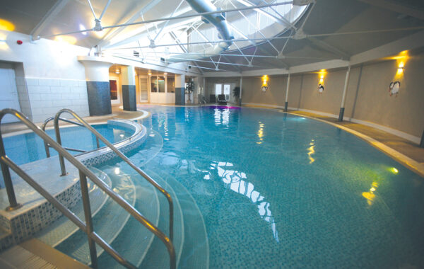
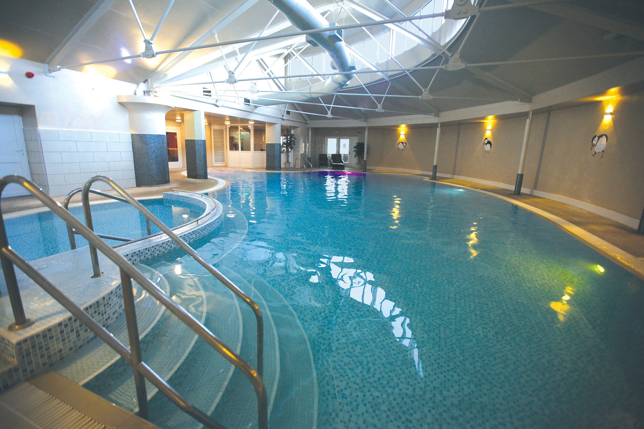
Indoor pool, games room and family room
-
Surrounded by a unique National Park
-
Winner of the Prince of Wales Award for Architecture
-
Superb walking country
-
Set in 99 acres of mature parkland
Discover Pembrokeshire
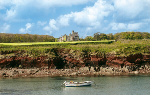
Remote and unspoilt, the Pembrokeshire peninsula – at the southwest corner of Wales – must surely rank among Europe’s most magnificent and varied coastlines. Here you’ll find St Brides Castle, the restoration of which earned a Prince of Wales Award for Architecture.
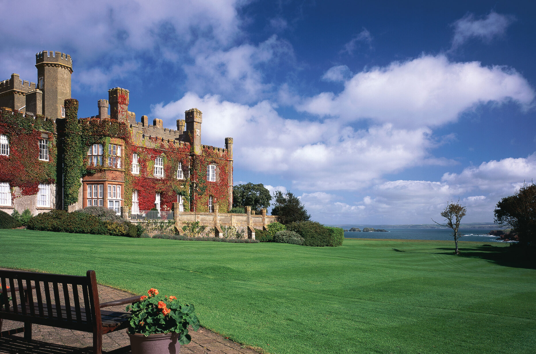
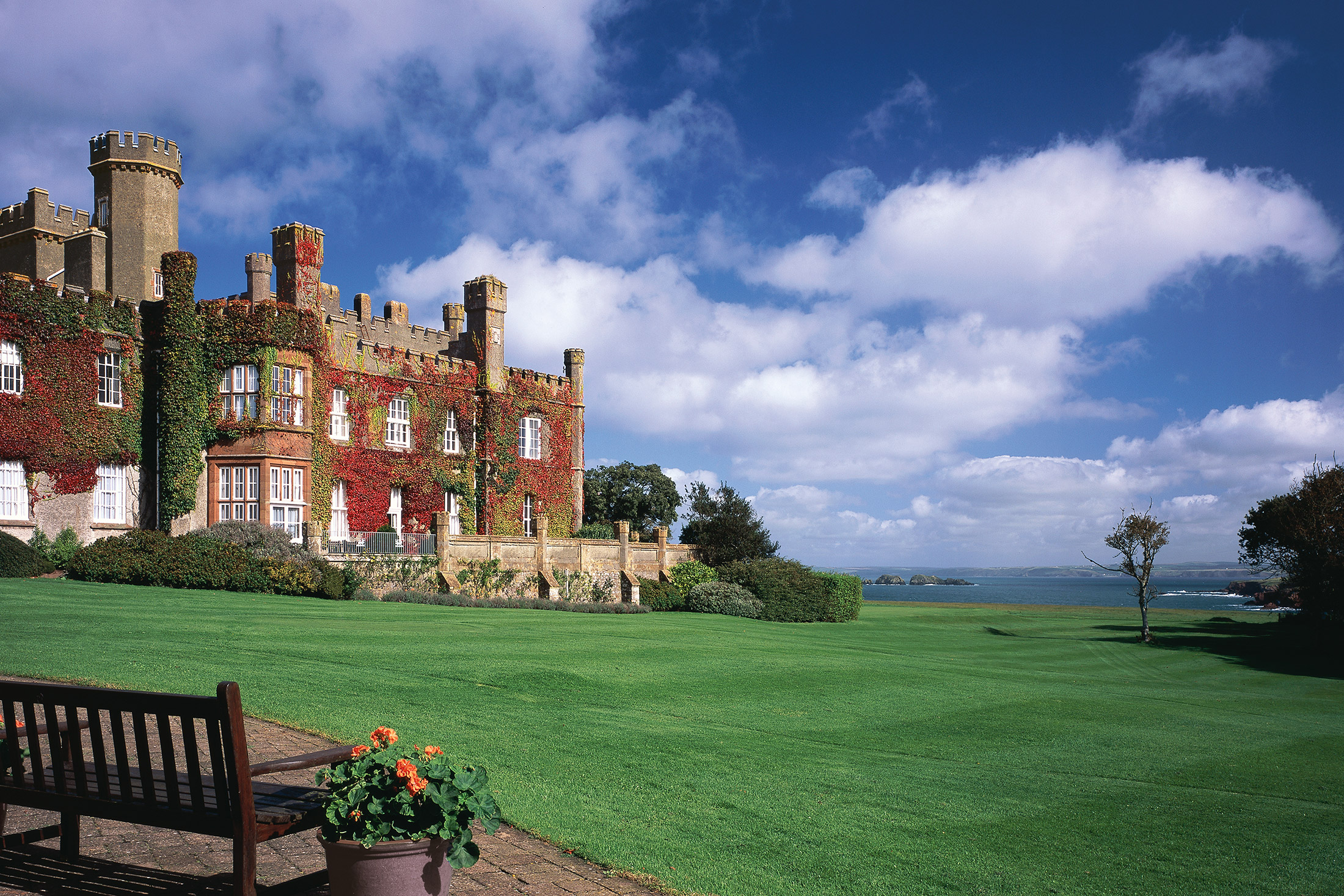
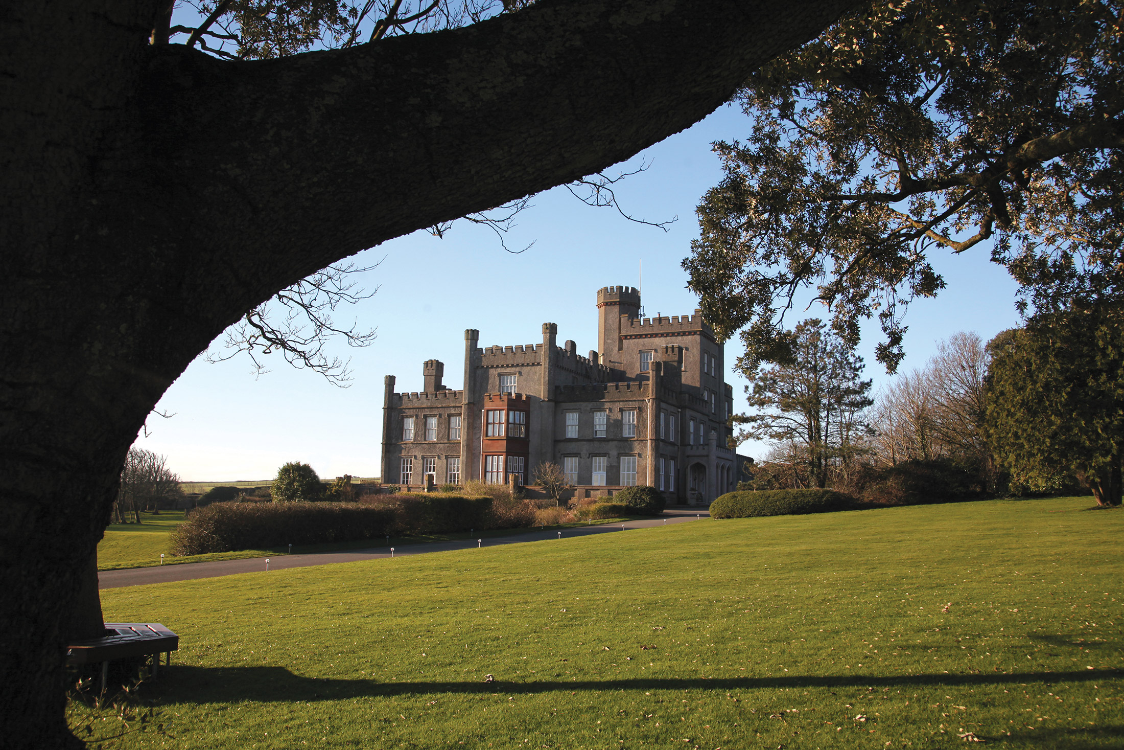
Set in 99 acres of mature parkland, the fine 19th-century baronial country mansion was re-styled in 1833 at the whim of the fourth Lord Kensington. As a result, its castellated outline reflects the eccentricity common among the wealthy landowners of the time. Today, this fascinating castle has a modern purpose, providing the discerning holidaymaker with a choice of stylish and comfortable apartments and cottages.
Not far from St Brides is Haverfordwest, an attractive and bustling market town that boasts a range of shops and restaurants. Also within easy driving distance to the north is Britain’s smallest city, St Davids, with its lovely 12th century cathedral – and to the south is the town of Pembroke, home of a beautiful old Norman castle.
St Brides is located in the Pembrokeshire Coast National Park, which offers a wealth of wonderful places to explore and enjoy. Its stunning coastline spans 186 miles and contains safe, sandy beaches ideal for families, as well as rugged cliffs and secluded rocky coves. It is also a paradise for the wildlife enthusiast, with plenty of rare habitats and species.
Enjoy Pembrokeshire’s 52 pristine beaches
If you love to spend your holidays relaxing on the beach, then look no further than Pembrokeshire. It boasts more Blue Flag and Green Coast beaches than any other part of the UK. With so much choice, you’re bound to find your perfect sunbathing spot.
Caerfai Bay is an ideal family hangout, as it’s great for rockpooling, swimming and snorkelling. St Brides Haven is best for fishers and divers, but if you’re looking for a particularly attractive beach, be sure to visit Marloes Sands. This long stretch is backed by orange and red cliffs – perfect for an evening walk.
Explore Pembrokeshire’s historic buildings
History lovers are in luck – Pembrokeshire has more than 51 forts and castles. Pembroke Castle is the most famous, and was built 27 years after the Battle of Hastings by the Normans. Much work has gone into restoring the castle to its former glory, so it’s well worth a visit.
Don’t go home without seeing St Davids either. Britain’s smallest city was named after the patron saint of Wales, and is well known for its stunning 12th-century cathedral.
Feast at the farmer’s market
You can’t beat fresh produce, and the best place to buy it in Pembrokeshire is arguably at the farmer’s market in Haverfordwest. It runs from 9am-3pm every Friday and sells a variety of fresh food, from rare-breed pork and dressed crab to apple-blossom honey and apple-y-ever-after cake. There are also markets on Saturday and Sunday, just outside Haverfordwest.
Walk the Pembrokeshire Coast Path
Keen walkers must take up the challenge of the Pembrokeshire Coast Path. It takes between 10 and 15 days to complete the whole thing, but even to walk just a bit is worth the effort. You’ll see a variety of landscapes during the 186-mile walk, including limestone cliffs, sea-flooded river valleys and red sandstone bays.
Hop on the Puffin Shuttle and Coastal Bus if you’re feeling too tired to walk all the way back to St Brides!
Family fun in Pembrokeshire
There’s no shortage of family attractions in Pembrokeshire – no matter whether it’s raining or shining, it’s easy to keep the children entertained. Folly Farm is a great all-weather attraction. It has both indoor and outdoor play areas, as well as zoo and farm animals.
Older children may prefer Oakwood Theme Park, which boasts more than 30 rides and attractions, though there is plenty for the little ones to enjoy too. If you and the children want to try something new, visit Heatherton Country Park. Entry is free, you just pay per activity, and they range from zorbing and go-karting to archery and pistol shooting.
Recreation and Facilities
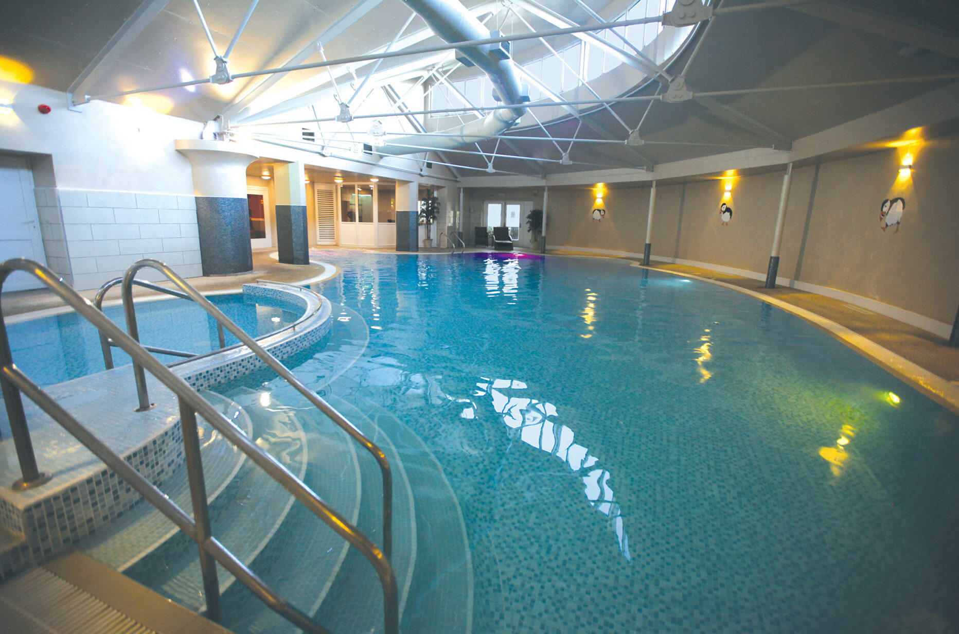
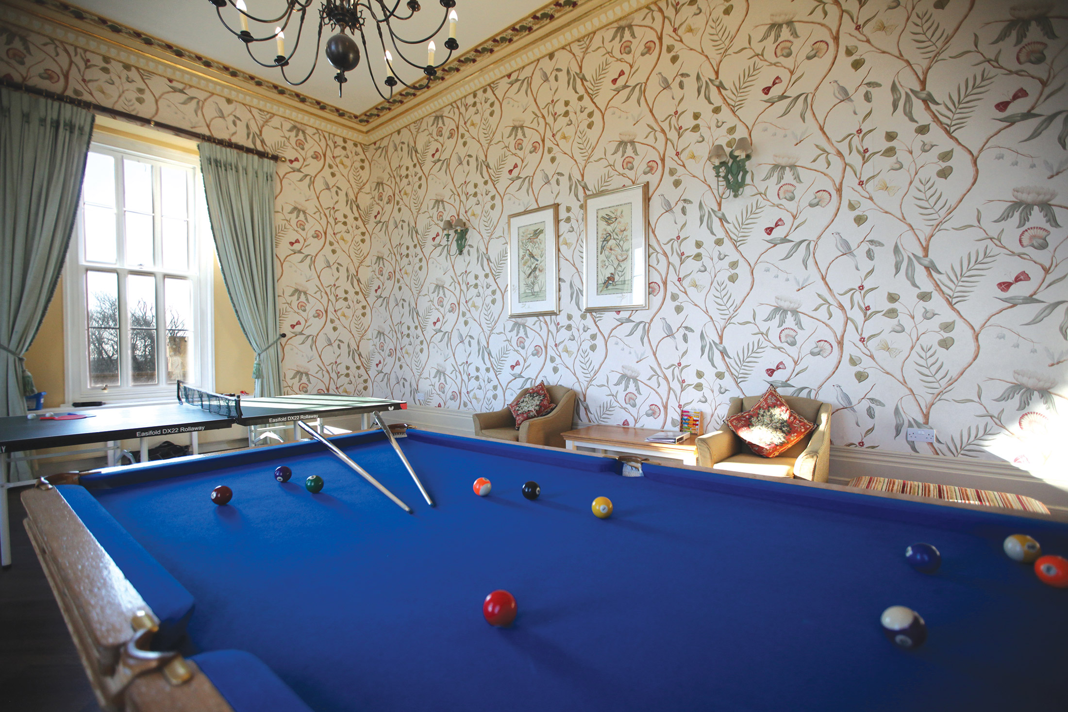
The recreation centre in the castle comprises a large heated indoor freeform swimming pool, an exercise room, sauna, and steam room, as well as table tennis, pool, snooker and billiards, and a library/writing room. Guests can use a variety of on-site facilities, including:
- an information and sitting room
- a kitchen
- a luggage store (for early arrivals and late departures)
- table tennis and a pool table
- a free launderette
- changing rooms and showers
- a WC that is adapted for disabled holidaymakers
- swimming pool
- free internet through WiFi access
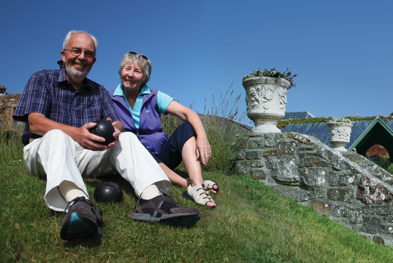
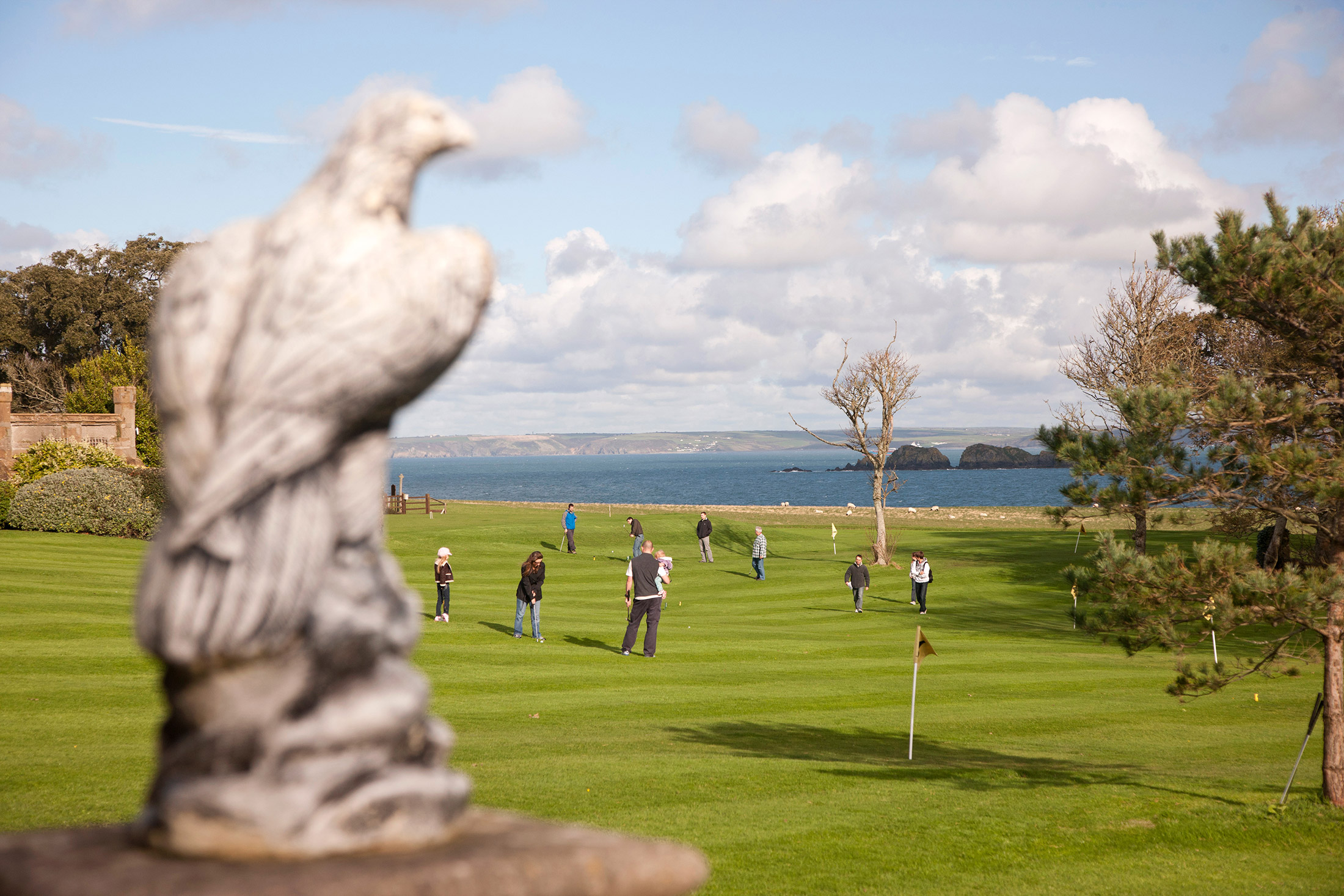
In the grounds, guests can enjoy three tennis courts and an artificial (all-year-round) bowling green, together with a croquet lawn and pitch and putt course in the summer months. There is a small shop selling essential provisions, as well as an information room with free Internet and Wi-Fi access in the reception building.
For children there is an adventure playground, and there is a barbecue area nearby.
Dylan’s bar/bistro overlooks the pitch and putt course and is available to the occupants and their guests.
Nearby, St. Brides Haven offers a safe children’s beach. There are 18-hole golf courses at Haverfordwest and Milford Haven – both of which offer concessionary rates to St. Brides Castle residents.
Shops and Restaurants
Tesco in Haverfordwest is the nearest supermarket and petrol station. Smaller village shops can be found in Broad Haven and Marloes. A number of restaurants to suit all tastes are available in and around Haverfordwest.
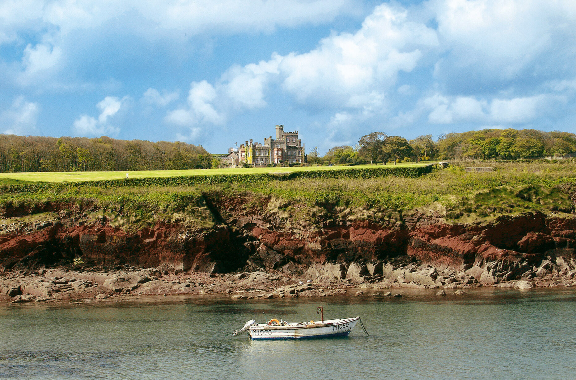
The estate’s long sweeping drive is flanked by pastures, which – on the seaward side – run down to a small haven.
There are spectacular views from the east side of the house, out across St. Brides Bay and the Irish Sea. At the northeast corner of the grounds, at the edge of St. Brides Haven, stands the tiny church of St. Bridgets.
The castle itself offers 22 self-contained apartments of varying sizes, plus reception rooms, a billiards room, library and family room (which are available for use by all guests). It also contains a splendid indoor swimming pool. The attractive furnishings are of a high standard: each property has a DVD player and a combined radio and teletext television (the site also has a free DVD library).
Properties in Pembrokeshire
Cottages
St Brides’ cottages are perfect for providing that degree of privacy, located slightly away from the main, stunning castle. Most are two storey properties and, depending on their size, can sleep between two and eight guests – with larger properties featuring an open-plan living area perfect for larger group get-togethers.
St Brides Castle, Pembrokeshire, Wales Cottages
Book a tourAll of the 26 cottages – two of which have been adapted for wheelchair access – sit in the grounds surrounding the beautiful St. Brides Castle, and the majority of them are terraced, stone properties that complement the imposing 19th century baronial mansion well. Some properties enjoy spectacular views down to St Brides Bay – so you really feel you’re sleeping right on the edge of the spectacular Pembrokeshire coast and, for a number of the cottages, access to a communal courtyard or garden area completes the charm.
As with all the holiday units at St Brides, the cottages are decorated in a manner sensitive to the local environment; soft, neutral hues, bright and airy by day, cosy and welcoming at dusk, with nautical elements reflecting the nearby coastline. With properties ranging from one to three-bedroom in size, the cottages at St Brides offer comfortable, communal living, lending themselves to family holidays, or to trips away with a group of friends.
After a day out with the dog – no coincidence that twenty of the cottages are designated “pet-friendly” – settle in for an evening spent in well-designed, comfortable interiors.
All cottages are equipped to a high standard, with a spacious and comfortable living area ready and waiting for you after a day of exploring Pembrokeshire’s exquisite, craggy coastline along the Pembrokeshire Coast Path that runs just a stone’s throw from your door. None of the cottages are far away from the main building, with its clubhouse and other communal facilities – but there’s a degree of independence and privacy in these properties that some will find welcome, especially in the detached six-guest cottage.
Facilities/equipment
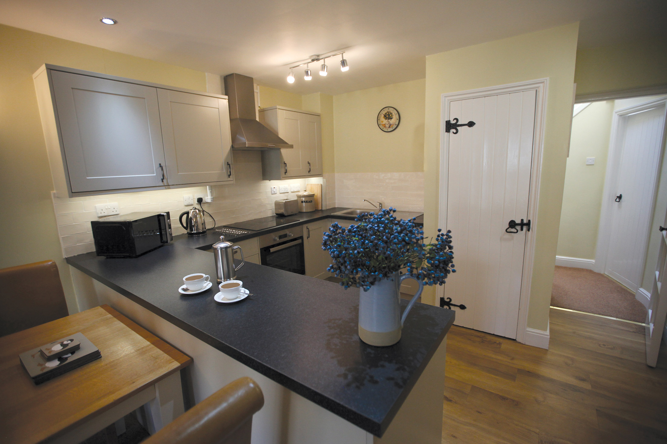
The largest cottage has three-bedrooms and can sleep six guests, however a maximum of eight guests can be accommodated, with a sofa bed providing space for the extra two people. All of the cottages have kitchens and dining areas, and some of these are spacious and perfect for big dinner parties. The kitchens are all inclusive and feature most of what you could wish for, for the preparation of a quick snack, or for a fine dinner!
Apartments
Many of the St Brides apartments are located within the stunning castle itself: from one-bedroom apartments with views over the woodland to two-bedroom apartments with unbeatable views out over the bay and across the Irish sea. There are a further three apartments in the surrounding buildings as well, one of which is three-bedroom. All these properties maintain their traditional feel, while well-designed furnishings demonstrate the care with which each room has been elegantly designed for your comfort.
St Brides Castle, Pembrokeshire, Wales Apartments
Book a TourWith lots of space and incredible views, your Pembrokeshire apartment is the epitome of comfort in an idyllic setting. Many of the 21 apartments offer sublime views down towards St Brides Bay and the Irish Sea beyond. With one, two or three-bedroom apartments available, these St. Brides properties can sleep anywhere between two and six people.
All bedrooms have either double or twin beds and the majority of one-bedroom apartments feature an en-suite, while many of the two-bedroom apartments feature an en-suite as well as separate bathroom facilities. With a range of sizes, some of the apartments will suit families or larger groups and are perfect for gathering together in a well-designed, open layout.
Smaller properties lend themselves more to couples, with the home-from-home setting providing a living space that is welcoming and cosy after a day out in the fresh Welsh air, as well as some additional features like stately four-poster beds keeping the magic of the castle setting alive.
For those that want to make the most of the incredible surroundings, we won’t blame you! But our stylish, well-equipped kitchens and carefully designed dining areas make staying in just as enjoyable. You’ll find you have an extensive range of facilities provided for you in the St Brides apartments.
Facilities/equipment
Facilities include well equipped kitchens, so an evening in for a quiet meal together is no bother, plus there are televisions and DVD players, ideal for curling up in front of a film from the extensive DVD library over in the communal games room. Quality furnishings and relaxing decorative touches ensure your stay in St Brides is a restful and happy one.
Studios
The four two-guest studio apartments at St Brides couldn’t be better suited for a romantic get-away. All, like many of the larger apartments, have been beautifully converted from rooms within the baronial castle and are neat, simple and practical, some with beautiful views of the surrounding countryside. Perfect for a romantic, castle escape.
St Brides Castle, Pembrokeshire, Wales Studios
Book a TourSmall, but perfectly formed. A phrase that could have been coined to describe St Brides’ four studio units. These cosy properties provide all you need for that perfect holiday. Attractively furnished, with homely details, these studios are comfortable and relaxed. All properties are fully furnished and open plan, with the exception of one separate-bedroom studio apartment. There are three double bed properties and one with twin beds for those travelling with a friend or family member.
An open-plan layout is a good use of space and, for couples travelling without children, St Brides’ studio accommodation offers the perfect chance to relax and really enjoy each other’s company. But, with the Irish Sea on the doorstep – sometimes wild, sometimes benign, always majestic – there really is no better place to be. A kitchen that comes with all sorts of equipment means you will have most of what you need right at your fingertips.
Spend the days exploring the magnificent surroundings; and in the evenings settle in with your nearest and dearest, surrounded by impressive views that leave you in no doubt that you’re in the midst of the glorious Pembrokeshire Coast National Park.
Facilities/equipment
Just because some of the studios are small doesn’t mean they’re any less well-equipped than their more spacious counterparts; all the studios boast comfortable, stylish furnishings, modern televisions and DVD players, and well equipped kitchens. We’ve got everything from roasting trays to corkscrews, so you can prepare the perfect romantic dinner for two, or simply curl up with a glass of wine.
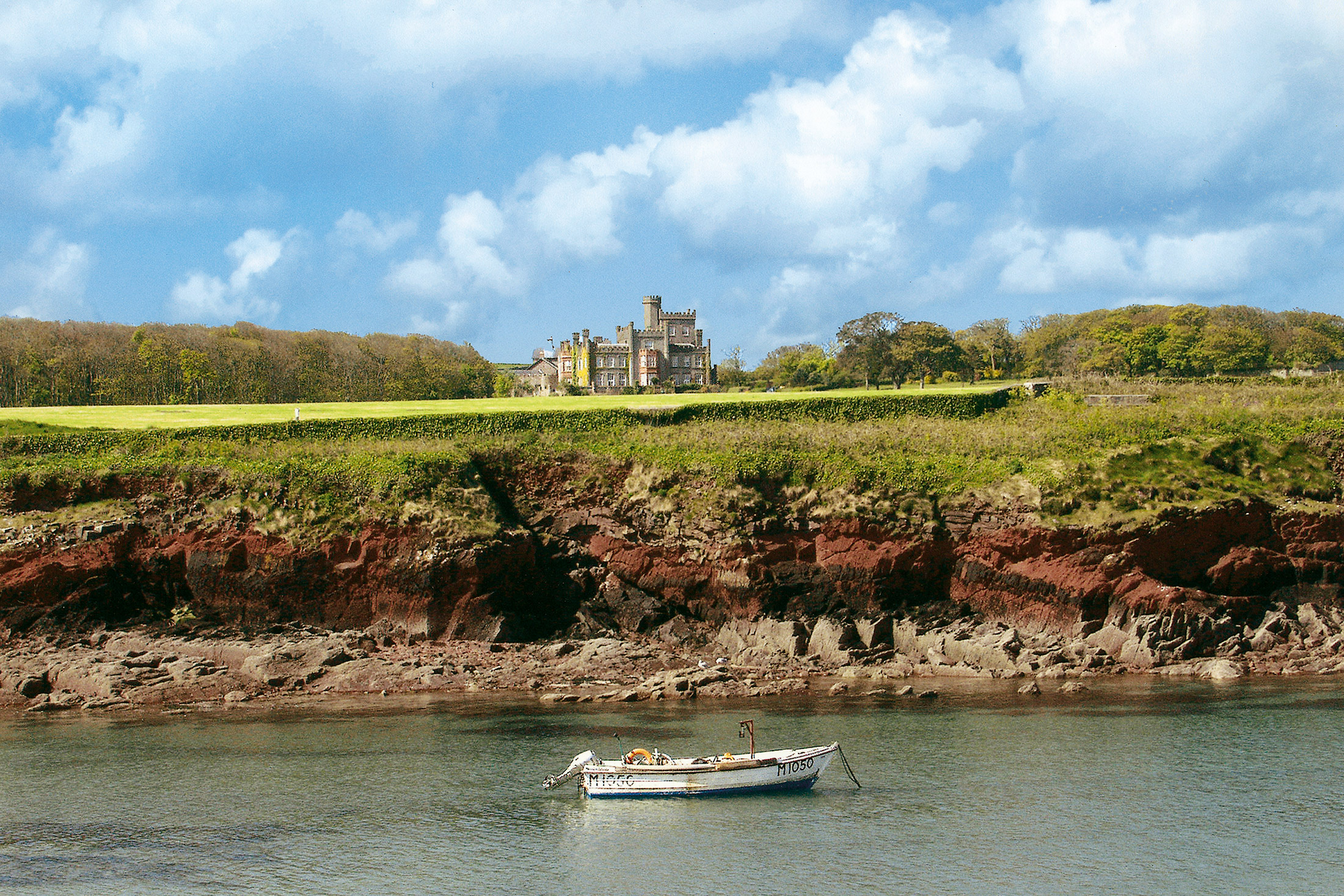
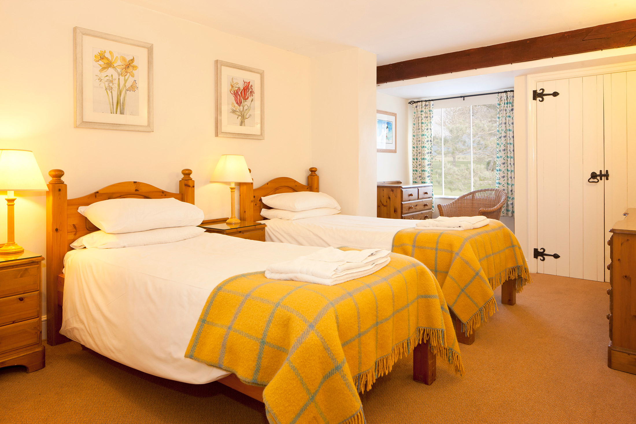
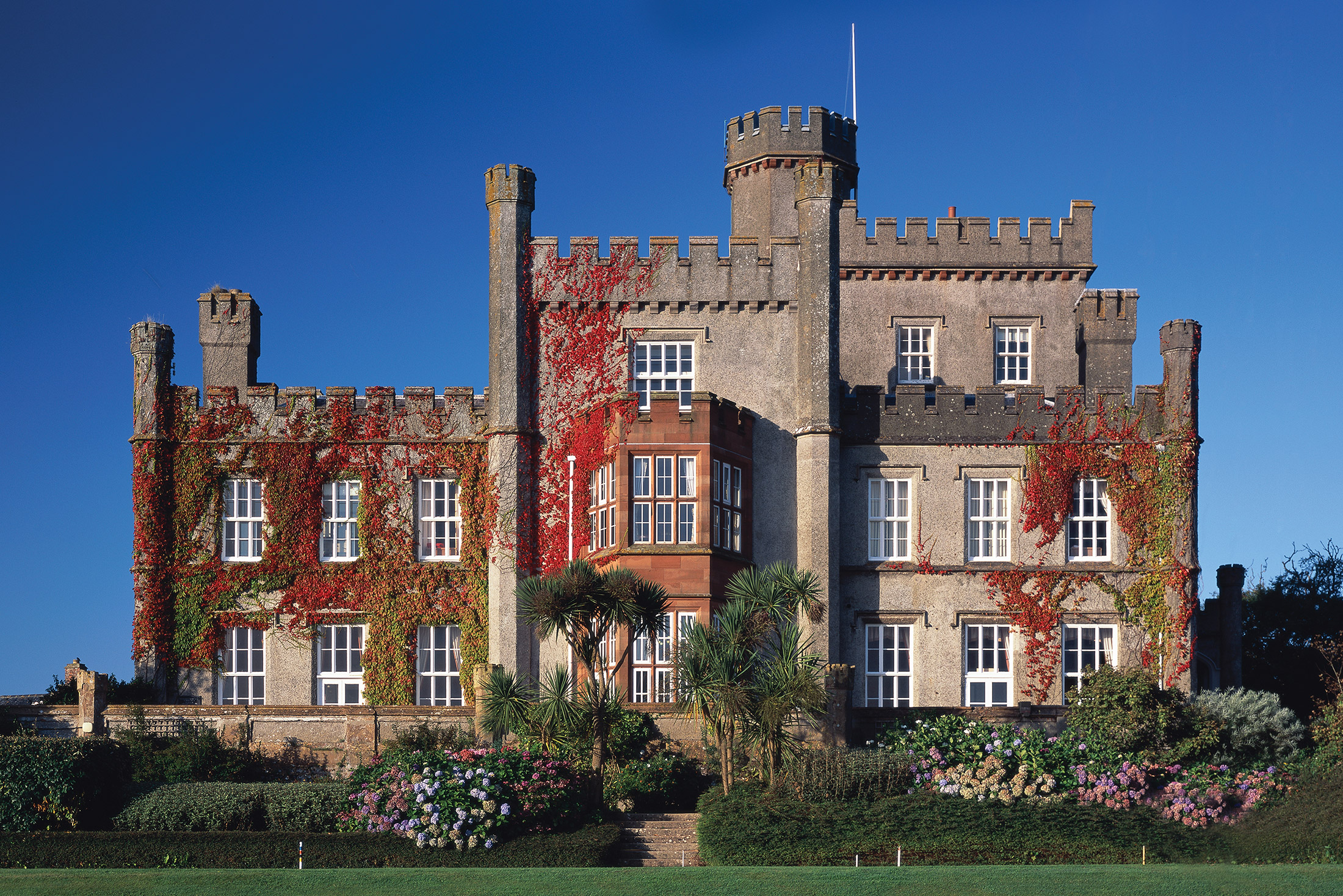
The photos below show that St Brides Castle really is an impressive building, both inside and out. Boasting incredible views of the Pembrokeshire coast and surrounding National Park, it will no doubt inspire you to get out and explore somewhere new each day of your stay.
While the castle has been renovated in recent years, it has retained its original look. Even the interior is traditional – you’ll feel like you’ve gone back in time! The four-poster beds are a particularly attractive feature.
St Brides has a range of facilities suitable for the whole family, from a children’s play area to a bowling green. In the summer, why not make use of the barbeque area? The castle offers better views than any restaurant ever could.



Gallery


Location
HPB St. Brides Castle
St. Brides Bay
Haverfordwest
Pembrokeshire
Wales
SA62 3AL
Tel: +44 800 230 0391
Email: details@hpb.co.uk
Apart from the jaw-dropping nature of the building, what strikes most people about St Brides Castle is its remoteness. Close to the edge of the Irish Sea, drive any further and you’d be in the drink! It is a truly magnificent setting. The view out over the cliffs and across the water is just glorious – and, when the weather does ‘get up’ (and it can), is nothing less than spectacular. Best observed through the window, from your well-equipped, cosy apartment within the Castle itself.
But there’s much to do at St Brides – whatever the weather. Tennis players, bowlers, golfers and croquet fanciers will all find much to their liking; while ‘indoors’ boasts the full panoply of games and leisure facilities.
And, if you don’t fancy cooking, why not treat yourself to dinner and drinks at the on-site bistro and bar?
Things to do in Pembrokeshire
The unspoilt village of Dale is just four miles south of St Brides, in the heart of the National Park. Traditionally an agricultural and fishing community, there’s plenty of wildlife including birds, seals, dolphins and porpoise. Located on the National Park’s long-distance path, the village is popular with walkers.
It has safe beaches where there are plenty of opportunities for water sports. The West Wales Wind, Surf and Sailing company offers training and equipment hire for a range of activities. There are also pony trekking and riding facilities nearby.
Britain’s smallest city, St Davids, is also within easy driving distance along the coast. This beautiful city has been a favourite with artists, travellers and pilgrims for centuries. Visit its lovely 12th-century cathedral, which is built on the site of a 6th-century monastery and still serves the local community.
Festivals and events
While you will probably be spoilt for choice with all the attractions in and around Pembrokeshire, it is especially worth visiting when one of the big festivals or events is taking place. Whether you’re into music, sport or food, these gatherings are not to be missed.
Sporting events
With so much great scenery, Pembrokeshire is the ideal spot for participating and watching sporting events of all kinds.
Ironman Wales
For the ultimate in sporting events, look no further than Ironman Wales. An extremely tough course, this triathlon takes competitors on a legendary journey through Pembrokeshire’s sights, visiting castles, rugged coastlines and breath-taking scenery.
For the ultimate in sporting events, look no further than Ironman Wales. An extremely tough course, this triathlon takes competitors on a legendary journey through Pembrokeshire’s sights, visiting castles, rugged coastlines and breath-taking scenery.
Although this is a challenge for any seasoned athlete, those not taking part will be treated to an amazing spectator event which celebrates everything great about human endurance.
Usually occurring in the middle of September, Ironman Wales starts on the beaches of Tenby and terminates once competitors have swum, cycled and run their way through the challenging course back to the town.
Spectators, on the other hand, will surely have a much more relaxing time.
Food festivals
We love our food in Pembrokeshire and every year there are a range of festivals for individuals to really get their teeth into.
Really Wild Food Festival
This amazing festival celebrates everything rural about Pembrokeshire. Although there are usually around 80 stalls selling wild foods, drinks, and crafts, you can never be entirely sure what you’ll discover. For example, 2015’s event based in St Davids had additional events such as pig racing, archery, falconry and mud runs.
Typically taking place in the start of summer, head on down if you fancy a truly ‘wild’ experience.
Narberth Food Festival
An award-winning event, the Narberth Food Festival is a renowned celebration famous for its treats and local delicacies. Taking place towards the end of September, the event prides itself on allowing local businesses to show off their wares and has a range of stalls and attractions to keep the whole family entertained.
Pembrokeshire Fish Week
Often regarded as one of Britain’s best food festivals, Pembrokeshire Fish Week is a celebration of everything the region has to offer. With hundreds of businesses taking part, this summer festival has numerous activities on the coasts and waterways, while budding chefs can learn a thing or two from celebrity cooking demonstrations.
With plenty of opportunities to enjoy some of the freshest produce you can imagine, this event is not to be missed.
Music festivals
Who doesn’t like a good music festival? In Pembrokeshire, we have just about every genre you could imagine – ranging from the blues to classical treats. Here are some of the highlights:
The Fishguard Folk Festival – A mostly free festival showcasing local artists in the region. Located on the Pembrokeshire coast, this event is fun for the whole family and typically occurs around May.
Fishguard International Music Festival – A classical music event set in various locations throughout Pembrokeshire. Takes place towards the end of July.
St Davids Cathedral Festival – A classical music festival typically taking place towards the end of May, it’s an event which is a must-see for anyone looking to experience a bit of culture.
Tenby Blues Festival – Taking place towards the end of the year, this celebration of live music is definitely worth seeing.
Fishguard Jazz and Blues Festival – While this popular festival takes place in August, the build up to this event starts with Aberjazz; an event to celebrate International Jazz Day. Originally started as a local gathering, this festival is now an established part of Pembrokeshire’s music scene.
If none of these are your thing, then there is always something interesting being played in one of the many pubs, clubs, and bars throughout the region. To discover what our local musicians are up to, take a look at the Visit Pembrokeshire website.
Spend a day in historical Pembroke
Head half an hour south east to the beautiful and ancient town of Pembroke, the birthplace of Henry VII. Its history can be traced to 1093, when the Normans built a wooden fortress, although the present castle was built in the latter end of the 12th century.
Pembroke Castle is largely intact and sits on the banks of the estuary. Its keep has a ‘massive cylindrical tower with an unusual stone dome’. The castle’s passages, tunnels and exhibitions of medieval life will keep everyone occupied for hours, and a visit to the Brass Rubbing Centre will create a unique souvenir.
Afterwards, enjoy a stroll or a picnic in the castle grounds, followed by a walk around the medieval town walls and millpond. Pembroke has many other attractions, including a popular town trail, a museum, a daily indoor market and plenty of craft and gift shops.
Explore Pembrokeshire's islands
Cruises are available from Milford Haven, on the Daugleddau waterways and upriver into unspoilt Pembrokeshire. Boats also depart regularly from Milford Haven to visit the local island bird sanctuaries of Skomer, Skokholm and Grassholm.
Pembrokeshire Islands Boat Trips offers 15-minute outings that take visitors to see ‘puffins, guillemots, razorbills, short-eared owls, Manx shearwaters and a host of other birds’. Grey seals can also be spotted throughout the year, along with their white furry pups from September.
The island of Skomer has ‘Britain’s largest undisturbed prehistoric Iron Age settlement with hut circles, cemeteries and field systems from 2000BC’. There’s also a farmhouse that describes farming methods through the ages.
Find adventure in Haverfordwest
Haverfordwest, a short drive north east, is a bustling medieval market town with narrow streets. The oldest part of the town is near the 12th-century castle, which is now a shell and home to the museum. There are several churches, many splendid Regency and Victorian buildings, and plenty of galleries, shops and places to eat.
Just outside Haverfordwest at Wolfscastle, the Sealyham Activity Centre offers adventure on both land and water. The centre’s qualified instructors turn the coastline into a playground for kayaking, surfing, climbing, biking and other exciting sports.
Theme parks galore
Heading 26 miles east from St Brides to the medieval town of Tenby on Wales’ south coast, you’ll encounter two theme parks (both of which cater for dogs).
Oakwood Theme Park has 30 rides and attractions, with something for everyone, and any hunger pangs can be satisfied at a number of food outlets. Dogs aren’t allowed in the park, but it offers free holding kennels.
Heatherton Activity Theme Park, which sits on the outskirts of the Pembrokeshire Coast National Park, has lots of activities for all the family. It has free entry with a ‘pay when you play’ approach and a dog-friendly Sports Park.
Closest to Tenby is the 200-acre Folly Farm park, which has six zones that range from the Jolly Farm to the Zoo. Originally a dairy farm, it’s now Wales’ top paid-for tourist attraction.
Tenby itself is a popular tourist destination, with lovely sandy beaches, 13th-century medieval town walls, the Tudor Merchant’s House (National Trust) and Tenby Castle, which has a museum and art gallery. There’s also plenty of wildlife along the Pembrokeshire Coast Path and on Caldey Island.
Milford Haven activities
With a history deeply rooted in maritime activity due to it being the home of the largest estuary in Wales this is possibly the sea goer’s haven. There’s plenty of water based activities with sailing being a popular activity here. Alongside this there’s plenty of evidence of the huge fishing fleet which used to be housed here including the area’s oldest building which used to keep whale oil in storage.
This building is now home to a local museum. The museum is genuinely fascinating covering all aspects of Milford Haven’s sea faring history which not only includes fishing but whaling and petrol too. Today that history of petroleum importing is prevalent with the local oil and gas refineries.
Once you’re finished there you can visit the numerous cafes, restaurants and small pubs that dot the town near the harbour.
Things to do in St. Brides Bay
Within the bay there’s an eclectic mix of activities. From horse riding over the sand to surfing in the fresh water that was used in a Harry Potter film to walking the Pembrokeshire coast path. The coast path is highly recommended being The National Geographic’s second best walk in the world! Taking the time to stroll the long path will have you seeing some incredible views and wildlife; an ideal activity for all the family even if you don’t experience the full length of the walk.
If you’re feeling more adventurous or have an out-going family with you there’s also the very exciting option of coasteering on the north side of the bay. Depending on exactly how adventurous you’re feeling you can take part in scrambling, swell-riding and even cliff jumping!
More information
Pembrokeshire National Park and the County Council provide lots of information booklets on the wide variety of activities and crafts available in the area. Maps, guides and other tourist information are also available at St. Brides reception.
Blog
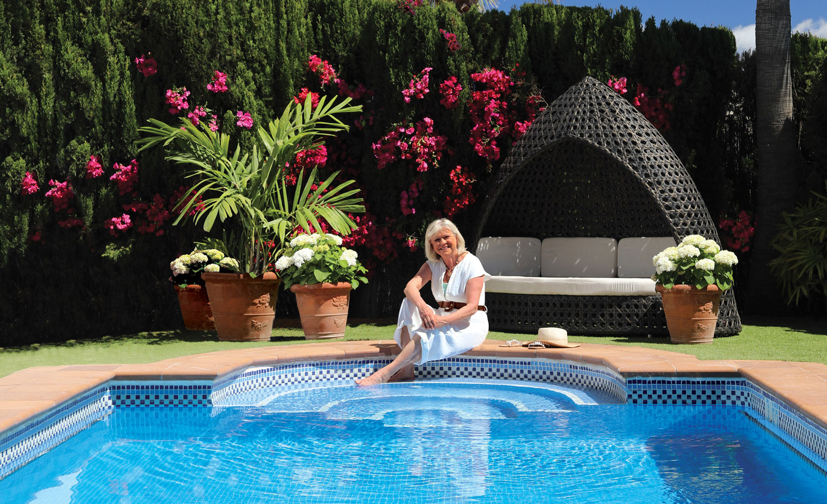
Sue Barker is making the most of her free time – and you could too.
Posted by Katy Peck on 9 July 2025
Learn more about how Sue Barker, retired broadcaster and Bondholder is making the most of her free time by enjoying holidays with HPB
Read moreLearn more about how Sue Barker, retired broadcaster and Bondholder is making the most of her free time by enjoying holidays with HPB
Read more
Autumn Escapes in France
Posted by Katy Peck on 26 June 2025
From late August to mid-October, France comes alive with les vendanges - the grape harvest. HPB’s three French sites, including St Siméon and Constant, are perfectly placed for a tranquil, enchanting holiday at this remarkable time of year.
Read moreFrom late August to mid-October, France comes alive with les vendanges - the grape harvest. HPB’s three French sites, including St Siméon and Constant, are perfectly placed for a tranquil, enchanting holiday at this remarkable time of year.
Read more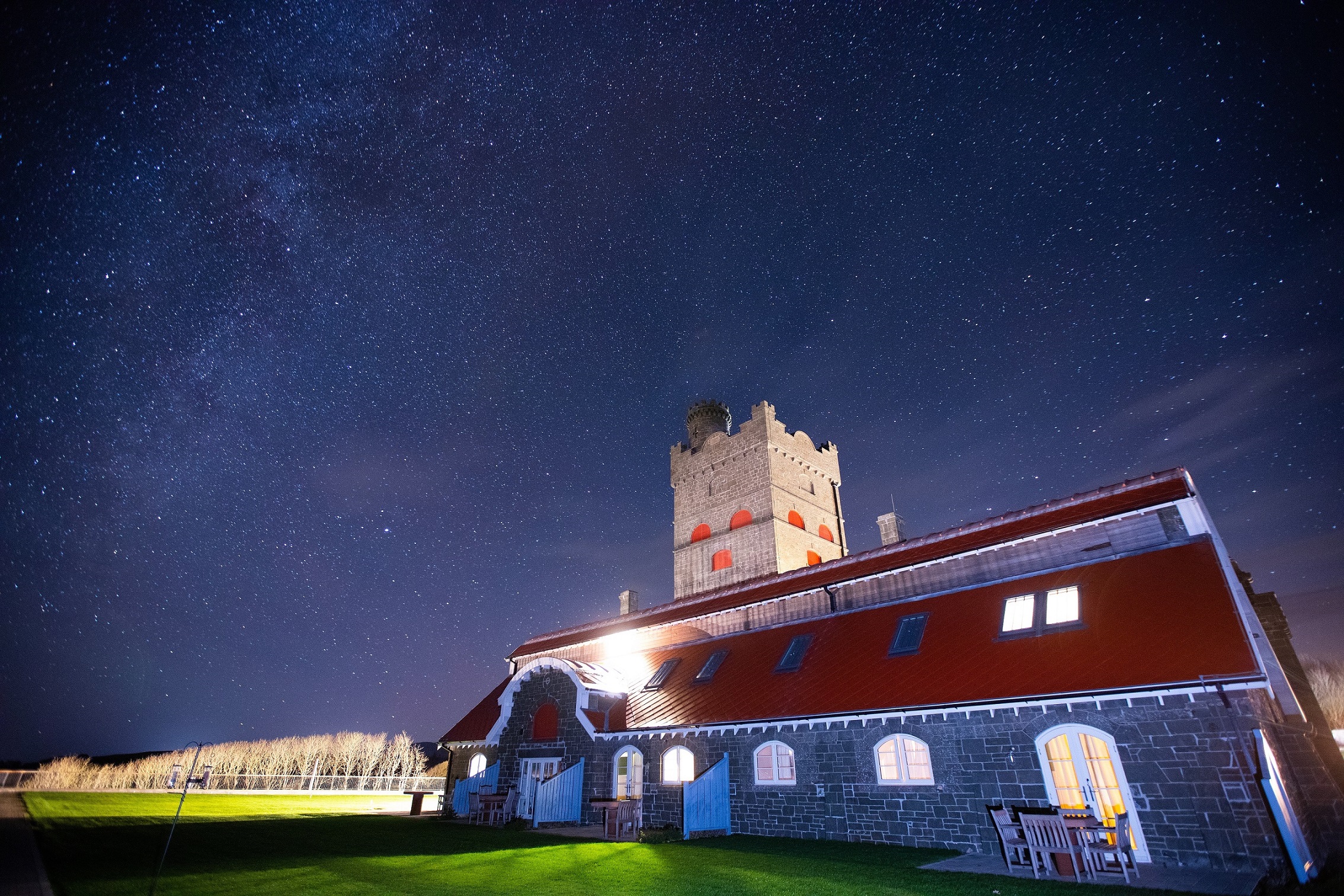
Stargazing Adventures Near HPB Properties: Explore the Night Sky
Posted by Katy Peck on 12 June 2025
From distant galaxies to meteor showers and the shimmering wave of the Milky Way, stargazing brings the beauty of the universe into clear view. Fortunately, some of the UK’s best places to explore the cosmos are just a stone’s throw from HPB locations.
Read moreFrom distant galaxies to meteor showers and the shimmering wave of the Milky Way, stargazing brings the beauty of the universe into clear view. Fortunately, some of the UK’s best places to explore the cosmos are just a stone’s throw from HPB locations.
Read more
Cooking by the Book
Posted by Katy Peck on 2 June 2025
Over a decade ago, Bondholder Dorothy Organ, sadly no longer with us, approached the HPB editorial team with an idea. What if Bondholders contributed recipes linked to their favourite HPB locations, and the collection was turned into a cookbook?
Read moreOver a decade ago, Bondholder Dorothy Organ, sadly no longer with us, approached the HPB editorial team with an idea. What if Bondholders contributed recipes linked to their favourite HPB locations, and the collection was turned into a cookbook?
Read moreView all the latest articles from HPB
Read moreWalks in Pembrokeshire
There are lots of places to discover. Have a look at some of our suggested walks below.
Having a Private Tour at an HPB holiday location is an enjoyable way to see the high standards of furnishings and facilities you could enjoy with HPB.
A local HPB Representative will show you around the site and answer any questions you may have.
Alternatively, you are welcome to book a Personal Presentation at a hotel near you. You can chat to one of our local HPB Representatives, ask your questions and view the complete portfolio of HPB locations.
Book a private tourRead our HPB Feefo Reviews
HPB’s holiday booking service has been rated 4.9 out of 5 based on 14,772 customer reviews on Feefo
![]()
What people like you say about HPB
“Going the ‘extra mile’ for our Bondholders”
Mr and Mrs WilsonWe caught up with Barbara and Chris at St Brides, where they were enjoying a well-earned early-summer break and collecting their granddaughter and a friend from a biology field trip in Pembrokeshire the next day to stay with them.
“We needed extra beds in the apartment but, yet again, nothing has been too much trouble for [site manager] Mandy [Rees] and her staff.”
“Have we become spoilt?” she asks (rhetorically). “Yes, we have – and yes we are, every time we visit an HPB property. And long may it continue!”
