St Brides Castle, Pembrokeshire, Wales
On the edge of the spectacular Pembrokeshire coast
Book a tour Open Gallery-
51 apartments and cottages in Pembrokeshire
-
On the edge of the spectacular Pembrokeshire coast
-
Indoor pool, games room and family room
-
Surrounded by a unique National Park
-
Winner of the Prince of Wales Award for Architecture
-
Superb walking country
-
Set in 99 acres of mature parkland
Discover Pembrokeshire
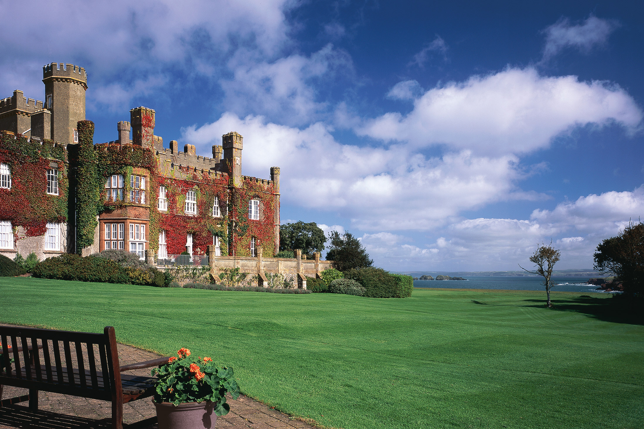
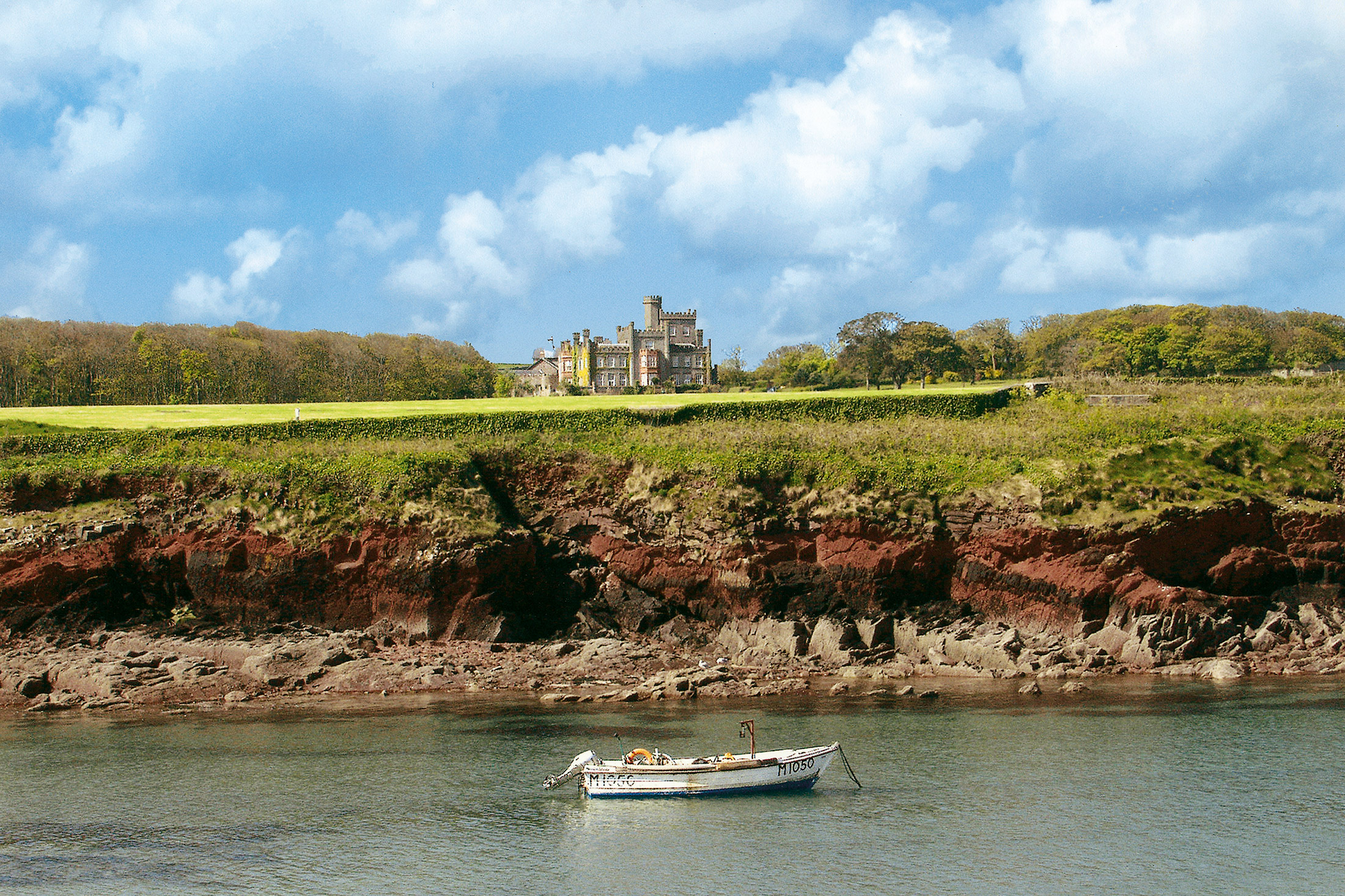
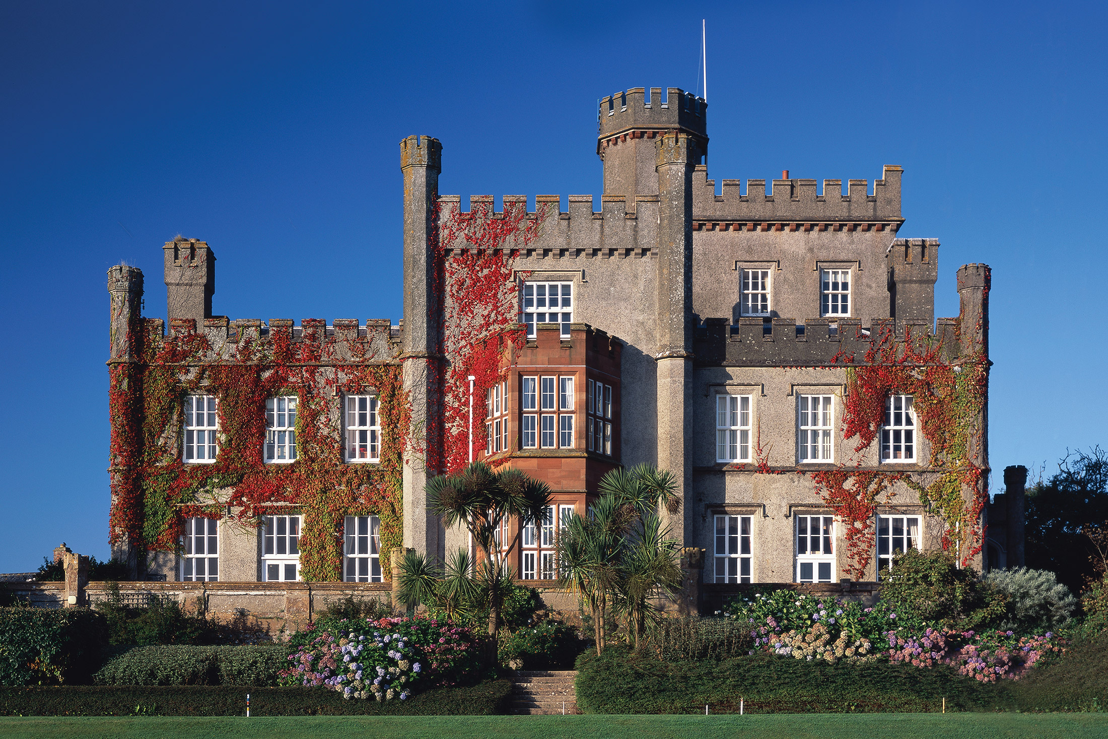
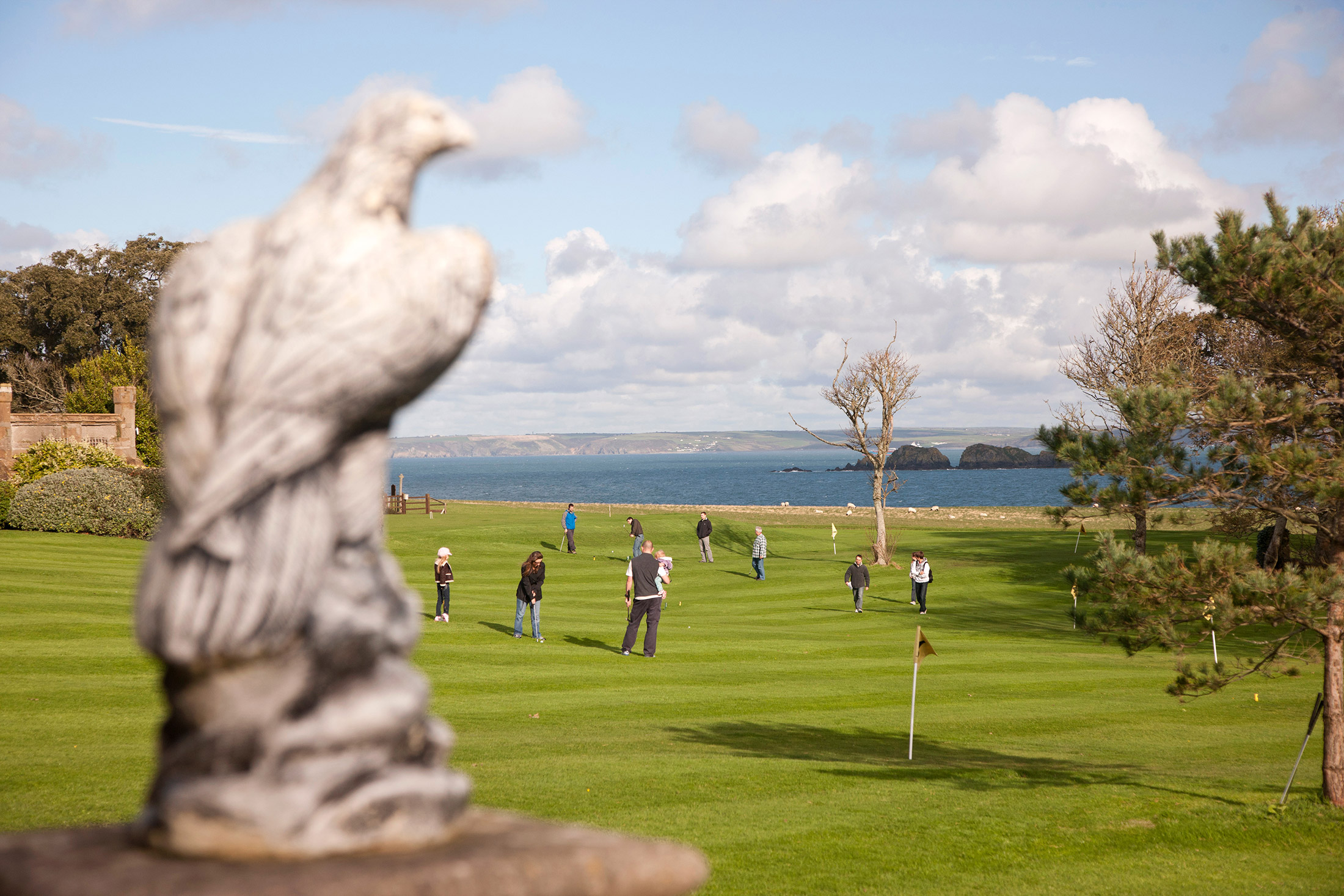
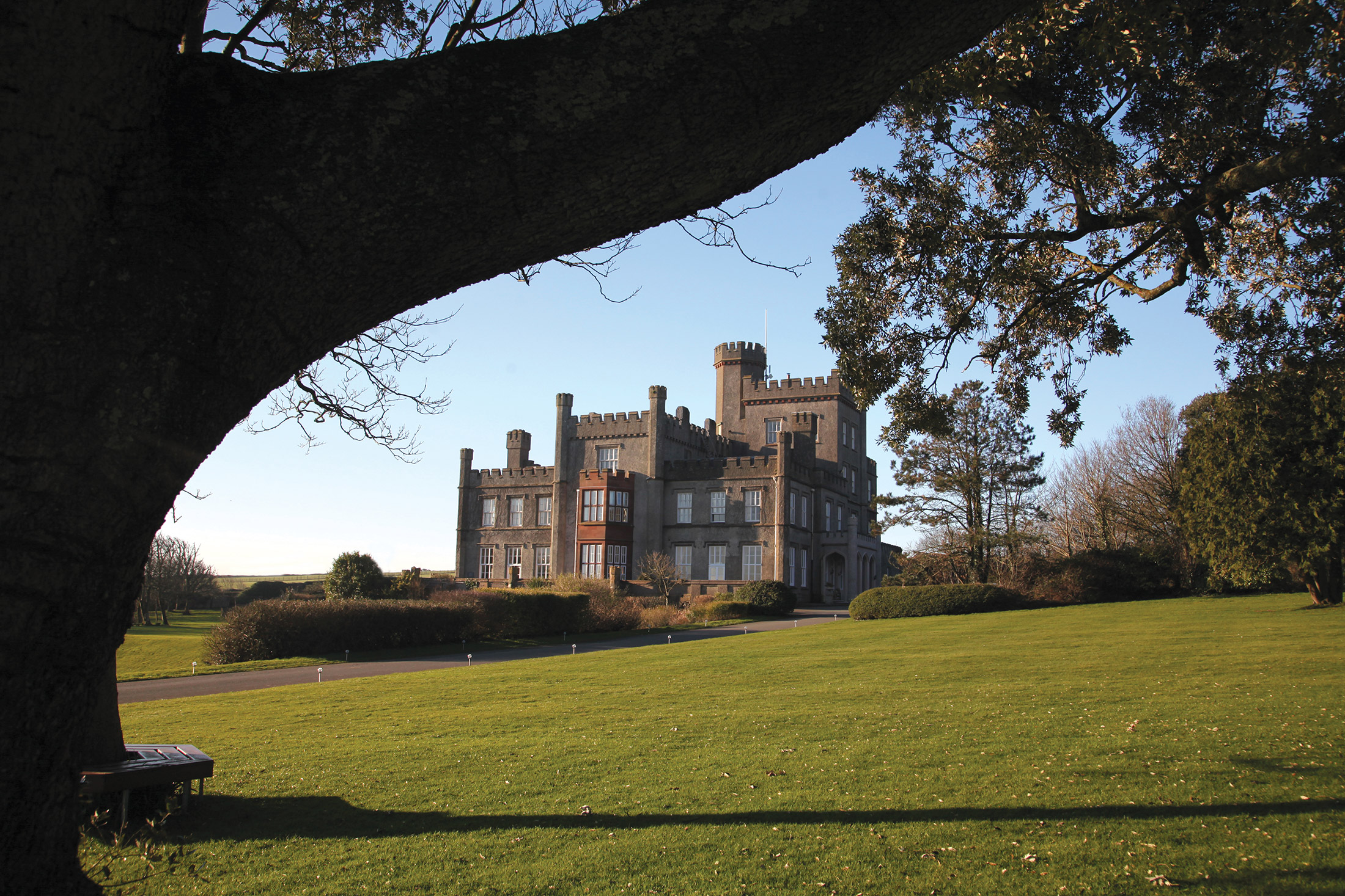
Remote and unspoilt, the Pembrokeshire peninsula – at the southwest corner of Wales – must surely rank among Europe’s most magnificent and varied coastlines. Here you’ll find St Brides Castle, the restoration of which earned a Prince of Wales Award for Architecture.
Set in 99 acres of mature parkland, the fine 19th-century baronial country mansion was re-styled in 1833 at the whim of the fourth Lord Kensington. As a result, its castellated outline reflects the eccentricity common among the wealthy landowners of the time. Today, this fascinating castle has a modern purpose, providing the discerning holidaymaker with a choice of stylish and comfortable apartments and cottages.
Not far from St Brides is Haverfordwest, an attractive and bustling market town that boasts a range of shops and restaurants. Also within easy driving distance to the north is Britain’s smallest city, St Davids, with its lovely 12th century cathedral – and to the south is the town of Pembroke, home of a beautiful old Norman castle.
St Brides is located in the Pembrokeshire Coast National Park, which offers a wealth of wonderful places to explore and enjoy. Its stunning coastline spans 186 miles and contains safe, sandy beaches ideal for families, as well as rugged cliffs and secluded rocky coves. It is also a paradise for the wildlife enthusiast, with plenty of rare habitats and species.
Enjoy Pembrokeshire’s 52 pristine beaches
If you love to spend your holidays relaxing on the beach, then look no further than Pembrokeshire. It boasts more Blue Flag and Green Coast beaches than any other part of the UK. With so much choice, you’re bound to find your perfect sunbathing spot.
Caerfai Bay is an ideal family hangout, as it’s great for rockpooling, swimming and snorkelling. St Brides Haven is best for fishers and divers, but if you’re looking for a particularly attractive beach, be sure to visit Marloes Sands. This long stretch is backed by orange and red cliffs – perfect for an evening walk.
Explore Pembrokeshire’s historic buildings
History lovers are in luck – Pembrokeshire has more than 51 forts and castles. Pembroke Castle is the most famous, and was built 27 years after the Battle of Hastings by the Normans. Much work has gone into restoring the castle to its former glory, so it’s well worth a visit.
Don’t go home without seeing St Davids either. Britain’s smallest city was named after the patron saint of Wales, and is well known for its stunning 12th-century cathedral.
Feast at the farmer’s market
You can’t beat fresh produce, and the best place to buy it in Pembrokeshire is arguably at the farmer’s market in Haverfordwest. It runs from 9am-3pm every Friday and sells a variety of fresh food, from rare-breed pork and dressed crab to apple-blossom honey and apple-y-ever-after cake. There are also markets on Saturday and Sunday, just outside Haverfordwest.
Walk the Pembrokeshire Coast Path
Keen walkers must take up the challenge of the Pembrokeshire Coast Path. It takes between 10 and 15 days to complete the whole thing, but even to walk just a bit is worth the effort. You’ll see a variety of landscapes during the 186-mile walk, including limestone cliffs, sea-flooded river valleys and red sandstone bays.
Hop on the Puffin Shuttle and Coastal Bus if you’re feeling too tired to walk all the way back to St Brides!
Family fun in Pembrokeshire
There’s no shortage of family attractions in Pembrokeshire – no matter whether it’s raining or shining, it’s easy to keep the children entertained. Folly Farm is a great all-weather attraction. It has both indoor and outdoor play areas, as well as zoo and farm animals.
Older children may prefer Oakwood Theme Park, which boasts more than 30 rides and attractions, though there is plenty for the little ones to enjoy too. If you and the children want to try something new, visit Heatherton Country Park. Entry is free, you just pay per activity, and they range from zorbing and go-karting to archery and pistol shooting.
Recreation and Facilities
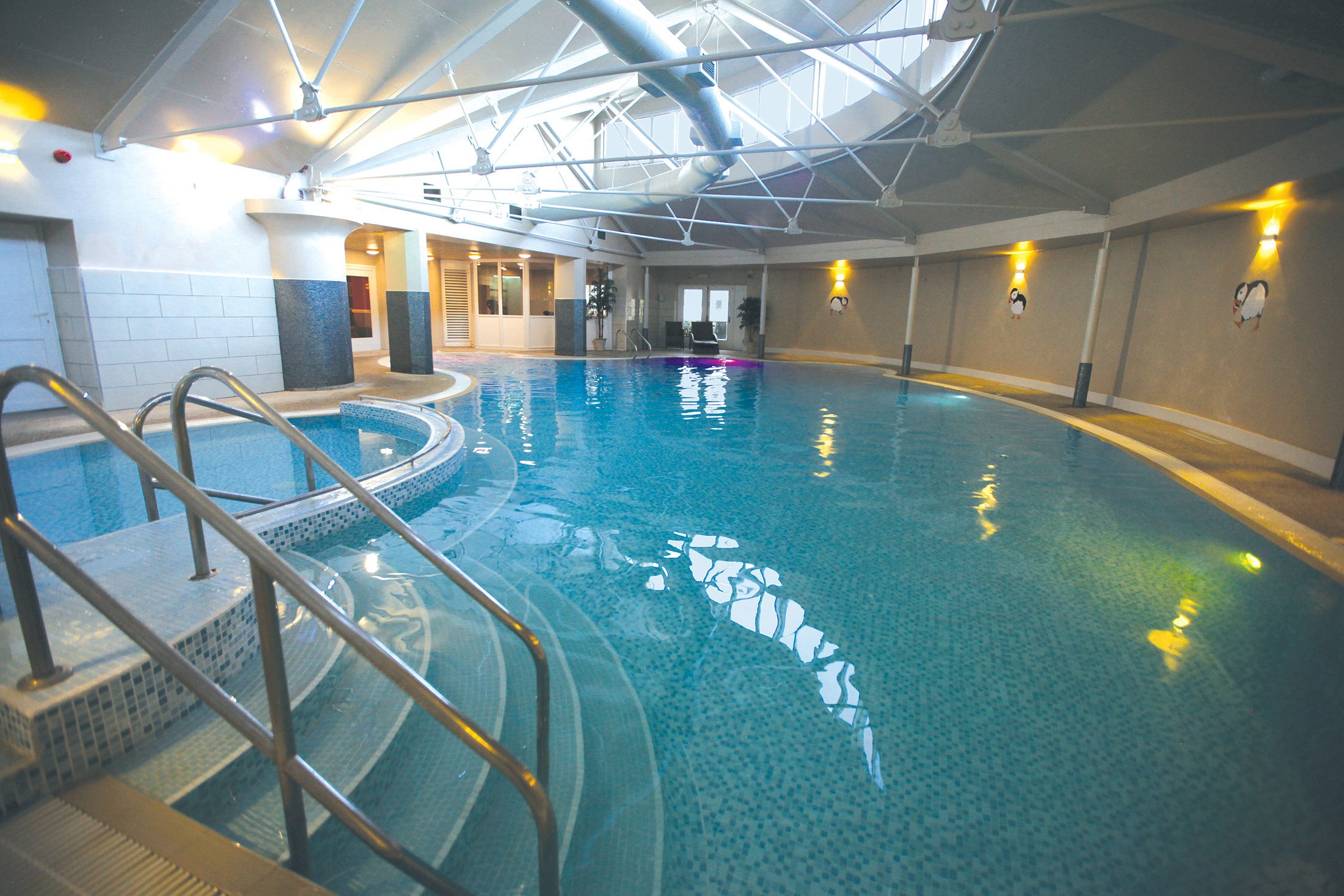
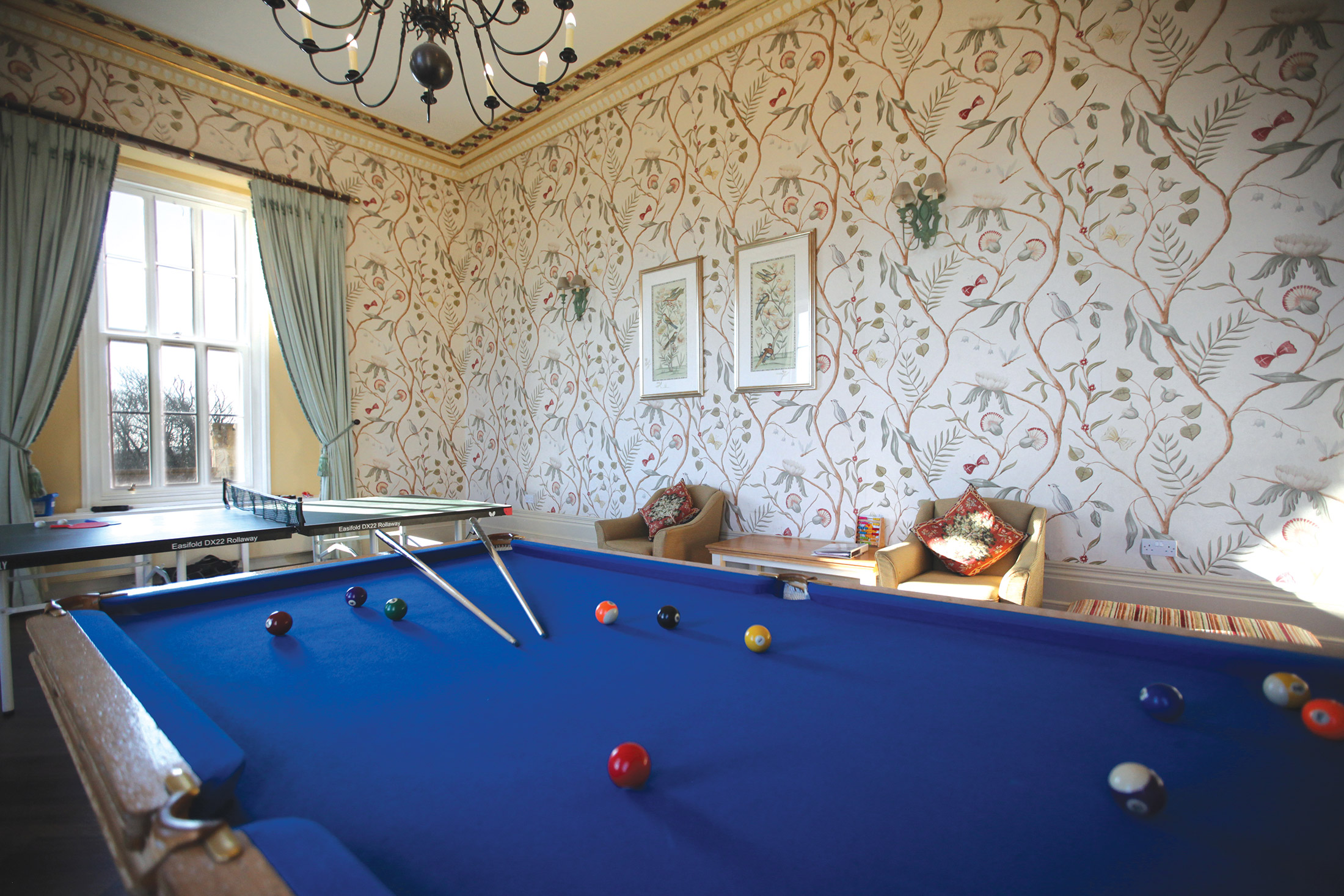
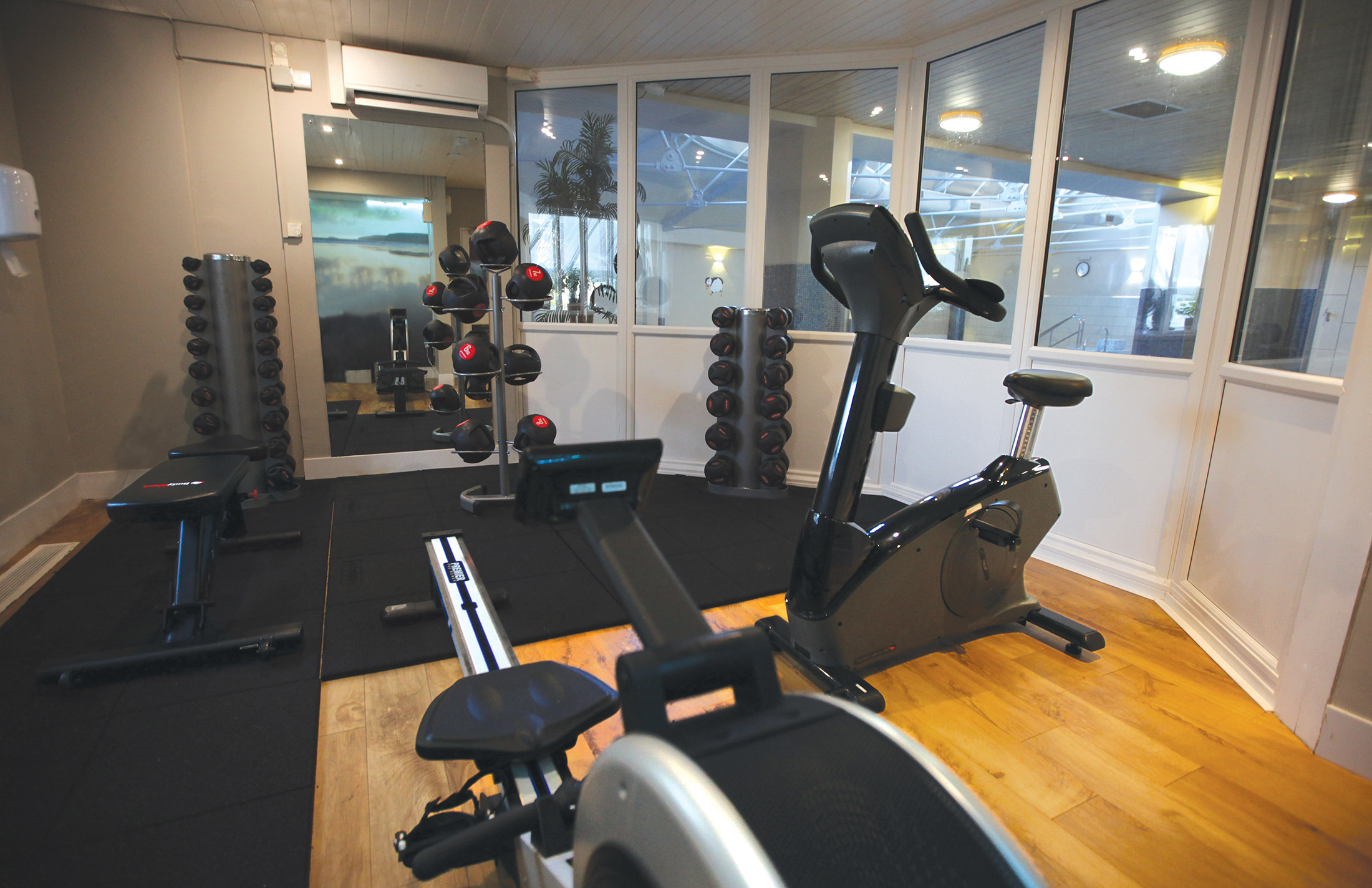
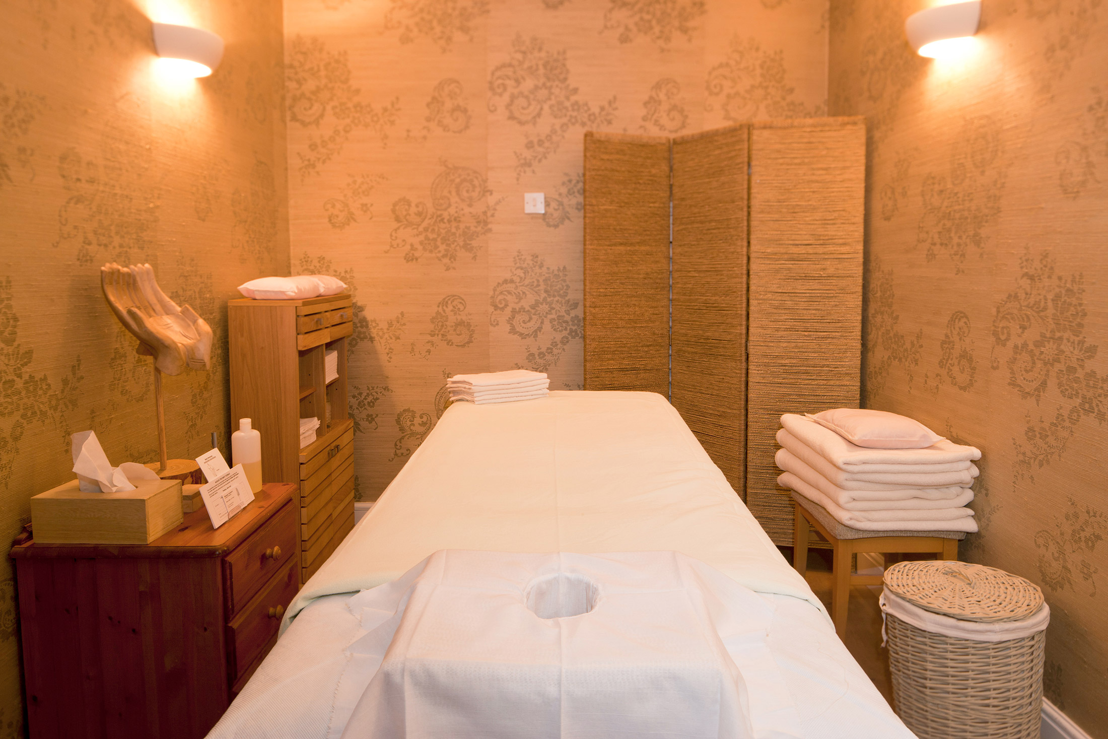
The recreation centre in the castle comprises a large heated indoor freeform swimming pool, an exercise room, sauna, and steam room, as well as table tennis, pool, snooker and billiards, and a library/writing room. Guests can use a variety of on-site facilities, including:
- an information and sitting room
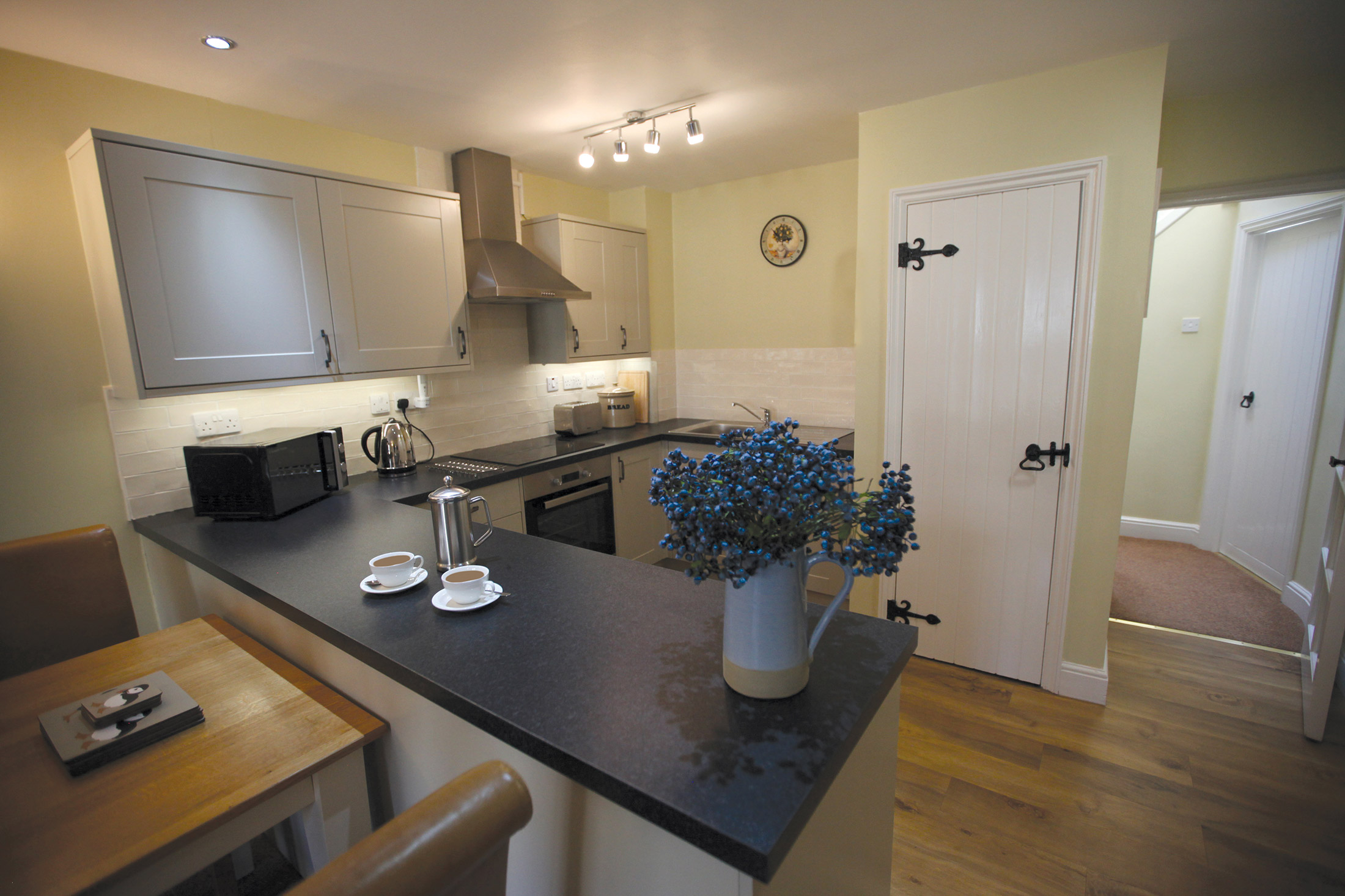
- a kitchen
- a luggage store (for early arrivals and late departures)
- table tennis and a pool table
- a free launderette
- changing rooms and showers
- a WC that is adapted for disabled holidaymakers
- swimming pool
- free internet through WiFi access
In the grounds, guests can enjoy three tennis courts and an artificial (all-year-round) bowling green, together with a croquet lawn and pitch and putt course in the summer months. There is a small shop selling essential provisions, as well as an information room with free Internet and Wi-Fi access in the reception building.
For children there is an adventure playground, and there is a barbecue area nearby.
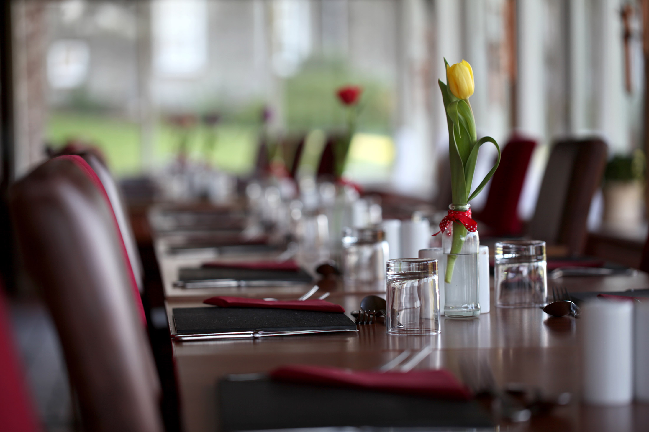
Dylan’s bar/bistro overlooks the pitch and putt course and is available to the occupants and their guests.
Nearby, St. Brides Haven offers a safe children’s beach. There are 18-hole golf courses at Haverfordwest and Milford Haven – both of which offer concessionary rates to St. Brides Castle residents.
Shops and Restaurants
Tesco in Haverfordwest is the nearest supermarket and petrol station. Smaller village shops can be found in Broad Haven and Marloes. A number of restaurants to suit all tastes are available in and around Haverfordwest.
The estate’s long sweeping drive is flanked by pastures, which – on the seaward side – run down to a small haven.
There are spectacular views from the east side of the house, out across St. Brides Bay and the Irish Sea. At the northeast corner of the grounds, at the edge of St. Brides Haven, stands the tiny church of St. Bridgets.
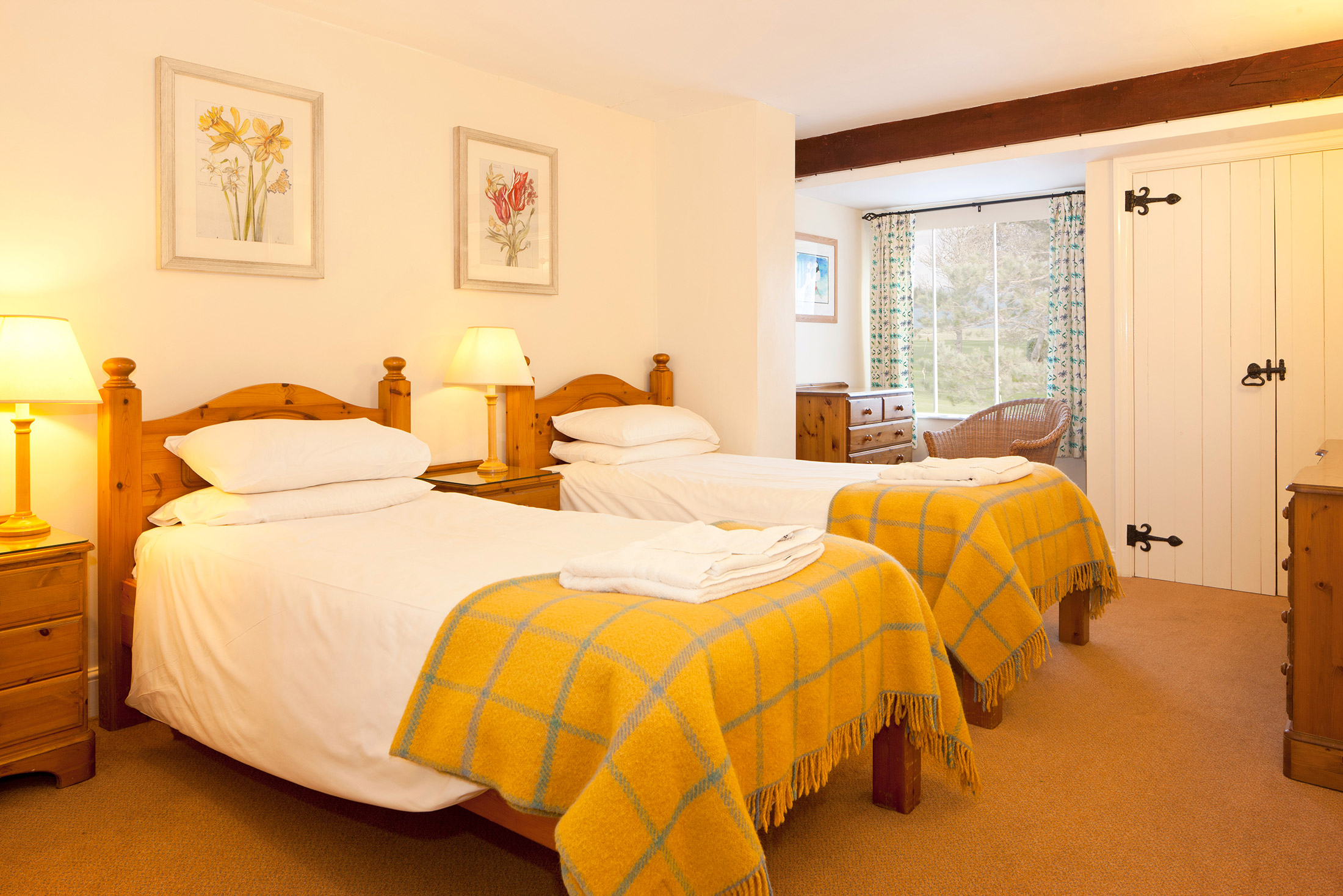
The castle itself offers 22 self-contained apartments of varying sizes, plus reception rooms, a billiards room, library and family room (which are available for use by all guests). It also contains a splendid indoor swimming pool. The attractive furnishings are of a high standard: each property has a DVD player and a combined radio and teletext television (the site also has a free DVD library).
Properties in Pembrokeshire
The photos below show that St Brides Castle really is an impressive building, both inside and out. Boasting incredible views of the Pembrokeshire coast and surrounding National Park, it will no doubt inspire you to get out and explore somewhere new each day of your stay.
While the castle has been renovated in recent years, it has retained its original look. Even the interior is traditional – you’ll feel like you’ve gone back in time! The four-poster beds are a particularly attractive feature.
St Brides has a range of facilities suitable for the whole family, from a children’s play area to a bowling green. In the summer, why not make use of the barbeque area? The castle offers better views than any restaurant ever could.
Location
HPB St. Brides Castle
St. Brides Bay
Haverfordwest
Pembrokeshire
Wales
SA62 3AL
Tel: +44 800 230 0391
Email: details@hpb.co.uk
Apart from the jaw-dropping nature of the building, what strikes most people about St Brides Castle is its remoteness. Close to the edge of the Irish Sea, drive any further and you’d be in the drink! It is a truly magnificent setting. The view out over the cliffs and across the water is just glorious – and, when the weather does ‘get up’ (and it can), is nothing less than spectacular. Best observed through the window, from your well-equipped, cosy apartment within the Castle itself.
But there’s much to do at St Brides – whatever the weather. Tennis players, bowlers, golfers and croquet fanciers will all find much to their liking; while ‘indoors’ boasts the full panoply of games and leisure facilities.
And, if you don’t fancy cooking, why not treat yourself to dinner and drinks at the on-site bistro and bar?
Things to do in Pembrokeshire
The unspoilt village of Dale is just four miles south of St Brides, in the heart of the National Park. Traditionally an agricultural and fishing community, there’s plenty of wildlife including birds, seals, dolphins and porpoise. Located on the National Park’s long-distance path, the village is popular with walkers.
It has safe beaches where there are plenty of opportunities for water sports. The West Wales Wind, Surf and Sailing company offers training and equipment hire for a range of activities. There are also pony trekking and riding facilities nearby.
Britain’s smallest city, St Davids, is also within easy driving distance along the coast. This beautiful city has been a favourite with artists, travellers and pilgrims for centuries. Visit its lovely 12th-century cathedral, which is built on the site of a 6th-century monastery and still serves the local community.
Walks in Pembrokeshire
There are lots of places to discover. Have a look at some of our suggested walks below.
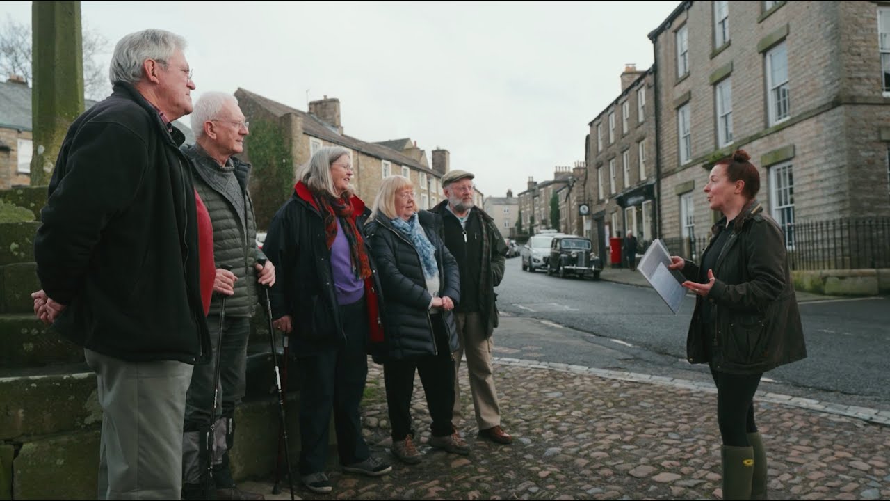
Having a Private Tour at an HPB holiday location is an enjoyable way to see the high standards of furnishings and facilities you could enjoy with HPB.
A local HPB Representative will show you around the site and answer any questions you may have.
Alternatively, you are welcome to book a Personal Presentation at a hotel near you. You can chat to one of our local HPB Representatives, ask your questions and view the complete portfolio of HPB locations.
Read our HPB Feefo Reviews
HPB’s holiday booking service has been rated 4.9 out of 5 based on 14,772 customer reviews on Feefo
![]()
“Going the ‘extra mile’ for our Bondholders”
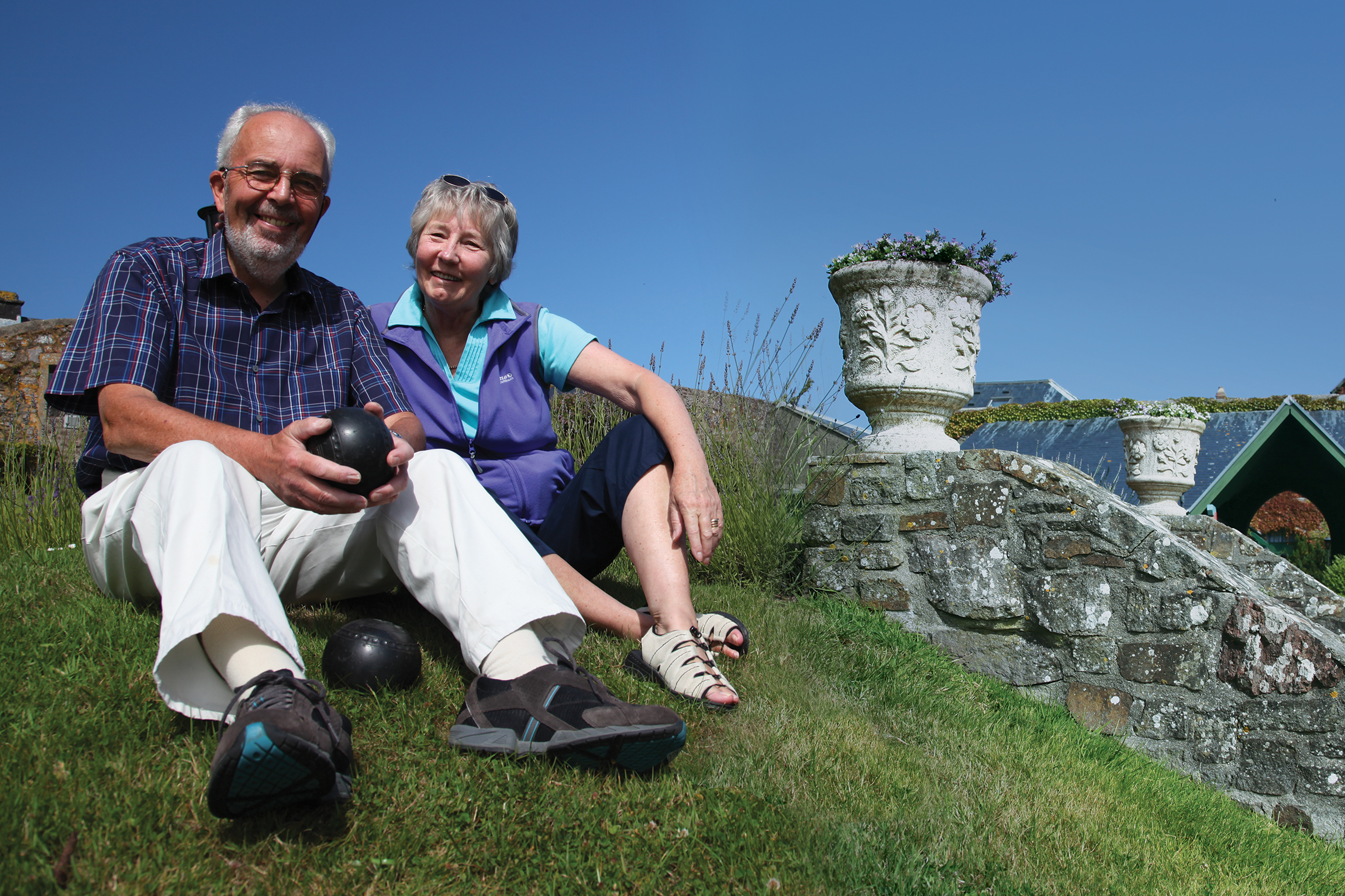
Mr and Mrs WilsonWe caught up with Barbara and Chris at St Brides, where they were enjoying a well-earned early-summer break and collecting their granddaughter and a friend from a biology field trip in Pembrokeshire the next day to stay with them.
“We needed extra beds in the apartment but, yet again, nothing has been too much trouble for [site manager] Mandy [Rees] and her staff.”
“Have we become spoilt?” she asks (rhetorically). “Yes, we have – and yes we are, every time we visit an HPB property. And long may it continue!”