

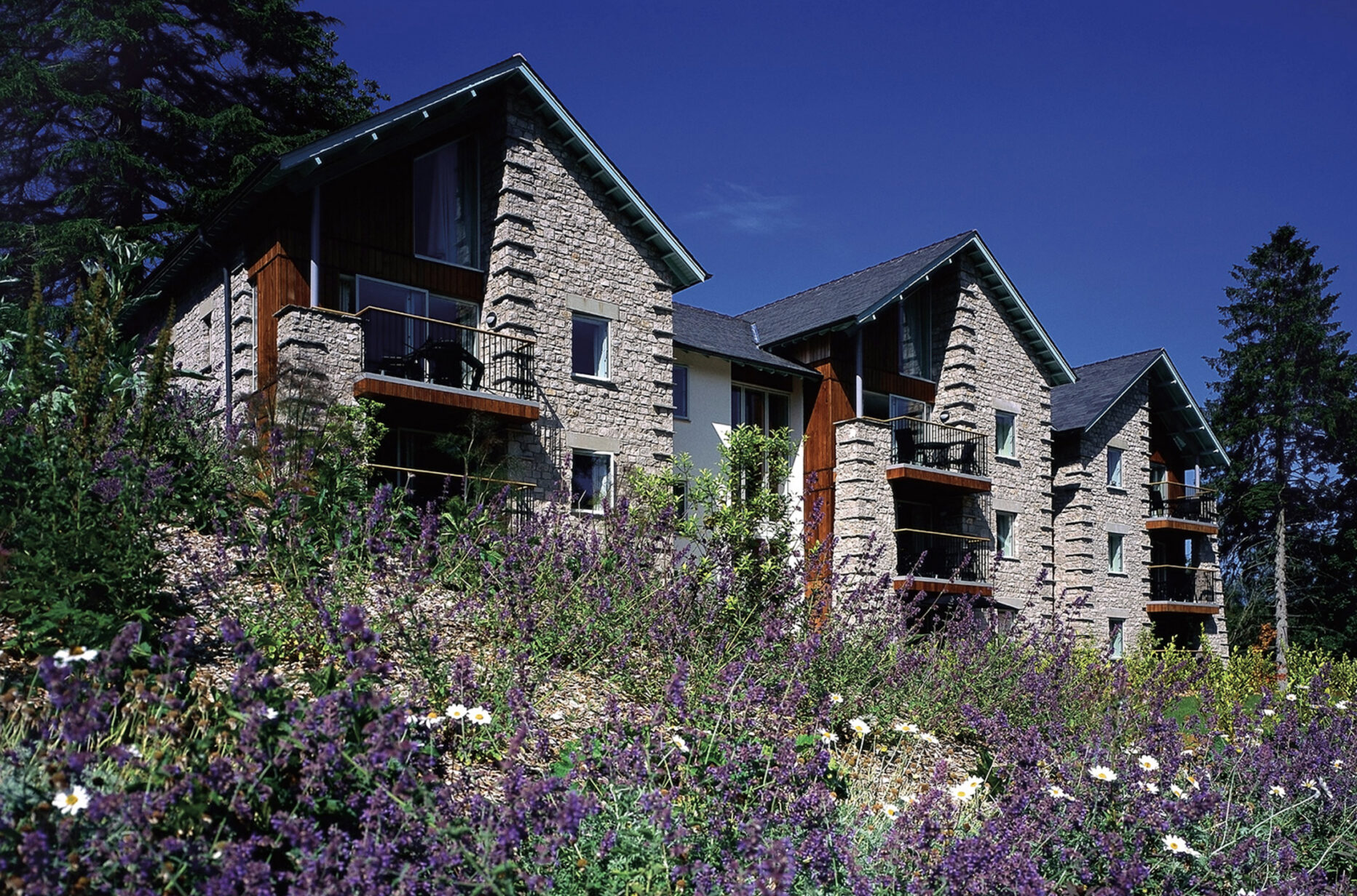


Merlewood, Cumbria, England
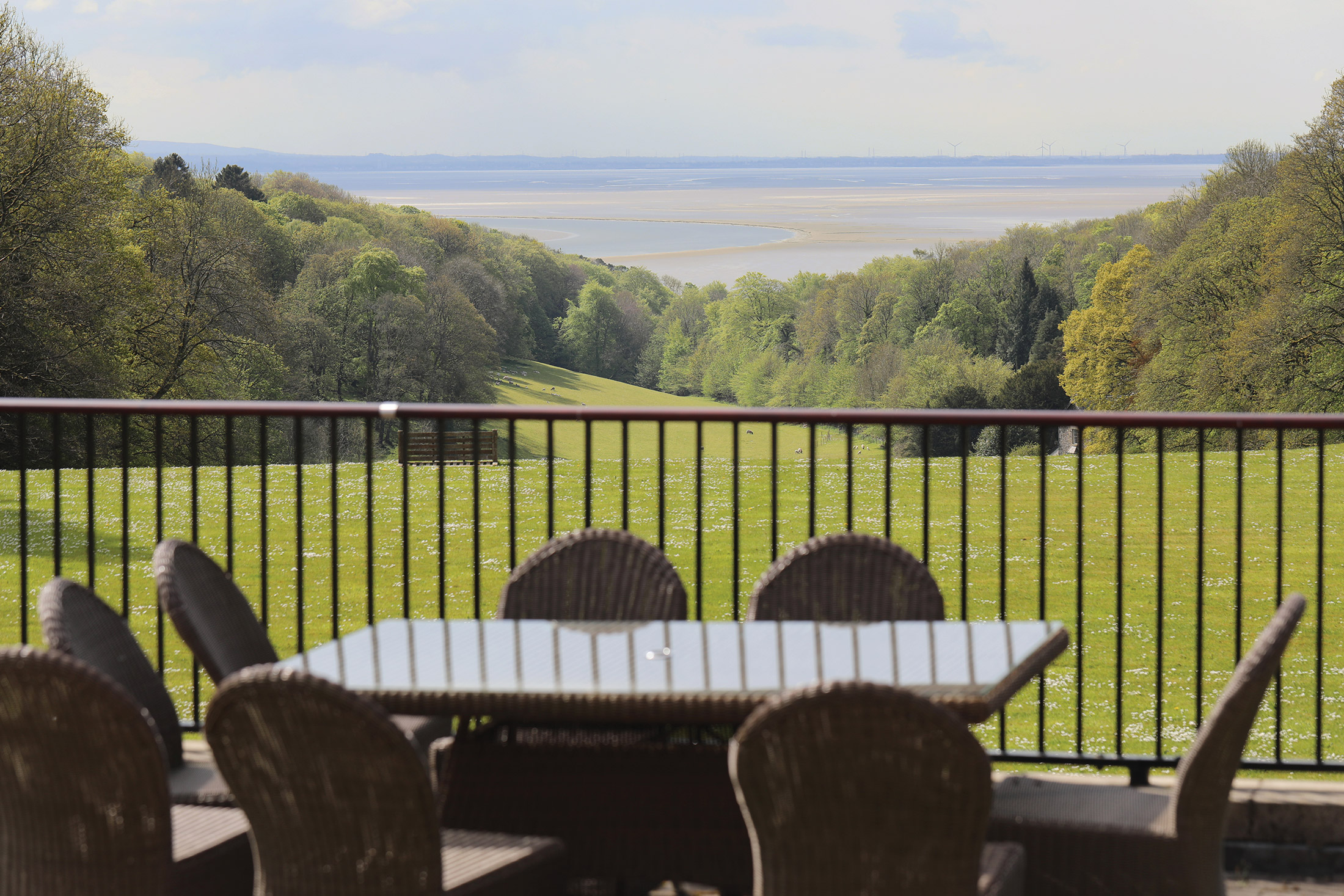
Superbly located overlooking Grange-over-Sands and Morecambe Bay
Book a tour Open Gallery-
55 properties in Cumbria, from one to four bedrooms
-
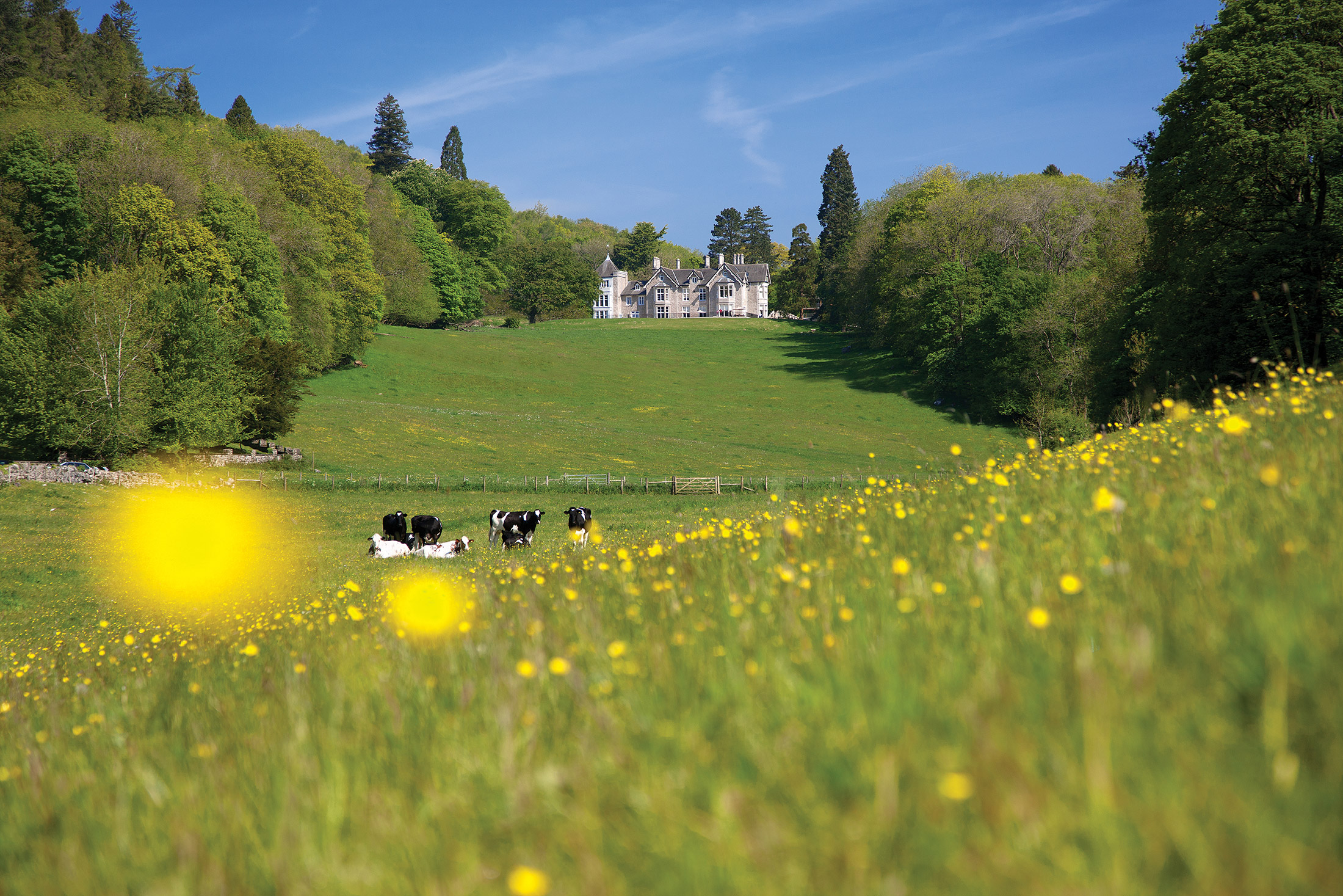
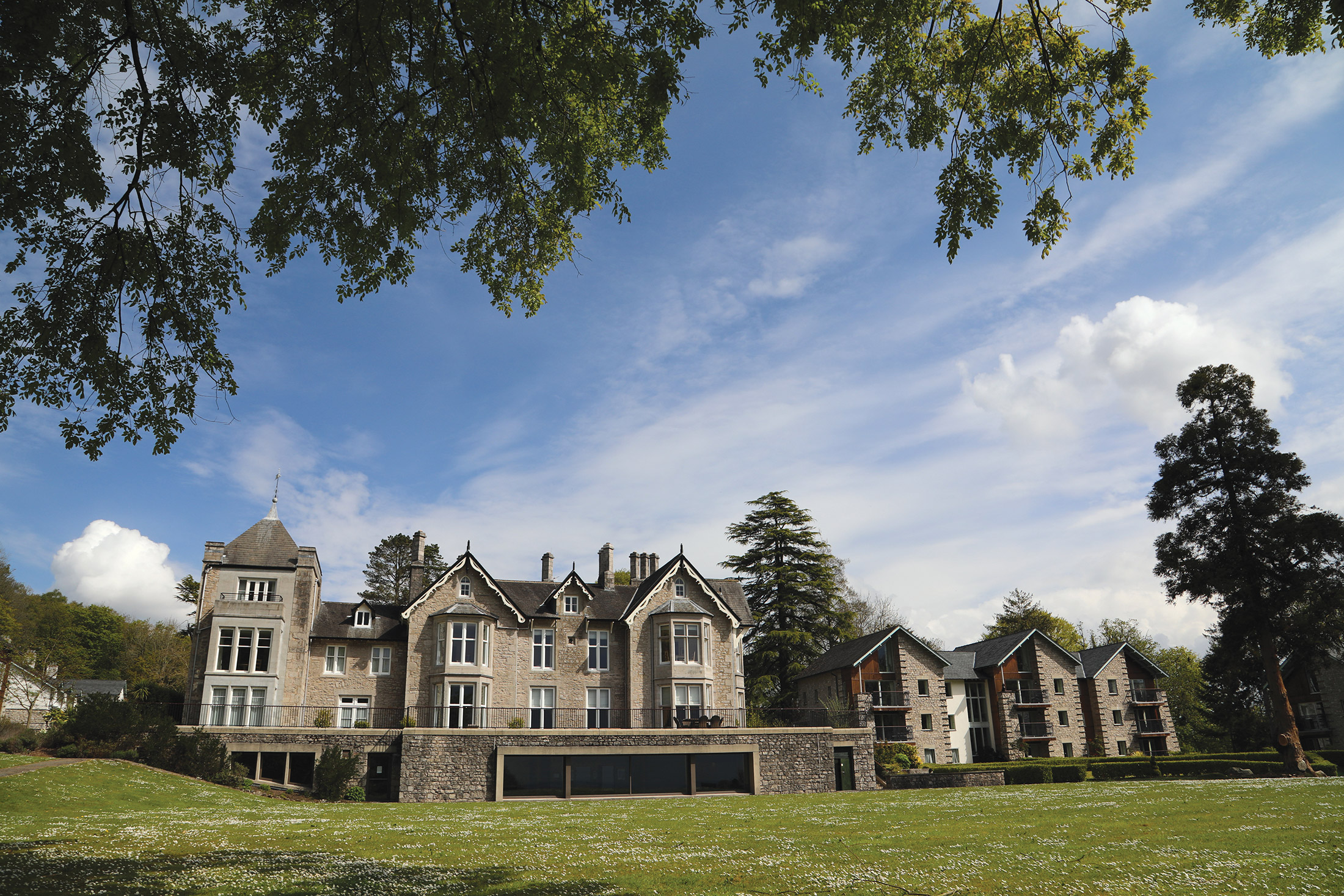
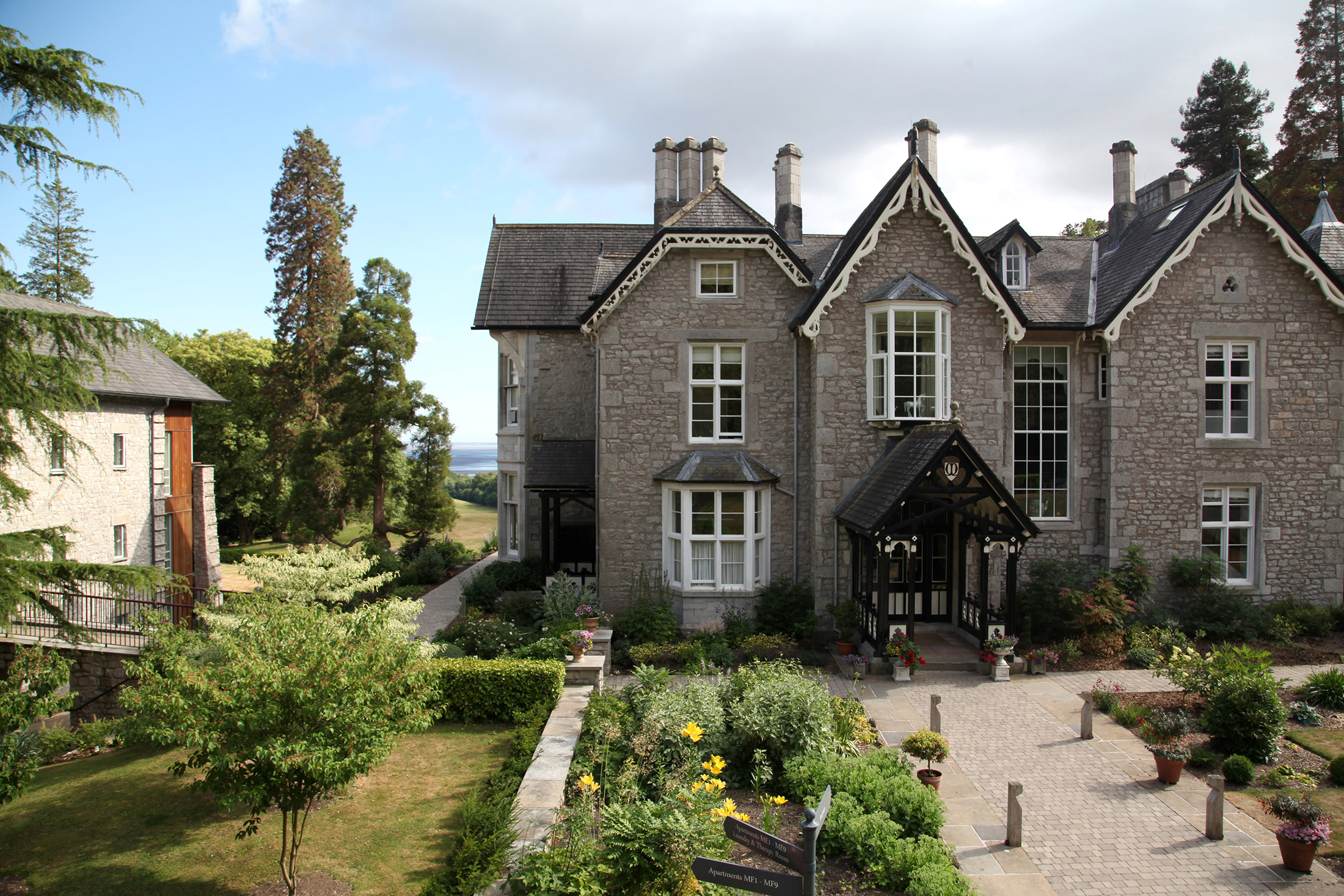
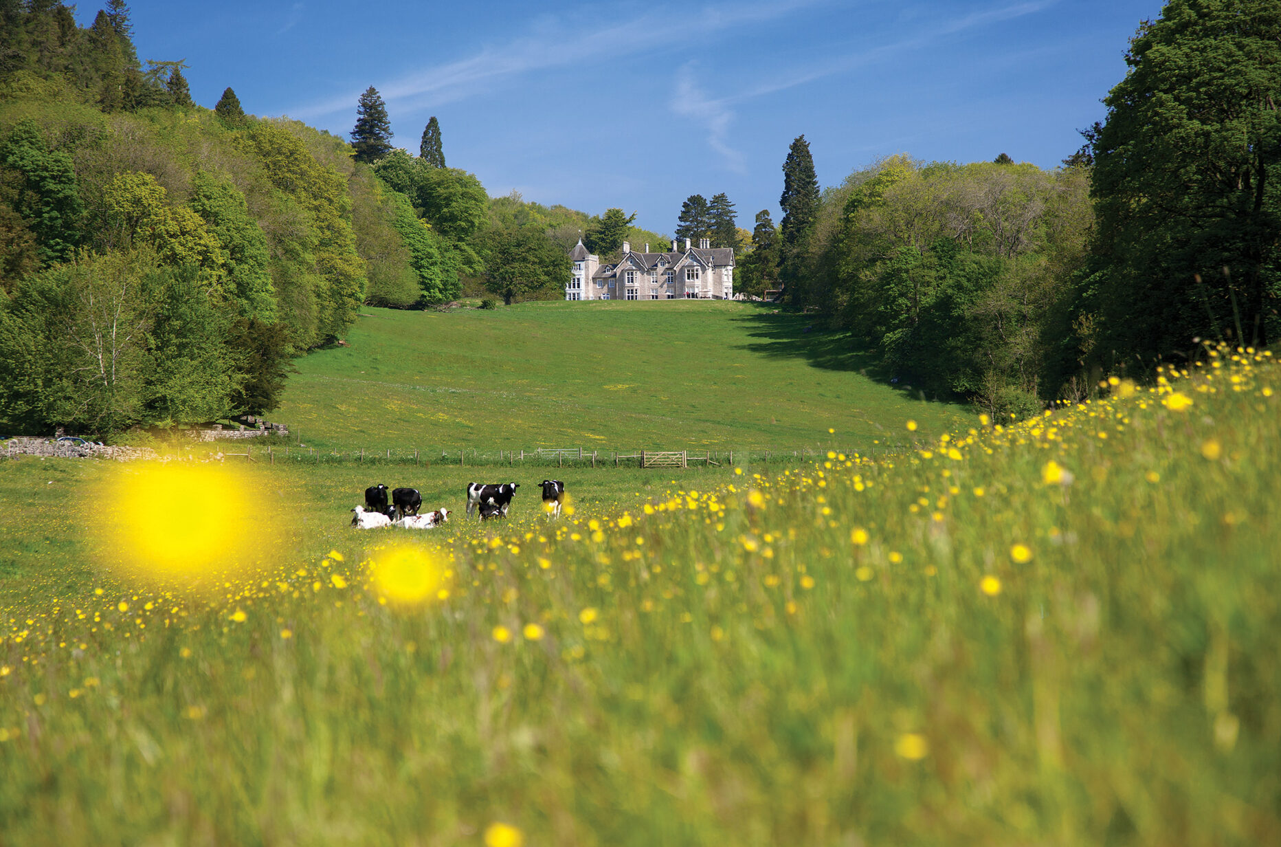
A beautifully restored Victorian mansion
-
Superbly located overlooking Grange-over-Sands and Morecambe Bay
-
Great facilities, including indoor pool, gym and snooker room
-
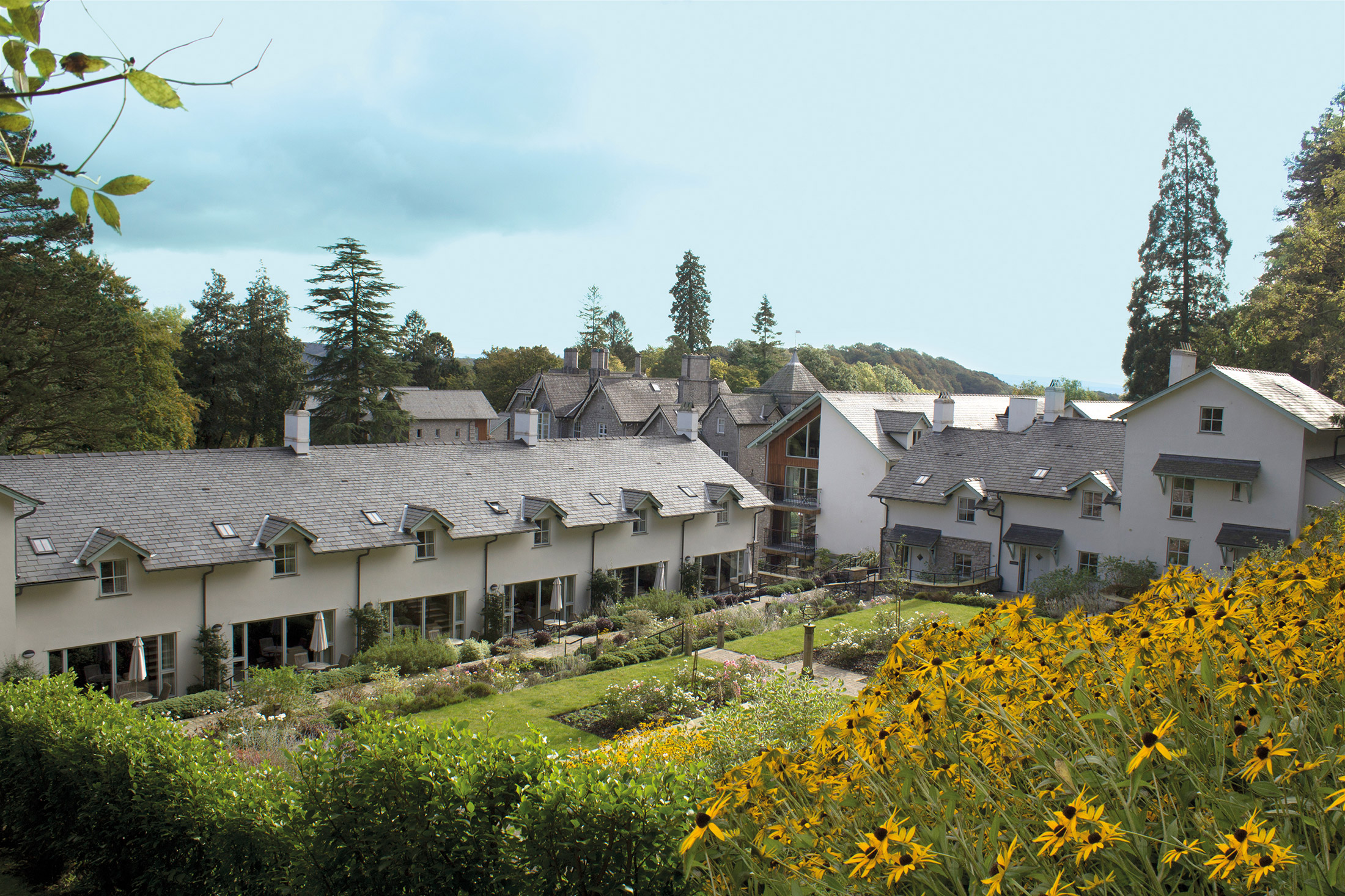
Beautiful gardens
-
Glorious woodland setting
-
Easy to reach by train or car
-
Close to the Lakes and Fells
-
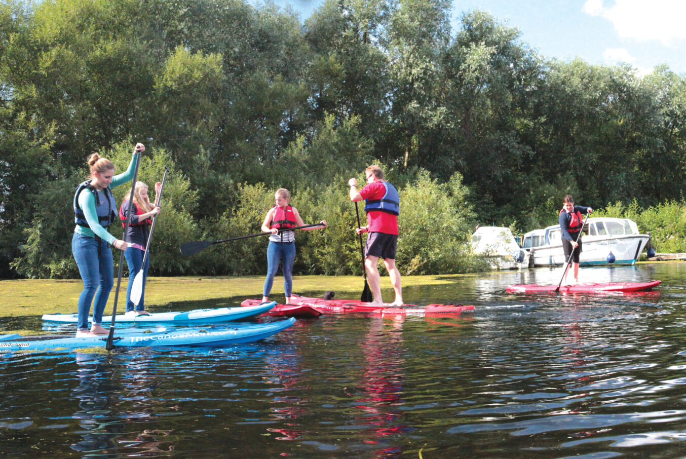
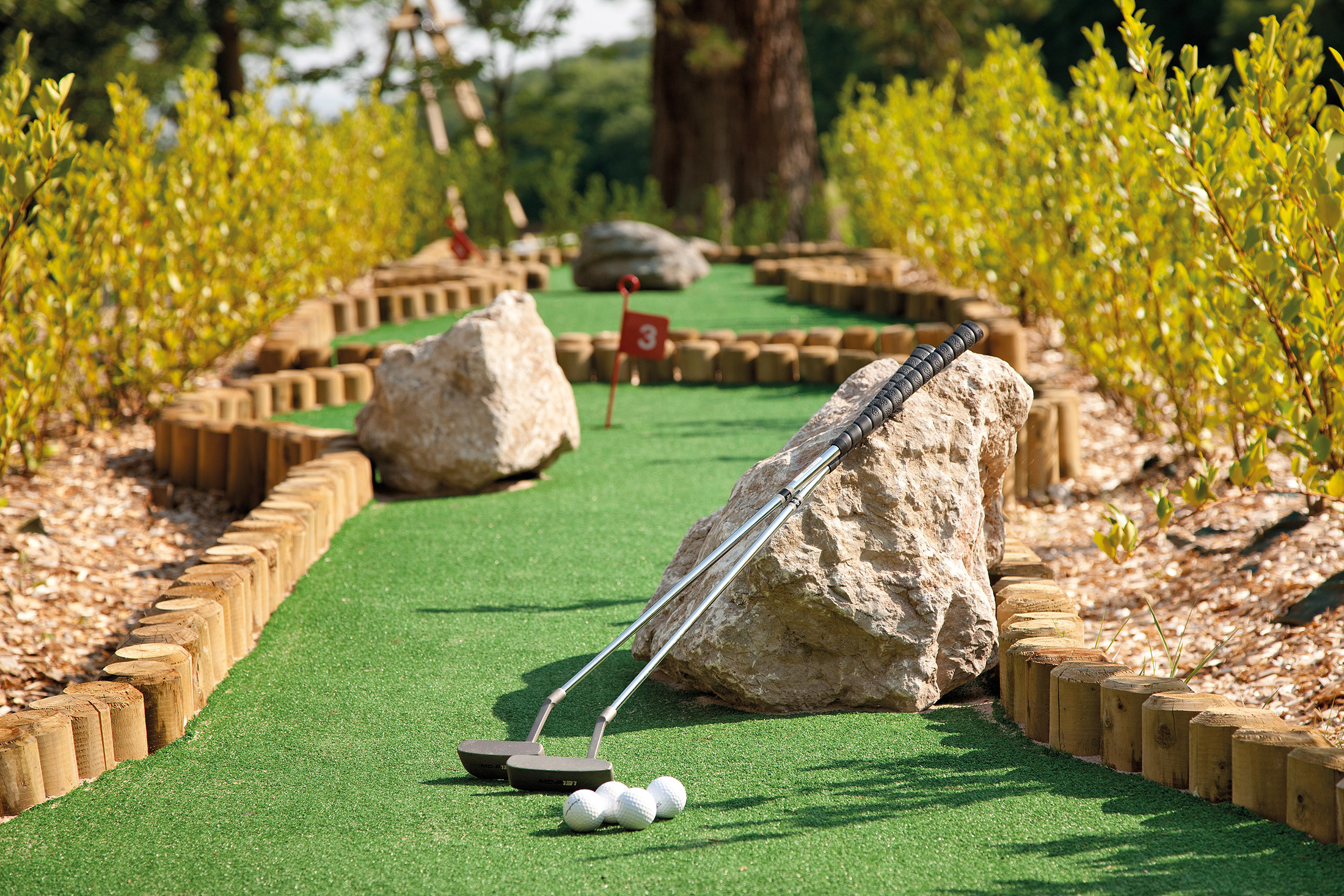
Tennis, crazy golf, a children’s play area – plenty to keep all ages busy
Discover Cumbria
Merlewood was formerly the home of Alfred Binyon whose nephew was the poet Lawrence Binyon. Today it provides 55 wonderfully comfortable self-catering holiday cottages and apartments in beautiful and peaceful surroundings, within easy reach of the southern Lake District.
The property is in Grange-over-Sands, a seaside resort that has retained its Edwardian charm. You truly feel as if you are stepping back in time here, with its pedestrian-only promenade, popular bandstand and lovely ornamental gardens. Even the shop fronts have stayed the same!
Windermere, Coniston Water et al are easily accessible, while for the more urban-minded, the city of Lancaster – often and unjustly overlooked in the guide books – is just a half-hour drive away.
There is a selection of dog-friendly holiday homes to let, and we also welcome kids and young families. Enjoy our on-site steam room, indoor swimming pool, children’s playground and even crazy golf. There is plenty to see and do both at Merlewood and in the surrounding areas, all of which you can enjoy from the comfort of your luxury holiday property.
Relax in some beautiful gardens
On a sunny day, what could be better than walking around some well-crafted gardens? Grange Ornamental Gardens has a Victorian feel and boasts a huge range of shrubs and trees, as well as rare genii.
If you venture out as far as Windermere during your stay, you may want to visit Holehird Gardens. Within its 17 acres of land, it features a variety of natural spaces, including rock, walled and heather gardens. Plus, an alpine house and many trees and shrubs.
Try the original sticky toffee pudding
A beloved British sweet, the sticky toffee pudding was apparently invented in Cartmel in 1960. A visit to this charming village is a must, then! It’s also home to the best restaurant in the country (according to The Good Food Guide): L’Enclume.
When you’re not gorging on food, be sure to visit the 12th-century Cartmel Priory and the National Hunt racecourse (the smallest racecourse in the UK).
Keep the whole family entertained
If you’re planning to take the kids away with you, there are plenty of family attractions to keep them entertained. Fell Foot Park not only has outdoor and indoor play areas for the little ones, easy access to the lake means everyone can go for a paddle or swim, or even hop on a boat.
Ducky’s Park Farm is also great for a family day out. It has a huge outdoor play area, a selection of rides and you can get up close to a variety of farm animals.
Learn more about the local area
There are plenty of museums around Merlewood should you want to learn more about the local area. Kendal Museum is well worth a visit, just for the fact it’s the oldest in the country! Here, you can find out more about the area’s natural history.
Promising Vikings, Victorians and warships, the Dock Museum in Barrow-in-Furness is free to visit and popular with families. It even has a playground. If you prefer cars to ships, however, you may prefer the Lakeland Motor Museum in Backbarrow.
Shops and restaurants
Merlewood overlooks the Edwardian seaside town Grange-over-Sands where you’ll find a range of shops and cafes. Nearby Cartmel, home of the sticky toffee pudding, has an even larger selection of eateries with pubs and restaurants to try as well as shops to stock up from. Its restaurant L’Enclume has been rated number one in the Good Food Guide for 2014.
There is also a small shop on-site where you can grab fresh bread or pastries for a simple breakfast.
On-site amenities
Merlewood’s clubhouse contains a pool table and billiard table, a selection of games and table tennis for guests to make use of. There is also a free-of-charge book and DVD library for quieter days.
Also on site you’ll find:
- Indoor swimming pool and steam room
- Small gym/exercise room
- Tennis court
- Crazy golf
- Children’s playground
- Laundry facilities
There is free internet and WiFi access.
Guests can take part in a range of organised activities such as talks, Opera nights and wine tasting evenings.
Properties in Cumbria
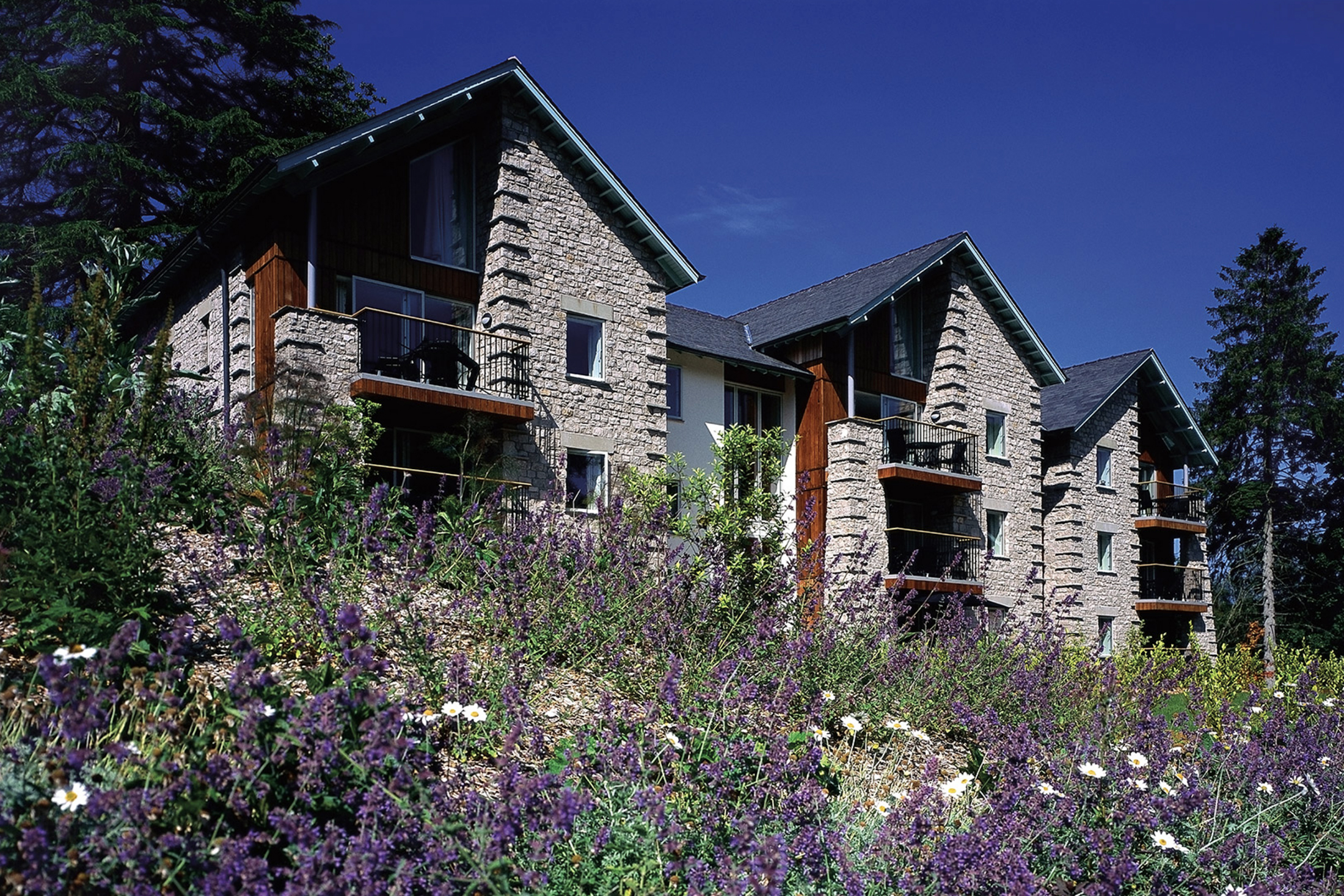
Nine elegant apartments in a Grade II-listed Victorian mansion. 46 beautifully appointed properties. The whole site nestling amidst secluded woodland and rolling pasture, just two miles from the border of the English Lake District National Park, and commanding fabulous views over the magnificent Morecambe Bay.
Soak up the splendour of the graceful drawing room. Enjoy a swim in the heated pool after a strenuous workout on the tennis court. Stroll through the woods and savour the peace and quiet of the countryside. And, at the end of a lovely day, sit on the terrace with a sundowner and contemplate That View.
Luxury Holiday Cottages in Merlewood, Cumbria - HPB
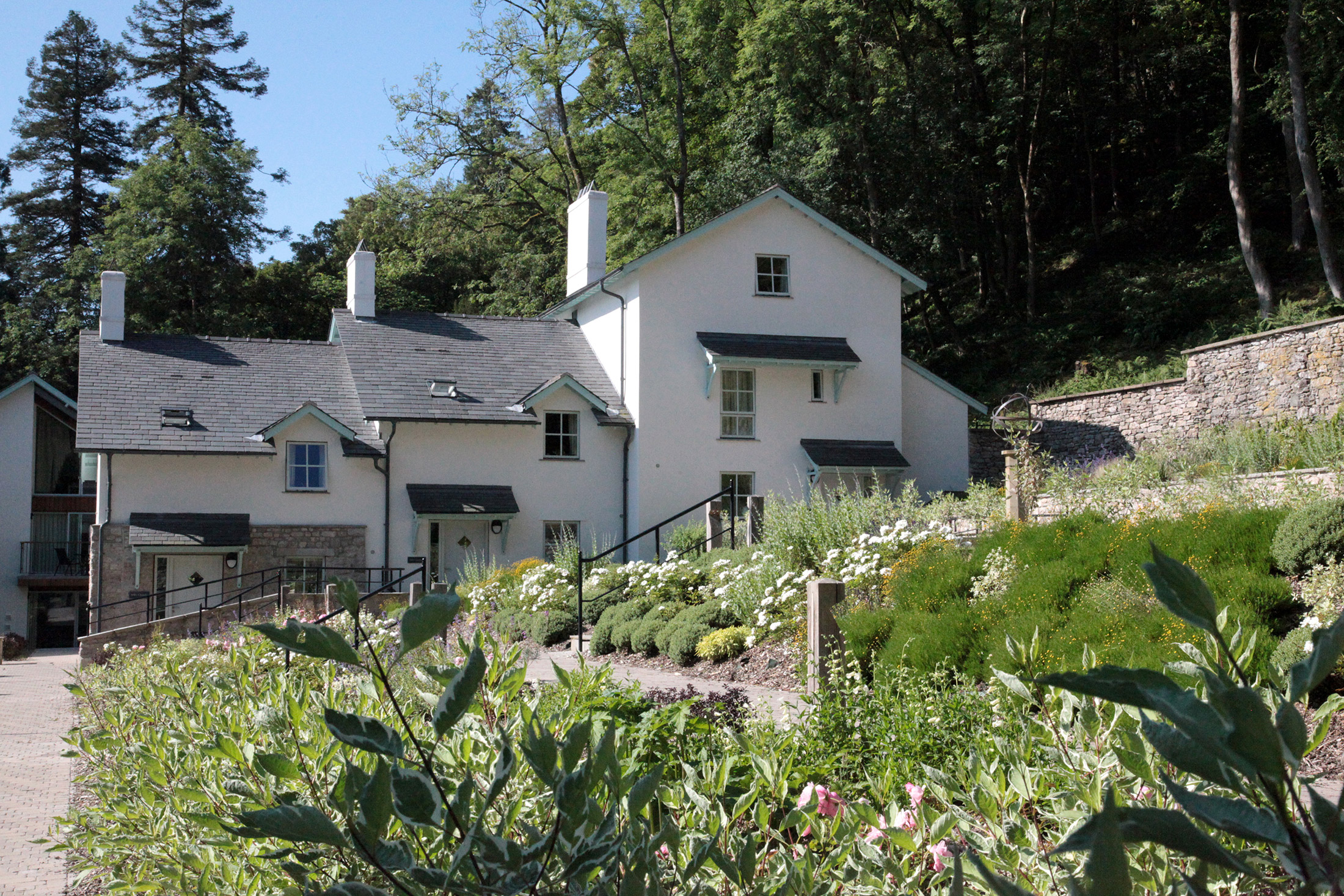
Terraced cottages surround the 19th century manor house of Merlewood. These new-builds in the beautiful grounds are located just a short distance from the main house and are modern and fresh, furnished to high standards. The majority of them are west-facing and look towards a peaceful Cumbrian countryside setting. With the pull of the Lake District right on your doorstep, what better place to spend a holiday with loved ones?
Luxury Holiday Cottages in Merlewood, Cumbria - HPB
Book a tourThe majority of Merlewood’s ten sleek and spacious, cottages (six of which welcome dogs) are two-storey and sleep four guests. For larger groups holidaying in spectacular Cumbria, two three-storey cottages are available, and these sleep eight guests. All Merlewood’s cottages have access to a terrace, meaning you can sit out and enjoy that fresh Cumbrian air. Here you are in a fantastic position to explore the incredible scenery of the Lake District, or head south to the dramatic coastline. As with all the holiday units at Merlewood, the cottages are decorated in a manner sensitive to the local environment; soft, neutral hues, bright and airy by day, cosy and welcoming at dusk. In a word, restful – just like the fabulous view over Morecambe Bay! Each cottage is within easy distance of the main building, which has a clubhouse and communal facilities. The cottages at Merlewood lend themselves to family holidays, or to trips away with a group of friends, offering comfortable, communal living.
Facilities/equipment
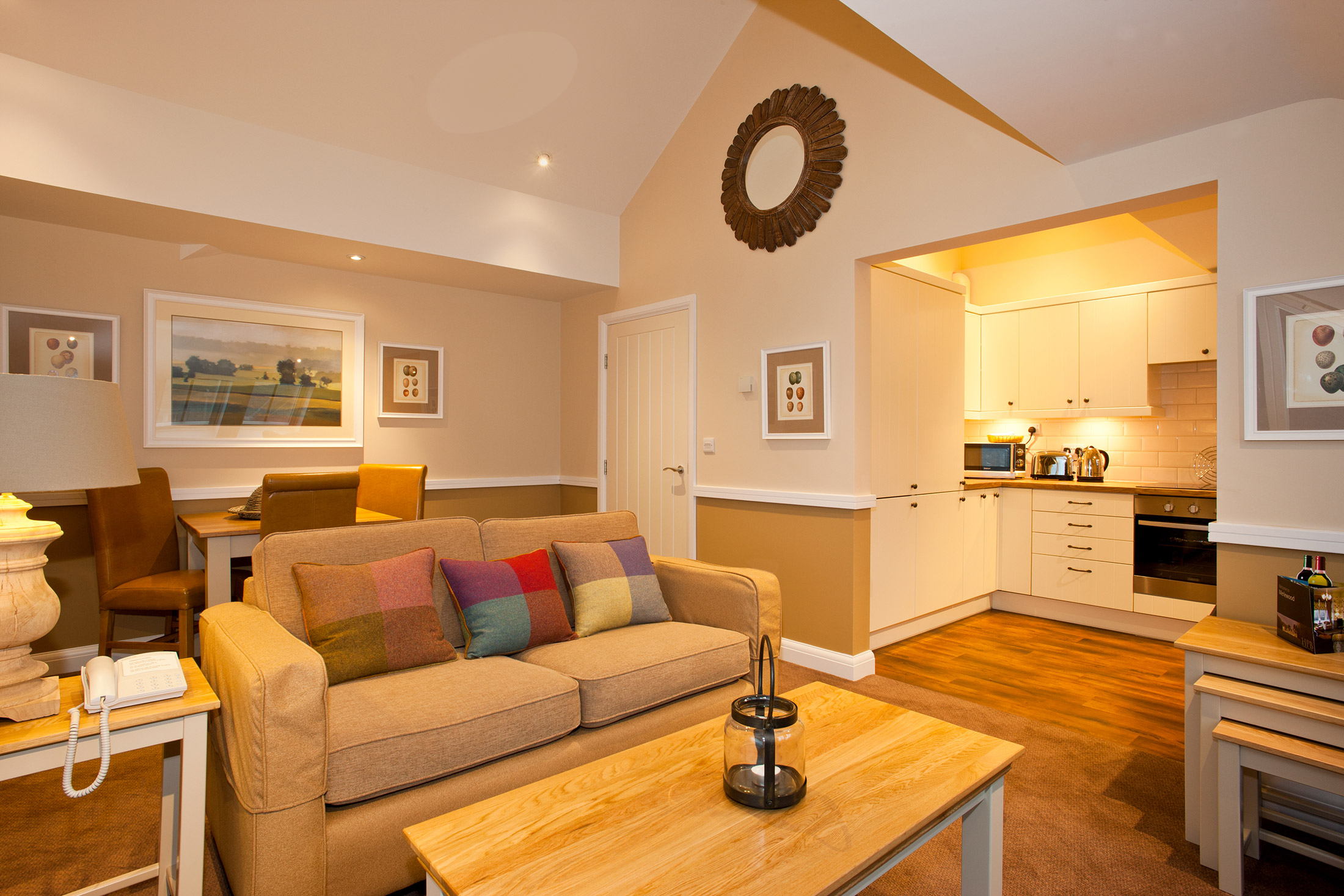
All cottages are well furnished and equipped to a high standard, allowing families or large groups to self-cater in ease and comfort. Open plan living/dining rooms and roomy kitchens make these properties spacious and relaxed, perfect for dinner parties. The kitchens all have most of what you could wish for, easily to hand. Bedrooms have either double or twin beds and, as well as separate bathroom facilities, one bedroom in every property features a modern en-suite as well.
Holiday Apartments
Sleek one, two and three-bedroom apartments are also available in Merlewood’s grounds, and, depending on their size, these can sleep anywhere between two and six guests. These open-plan properties are ideal for couples, friends or family. Here you are in the heart of Cumbria, just a stone’s throw from stunning Morecambe Bay and, with many of the apartments accepting dogs, these are the perfect base for outdoor walking holidays.
Holiday Apartments
Book a tourSlightly away from the main building, but still close enough to make use of the pool and clubhouse, the 36 apartments in the grounds of Merlewood’s stately 19th century manor house provide all you need to enjoy a holiday amongst the fresh air and stunning scenery of Cumbria. With one, two and three-bedroom apartments on offer, these properties can accommodate between two and six guests. These open-plan properties feature spacious kitchens and dining areas for those peaceful evenings in, while living rooms and bedrooms are decorated with subtle, relaxing touches. All of which contribute to making your stay in a Merlewood apartment a restful and happy one. Many of the apartments offer sublime views down towards Grange-over-Sands and Morecambe Bay beyond, while others look out on the glorious woodland that surrounds the site. Fourteen properties are pet-friendly, so provide the perfect base for a walking holiday and the homely interiors are guaranteed to make your stay in the southern Lake District a memorable and happy experience.
Facilities/equipment
The facilities in the Merlewood apartments are of a high standard with well equipped kitchens, televisions and DVD players and comfortable, quality furnishings. One property has been adapted for accompanied wheelchair users. Some of the properties feature a balcony and many enjoy west-facing views out over a lovely woodland setting. So your evenings could not be easier or more enjoyable after a day of exploring. Pop the kettle on and relax with a cuppa.
Main House Apartments
Merlewood’s imposing Victorian Grade II listed manor house has been beautifully converted into the nine apartments that complete this site. These in-house apartments benefit from an incredible location, and most have charming views. On a site overlooking Morecambe bay, with coast to the south and the iconic scenery of the Lake District National Park to the North, these elegant apartments are surely the perfect holiday location.
Main House Apartments
Book a tourDating from the 19th century, the manor house has been expertly restored to an exceptional standard, with the nine apartments benefiting from certain details and features that keep the history of their beautiful setting alive. All the properties at Merlewood offer high levels of comfort. But if it’s sheer elegance you’re after, the main manor house is where you’ll want to be. Built by Manchester calico printer Alfred Binyon in 1853 the house has enjoyed a chequered history: from private estate, to hotel, to War Office training centre, to ecological research station.
But the Grade II listed building is, arguably, only now fulfilling its true potential, with accommodation that provides a winning combination of comfort and style. Each of the nine manor house apartments has been expertly furnished, but retains an element of its 19th century charm, providing a retreat that is both charismatic and perfectly soothing. One has been adapted for wheelchair access and all provide a fantastic base from which to explore surrounding Lakes and fells but, at the end of the day, welcome you home to well-designed, relaxing living rooms and bedrooms for a great night’s sleep.
Facilities/equipment
With a choice of one or two bedrooms, these chic apartments feature either double or twin beds. Two one-bedroom properties have an en-suite bathroom and two two-bedroom properties have an en-suite in addition to separate bathroom facilities. An open and spacious kitchen/dining room means you’re fully provided with all the equipment you need to produce whatever culinary creation takes your fancy; from saucepans to corkscrews – with perhaps a cheeky little number chilling in the fridge. The majority have fantastic views as well, so you’ll have everything you need for that perfect evening.
Location
HPB Merlewood
Windermere Road
Grange Over Sands
Cumbria
England
LA11 6JT
Tel: +44 800 230 0391
Email: details@hpb.co.uk
Grange-over-Sands is a charming Edwardian seaside retreat situated on the Southern tip of the Cartmel Peninsula, between the Lake District and Morecambe Bay.
The Furness Railway transformed this small fishing village into a fashionable resort. The town features a pedestrian-only promenade, ornamental gardens, golf courses and a well-used bandstand.
The shop fronts have preserved their Edwardian appearance giving the whole place an old-fashioned, friendly atmosphere. It is an ideal destination to escape to, and for exploring the Lake District.
Things to do in Cumbria
As well as Grange-over-Sands – a charming little town that harks back to a more genteel age – Merlewood is well placed for a visit to Cartmel, home of the UK’s smallest (and surely most picturesque) National Hunt racecourse, the Michelin-starred L’Enclume restaurant; and of course sticky-toffee pudding!
Further afield – though not much – the Lakes beckon. Coniston and Windermere are magnificent, in any season; but both offer much more than just watery pleasures: Windermere in particular, with a fabulous collection of shops and museums dedicated to local lass Beatrix Potter – fascinating for young and old alike.
At the top end of Windermere, Ambleside is perhaps the jewel in the Lake District’s crown – a jaw-dropping setting, lovely architecture, plenty of welcoming pubs, shops and restaurants – and William Wordsworth.
The World of Beatrix Potter
Fun for all the family, the World of Beatrix Potter is an educational and insightful day out, with interactive exhibits helping to tell the story of Potter’s writing.
There are a number of enjoyable activities such as Jemima Puddle-Duck’s woodland glade and the Peter Rabbit garden. You’ll also find the award-winning Beatrix-Potter themed tearoom. There is ample parking at the attraction, which is open from 10am daily.
Lakeland Motor Museum
Situated in the picturesque Leven Valley, the Lakeland Motor Museum is a must-see attraction whilst visiting Cumbria. You’ll find a unique collection of road transport exhibits assembled over the last 50 years.
Suitable for people of all ages and interests, this attraction is not only accredited by Visit England but has also claimed a certificate of excellence award from Trip Advisor, providing a perfect day out, whatever the weather.
Lakeland Segway Tours
Choose Lakeland Segway for a truly memorable experience! A completely different way to explore, it is easy to see why these Segway tours have won Trip Advisor excellence awards. Take a guided trip around the Cartmel Racecourse or head off the beaten track in to the woodlands for the Adventure Tour.
On offer is a great selection of tours that include professional training, safety instruction and lots of practice to make sure you’re ready to set off. Group bookings are available, although it is advisable to book in advance.
Cartmel Racecourse
Fancy a day at the races? Against the backdrop of the beautiful English Lake District, Cartmel Racecourse rekindles the spirit of the original steeplechases. On a race day, large crowds descend on the centre of the racecourse for picnics and parties while the horses race around the outside. Check the official website for race details and other events at Cartmel.
South Lakes Safari Zoo
South Lakes Safari Zoo is a 51-acre Zoo established in 1994 and packed full of amazing attractions and experiences. Get up close and hand feed the big cats or wander amongst kangaroos. The experience at South Lakes Safari Zoo is truly one of a kind. Surround yourself with some of the planet’s rarest and most endangered animals during a fun-filled day out for all the family. You’ll find an abundance of outdoor space; perfect for a picnic. Of course there is the usual tearoom and gift shop too.
Ravenglass and Eskdale Railway
The Ravenglass and Eskdale Railway is one of the oldest and longest narrow gauge railways in England. It was over 100 years ago that the original 3ft line closed. The heritage steam engines transport passengers from Ravenglass, the only coastal village in the Lake District National Park, some 210ft above sea level.
Journey seven miles of spectacular scenery within sight of England’s highest mountains, the Scafell Range. It will take about 40 minutes to travel up the line from the stunning protected nature reserves of the Ravenglass Estuary through the ancient Eskdale Valley. During the trip, remember to keep your eyes peeled for greylag geese, curlew, shelduck, red squirrels, buzzards and other wildlife. With the option of covered and open top carriages, you’ll be in the best of comfort and have plenty of opportunity to take in the scenery.
On arrival to the destination there’s lots to do; stop for lunch at the cafe serving homemade food or explore with the numerous trails and walks in this beautiful pocket of the Lake District National Park.
Things to do in Ulverston
The Cumbrian town of Ulverston is one of the many places of interest located close by our fantastic array of Merlewood holiday properties. A historic, interesting town in its own right, Ulverston is also surrounded by particularly beautiful Cumbrian countryside, and boasts close proximity to Morecambe Bay.
Things to do in Kendal
Those who choose to stay at one of our delightful Merlewood based properties, situated in the South of Cumbria, can expect a wide range of exciting landmarks, countryside and towns to explore, providing a comprehensive, relaxing and interesting Northern English experience. There is plenty to discover and do in Kendal, regardless of the conditions you encounter during your holiday, or the preferences of those with whom you are holidaying; no matter if your trip is with family or friends.
Holker Hall
One of the best loved stately homes in England, set in beautiful countryside and framed by the Lakeland Hills, Holker Hall is just 5 miles from Merlewood. It dates from the 16th century and has a great range of rooms to explore. The parkland is 25 acres of colourful gardens, beautiful vistas and gentle walks and the estate is host to a number of events throughout the year too.
Sizergh Castle, just under 10 miles from the property is the famous 13th century property outside Kendal. And Hill Top, Beatrix Potter’s former home is a 25 minute drive north, close to Windermere, and offers an insight into 17th century cottage life, looking just as she left it, and featuring a number of references to her famous lovable characters.
Humphrey Head
Visit Humphrey Head, the tallest limestone cliff in Cumbria, and be rewarded with a fabulous view of Morecambe Bay.
If it is a good view you are after then you could always hop aboard the National Trust Steam Yacht Gondola – a Victorian steam-powered yacht which tours Coniston Water. Take a relaxing cruise across the beautiful lake and enjoy stunning panoramas of the surrounding Lake District scenery.
From Miniature Villages to Roman Settlements
See over 100 miniature buildings at the Lakeland Miniature Village; they are made from local Coniston slate and feature replicas of classics such as Hill Top and Slater’s Bridge. The village is hand crafted and has been growing for more than 20 years (and is still being added to!).
An hour’s drive will bring you to Hardknott, the remains of a Roman Fort that was founded under Hadrian’s rule in the 2nd century. You can see the outlines of the commandant’s house and the bath house. This site is just one of many in the area that hint at Cumbria’s long and interesting past.
Blog
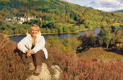
Join Sue Barker as she explores our Holiday Locations
Posted by Lucie Davies on 10 March 2025
Duration: 00:02:00
Read moreDuration: 00:02:00
Read more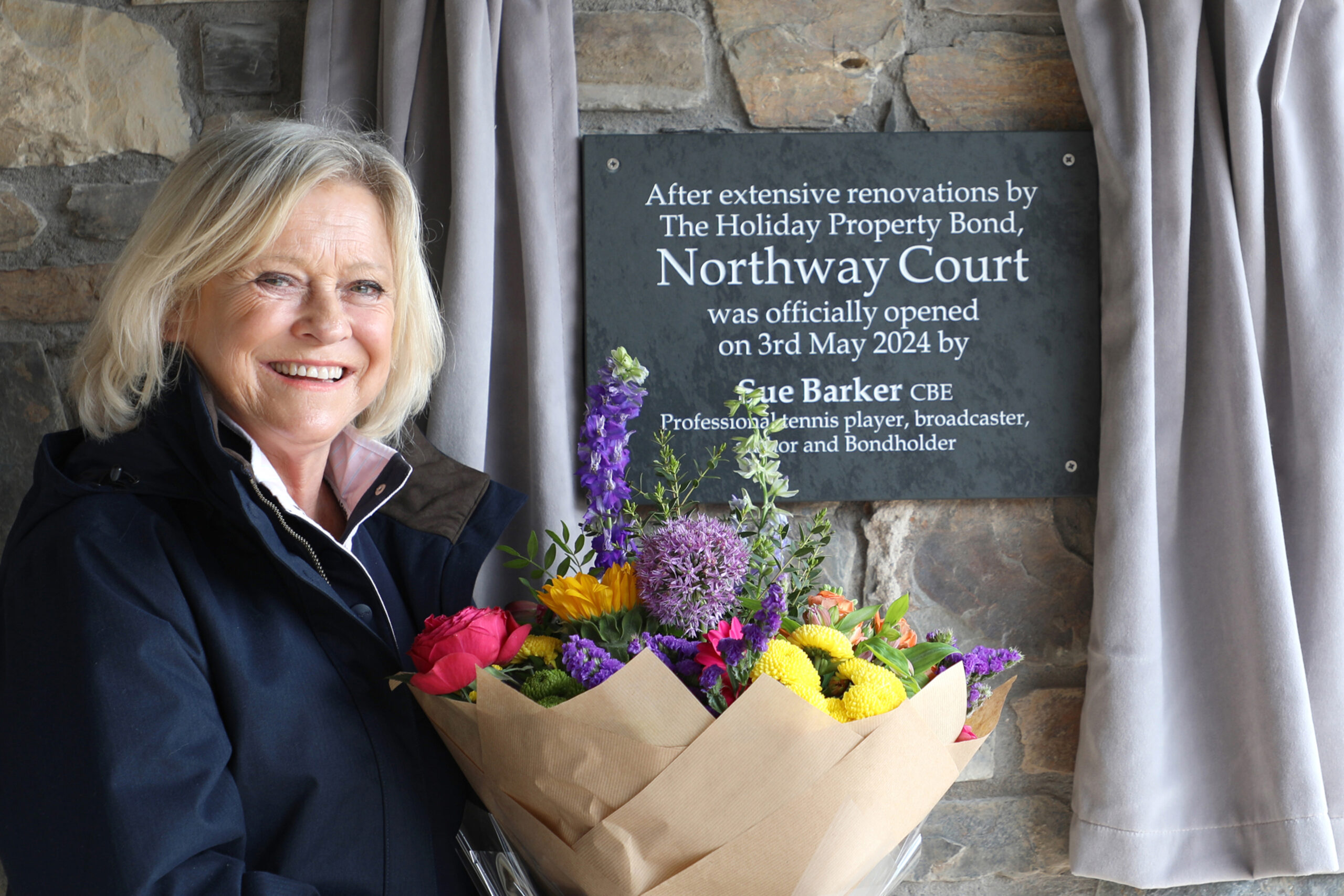
Sue Barker CBE officially opens HPB's newest site, Northway Court on the stunning North Devon coast
Posted by Katy Peck on 15 May 2024
Duration: 00:02:00
Read moreDuration: 00:02:00
Read more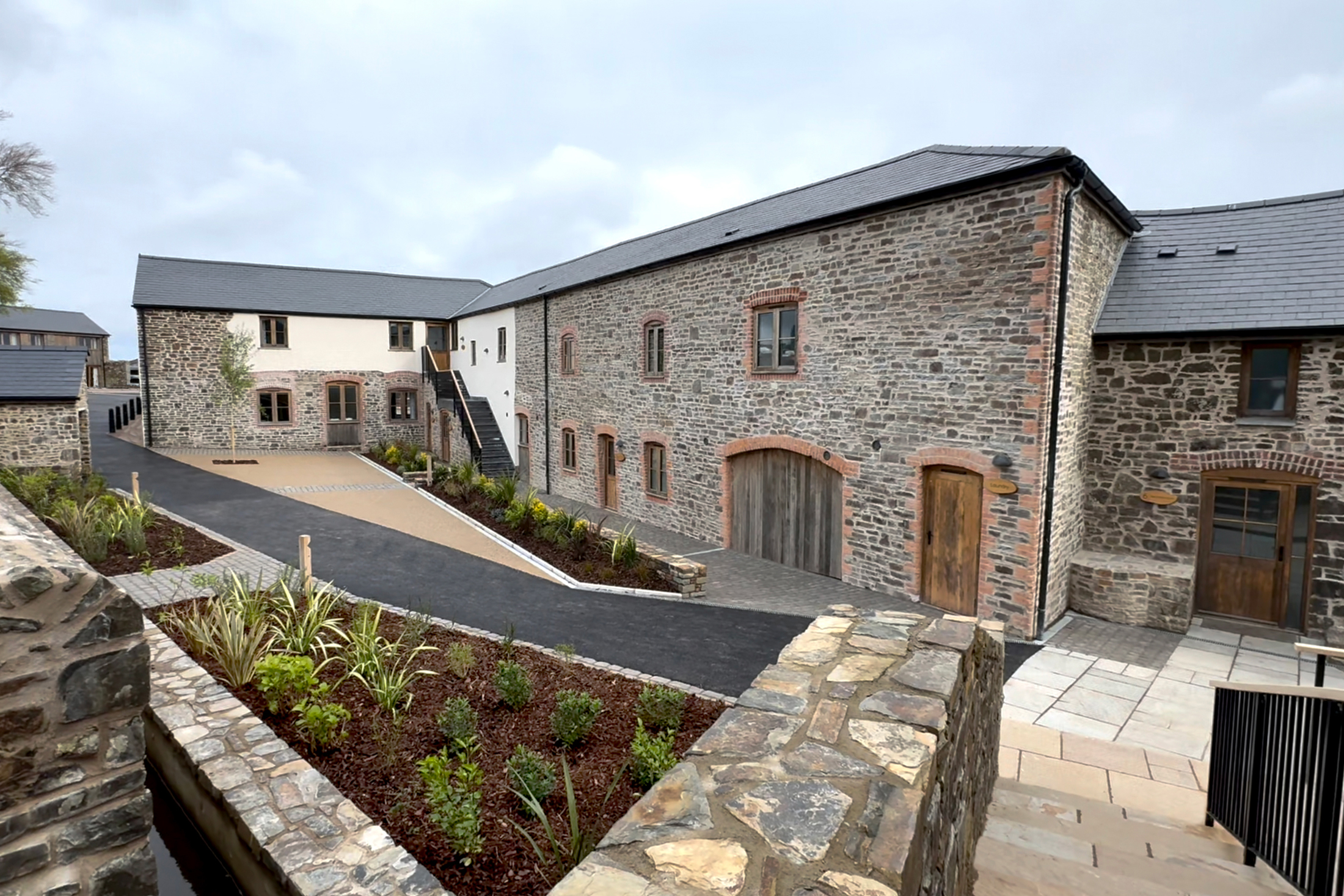
A Second Slice of Devon Heaven
Posted by Katy Peck on 3 May 2024
Since 2002, the Holiday Property Bond has owned Lower Knapp Farm near Honiton, south Devon: 16 beautiful holiday units deep in the heart of the bucolic tranquillity of the Devonshire countryside.
Read moreSince 2002, the Holiday Property Bond has owned Lower Knapp Farm near Honiton, south Devon: 16 beautiful holiday units deep in the heart of the bucolic tranquillity of the Devonshire countryside.
Read moreView all the latest articles from HPB
Read moreWalks
Having a Private Tour at an HPB holiday location is an enjoyable way to see the high standards of furnishings and facilities you could enjoy with HPB.
A local HPB Representative will show you around the site and answer any questions you may have.
Alternatively, you are welcome to book a Personal Presentation at a hotel near you. You can chat to one of our local HPB Representatives, ask your questions and view the complete portfolio of HPB locations.
Book a private tourRead our HPB Feefo Reviews
HPB’s holiday booking service has been rated 4.9 out of 5 based on 14,772 customer reviews on Feefo
![]()
What people like you say about HPB
“Buying into the future”
Mike DugdaleI got talking to our next-door neighbour at Barnham Broom, who’s been a Bondholder for a while; the family were full of enthusiasm and, while in no way pushy, was really keen to pass on advice and knowledge about any other sites we’re thinking of visiting. We swapped email addresses and will definitely be in touch – but it shows the strength of feeling about HPB, and the fact that there’s a real ‘family’ aspect to it.
