
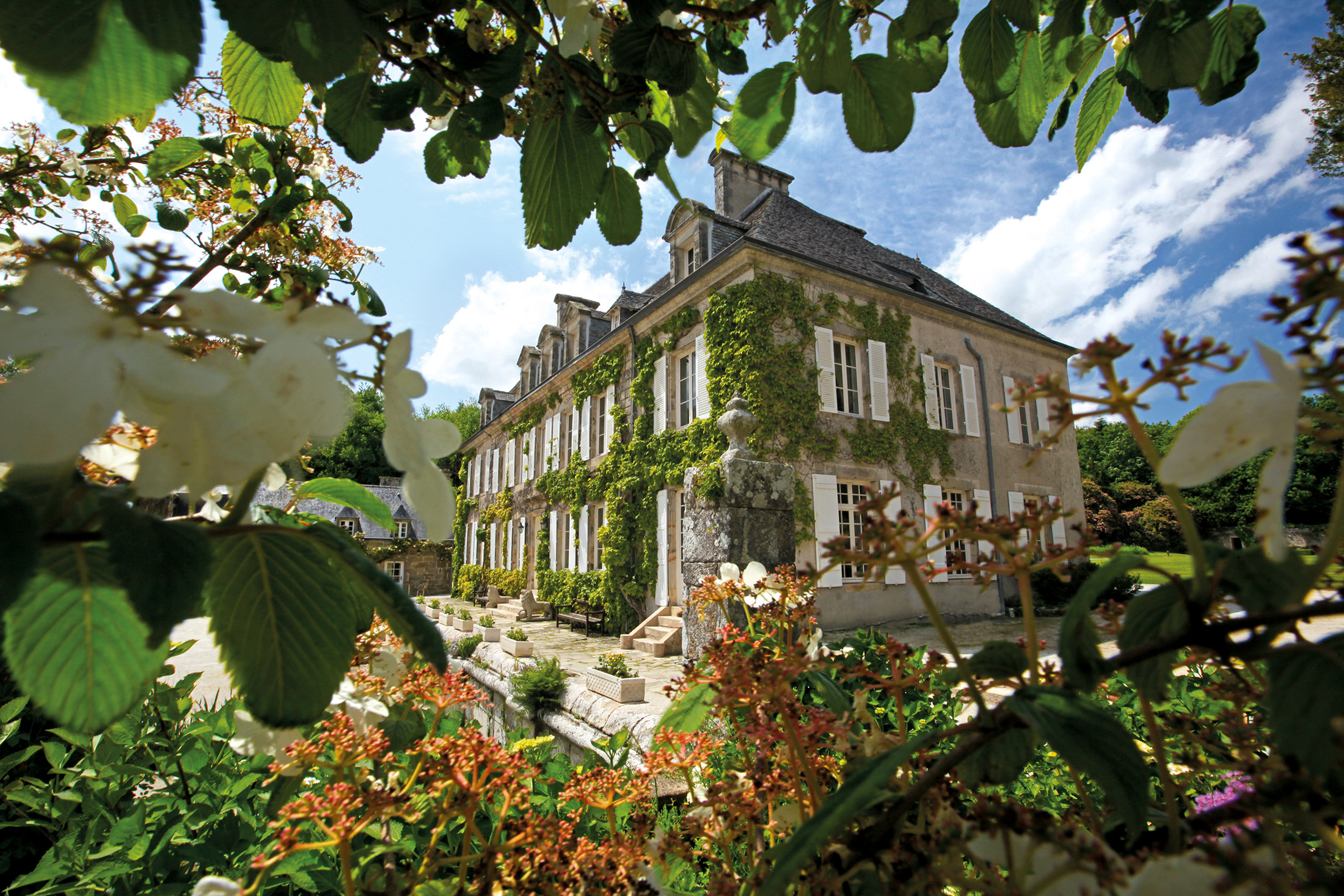
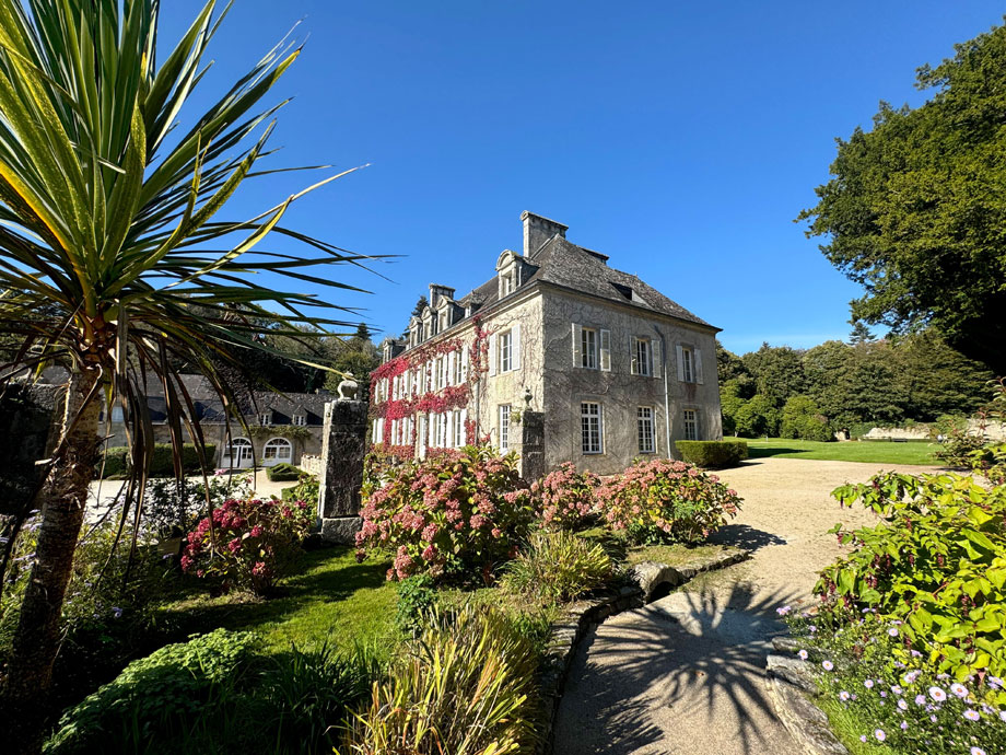
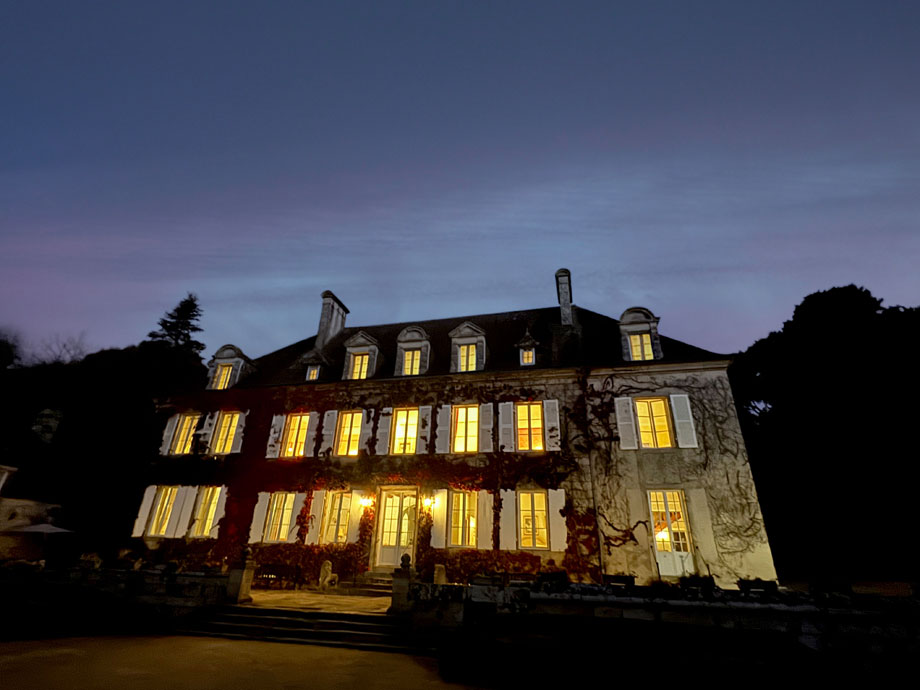
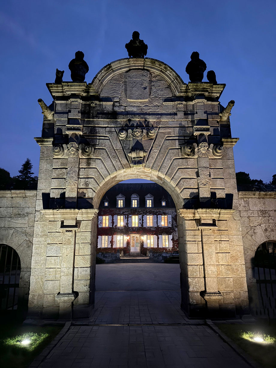
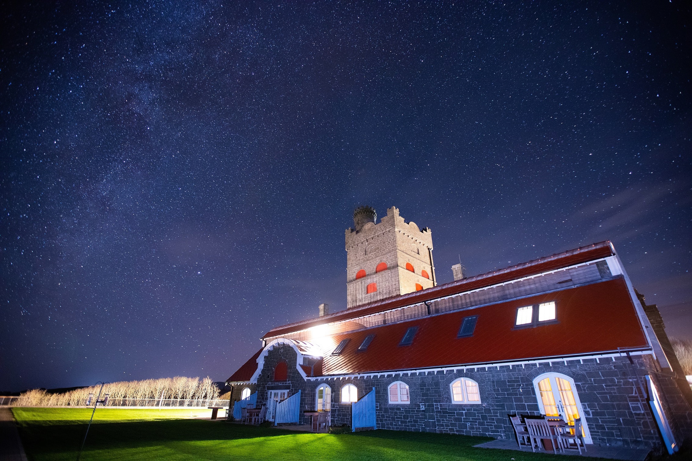
Manoir du Hilguy, Brittany, France
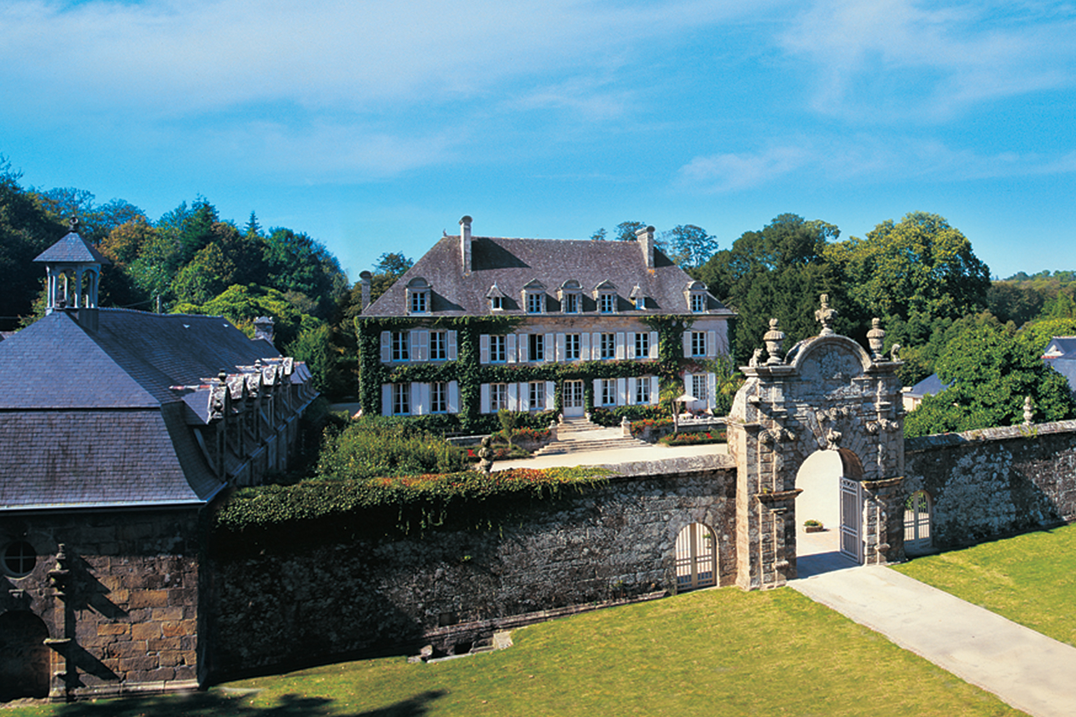
Magnificent 18th century château in Brittany
Open Gallery-
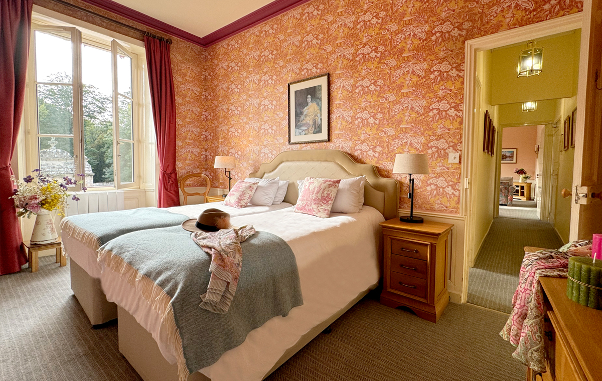
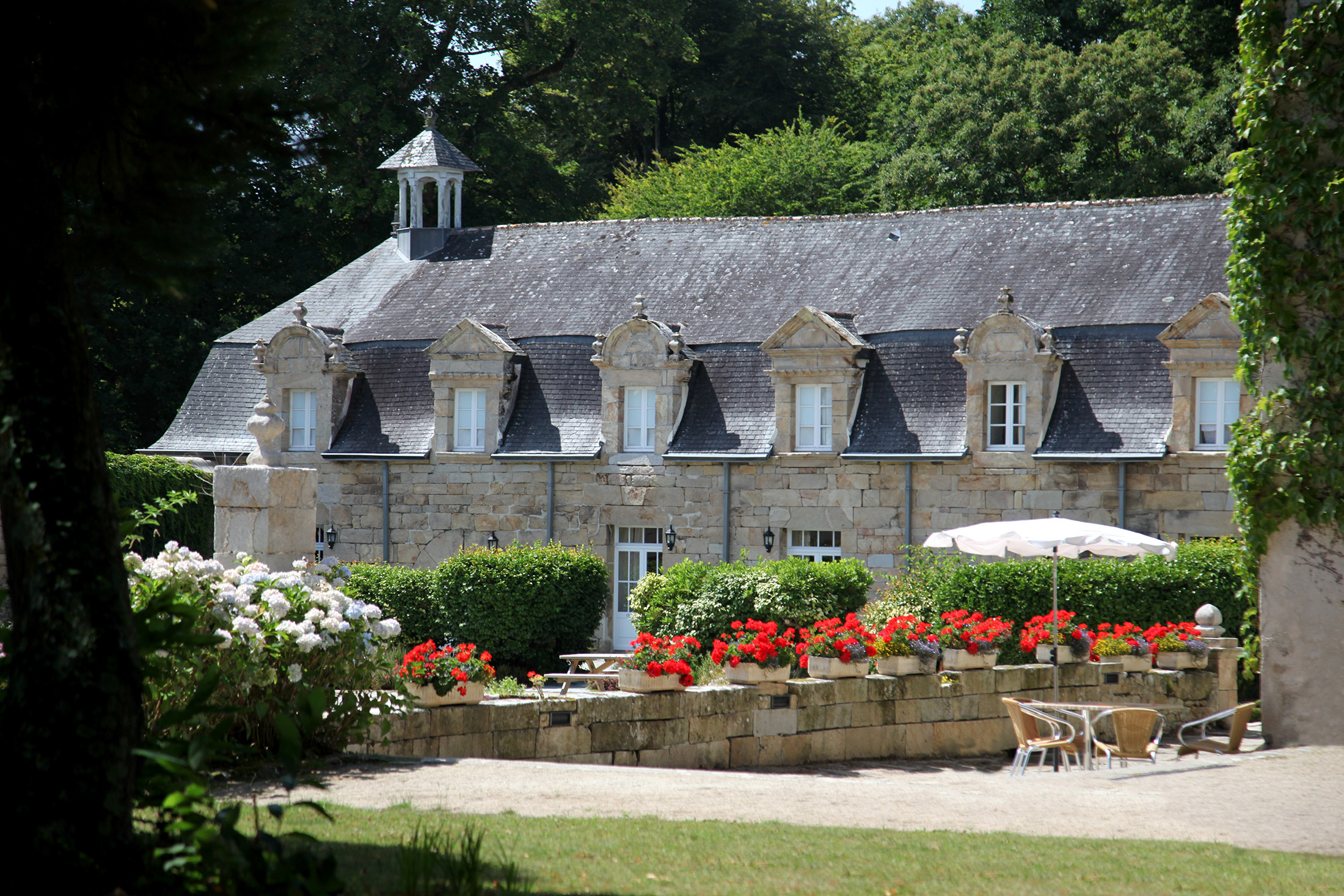
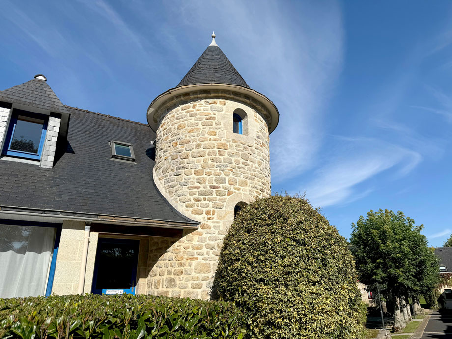
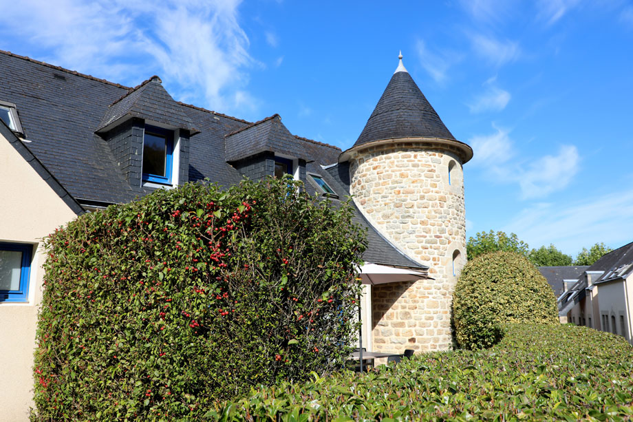
60 holiday properties, with 11 elegant apartments in the château and a further 49 cottages in the surrounding grounds
-
Magnificent 18th century château in Brittany
-
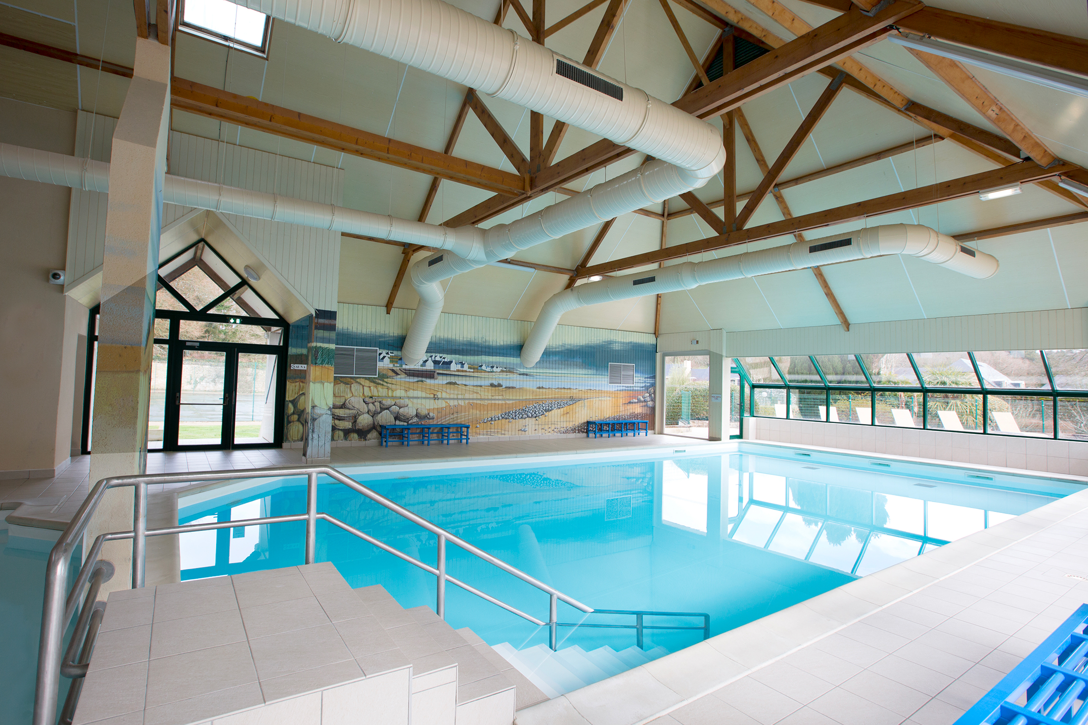
Sports and leisure facilities
-
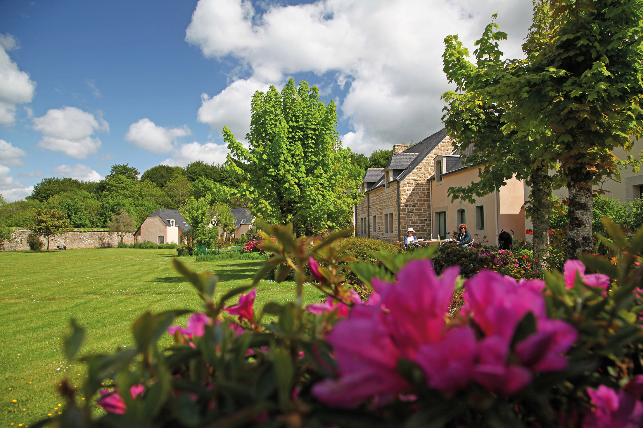
Glorious gardens
-
A sublime coastline – from beaches to rocky outcrops
-
Great for water sports
-
A haven for wildlife
-
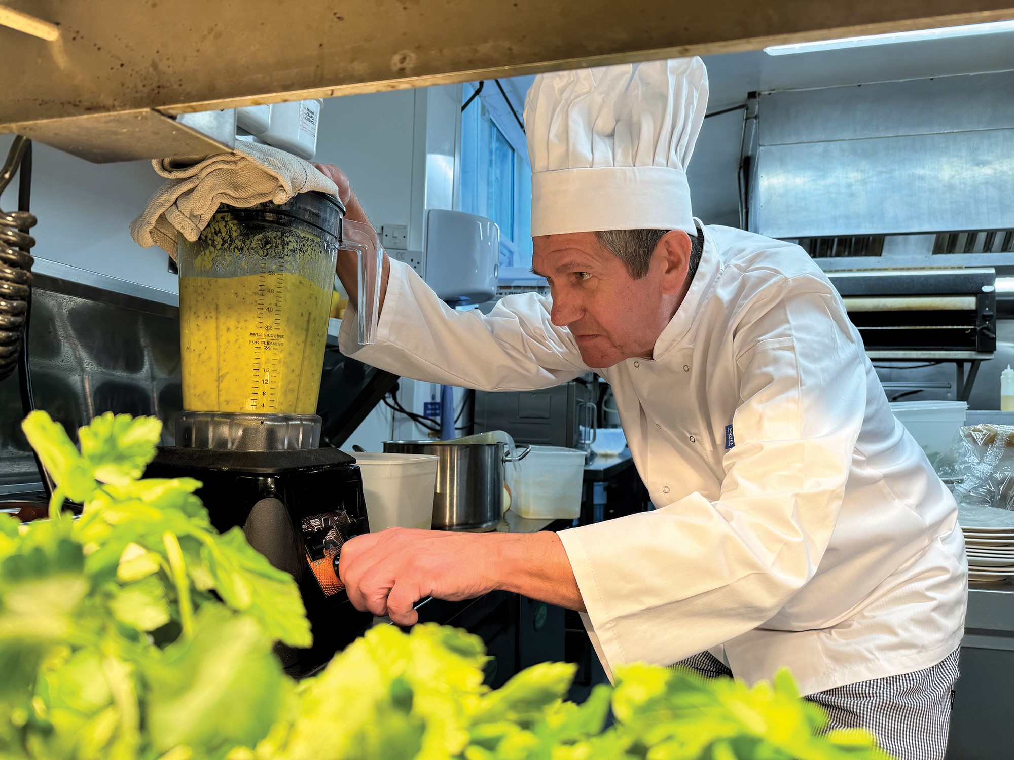
Fabulous food – especially seafood!
Discover Brittany
Close to the village of Plogastel St. Germain, in one of the most picturesque corners of Brittany, stands the 18th century chateau of Le Manoir du Hilguy. Once the home of French aristocracy, this fine house has been restored and converted to provide modern apartments and cottages, providing a unique holiday experience.
Here you can enjoy the peace and beauty of a particularly lovely part of rural France. This is also an area that is steeped in history, with many magnificent chateaux, stately homes, castles and fortifications to discover just a short drive away from Le Manoir.
Among the other local attractions are Bénodet, a charming seaside village with white sandy beaches; and Pont l’Abbé, southwest of Quimper, which has a superb shopping centre, a fascinating market and many fine castles, museums and churches. And for holidaymakers who love exercise and fresh air, there are plenty of walks to enjoy in the region, following well-marked paths, taking in glorious cliffs, forgotten river valleys, beautiful medieval villages and the most unspoilt scenery.
Brittany is famed for its seafood cuisine – 80 per cent of France’s shellfish come from the region, so don’t just go for the scenery, go for the food too!
Take in some fresh sea air
The seaside resort of Bénodet is popular with tourists and locals in the summer, thanks largely to its sandy beaches. Keen walkers and cyclists also love the resort’s many cycle and footpaths.
Alternatively, Le Guilvinec’s quayside is a wonderful place to watch the fishermen come in with their catches. As you might expect, the seafood restaurants here are superb too.
Go for a walk along the Crozon Peninsula
Part of the Armorique Regional Nature Park, Crozon Peninsula is one of the best places to go walking in the region. With 120km of coastal paths, you’ll enjoy stunning views, particularly from the Penhir headland and the three rocks better known as Menez-Hom (‘at the giant’s feet’). However, many of the paths can also be enjoyed on horseback or bicycle.
Play a game of golf (or two)
If you love golf, then you’re in luck – there are five courses within an hour of Manoir du Hilguy. The 18-hole golf course at La Forêt Fouesnant, Golf de Cornouaille, gives players a fantastic view of the bay. It’s also the oldest course in Brittany and surprisingly challenging, so beware if you’re a newbie to the sport!
Take part in one of the many festivals
The Bretons are fond of their festivals – a huge number occur every year in the summer. There’s something for everyone too, as there are festivals for music, religion, food, dance and more. Each one is traditional and colourful, so it’s worth checking to see if any coincide with your next holiday.
Enjoy the rugged coastline of Pointe du Raz
Pointe du Raz is a popular tourist spot, and it’s easy to see why. The most western point in Finistère, the rocky cliffs, crashing waves and La Vielle lighthouse make this one of the best views in the area.
Shops and restaurants
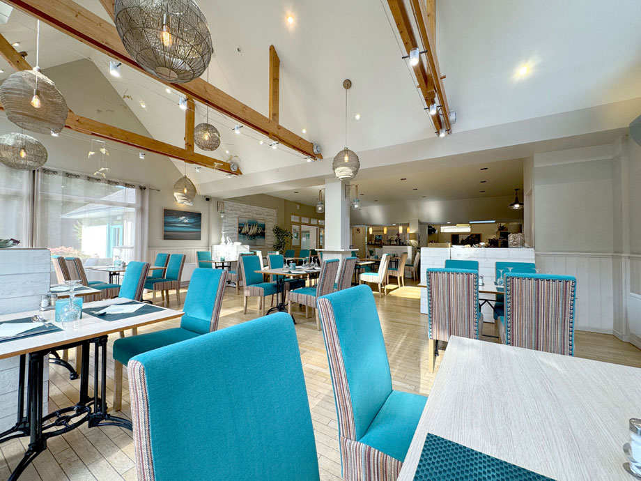
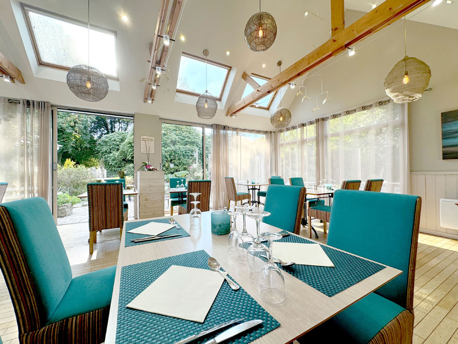
On-site, Westgate Lounge Restaurant provides excellent French style cuisine, while the adjoining bar offers aperitif and/or digestif.
The Ty-Pin restaurant near the Manoir is also worth visiting as is the Breiz Armor at the beach. Quimper, eight miles away, has an excellent selection of shops, restaurants and hypermarkets.
Don’t miss the Breton seafood platter
Given its proud maritime tradition, it’s no surprise that Brittany is renowned for the quality of its seafood – and, in particular, its seafood platter, which is regarded as a classic of Breton cuisine.
The composition of the dish varies according to the season and the vicissitudes of the fishing. But so seriously is it taken that many restaurateurs have signed up to an official Seafood Platter Quality Charter: the ‘l’authentique plateau de fruits de mer frais bretons’ (authentic fresh Breton seafood platter).
To be allowed to feature the charter-mark on their windows, participating restaurants must offer a choice of at least six different sorts of shellfish – usually including lobsters, clams, mussels, scallops, shrimps and oysters – served on a bed of seaweed, and accompanied by bread, salted butter, homemade mayonnaise and a wedge of lemon.
And a trip across the Channel would not be complete without a crêpe and/or a galette – pancakes made of buckwheat (for savoury main courses), and wheat (for deserts). Washed down with a draught of locally produced cider, of course.
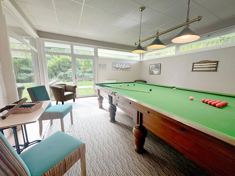
On-site facilities
The sports and leisure complex offers, free of charge:
- a heated indoor swimming pool
- an adjoining children’s splash-pool and sauna
- a small exercise room with exercise equipment
- changing rooms and showers
There is also:
- table tennis and snooker
- a pool table and a children’s room
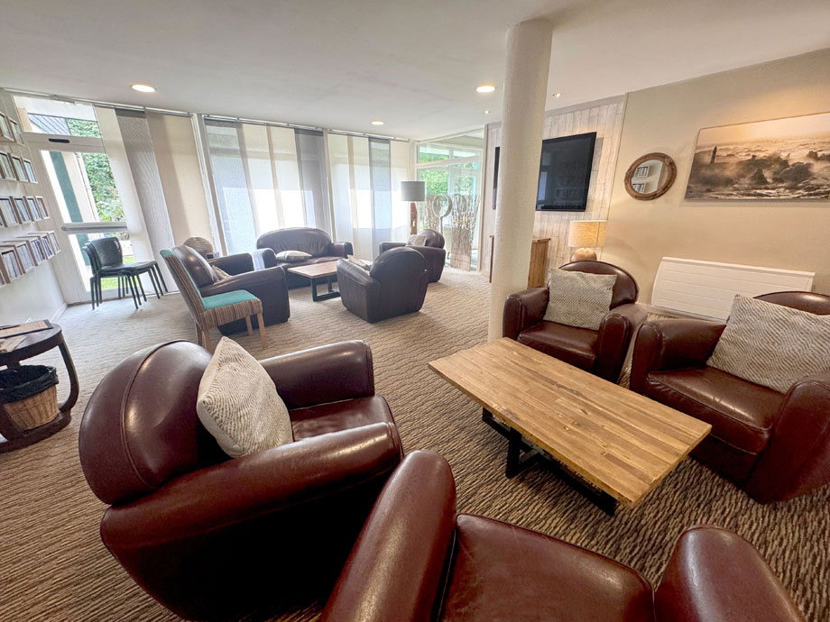
- a free-to-use DVD library in reception
- washing machines in the laundry room
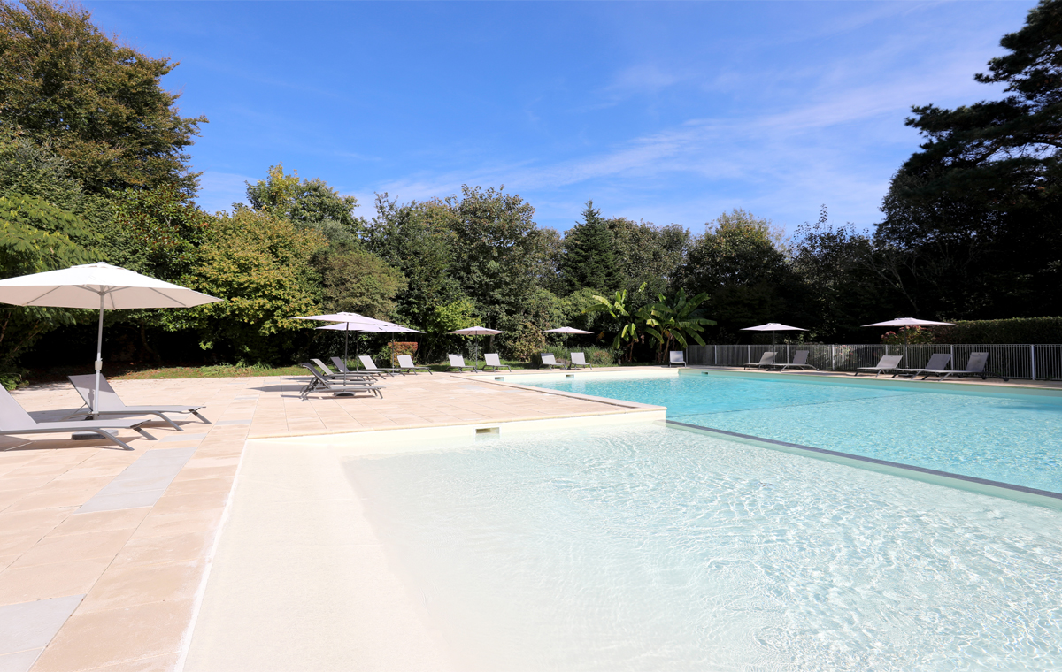
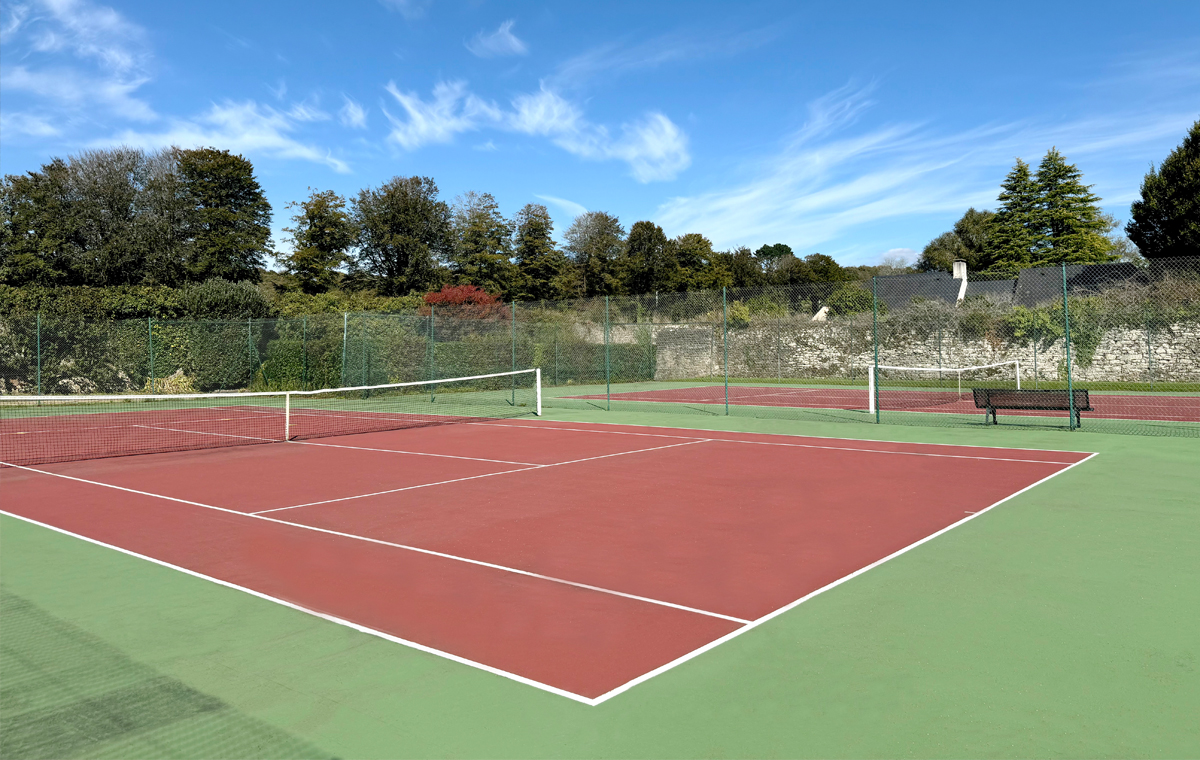
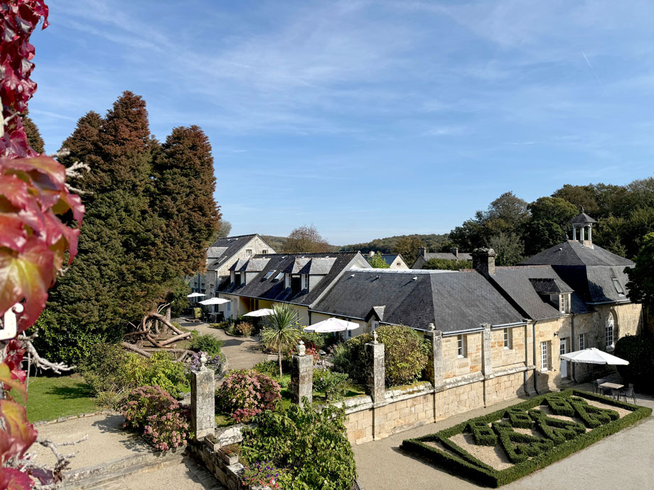
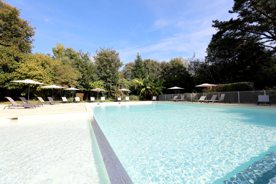
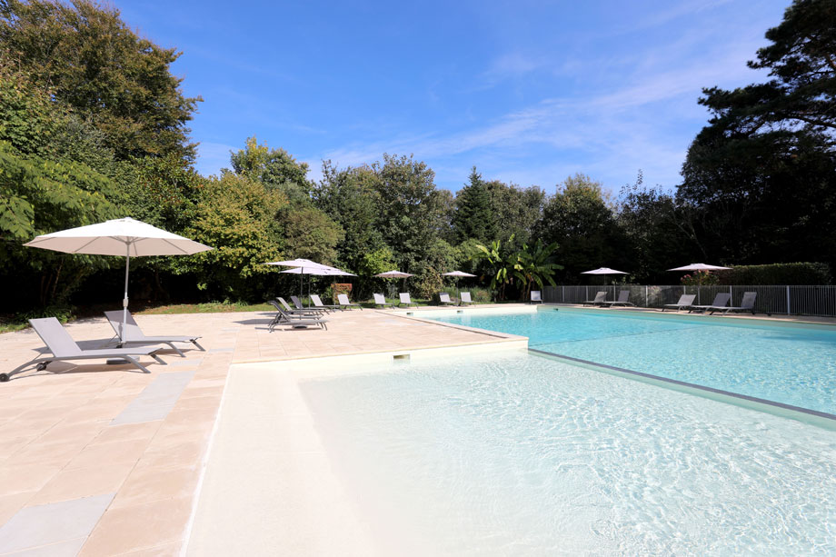
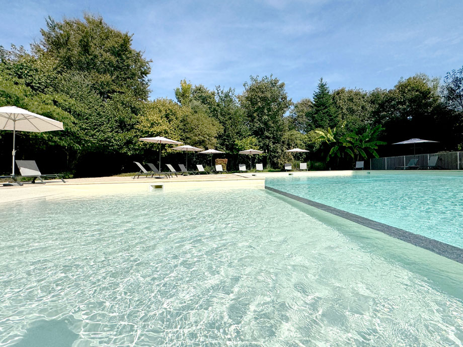
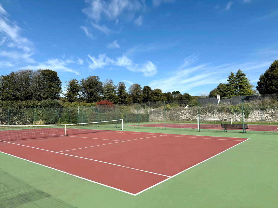
In the grounds are an outdoor ‘summer’ swimming pool (which is open from 15th May – 15th September) and three all-weather tennis courts. The Manoir courtyard is ideal for playing pétanque and the lawn is perfect for croquet and badminton.
Separated from the gardens by a high stone wall is a private copse, which has been landscaped to provide a further recreational amenity.
Brittany itself has ten 18-hole golf courses and six nine-hole courses. Watersports are very popular along the coast, especially scuba diving, sailing, surfing, windsurfing, waterskiing and angling.
A riding stables can be found seven miles away.
Properties in Brittany
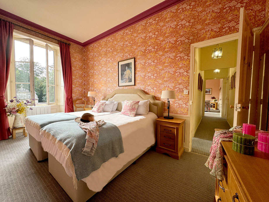
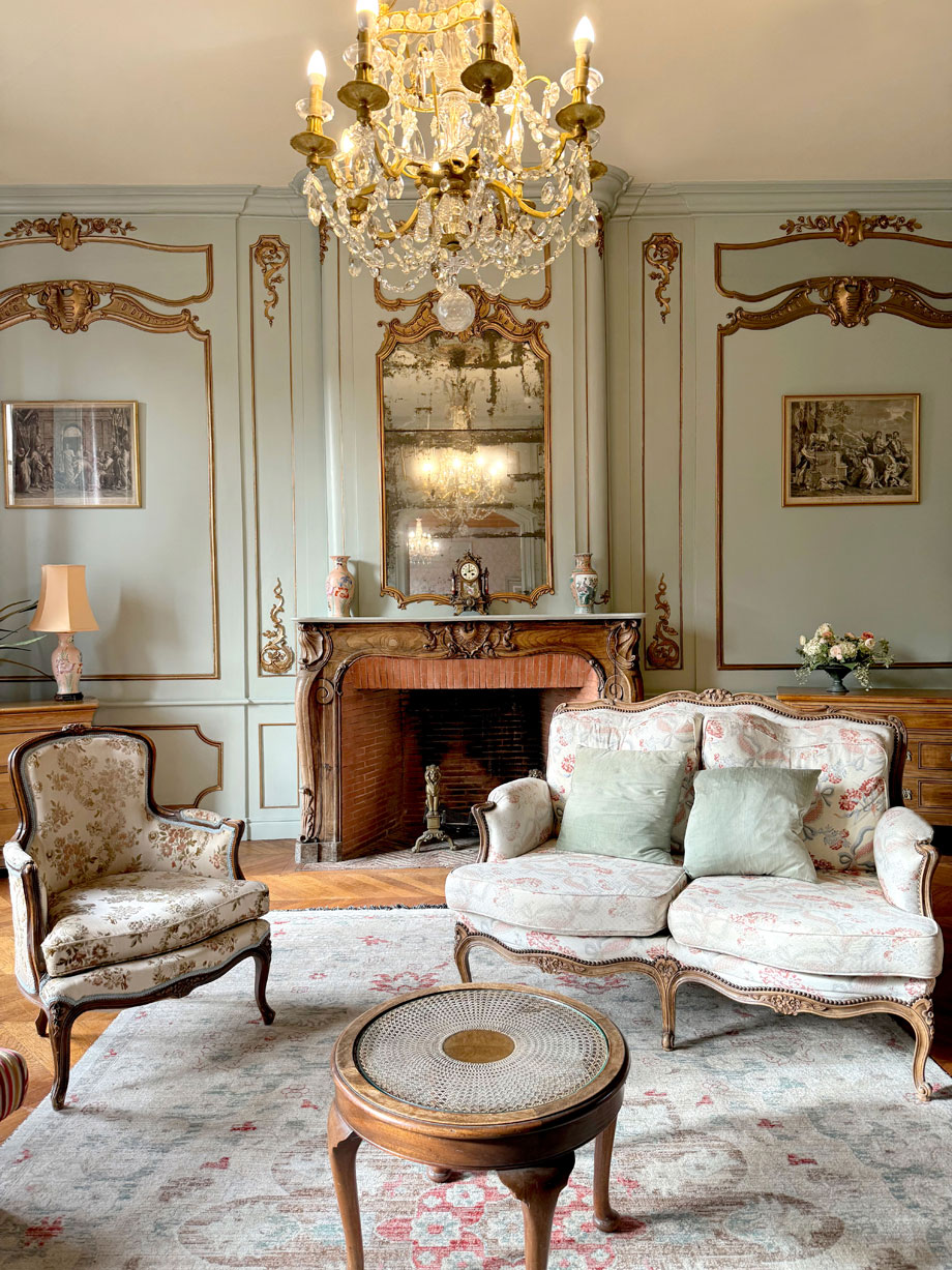
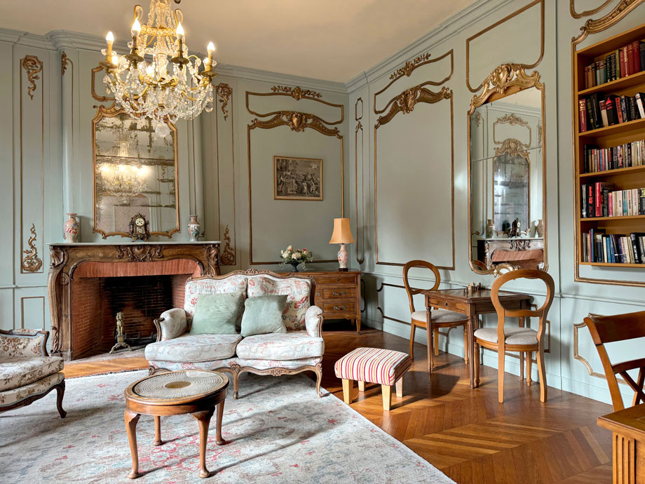
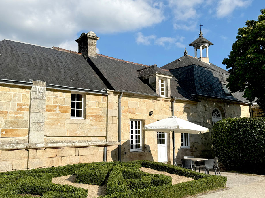
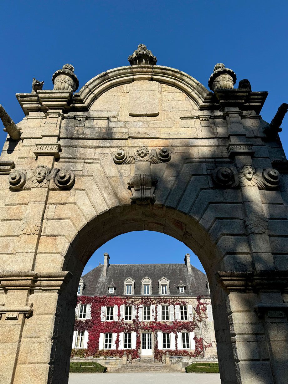
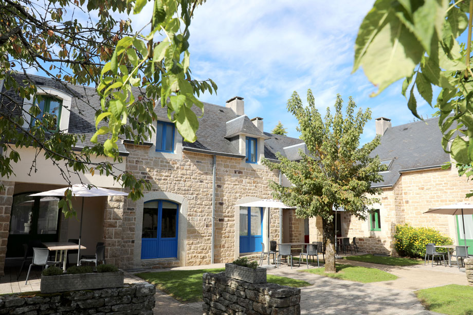
Dating from the mid-1850s, Le Manoir du Hilguy is the epitome of French architectural beauty, set in stone. It’s not large, as châteaux go; but both the house and the beautiful gardens surrounding it combine to give an impression of timeless elegance. In a word, bijou.
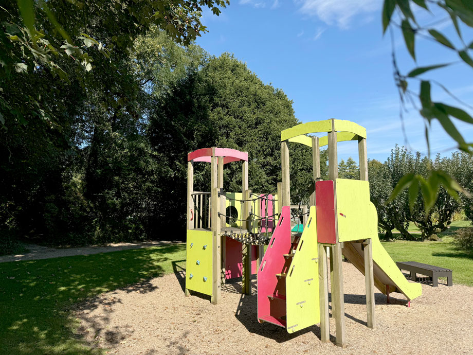
But if you should tire of strolling round the grounds and admiring the rhodedendra, there is much else to do, for all ages. Tennis? Swimming? Pétanque? These, and more, are available on site; and a meal in the on-site restaurant is not to be missed. And the site runs an Activity Club for kids during the school summer holidays.
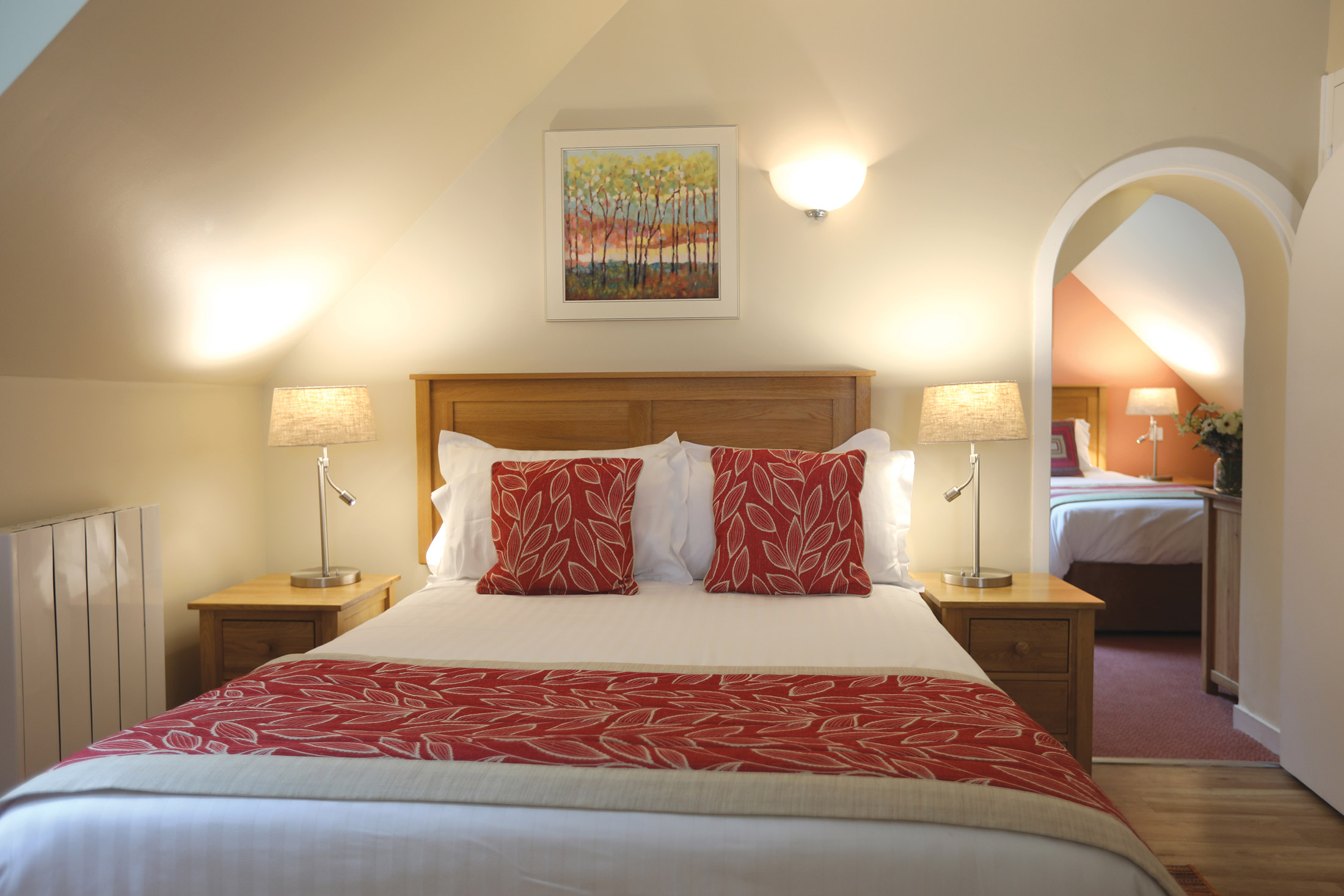
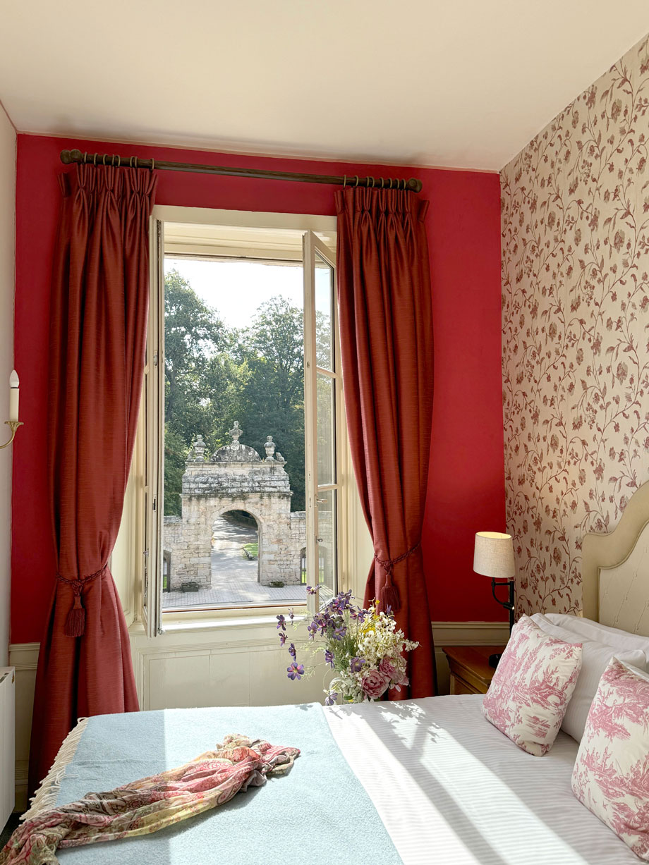
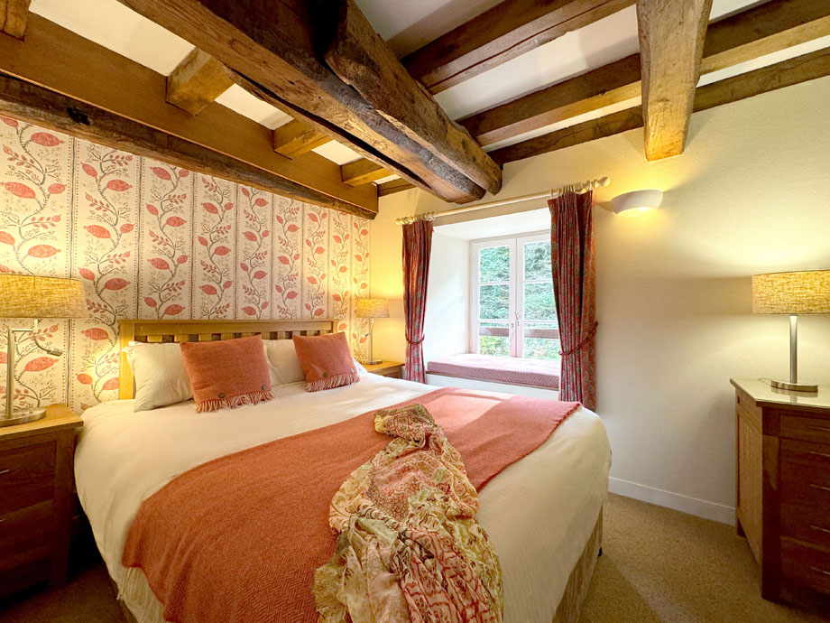
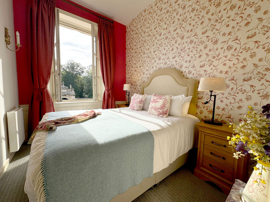
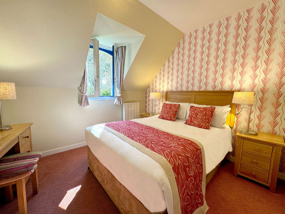
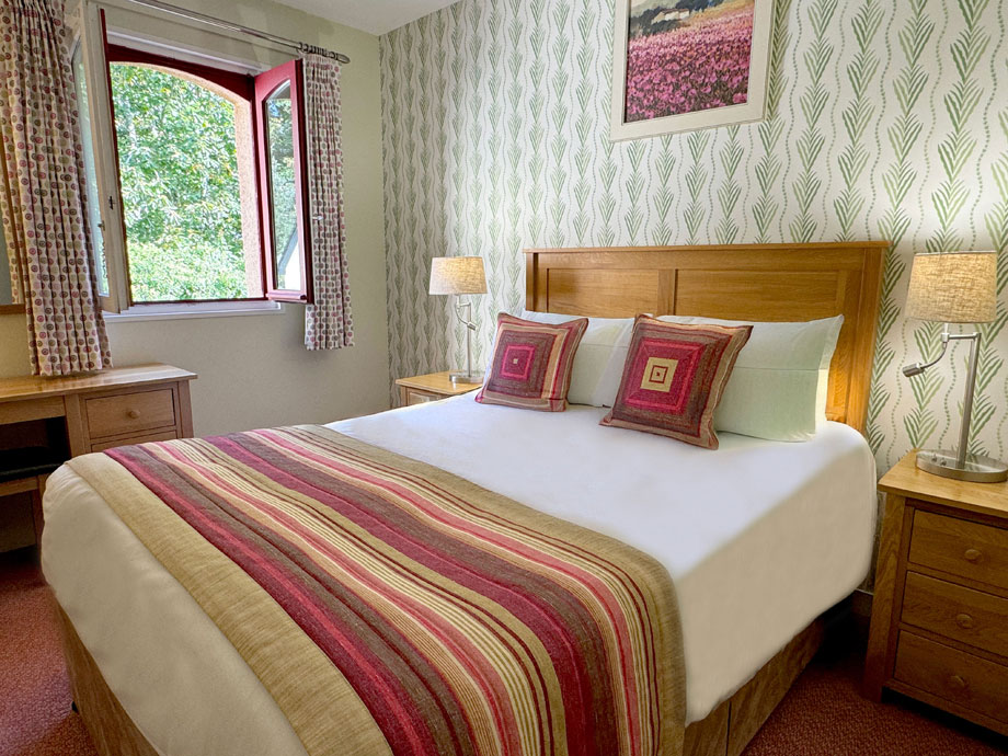
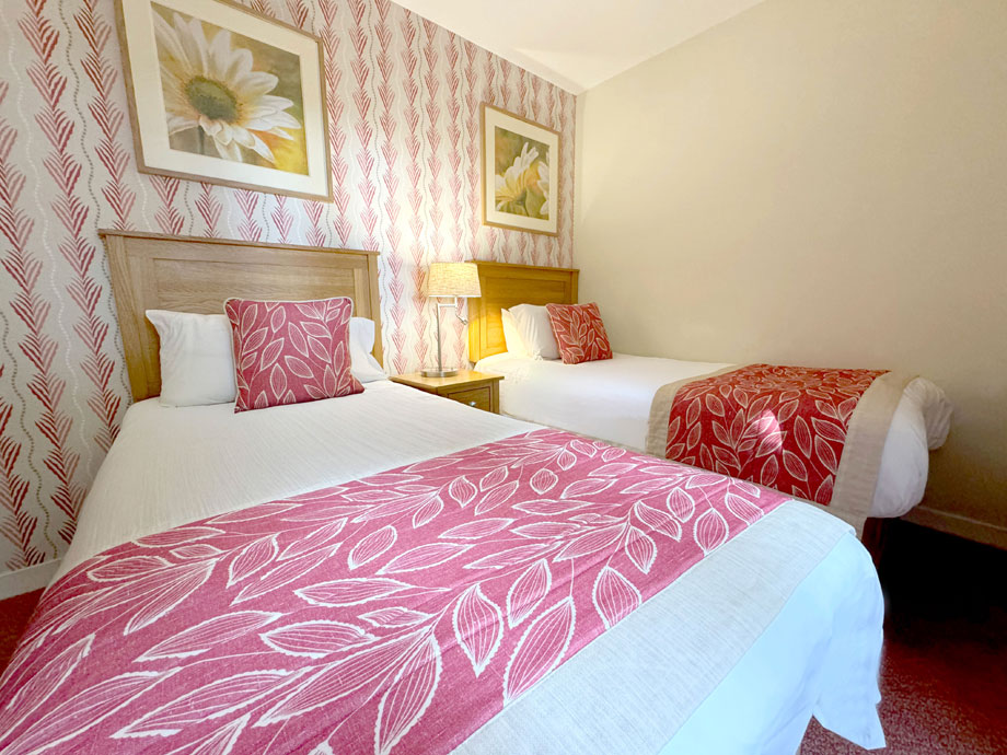
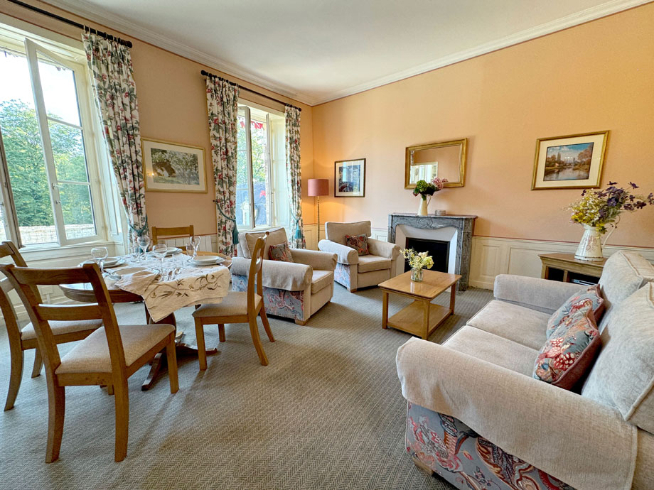
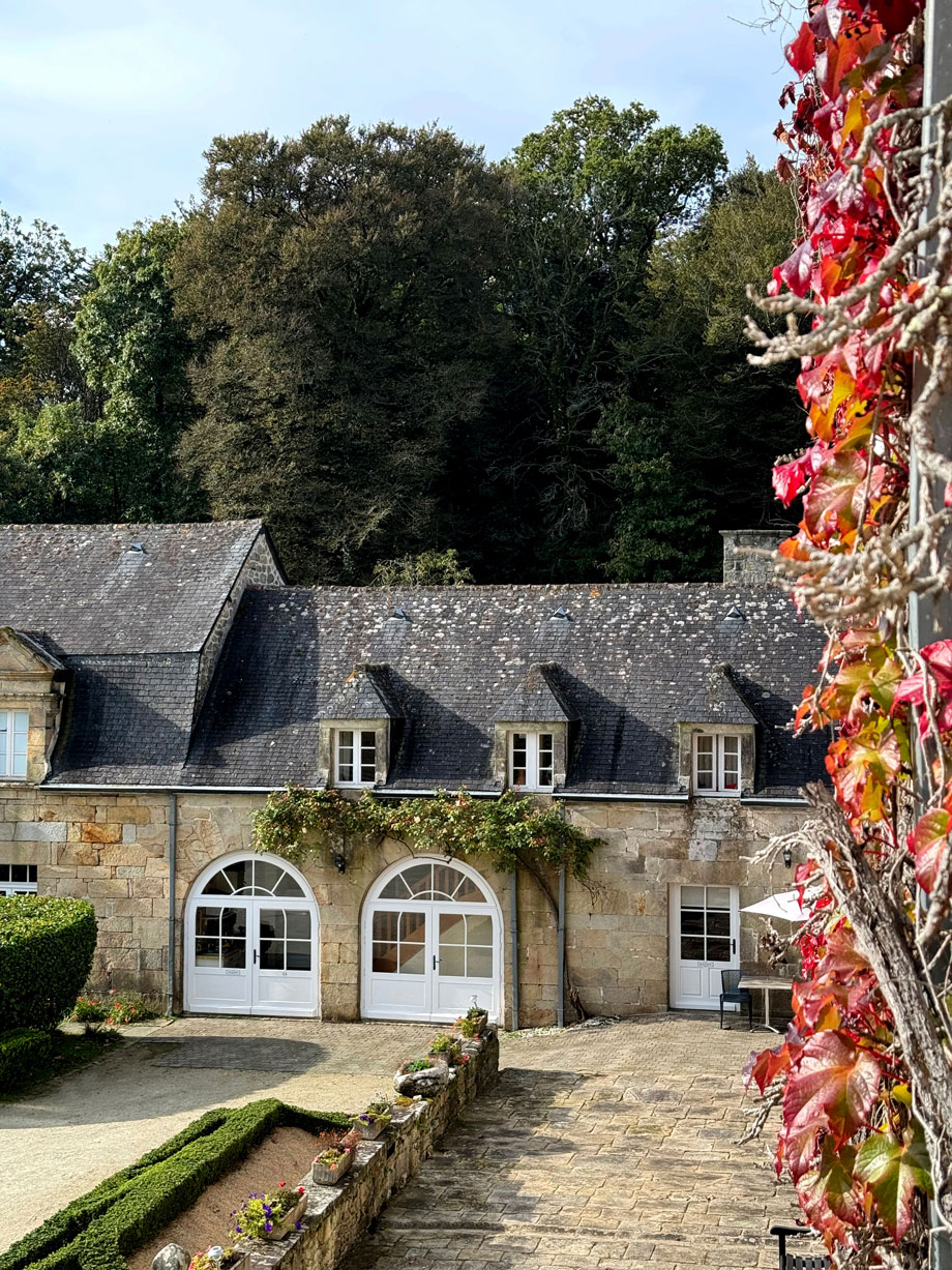
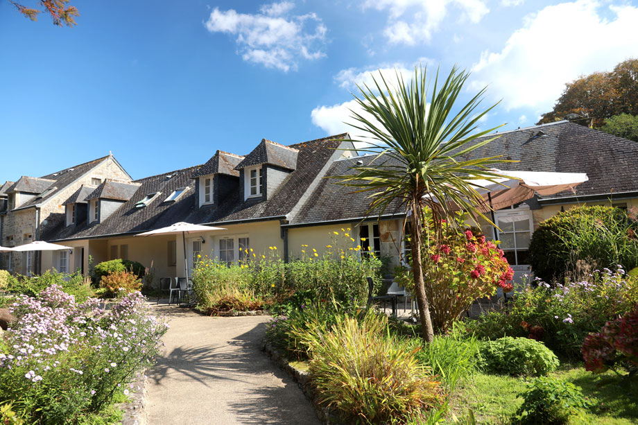
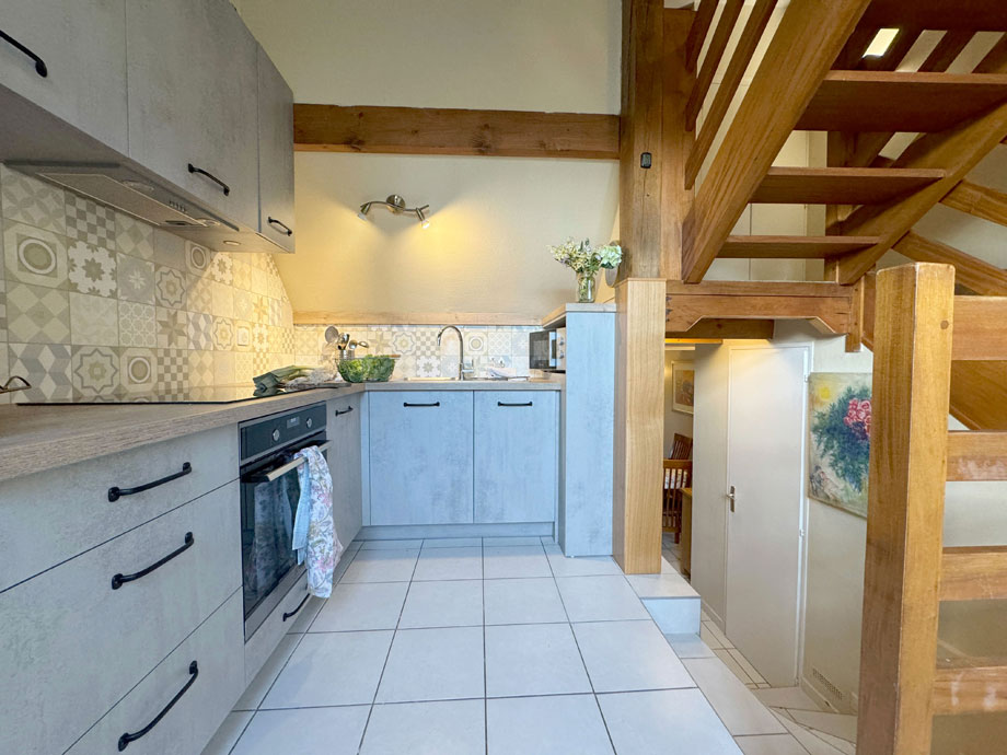
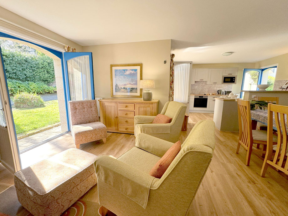
In complete contrast, the cottages are bright and informal. In all, there are 60 one, two and three-bedroom cottages, apartments and studios.
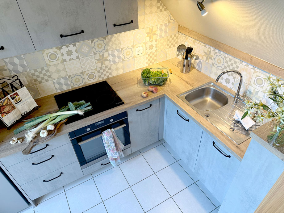
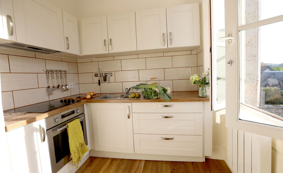
Though the properties differ in size and layout, they all have fully-fitted kitchens and televisions (with English speaking channels) and DVD players.
Each property has been named after a famous French artist, writer or a Breton town.
Manoir du Hilguy’s beauty is plain to see from the photos below. You can stay in one of grand chateau’s apartments or opt for a charming cottage. As you can see, both options look incredibly inviting – we can’t think of a better place to stay!
Of course, there’s much more to Manoir du Hilguy than the properties. When the sun is beating down, you can enjoy a dip in the outdoor swimming pool. The extensive lawn space is perfect for a variety of games, such as badminton or croquet. When you’re feeling peckish, there’s an on-site restaurant serving great French cuisine.


Location
HPB Manoir du Hilguy
Plogastel-St-Germain
Quimper
Brittany
France
29710
Tel: +44 800 230 0391
Email: details@hpb.co.uk
Brittany is a fascinating blend of amazing coastline, historic towns and spectacular countryside.
It is renowned for being the home of seafood cuisine and accounts for 80% of France’s shellfish industry. The area is rugged, breathtaking and one of the most beautiful French regions.
The Bretons are hugely proud of their heritage and enjoy celebrating their culture.
Things to do in Brittany
Surrounded on three sides by sea, La Cornouaille – on the west coast of Brittany – is France’s ‘Land’s End’. Celtic in tradition, history and myth (but not in climate!), the region relies mainly on tourism and fishing.

Walks
Read our HPB Feefo Reviews
HPB’s holiday booking service has been rated 4.9 out of 5 based on 14,772 customer reviews on Feefo
![]()
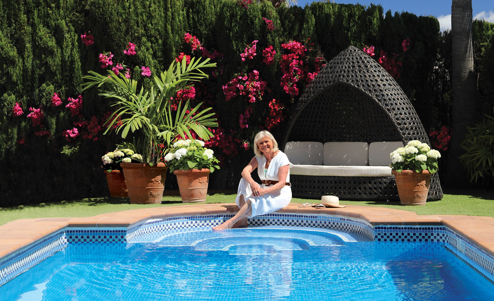
“We knew HPB would give us years of excellent holidays”
Carol and Craig BustardWe knew HPB would give us years of excellent holidays. We estimate that we have averaged three to four holidays a year.