

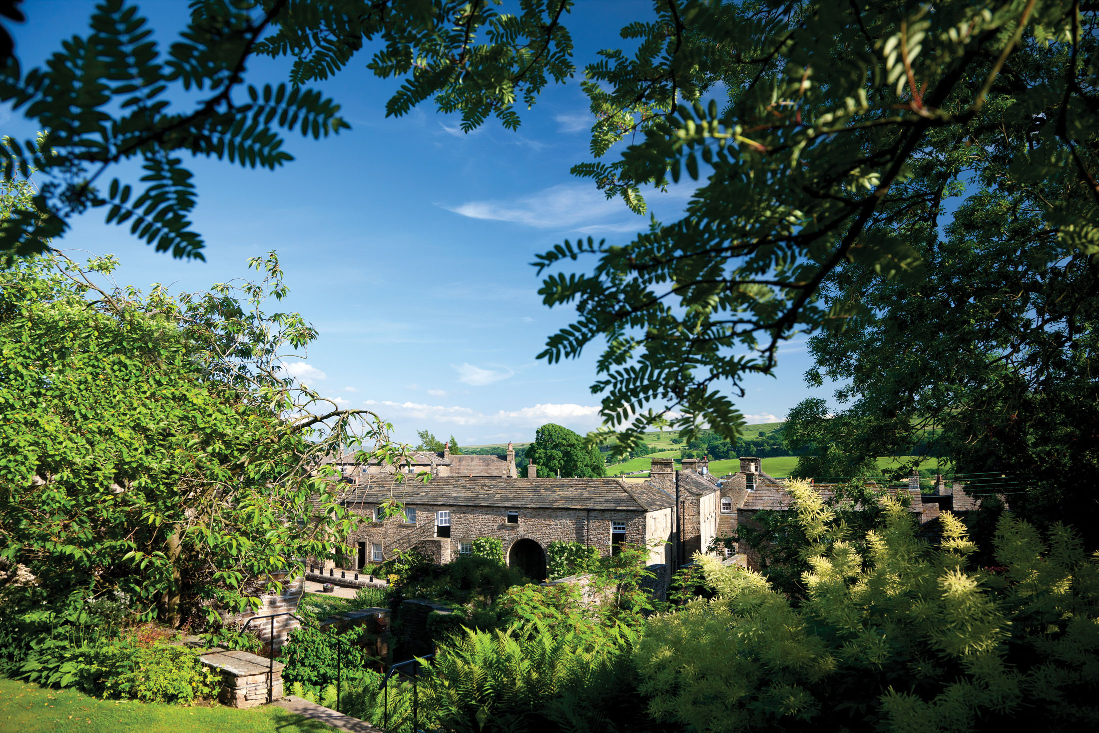


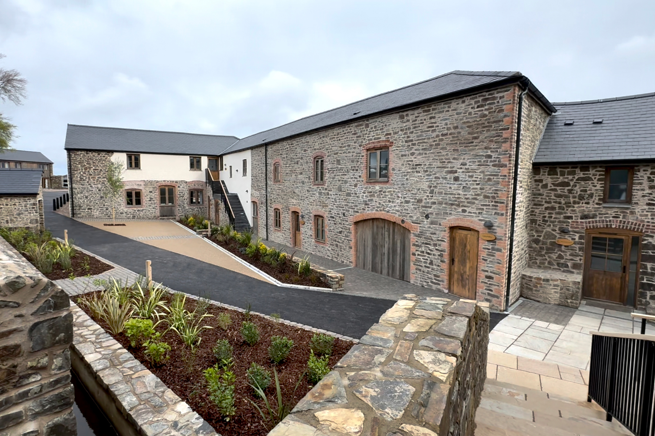
Lodge Yard, Askrigg, Yorkshire Dales, England
An award-winning development of 29 apartments and cottages in the Yorkshire Dales
Book a tour Open Gallery-
An award-winning development of 29 apartments and cottages in the Yorkshire Dales
-
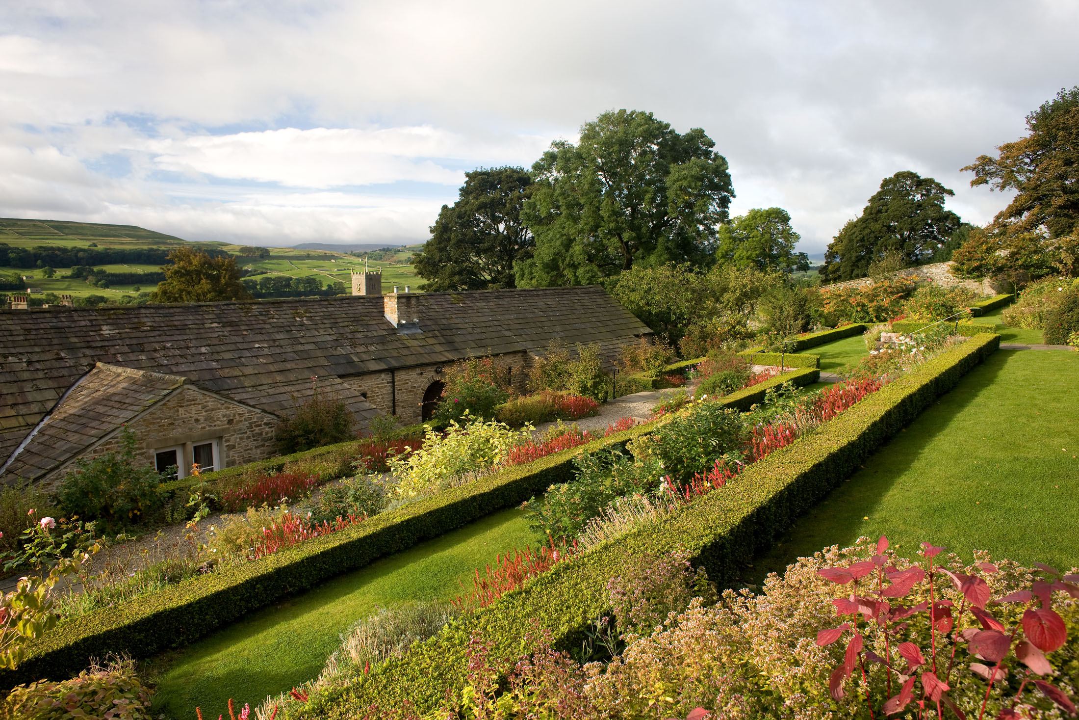
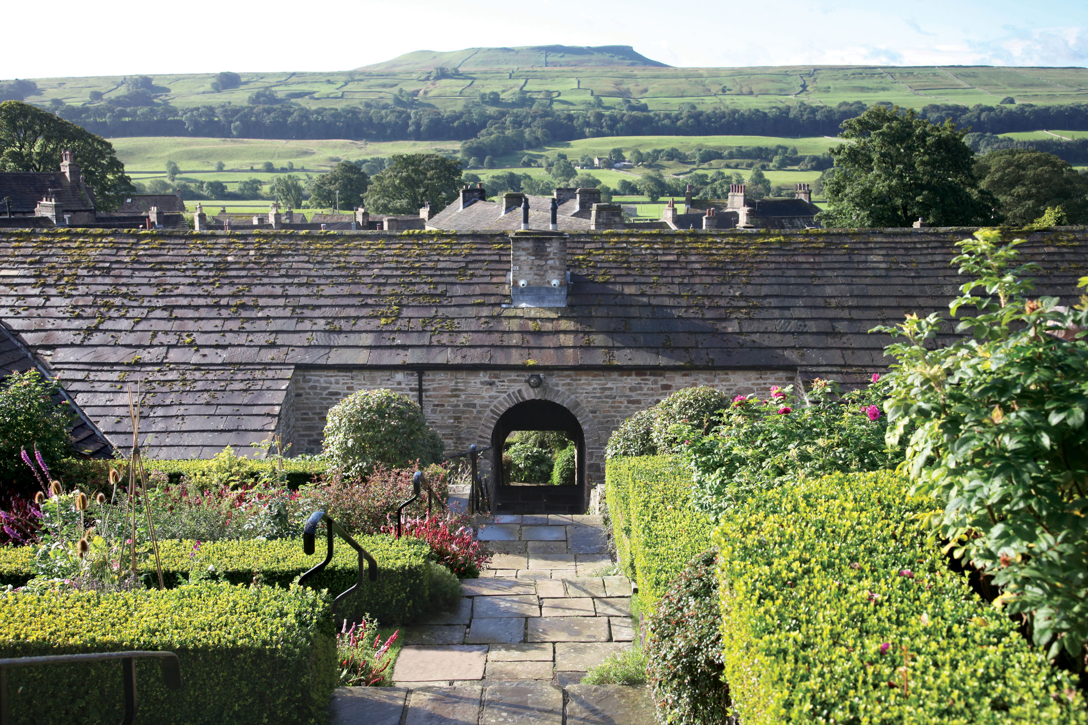
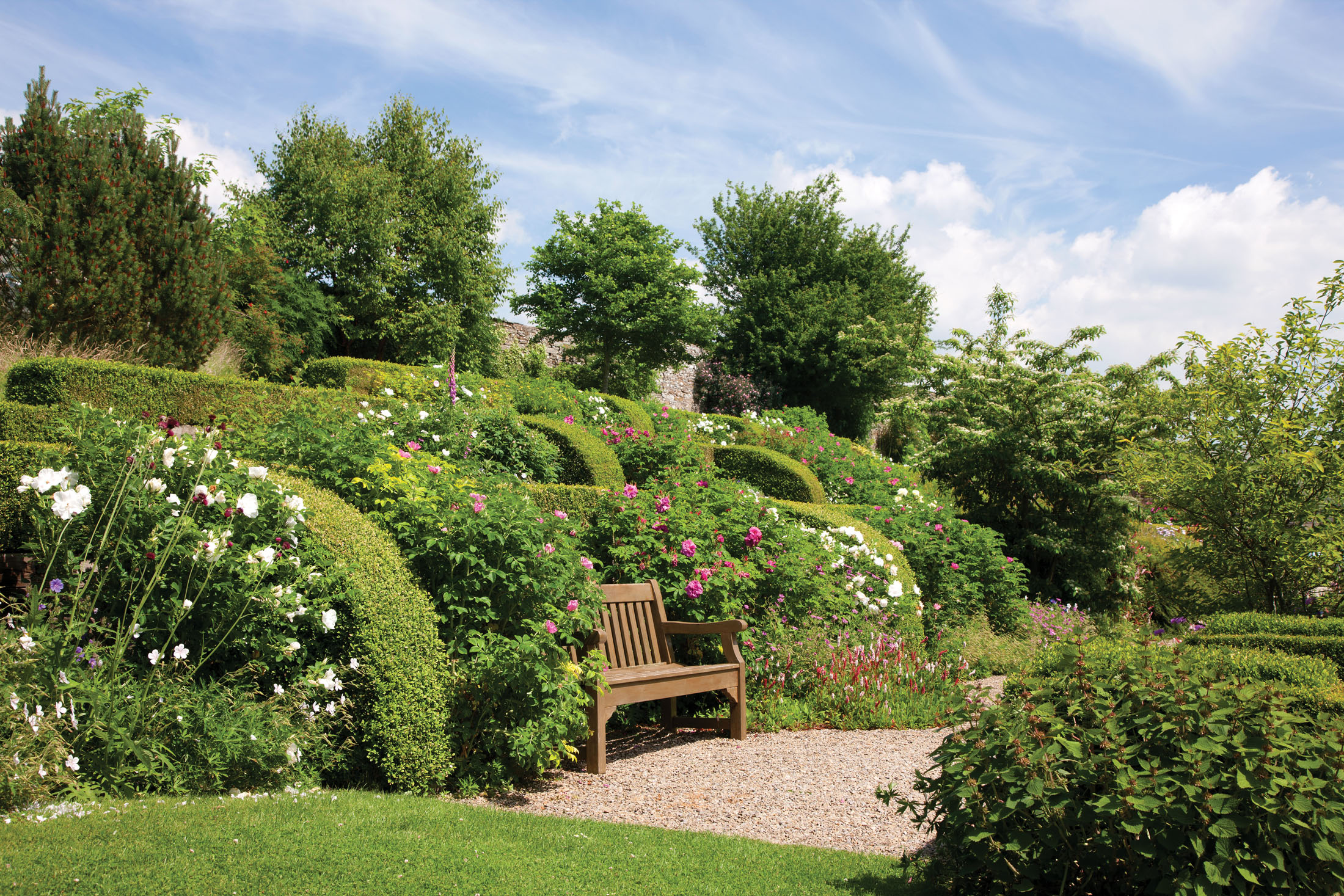
Glorious gardens with 18th century stable yard
-
Ideally situated for walking in the Yorkshire Dales
-
Pretty villages and quaint towns
-
Good old-fashioned Yorkshire charm
Discover Yorkshire Dales
More about Lodge Yard, Askrigg
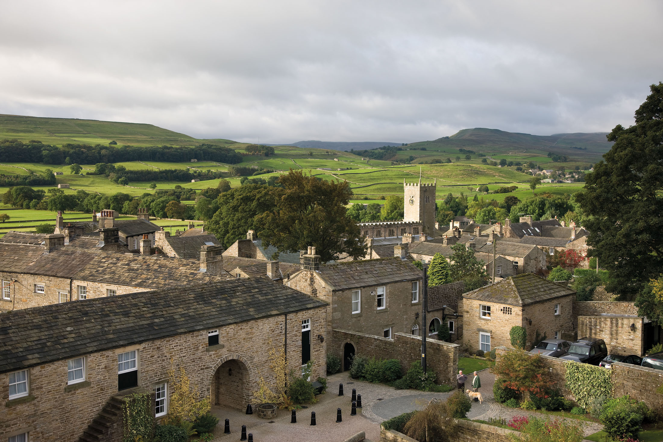
Lodge Yard is a delightful development of cottages and apartments close to the centre of the Yorkshire Dales National Park. It is located in the small village of Askrigg, in Wensleydale, which was celebrated as Darrowby in the popular TV series All Creatures Great and Small.
Lodge Yard is an award-winning conversion of historic stable buildings and is adjacent to the local pub, the Kings Arms, which featured in the James Herriot stories as The Drovers.
Askrigg has an interesting history – its name is actually Norse for ‘the ridge where ask tress grew’, meaning Vikings once settled there.
The National Park straddles the central Pennines in the counties of North Yorkshire and Cumbria, combining breathtaking scenery with beautiful wildlife and a rich cultural heritage. Packed into this area is a fascinating variety of natural attractions, from rolling moors and spectacular limestone crags to the famous Three Peaks of Ingleborough, Pen-y-Ghent and Whernside, as well as the yawning cavern of Gaping Gill.
Explore Yorkshire Dales National Park
Well, when it’s on your doorstep, it would be rude not to! If you’re keen to stretch those legs, there are over 140 guided walks to complete, giving you more than enough reasons to keep coming back to Lodge Yard. Those after a real challenge will want to try and climb the three peaks: Ingleborough, Pen-y-Ghent and Whernside.
Hundreds of events take place in the National Park every year, too. You can go for a night walk in a quest to spot some bats, drink your fill at a beer festival or take the children to go stream dipping. Additionally there are more traditional events, such as village fetes and farming shows, to attend.
Treat yourself with a shopping trip to Harrogate
If you love to shop until you drop, we strongly suggest paying a visit to the spa town of Harrogate. Here, you’ll find a wide selection of shops, from high street favourites to designer stores and independent boutiques. When you need a break from shopping, head to one of the many great local cafes. Bettys Café Tea Rooms is highly recommended – though it’s so popular you may have to wait to secure a seat.
Learn more about this interesting town’s history by taking a trip to the Royal Pump Room Museum. You’ll get to see the strongest sulphur well in Europe, learn about Ancient Egypt, and more – the children will love it.
Go birdwatching in the Yorkshire Dales
Make sure you pack the binoculars – the Yorkshire Dales is a haven for all forms of wildlife, especially birds. One of the best places to go finding is Wensleydale, where birds of prey such as the peregrine falcon and kestrel can be seen. If you’re lucky, you may even spot the elusive goshawk.
Pick up one of the many guides to birdwatching in the Yorkshire Dales to discover what organised activities are taking place this year.
Enjoy a day out in Hawes
The market town of Hawes is home to the famous Wensleydale cheese, so make sure you pick some up to take home with you. Tuesday is market day – stalls are located both in and outdoors, so there’s fun to be had whatever the weather.
There is lots to see and do in Hawes; you could visit the Dales Countryside Museum, participate in a craft workshop or grab a bite to eat in one of the many pubs, restaurants and cafes. After lunch, why not go for a stroll? There are several routes you can follow, including the Hawes Town Trail and the Pennine Way.
Gaze upon Yorkshire’s beautiful waterfalls
You can’t visit Wensleydale without taking in its amazing waterfalls. Aysgarth Falls, which comprises a triple flight of waterfalls, is truly incredible. If you want to see all three falls, there is a riverside walk you can follow. You may recognise this stretch of water from the film Robin Hood: Prince of Thieves.
Another waterfall not to be missed is Hardraw Force – the highest single-drop waterfall in England.
Shops and restaurants
Askrigg is well-served, with three pubs, a restaurant and grocery/tea shop (for basic provisions). There is a butcher in the next village.
Larger shops are available in Hawes and Leyburn.
On-site facilities
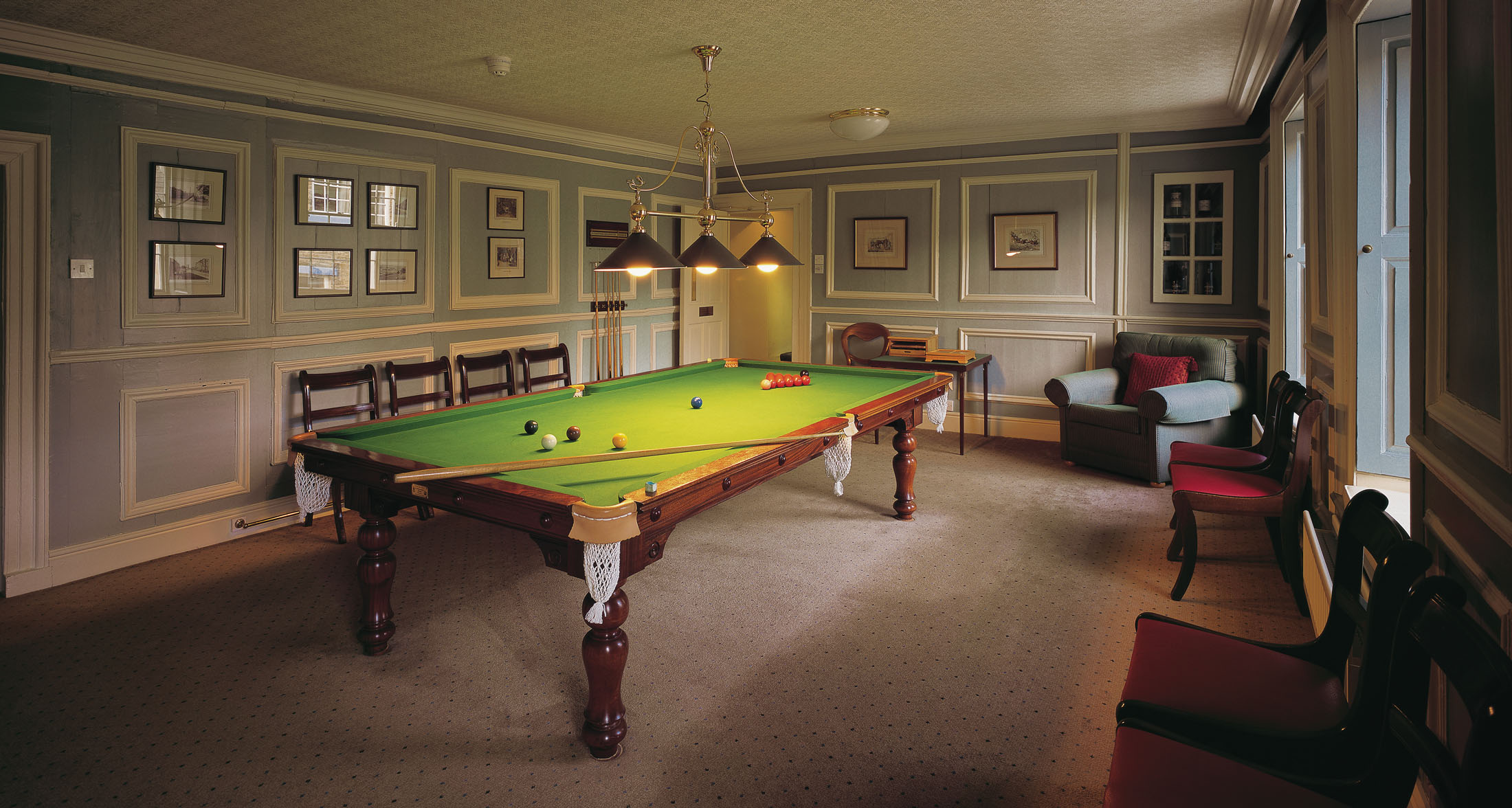
Lodge Yard has a barbecue, washing machines and tumble driers, and small clubroom with information area, DVD library, pool table and bar billiards. On the first floor of the Kings Arms are reading and snooker rooms. Free Internet and Wi-Fi access are available.
Properties in Yorkshire Dales
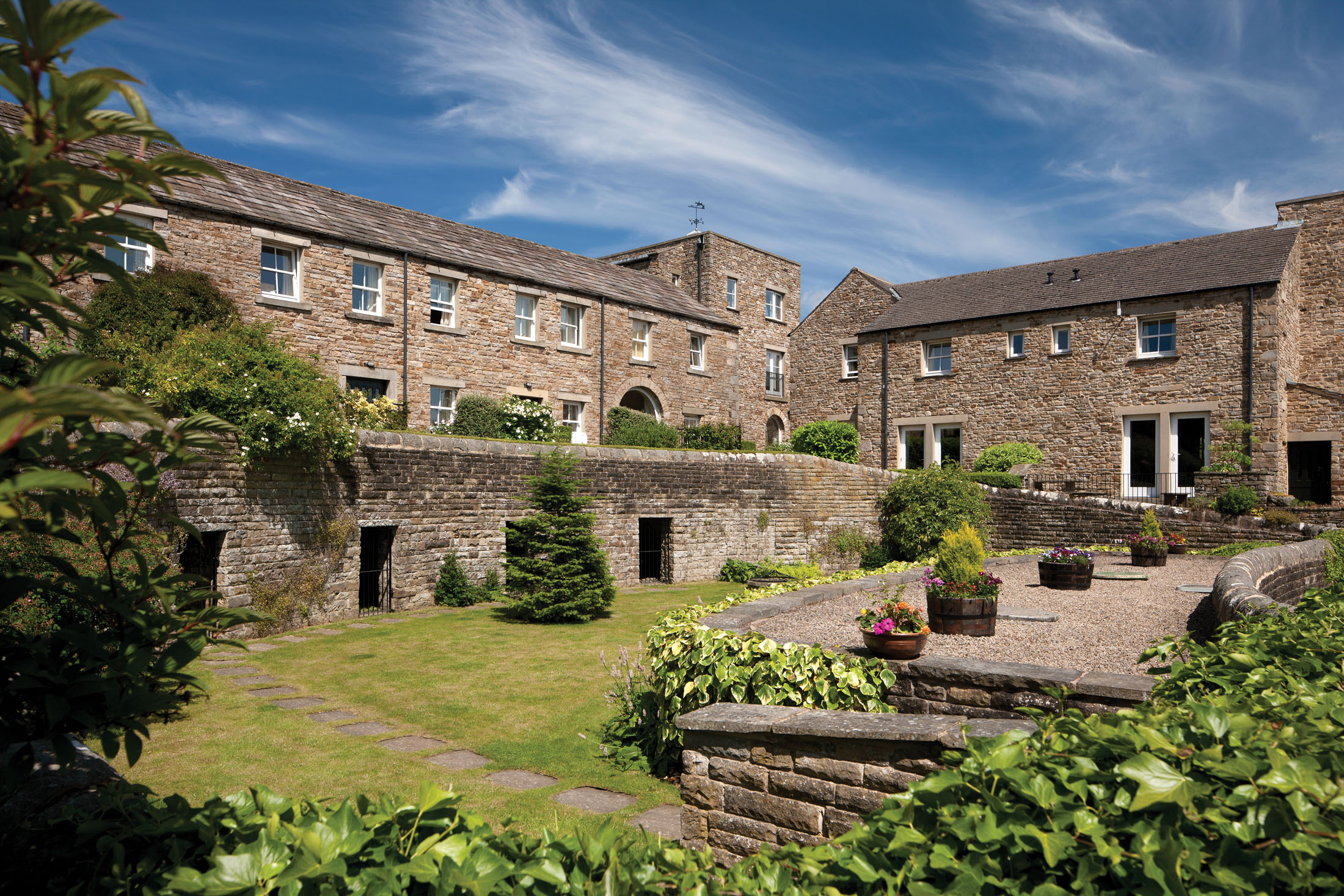
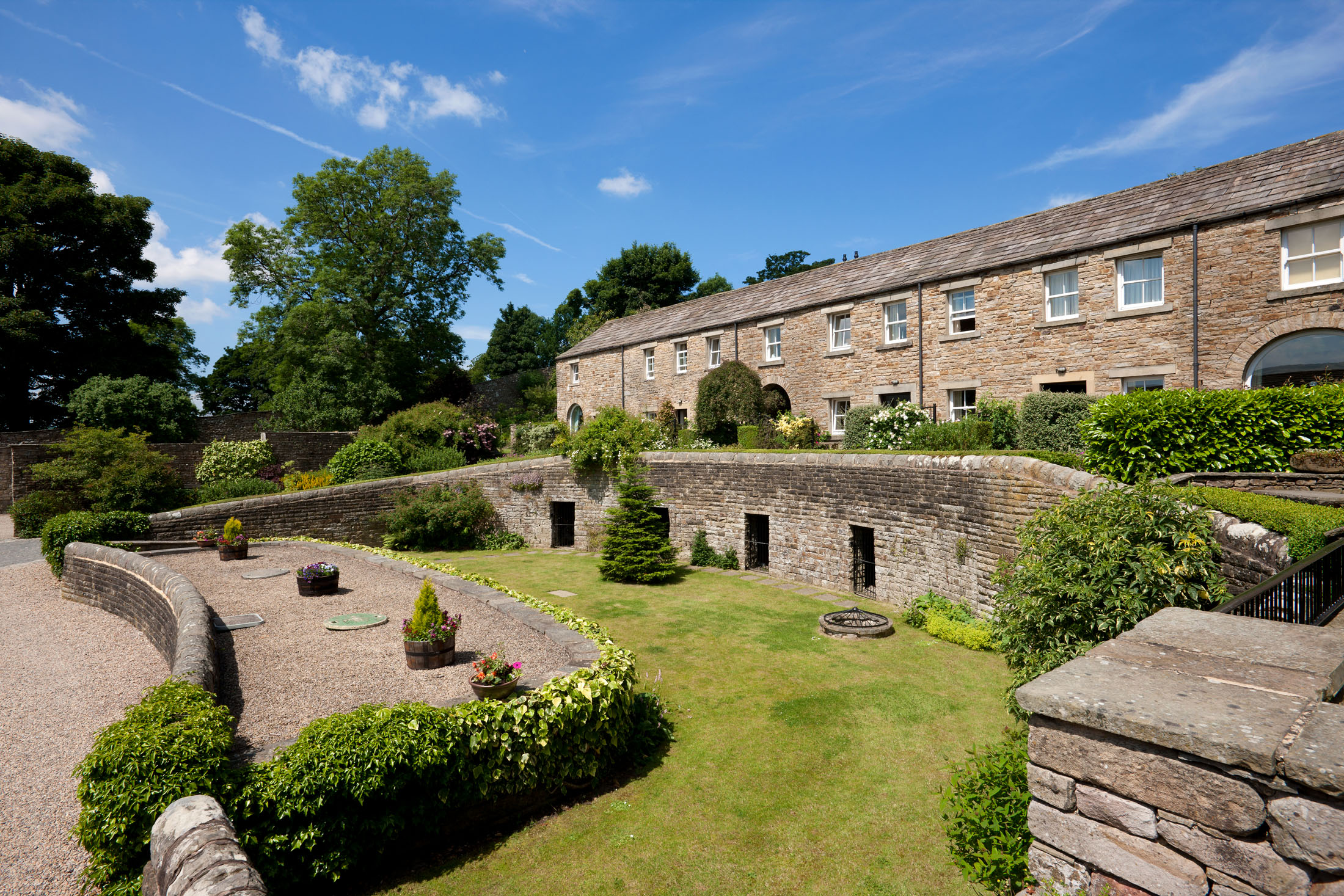
Lodge Yard is a listed 18th-century stable yard in the middle of the village, its once-derelict buildings now reconstructed to combine their original charm with contemporary utility.
Askrigg may be small; but it’s a thriving little place, with three pubs and a grocery/tea shop for basic provisions. The ‘Village Kitchen’ provides takeaway savouries and sweets (which can be pre-ordered).
Occupants of the site’s 29 cottages and apartments enjoy communal use of a snooker room, a reading room and a clubhouse with pool table and bar billiards and, in the adjacent Kings Arms – a former coaching inn – a lovely old pub, a first-class restaurant, and en-suite rooms.
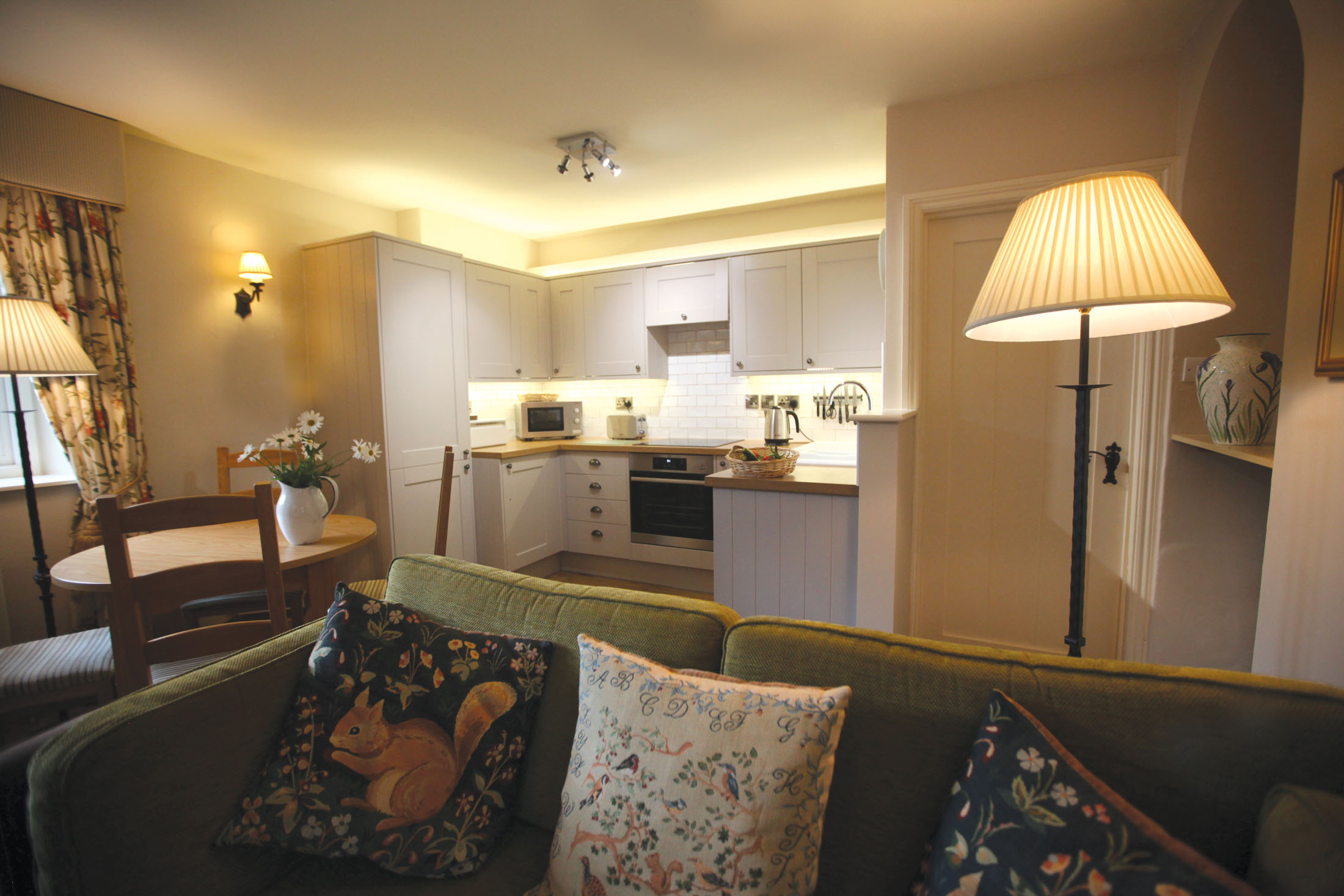
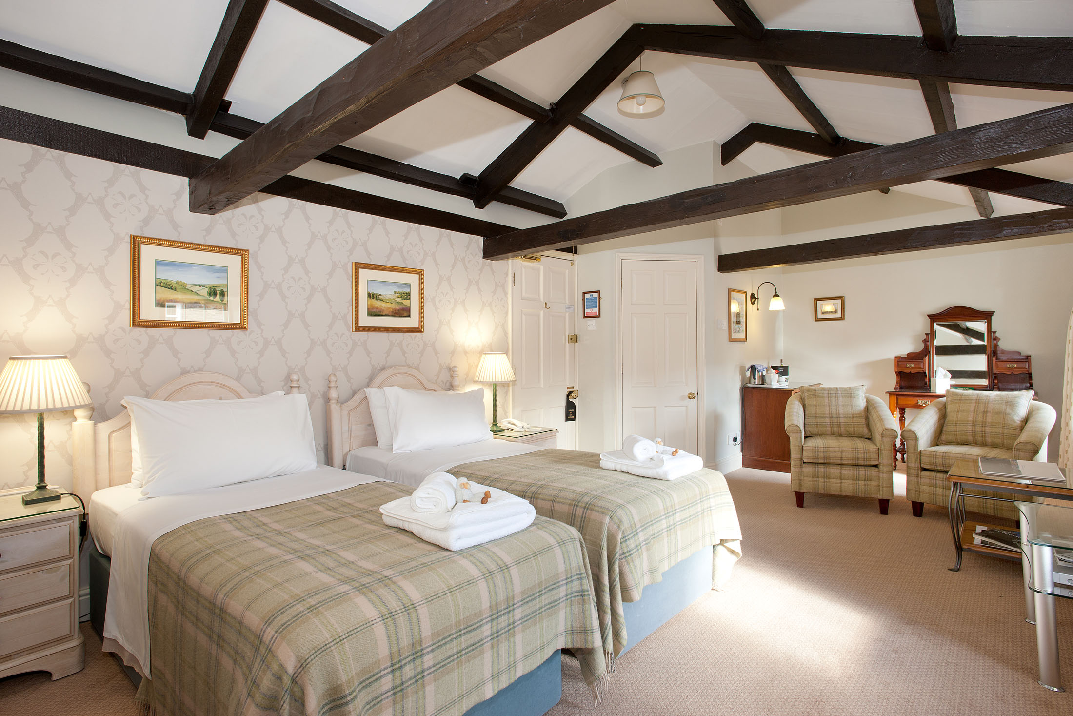
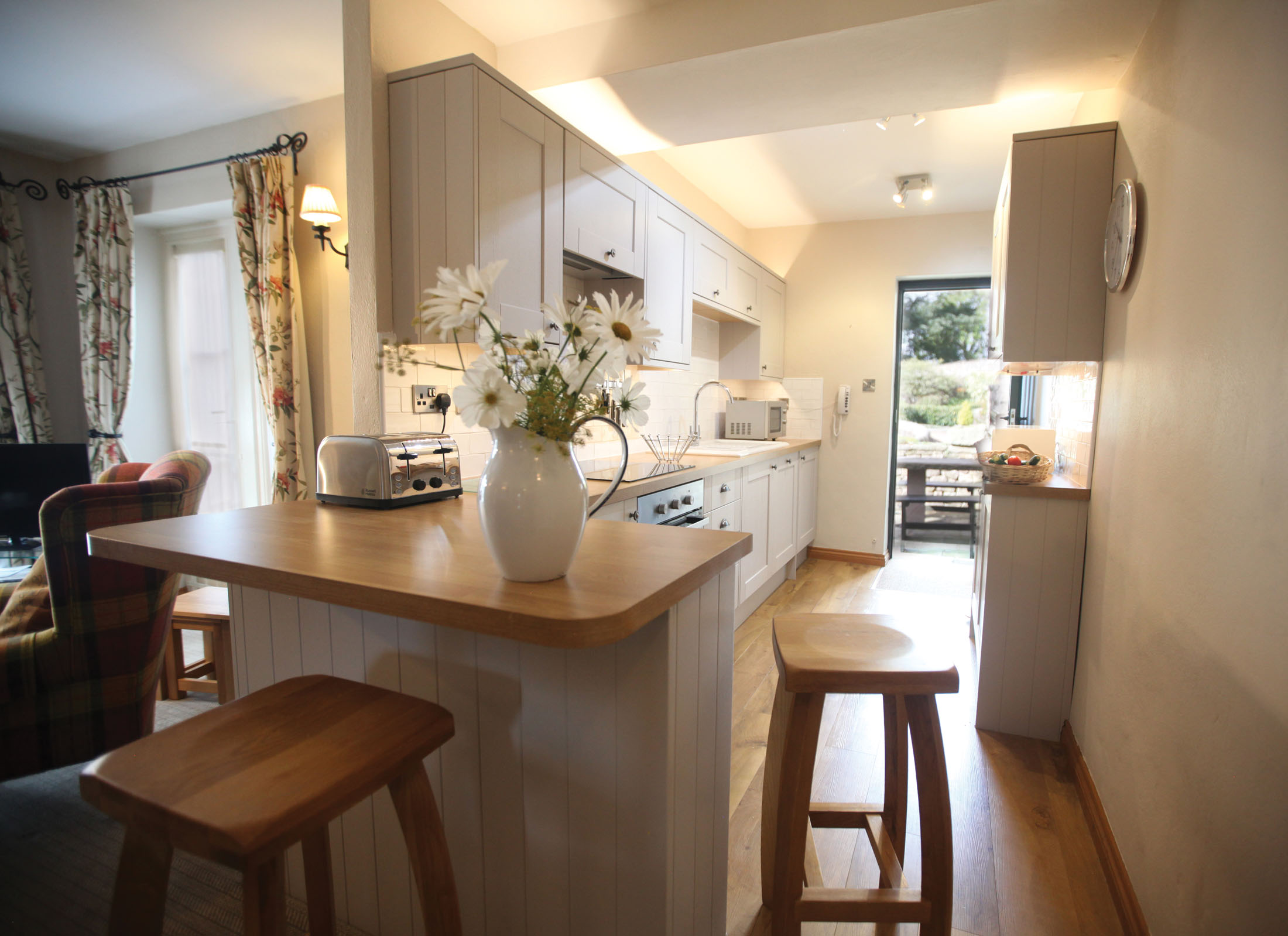
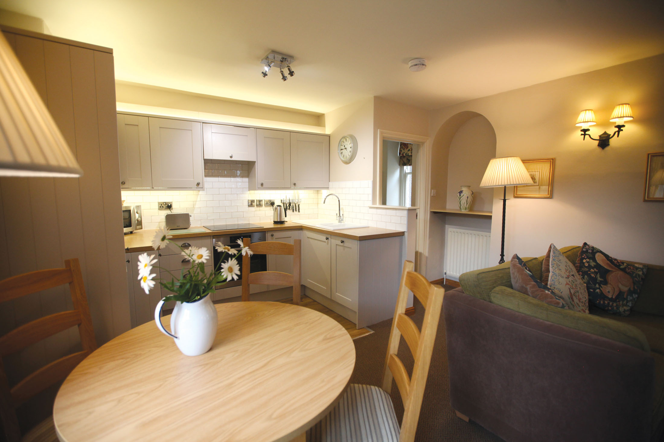
You only need to look at the images below to see how stunning the Yorkshire Dales National Park is. Whether you choose to holiday in an apartment or cottage, you’ll feel right at home at Lodge Yard, thanks to the modern kitchens and big comfy beds.
When you’re not sitting outside in the beautiful gardens or enjoying the Yorkshire Dales themselves, there are plenty of on-site facilities to keep you and the family entertained. When the weather is fine, why not host a barbeque? Lodge Yard also has a clubroom complete with pool table, a library and a selection of DVDs – perfect for a rainy day.
Location
HPB Lodge Yard
Main Street
Askrigg
North Yorkshire
England
DL8 3HQ
Tel: +44 800 230 0391
Email: details@hpb.co.uk
Askrigg is a small village in Wensleydale in the Yorkshire Dales National Park.
Askrigg is Old Norse for “the ridge where ash trees grew”, denoting the presence of Viking settlers. The Yorkshire Dales National Park has outstanding scenery and a rich cultural heritage.
It is a superb outdoor arena, built for fun as well as peaceful respite, and a haven for a wide range of wildlife. It is an expansive area of hill country that rises to the Three Peaks.
Things to do in the Yorkshire Dales
The nearby market town of Hawes is situated on the Pennine Way at the head of Wensleydale (near Hardraw Force waterfalls). The home of Wensleydale cheese and the Dales Countryside Museum was awarded the English Tourist Board Silver Award for the ‘Best Day Trip Out’.
The Hawes National Park Centre, based in the Dales Countryside Museum, is one of five run by the Yorkshire Dales National Park Authority. It has local crafts and an information area, and also provides community, educational and conference facilities.
The National Park itself was established in 1954 and covers an area of 1,762 square kilometres. It offers a recreational outdoor space and wildlife haven set amidst outstanding scenery with a rich cultural heritage.
Walks
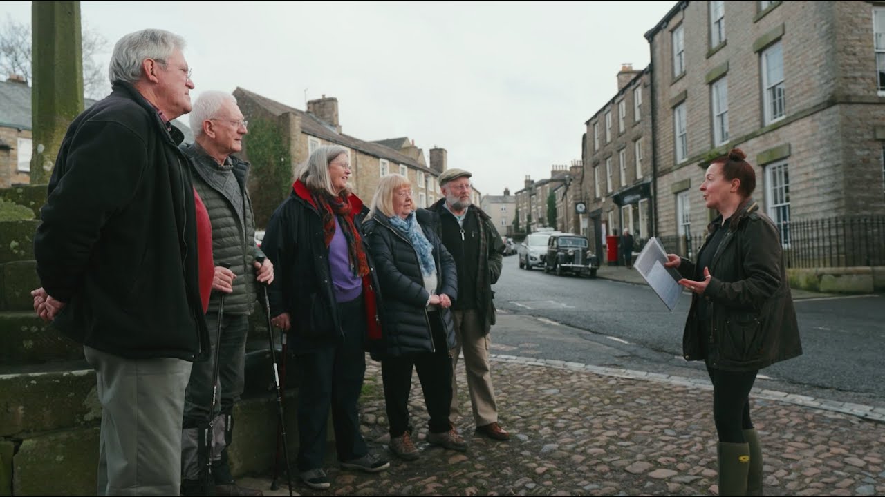
There are lots of places to discover. Have a look at some of our suggested walks below.
Having a Private Tour at an HPB holiday location is an enjoyable way to see the high standards of furnishings and facilities you could enjoy with HPB.
A local HPB Representative will show you around the site and answer any questions you may have.
Alternatively, you are welcome to book a Personal Presentation at a hotel near you. You can chat to one of our local HPB Representatives, ask your questions and view the complete portfolio of HPB locations.
Read our HPB Feefo Reviews
HPB’s holiday booking service has been rated 4.9 out of 5 based on 14,772 customer reviews on Feefo
![]()
“Buying into the future”
Mike DugdaleI got talking to our next-door neighbour at Barnham Broom, who’s been a Bondholder for a while; the family were full of enthusiasm and, while in no way pushy, was really keen to pass on advice and knowledge about any other sites we’re thinking of visiting. We swapped email addresses and will definitely be in touch – but it shows the strength of feeling about HPB, and the fact that there’s a real ‘family’ aspect to it.
