


-
29 cottages and apartments in Dorset
-
Clubhouse and family games room
-
Nestled in the rolling Purbeck Hills
-
Views of the Needles and Isle of Wight
-
15-acre grounds surrounded by National Trust land
-
Super walking country
-
A geologist’s paradise
-
History aplenty and museums galore
Discover Dorset
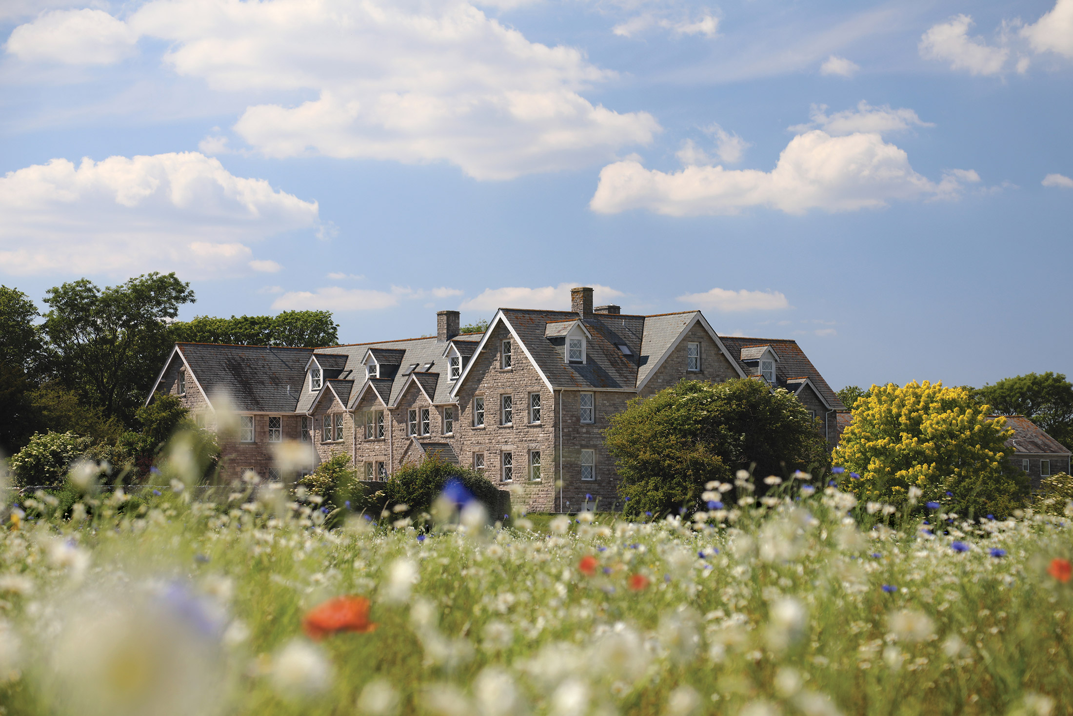
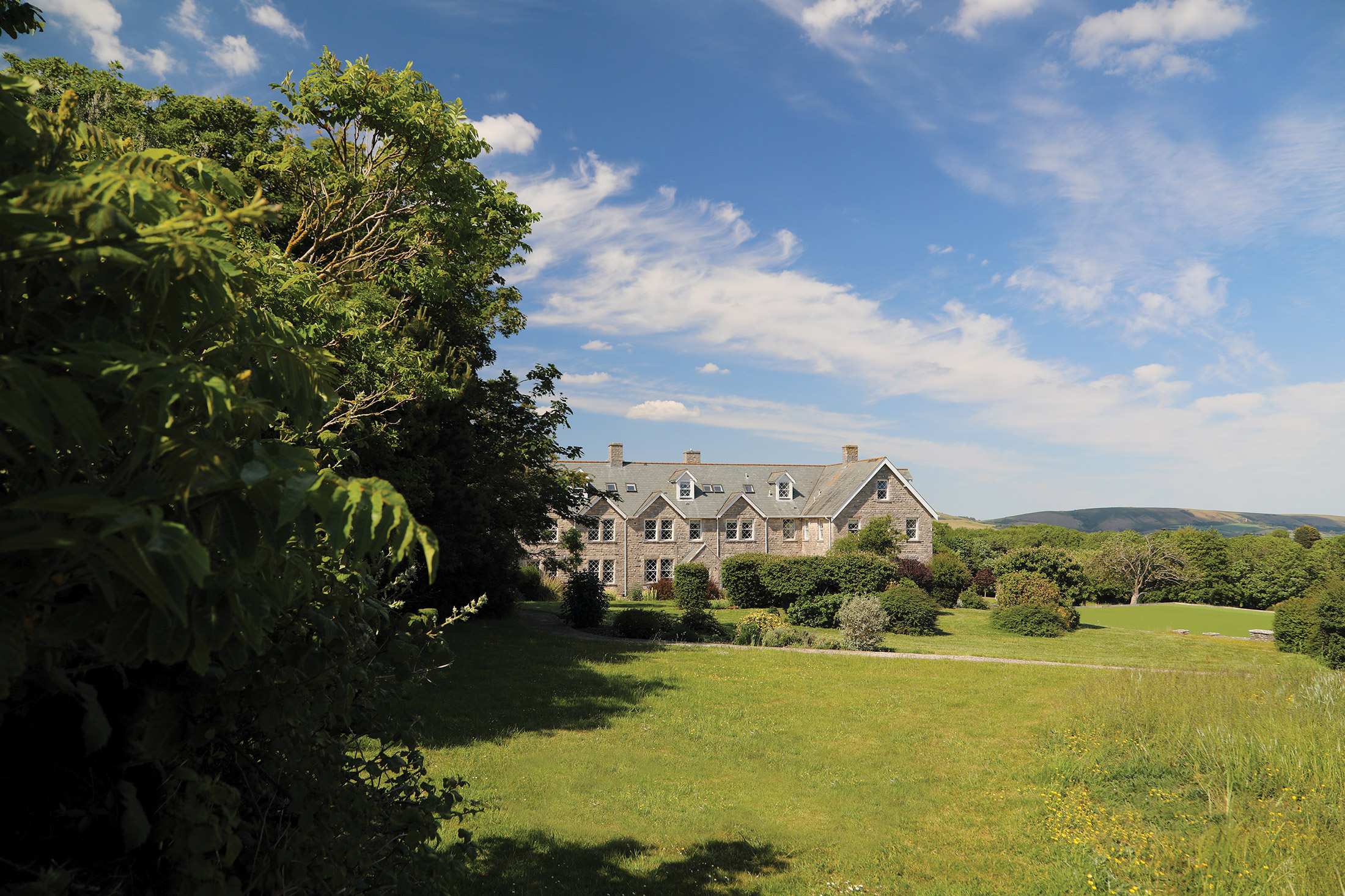
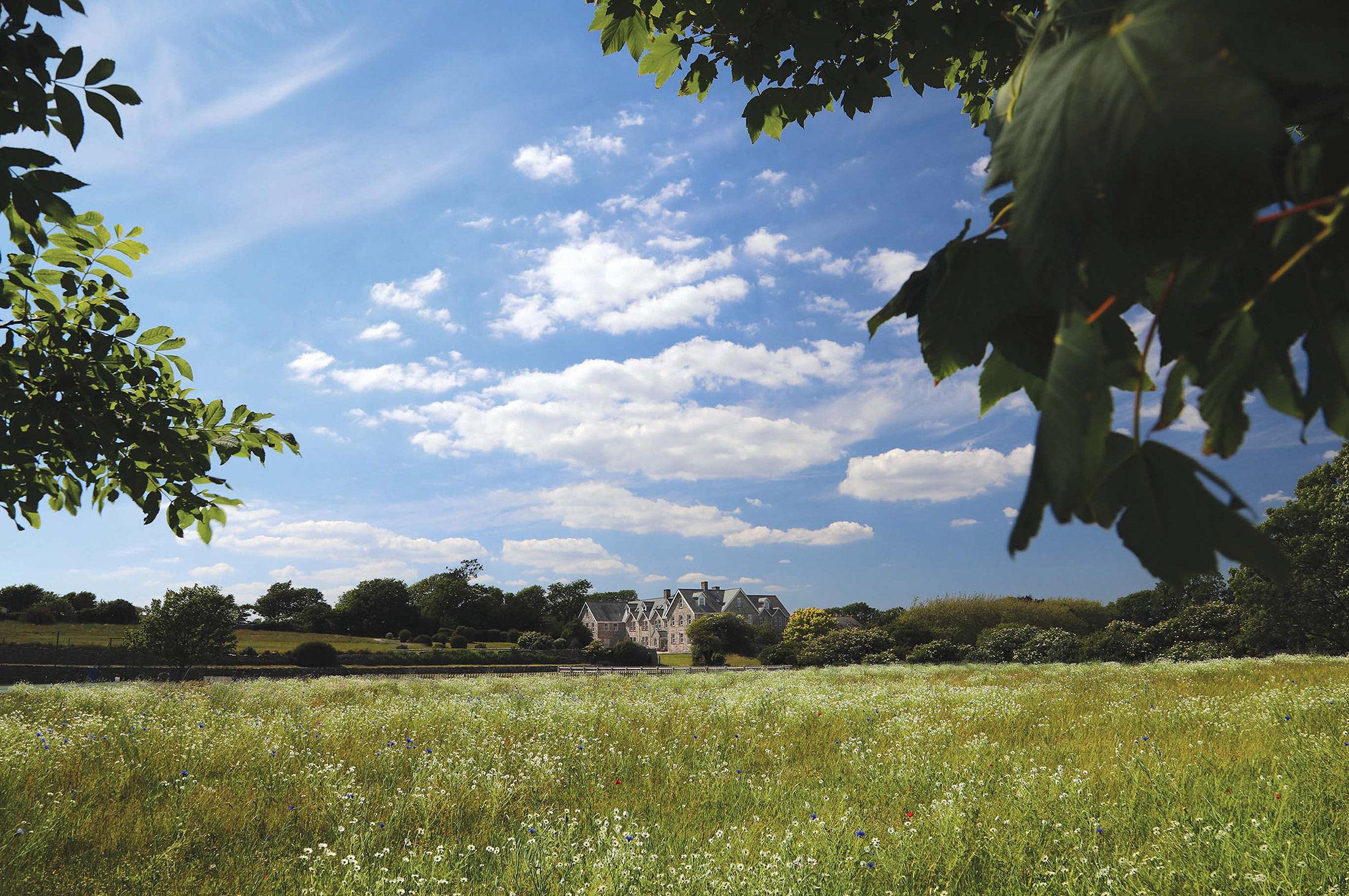
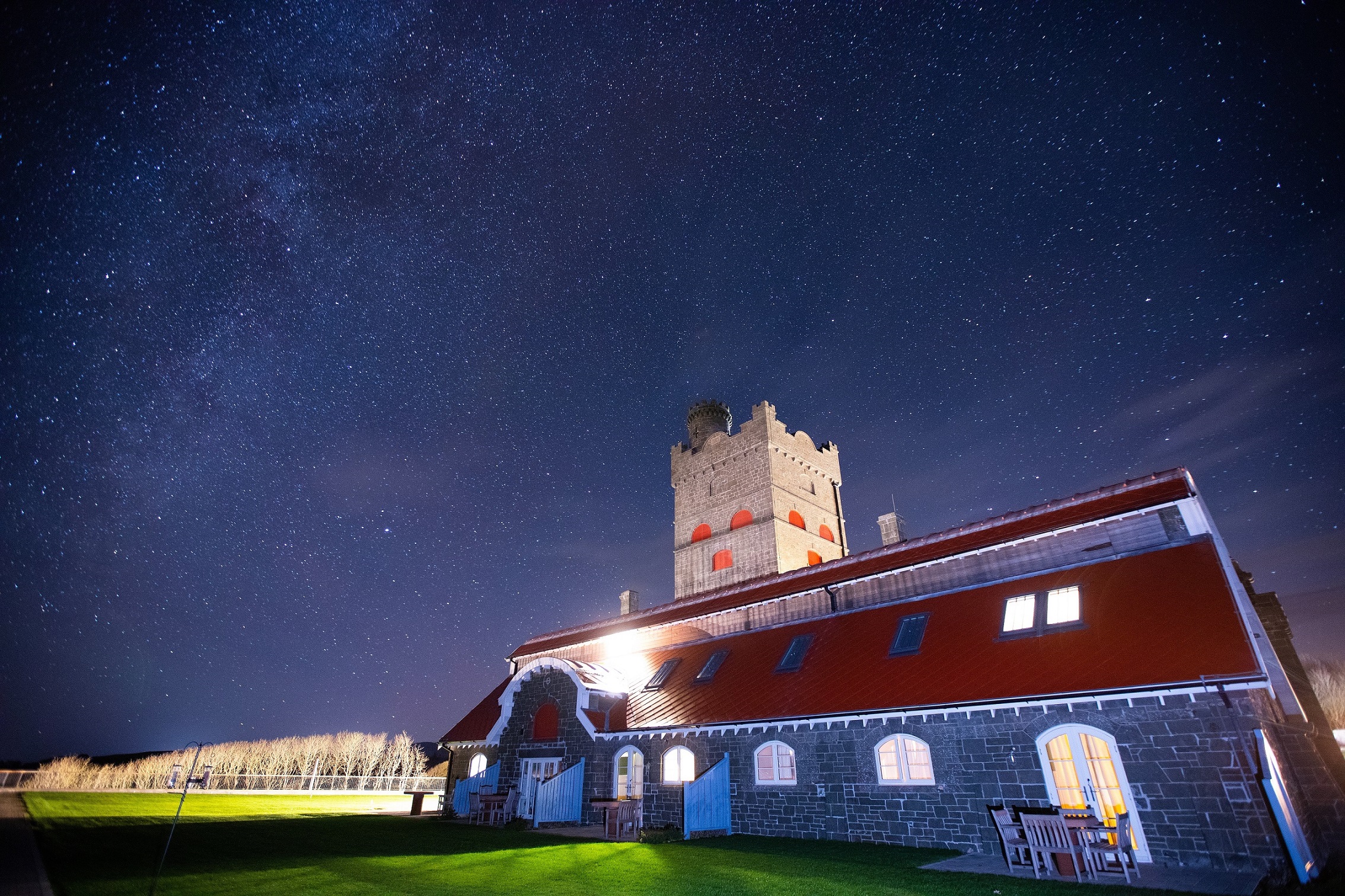
Less than ten miles south west of Bournemouth lies the Isle of Purbeck – a designated Area of Outstanding Natural Beauty, and the source of the fine grey stone and unique dark green marble that bear its name. Rising steeply, in places to over 600 feet, within a mile of the sea, the Purbeck Hills create a dramatic landscape dominated by the striking ruins of Corfe Castle.
Here you will find Langton House, a former school now restored and converted into comfortable apartments and cottages. It is located on the edge of the Purbeck village of Langton Matravers, overlooking the English Channel on the slopes above Swanage, with distant views of the Needles and the Isle of Wight.
Standing in 15 acre-grounds, and surrounded by National Trust land, Langton provides a convenient base from which to explore the beautiful countryside to the south of Dorset and beyond.
Learn more about Thomas Hardy
Bookworms will likely know that author Thomas Hardy, who wrote classic such as ‘Far from the Madding Crowd’ and ‘Tess of the d’Urbervilles’, was born in Dorset. In fact, he spent the majority of his life here, which is clear in his work, as the area’s landscape and local events served as constant inspirations.
The Dorset County Museum in Dorchester has the world’s largest collection of Hardy paraphernalia. There, you can see various photographs, manuscripts, diaries and books, which once belonged to the writer. That’s not the only collection at the museum, though, as it has exhibits on geology, wildlife, history and farming.
Go fossil hunting on the Jurassic Coast
The 95-mile long Jurassic Coast is a wannabe archaeologist’s dream, as there are plenty of fossils to be found. The rock features here date back to the Cretaceous, Triassic and Jurassic periods, and are fascinating to look at, even if you’re not keen to have a go at fossil hunting yourself.
Discover Dorset’s fascinating history
Dorset has a vibrant past, so it’s no surprise the National Trust has such a huge presence here. Of the many famous landmarks and properties situated in the county, don’t miss the Cerne Giant, a huge naked man carved into the hillside or Thomas Hardy’s Cottage in Higher Bockhampton, where the famous writer was born.
Don’t forget to see Clouds Hill, T.E. Lawrence’s rural retreat and Kingston Lacy, a luxurious stately home, complete with its own Japanese garden, too. Plus, there’s the Tolpuddle Martyrs Museum, which tells the story of how modern-day trade unionism began.
Enjoy a festival in Swanage
Time your holiday right and you’ll get the chance to enjoy one of the many festivals that take place in Swanage every year. For example, there’s the Swanage Jazz Festival, which takes place over a weekend in July, is extremely popular and must not be missed. Then, in late July/early August, the colourful and cheerful Swanage Carnival and Regatta hits the town – it’s a wonderful family event filled with lots of different things to see and do. If you visit in September, you could experience the Swanage Folk Festival, which features a variety of musical acts, children’s activities, a craft fair and Morris dancing. What’s not to love?
Take the kids somewhere special
Dorset is the perfect location for a family holiday, as there’s so much to do nearby. If it’s the beach they’re interested in, the Blue Flag beaches at Sandbanks and Swanage are wonderful places to go for a dip, while Kimmeridge is the best beach to search for fossils on.
Got a little one who’s always wanted a pony? You can go horse riding on the beach at Studland, an experience they’ll never forget. If your child’s into armoured vehicles instead, Bovington Tank Museum is sure to keep them entertained.
Shops and restaurants
Swanage is a busy and thriving community and is well served with an array of shops, bars and restaurants to suit all tastes (and budgets).
For true shopaholics, Bournemouth Town Centre has a pedestrianised shopping precinct with a range of shops and boutiques.
On-site facilities
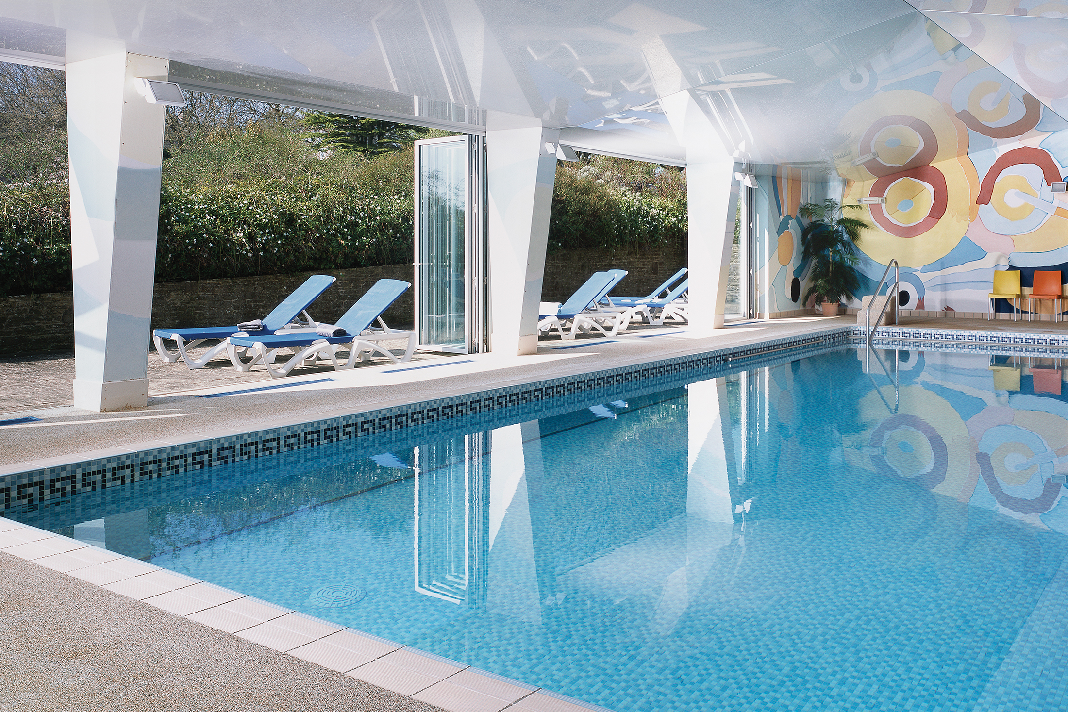
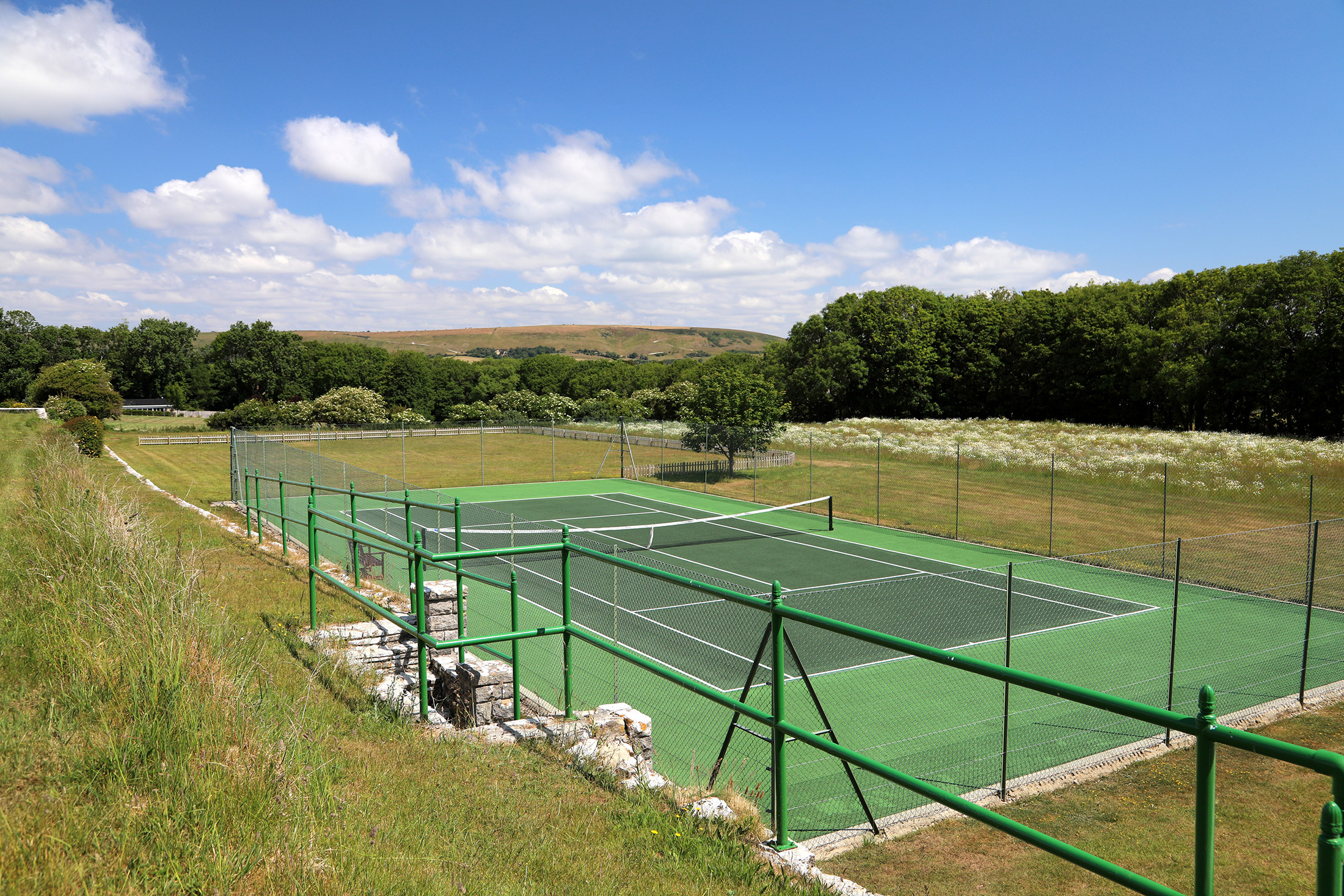
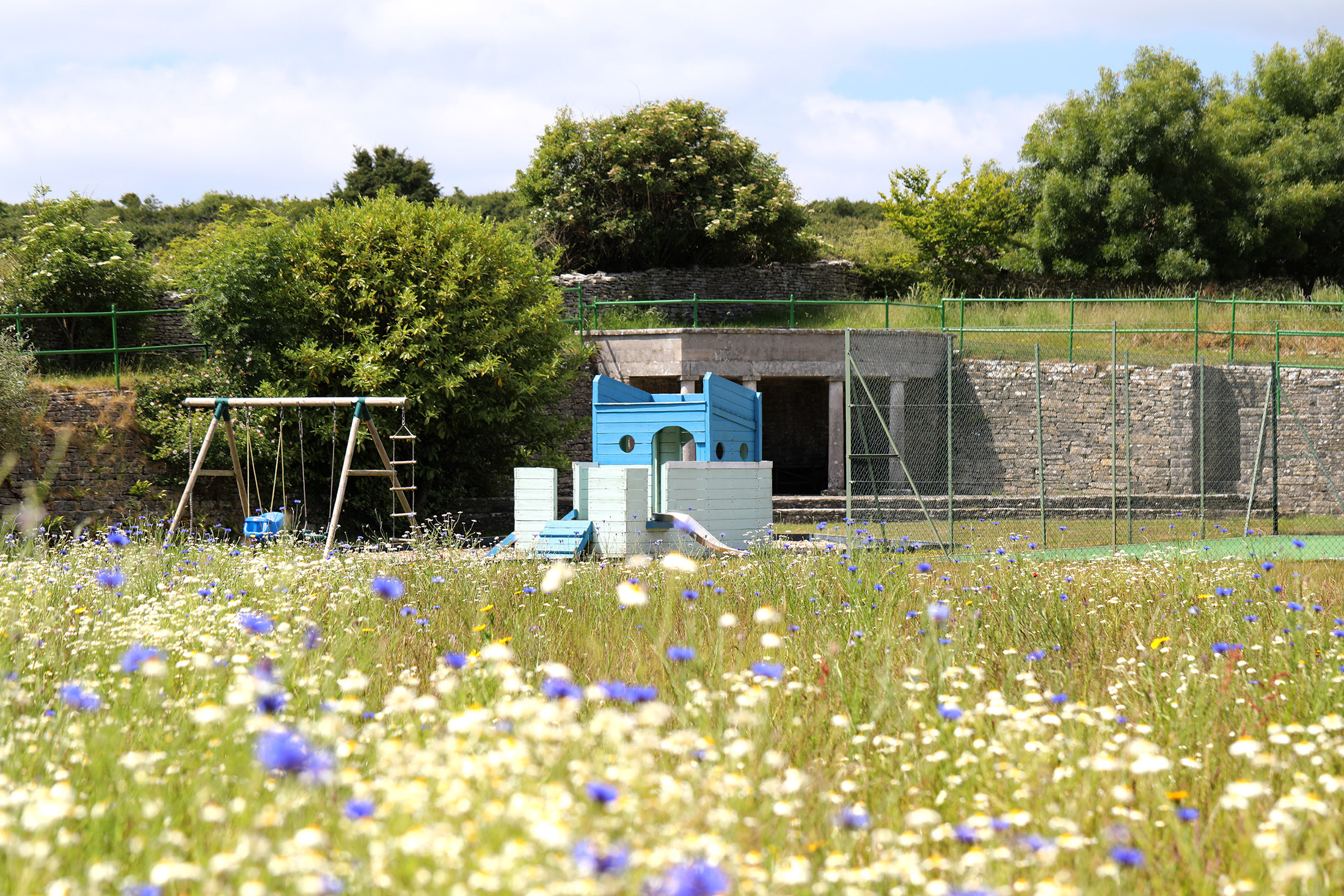
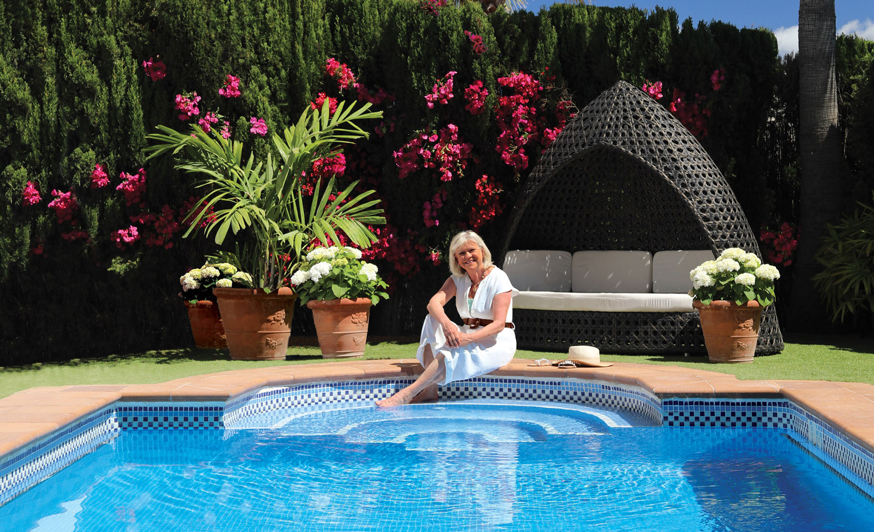
Within Langton’s 15 acres of grounds are a tennis court, all- weather bowling green, nine hole pitch and putt course, croquet lawn, outside play equipment (for children under five), and a separate building which houses a heated 12 x 5 metres swimming pool and sauna.
There is free Internet and Wi-Fi access.
Properties in Dorset
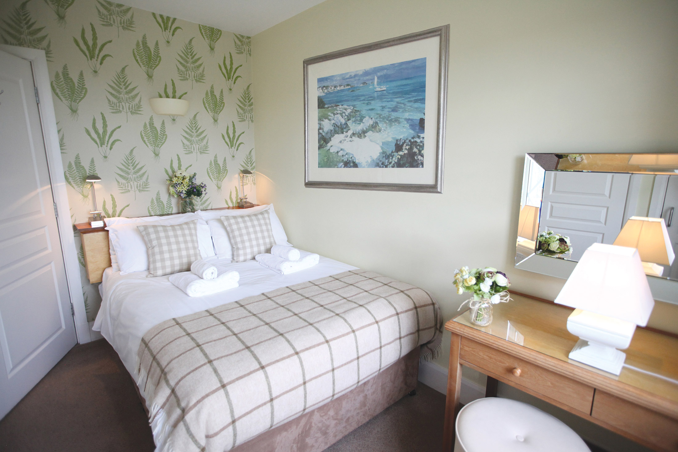
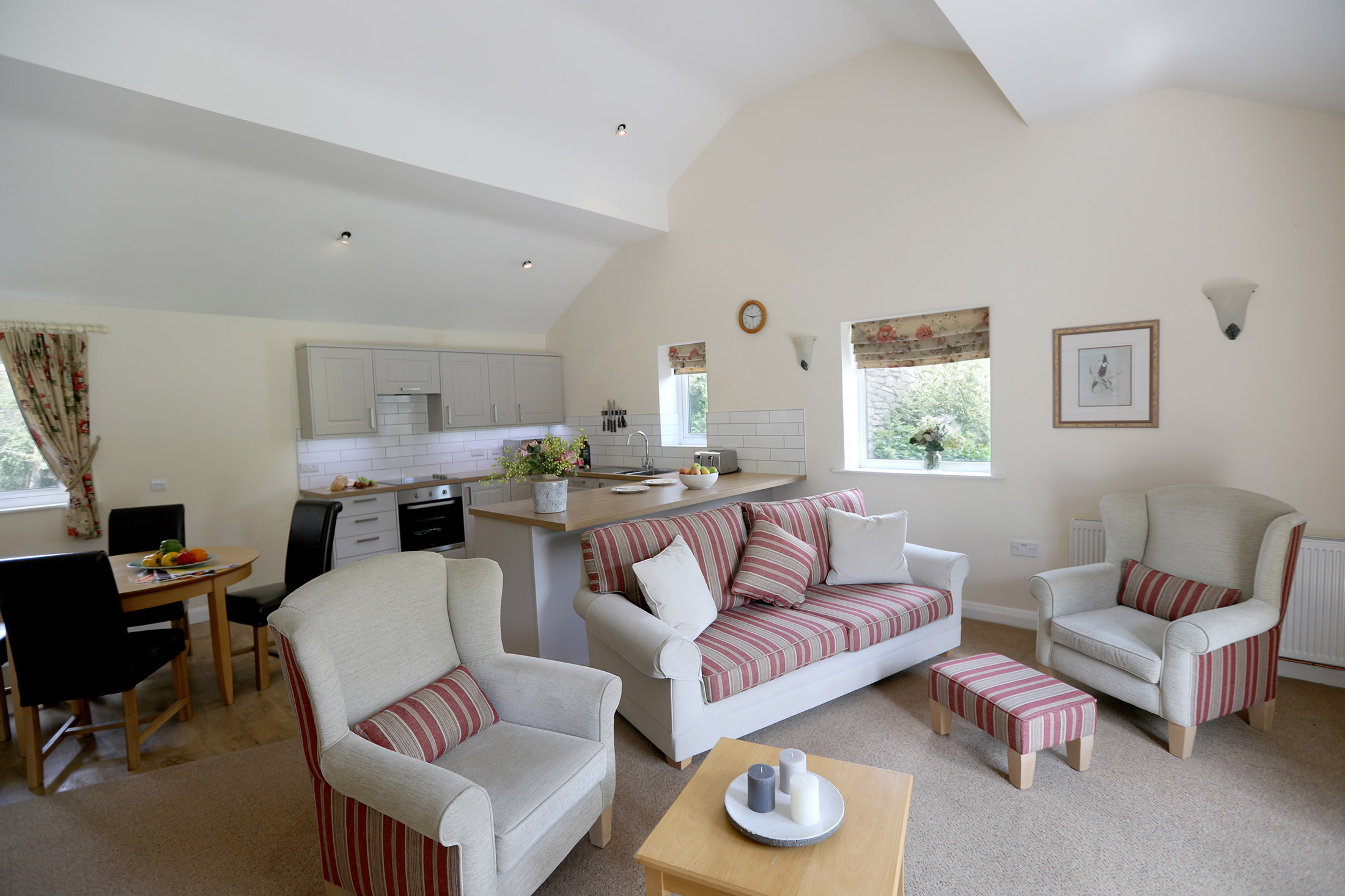
A former school, Langton House was, apparently, something of a harsh, unforgiving academy – all cold showers and 10-mile cross-country runs. Not any more! Today, Langton’s 29 apartments and cottages house guests in total up-to-the-minute comfort, while the site’s communal facilities include an indoor swimming pool, sauna, sun terrace, tennis court, a nine-hole pitch-and-putt golf course, a children’s play area, a croquet lawn, an all-weather bowling green, and a clubhouse with a selection of games. Of course, if you feel the need for a muddy 10-mile slog or a bracing shower, these can be arranged…
The main house has been converted into 25 one, two and three-bedroom apartments, one of which, a two-bedroom apartment, is adapted for use by accompanied disabled holiday-makers.
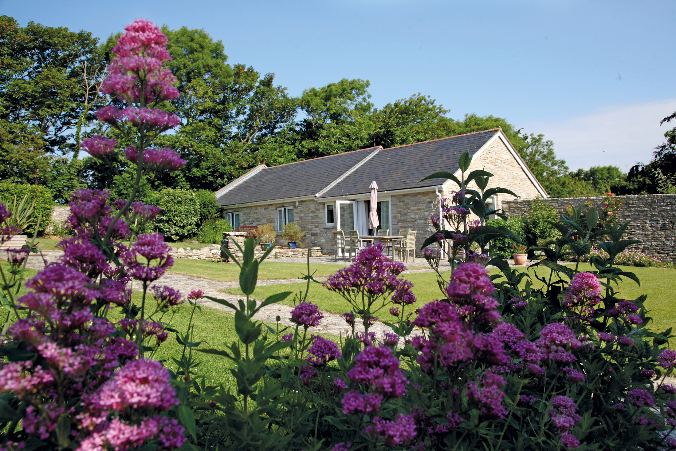
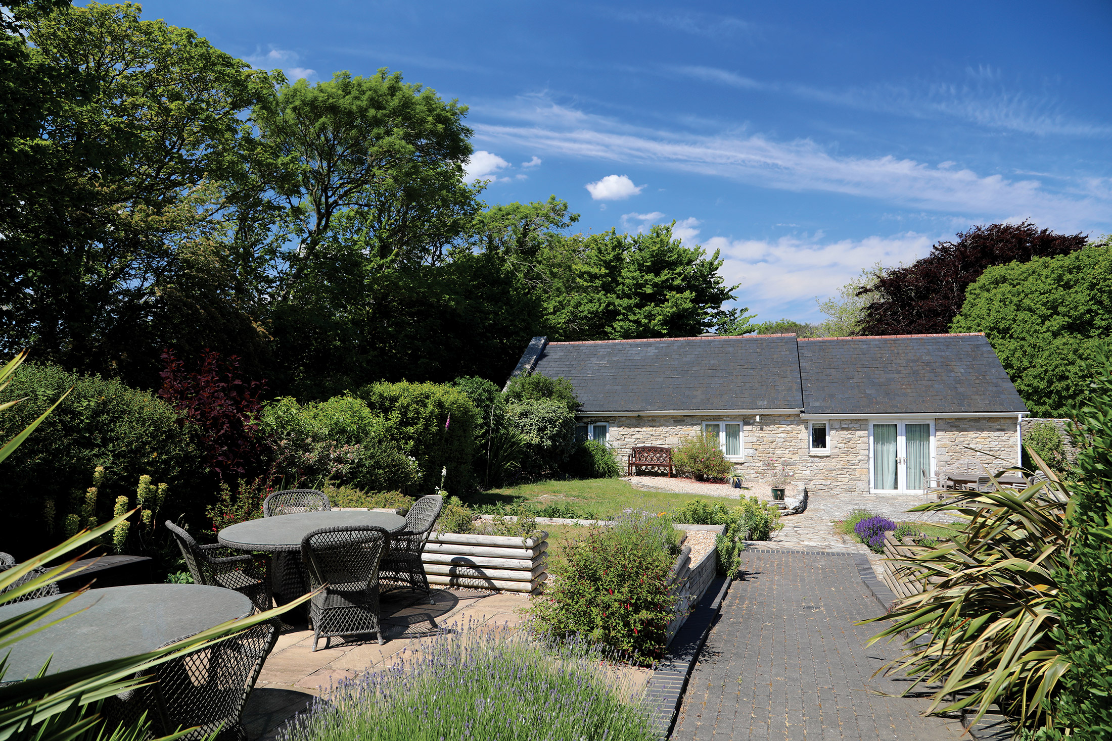
There are 2 two-bedroom cottages beside the clubhouse building. Nearby is a separate two-bedroom detached cottage which has also been adapted for the use of accompanied disabled holidaymakers.
The spacious clubhouse accommodates an information room with DVD library, billiards room and family games room with table tennis, bar billiards and football machine – all of which are available to use free of charge.
You couldn’t ask for a more perfect holiday home location than that of Langton House. Boasting amazing views of the English Channel with the Isle of Wight in the distance, and backed by rolling hills, Langton House will take your breath away.
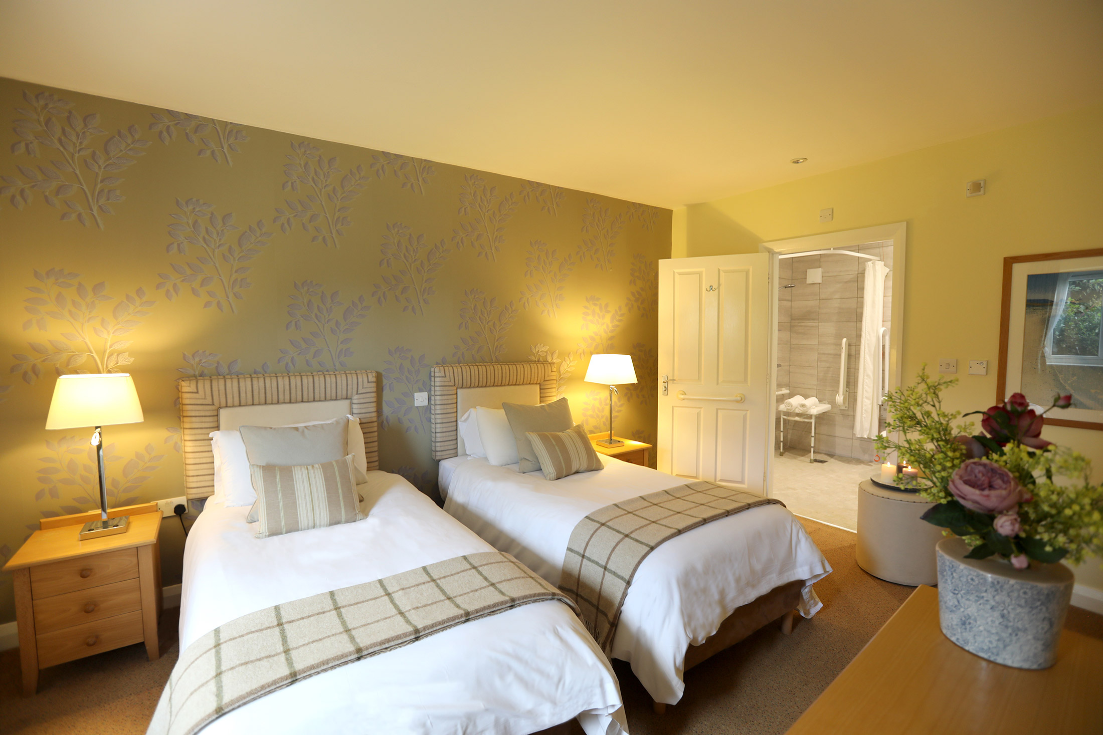
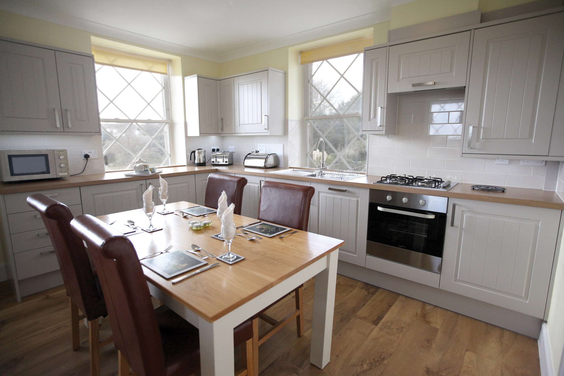
It’s not just the views and exterior that are beautiful, though, as our interior photos show. These apartments and cottages are homely, with traditional décor and living areas that feel bright, fresh and spacious. On-site facilities include a heated swimming pool, which is an absolute dream to come back to at the end of a long day spent exploring Dorset.

Location
HPB Langton House
Durnford Drove
Langton Matravers
Dorset
England
BH19 3HG
Tel: +44 800 230 0391
Email: details@hpb.co.uk
Things to do in Dorset
Dorset is one of the UK’s most popular holiday destinations with no shortage of tourist attractions.
It has an abundance of breathtaking rural and coastal scenery and has been designated an Area of Outstanding Natural Beauty. The county is edged by over 90 miles of coast, making the coastal path a must for any enthusiastic walker.
All over Dorset you will find attractive market towns and tiny villages. It is no wonder the area features in countless TV and film productions, with its unspoilt countryside, plentiful historic houses and gardens and dramatic coastline being used as an impressive backdrop.
Athelhampton House and National Trust properties Hardy’s Cottage and T.E. Lawrence’s Clouds Hill are all within easy driving distance of Langton. The many museums and heritage centres that contain revealing insights into Dorset’s past are also close by.
The Tank Museum at Bovington has possibly the finest collection of tanks in the world. From the first tank ever built to the modern Challenger II, the museum’s definitive collection comprises over 250 vehicles and supporting artefacts from across the globe.


Walks around Langton House
Less than ten miles south west of Bournemouth lies the Isle of Purbeck – a designated Area of Outstanding Natural Beauty, and the source of the fine grey stone and unique dark green marble that bear its name. Rising steeply, in places to over 600 feet, within a mile of the sea, the Purbeck Hills create a dramatic landscape dominated by the striking ruins of Corfe Castle.
Here you will find Langton House, a former school now restored and converted into comfortable apartments and cottages. It is located on the edge of the Purbeck village of Langton Matravers, overlooking the English Channel on the slopes above Swanage, with distant views of the Needles and the Isle of Wight.
Having a Private Tour at an HPB holiday location is an enjoyable way to see the high standards of furnishings and facilities you could enjoy with HPB.
A local HPB Representative will show you around the site and answer any questions you may have.
Alternatively, you are welcome to book a Personal Presentation at a hotel near you. You can chat to one of our local HPB Representatives, ask your questions and view the complete portfolio of HPB locations.
Read our HPB Feefo Reviews
HPB’s holiday booking service has been rated 4.9 out of 5 based on 14,772 customer reviews on Feefo
![]()
“Buying into the future”
Mike DugdaleI got talking to our next-door neighbour at Barnham Broom, who’s been a Bondholder for a while; the family were full of enthusiasm and, while in no way pushy, was really keen to pass on advice and knowledge about any other sites we’re thinking of visiting. We swapped email addresses and will definitely be in touch – but it shows the strength of feeling about HPB, and the fact that there’s a real ‘family’ aspect to it.
