


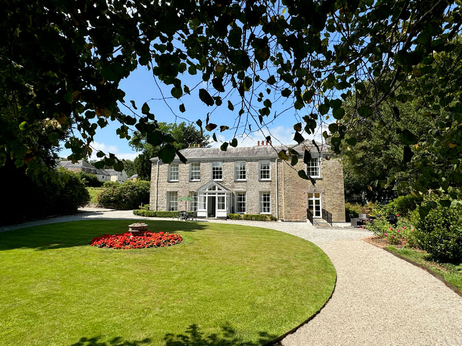
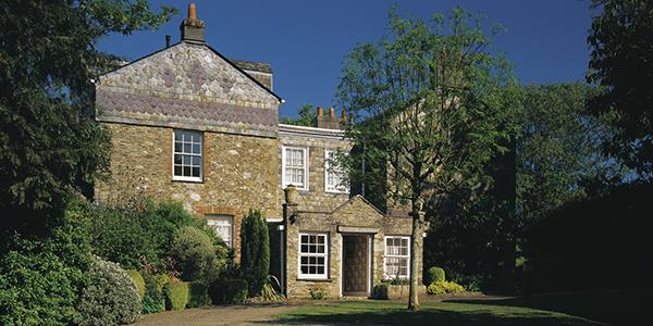
Duloe Manor, Cornwall, England
The stunning Cornish coast is on the doorstep.
Book a tour Open Gallery-
40 apartments and cottages in Cornwall
-
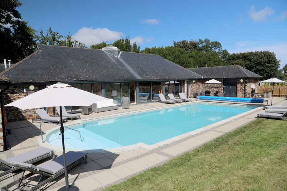
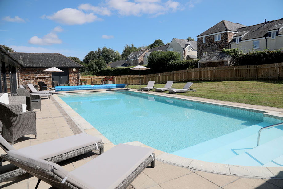
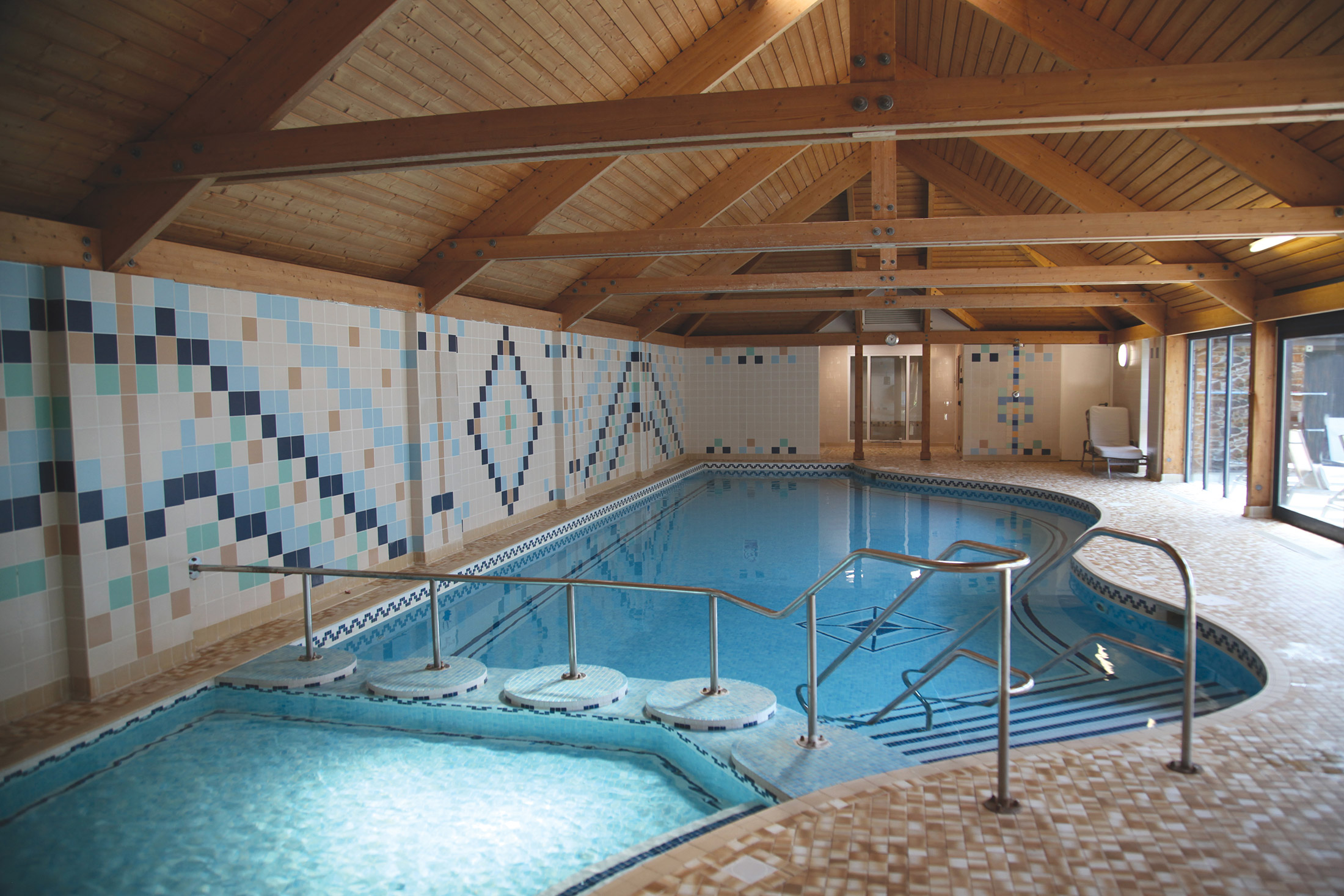
Indoor and outdoor heated pools
-
Close to the Eden Project and Lost Gardens of Heligan
-
The stunning Cornish coast is on the doorstep
-
Pretty fishing villages and harbour towns
-
Loads to do - for all ages
Discover Cornwall
More about Duloe Manor
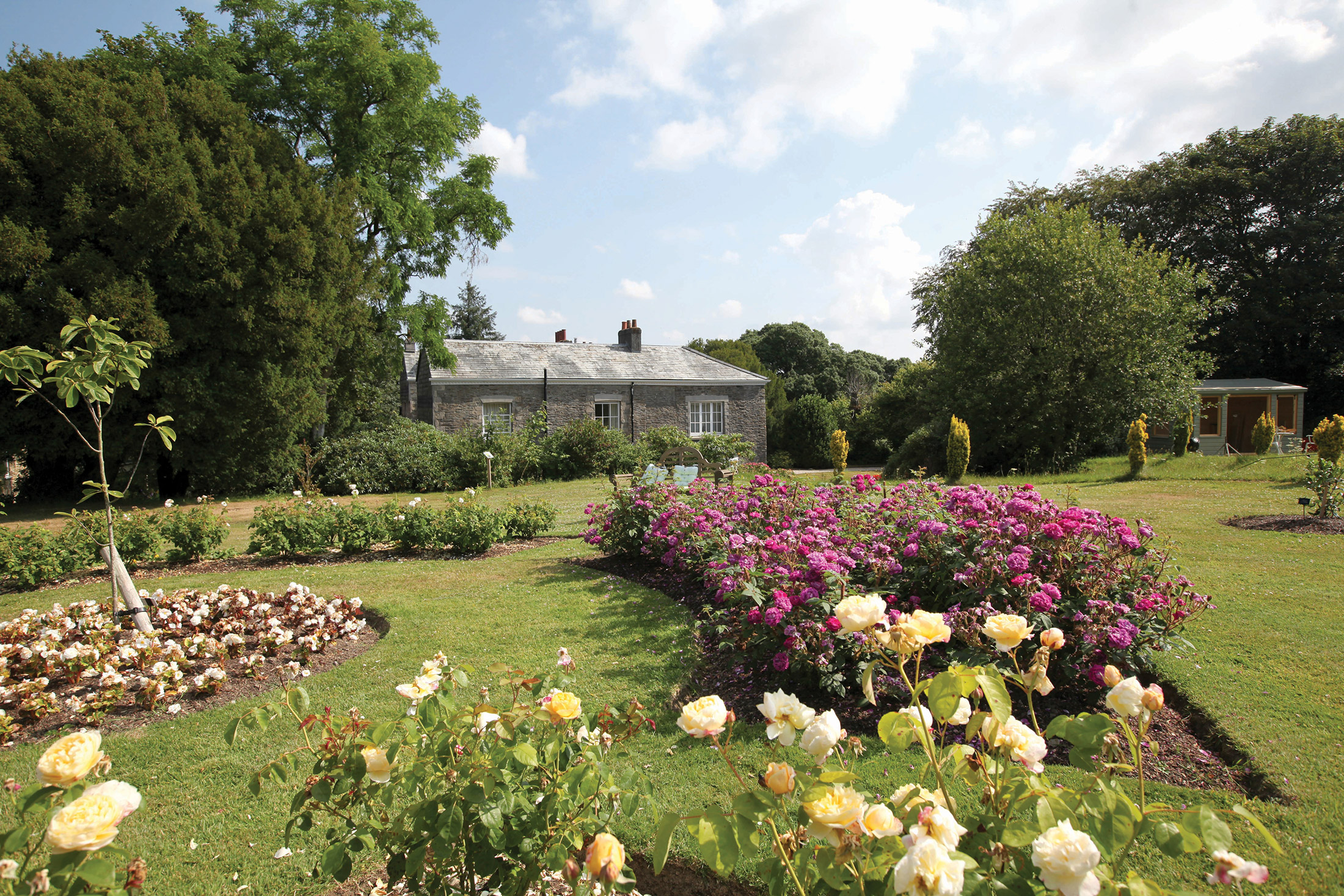
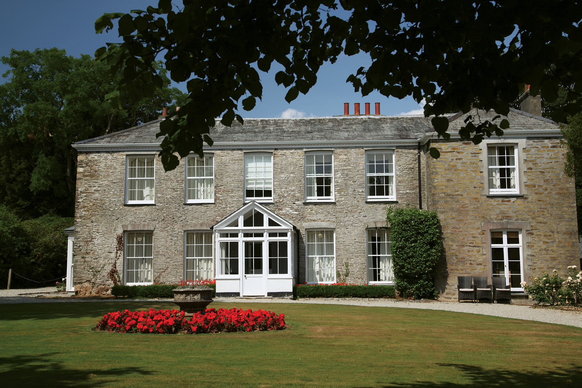
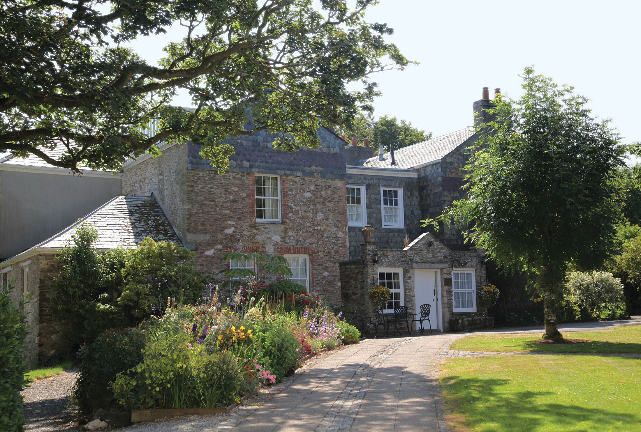
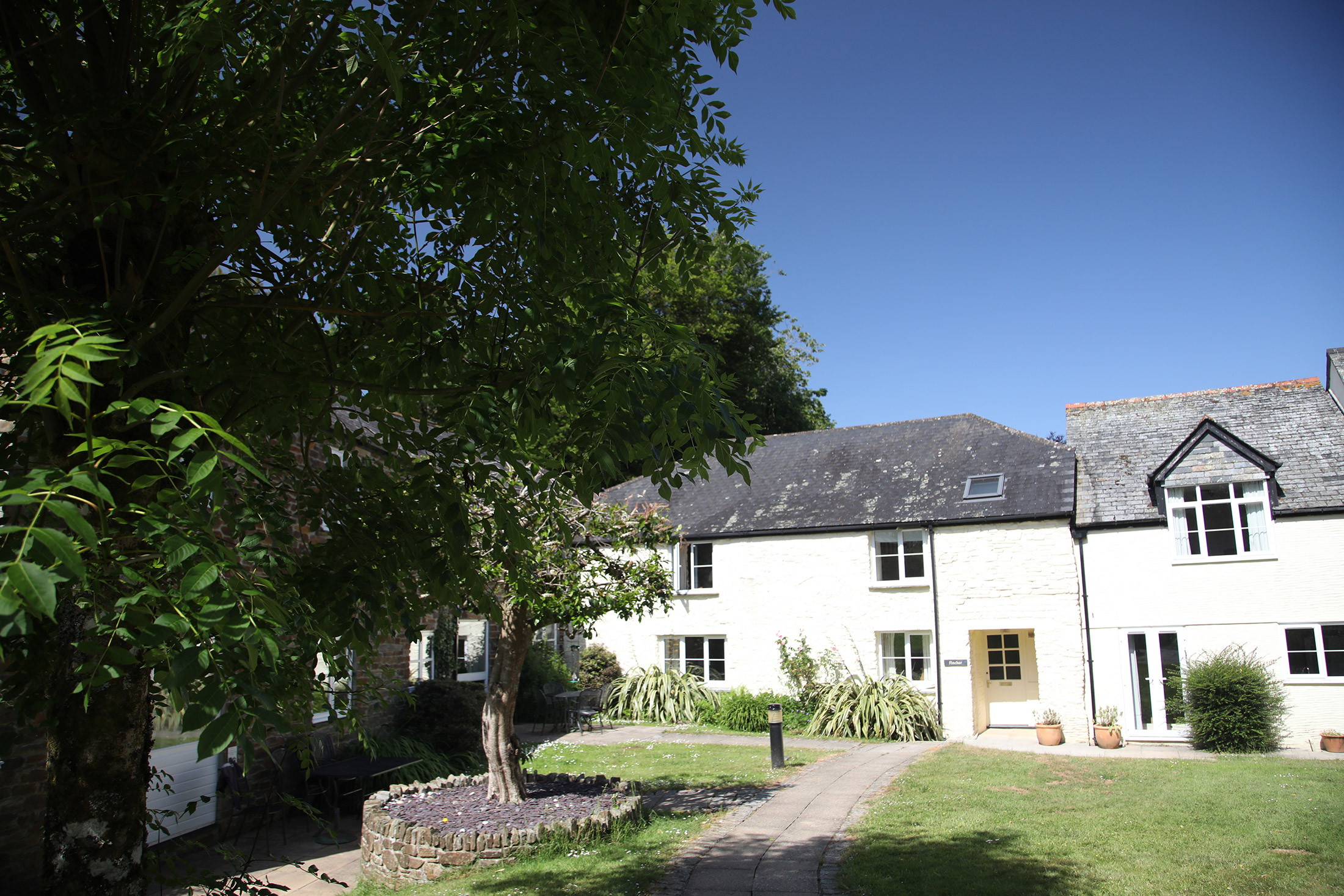
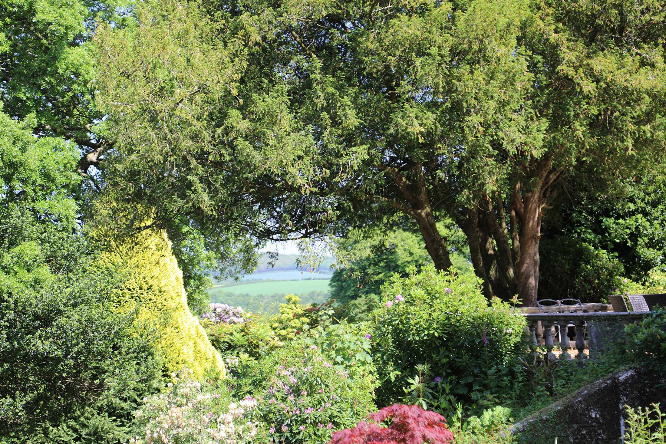
With its safe, sandy beaches, towering rugged sea cliffs and dramatic moorland, Cornwall enjoys more hours of sunshine than virtually any other part of the British Isles. It is here, to the south of the village of Duloe, a little over three miles inland from the fishing village of Looe, that you will find Duloe Manor. Built around 1690, this historic Queen Anne manor house has now been restored and converted into superb holiday apartments and cottages.
At Duloe Manor, you can make the most of one of the UK’s premier tourist destinations. Cornwall has no shortage of things to do, whatever the weather. If cliffs, beaches and charming fishing villages aren’t enough, then you can enjoy the many renowned gardens, museums, theme parks, maritime centres, heritage centres, zoos and wildlife reserves dotted around the county.
Sunbathe on some of the best beaches in the world
We’re not over-exaggerating – seven of Cornwall’s beaches were listed as Blue Flag in 2016. There are hundreds of beaches in the county, but if you’re a surfer, one of the best is Sennen Cove, close to Land’s End. Families, on the other hand, may prefer Porthminster, which provides safe swimming conditions even at high tide.
Admire the many historic buildings
Boasting more than 32 historic National Trust buildings, there are plenty of incredible sites to visit, from the grandiose to the small and unusual. Alice in Wonderland fans will want to visit Antony House, as this is where Tim Burton’s cinematic take on the children’s book was filmed. Plus, of course, this 18th-century mansion is beautiful – the gardens and parkland are particularly impressive.
St Michael’s Mount should also be paid a visit. The Medieval church and castle are fascinating, but it’s the views that will really blow you away. It’s well worth the trek across the sand at low tide, or the boat ride at high tide.
Celebrate with the locals
Whatever you’re into, whether it’s flowers, film, fishing, music or something else entirely, there’s a festival for it in Cornwall. Surfers and music-lovers won’t want to miss Boardmasters in August, while cider fans will adore the Little Orchard Cider & Music Festival in September. Be sure to check what’s on before your holiday.
Find a hidden cove
If you want to avoid the crowds on the beaches, your best bet is to find a hidden cove or inlet, of which Cornwall has many. Penberth and Prussia are examples of ones which have been beautifully preserved – you’ll feel as if you’ve gone back to the time of smugglers!
The kids will love exploring the various caves and rockpools often found within these coves and inlets, so they’re well worth searching for.
Lose yourself in a gorgeous garden
Cornwall really is one of the most picturesque places in the UK, if not the world. Not only is the natural scenery stunning, it’s home to a variety of gardens too. The Lost Gardens of Heligan, one of the county’s most popular attractions, should not be missed. This Victorian garden spans 200 acres and features ancient woodlands, subtropical jungle and huge stone sculptures.
Shops and restaurants
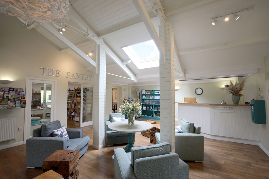
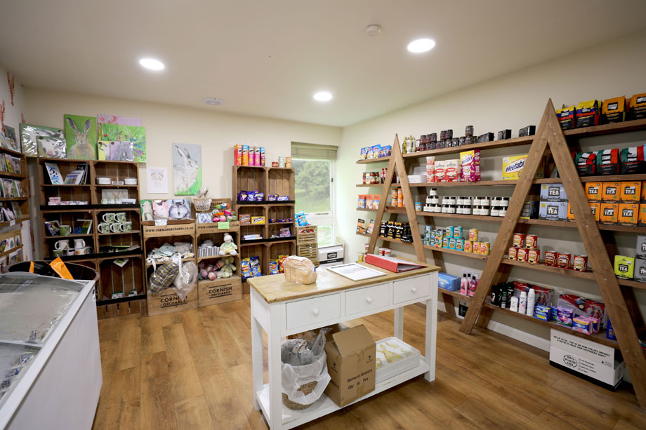
Duloe Manor’s popular on-site shop, The Pantry, sells fresh local produce, gifts and other provisions. The site also hosts a regular market.
The nearby towns of Looe and Liskeard have a range of shops, restaurants, pubs and banks.
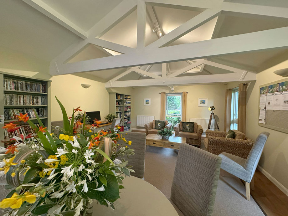
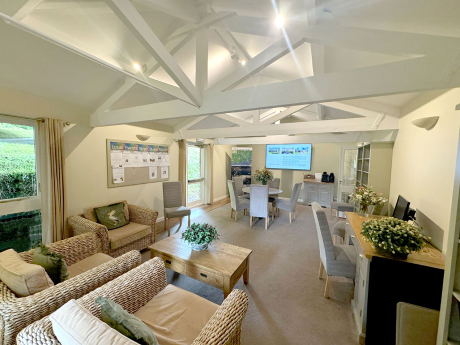
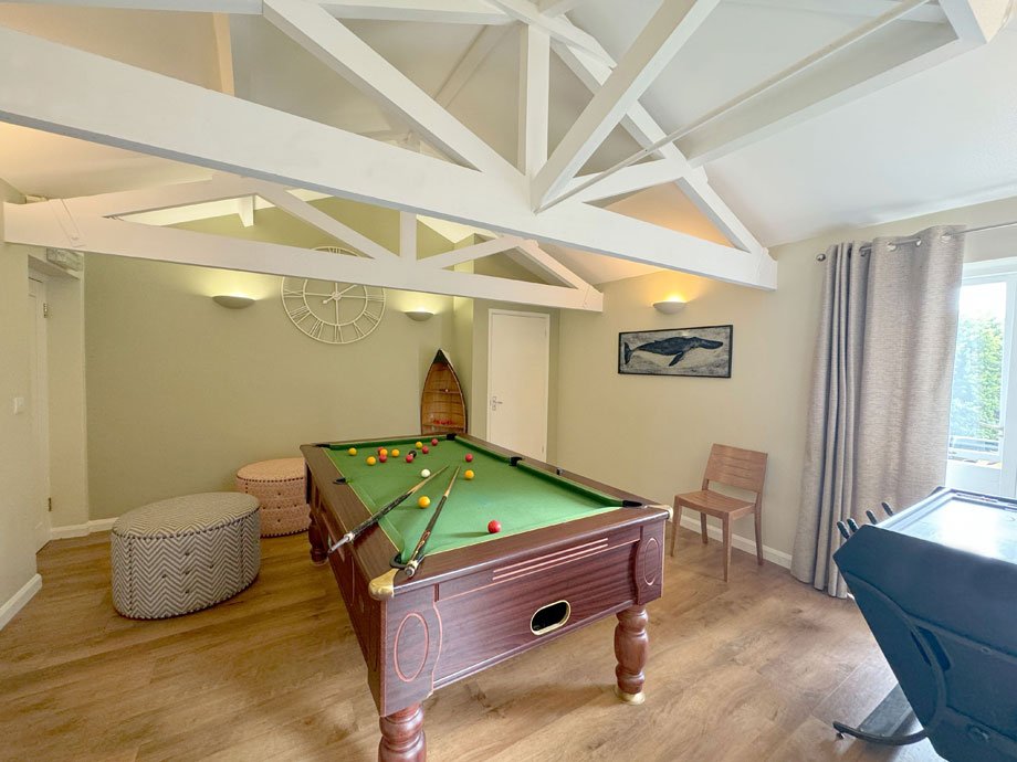
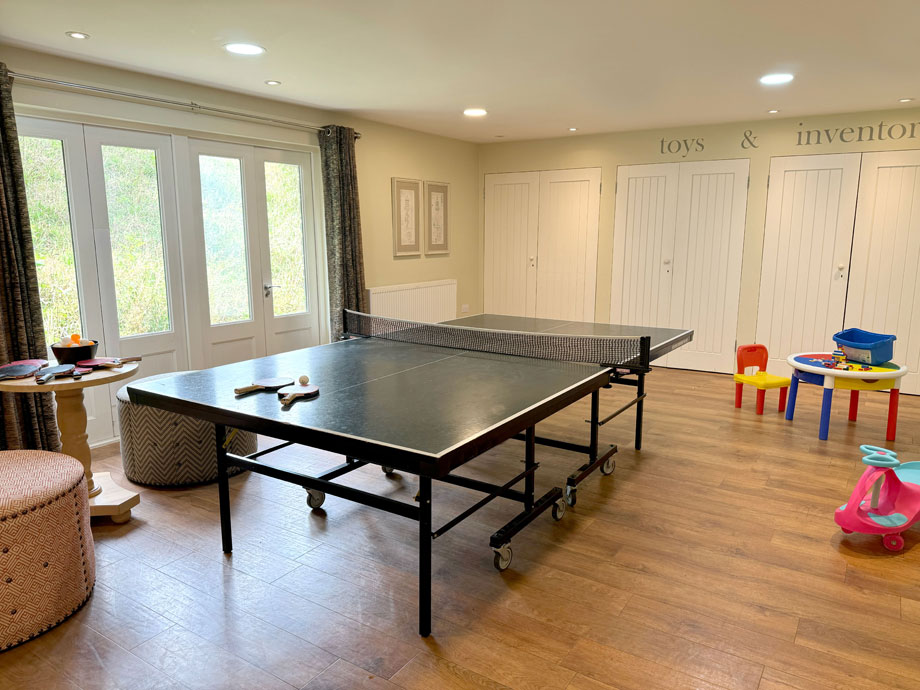
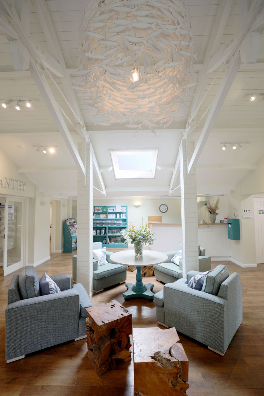
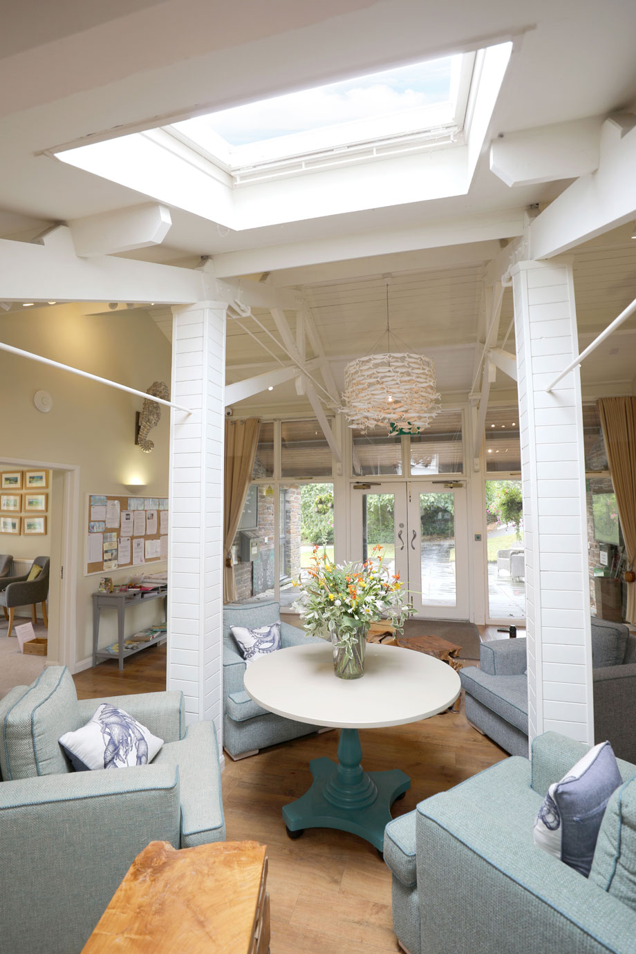
On-site amenities
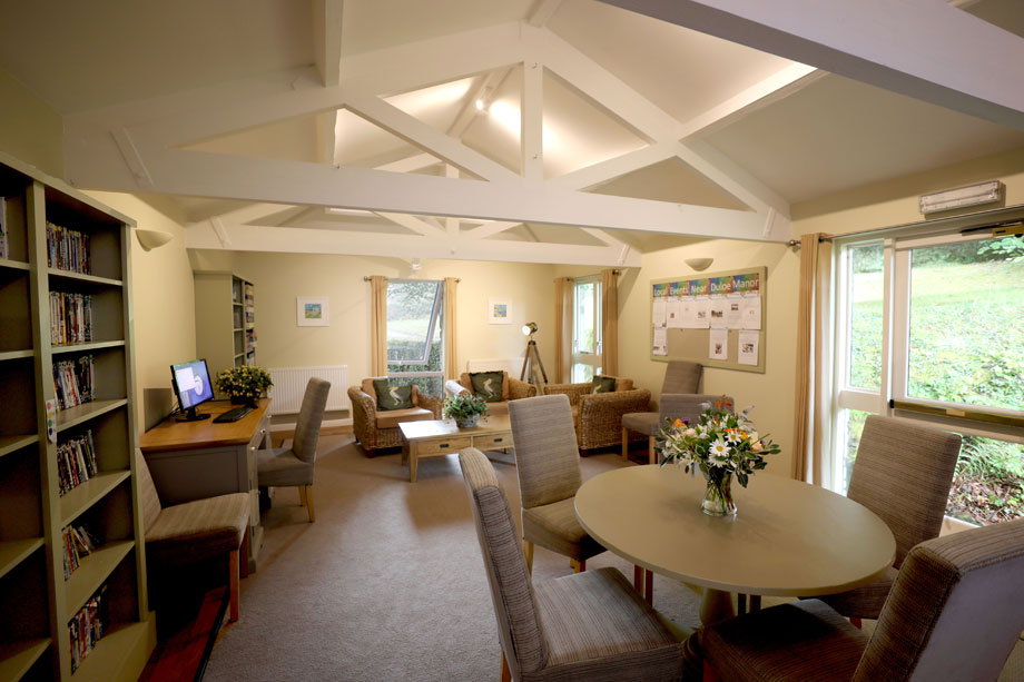
The reception and leisure building contains:
- an information room
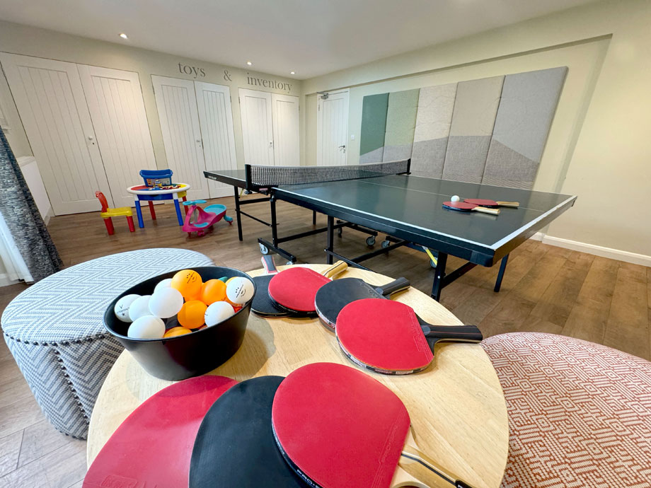
- a pool table, table tennis and table football
- a Lego table
- a free DVD library
- sports equipment
- outdoor heated pool
All guests benefit from free internet and Wi-Fi access.
The leisure complex has an indoor pool with:
- toddlers’ splash pool
- sauna and steam room
- mini exercise room
- laundry room
Open from mid-May to mid-September, the open-air swimming pool is heated and surrounded by tables, chairs and sun-loungers.
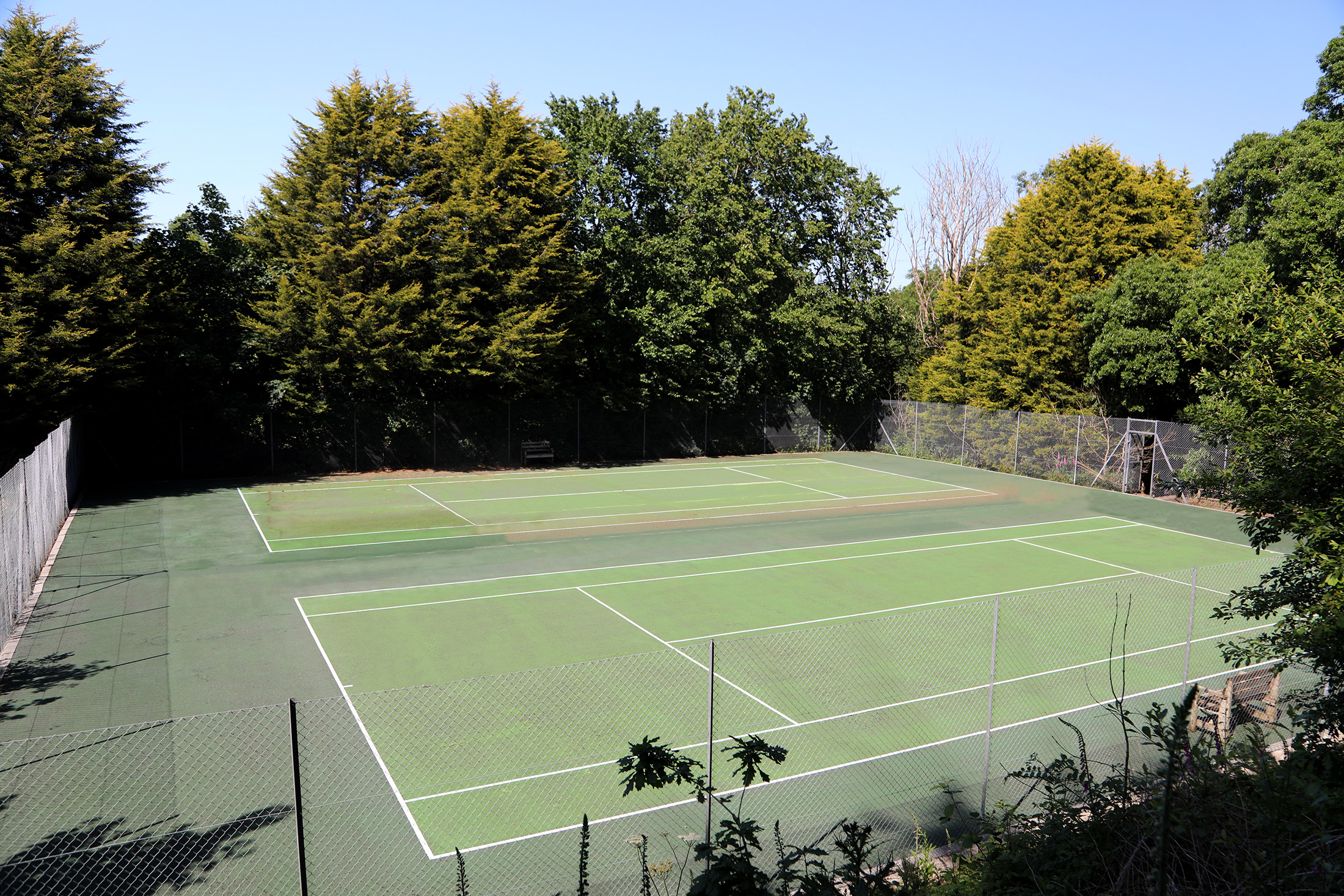
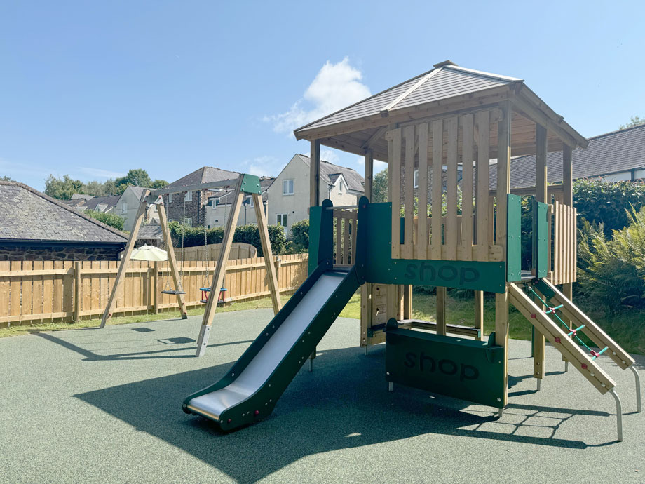
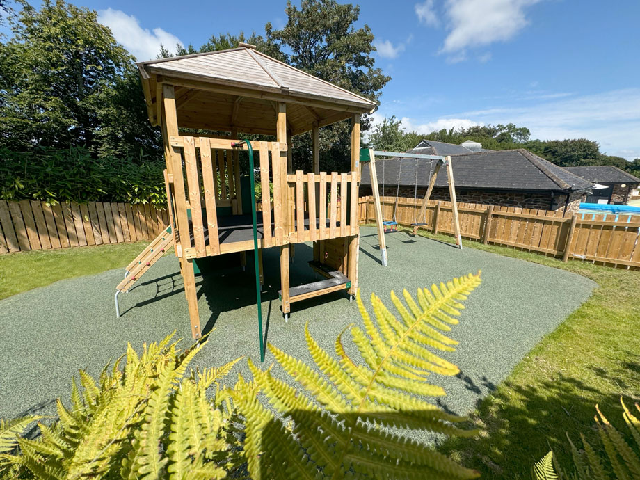
Two tennis courts, a putting green, lawn badminton, croquet and a small children’s adventure playground complete the facilities.
That the Rev Charles Dodgson was a sometime guest at Duloe Manor is not in doubt. Whether Lewis Carroll wrote all, or even part, of Alice’s Adventures in Wonderland while staying at the former rectory is rather more open to question (though we’d like to think he did!).
But holidaymakers ensconced in any of Duloe’s 40 cottages and apartments will find themselves in a wonderland of their own. Children, especially; during the school holidays there are all sorts of opportunities for kids to get out and have fun in the fresh air – whether it’s learning archery, practising bushcraft, or just getting back in touch with the natural world about them.
Properties in Cornwall
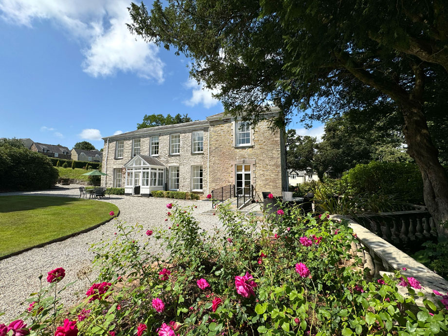
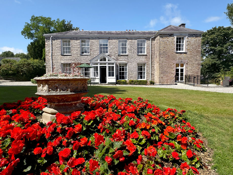
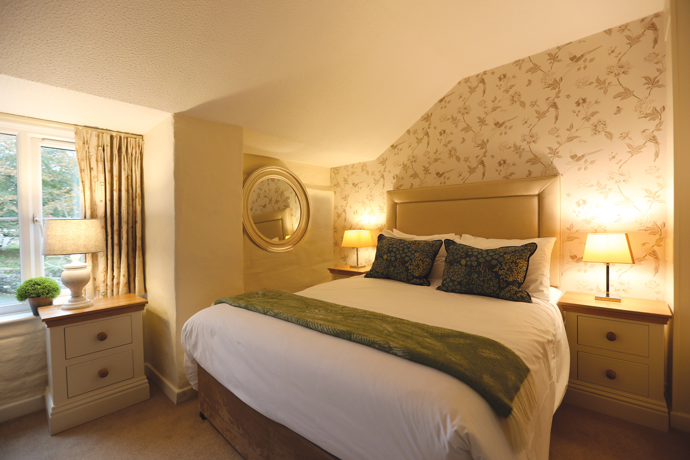
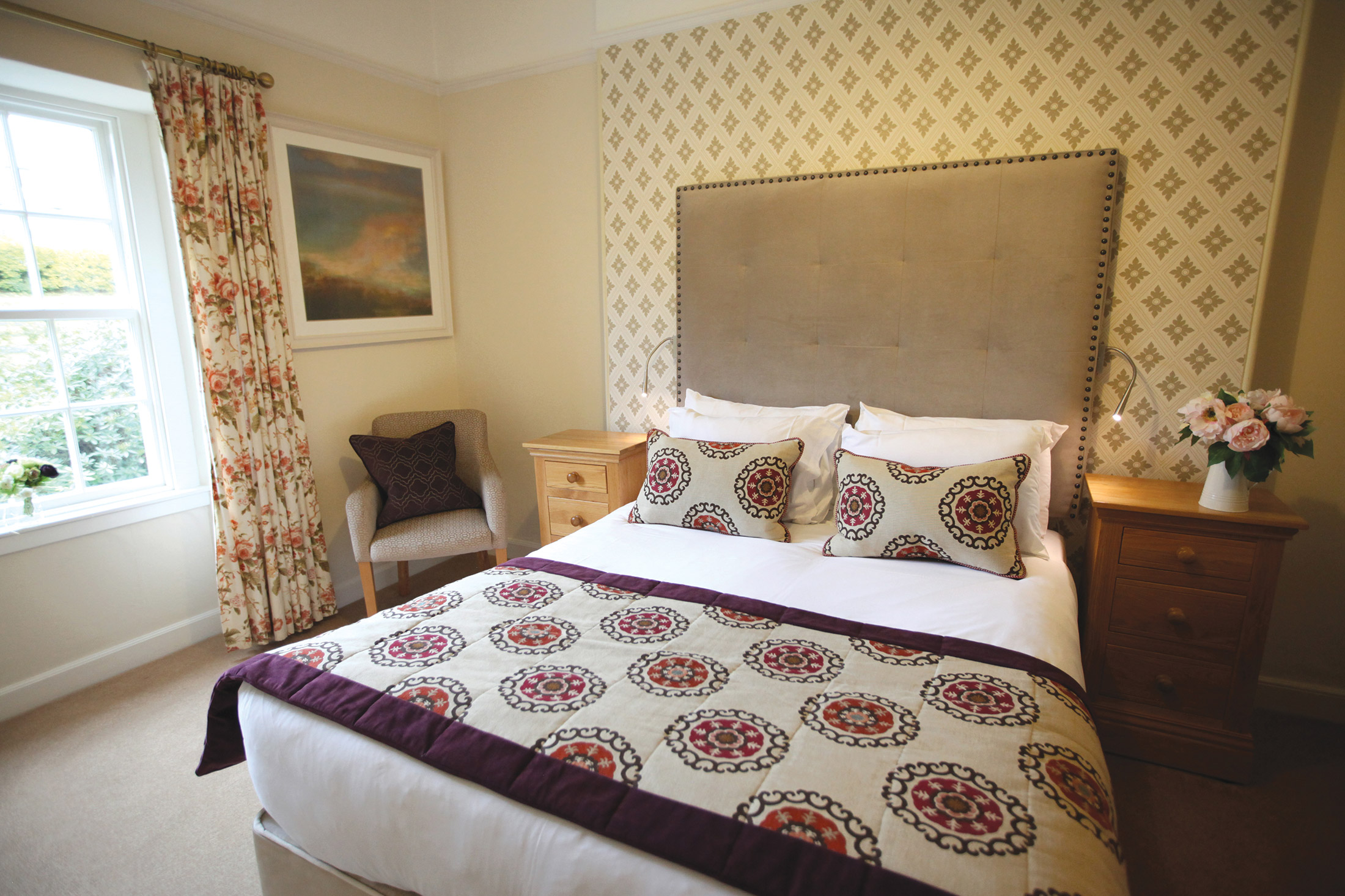
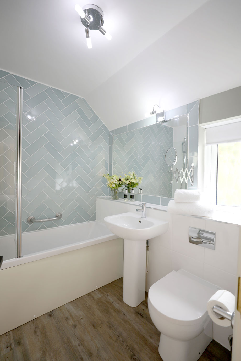
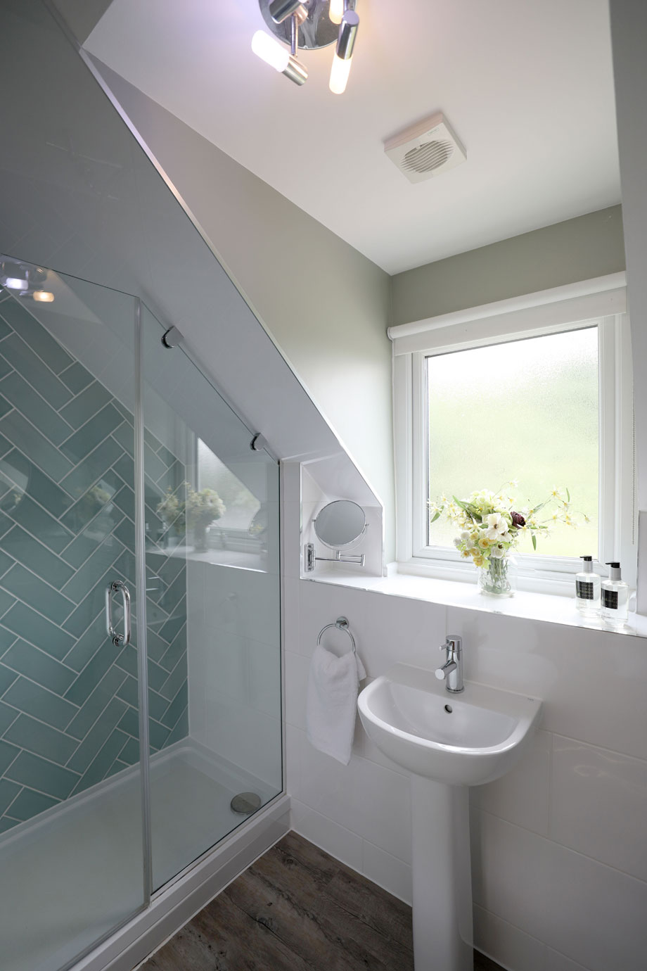
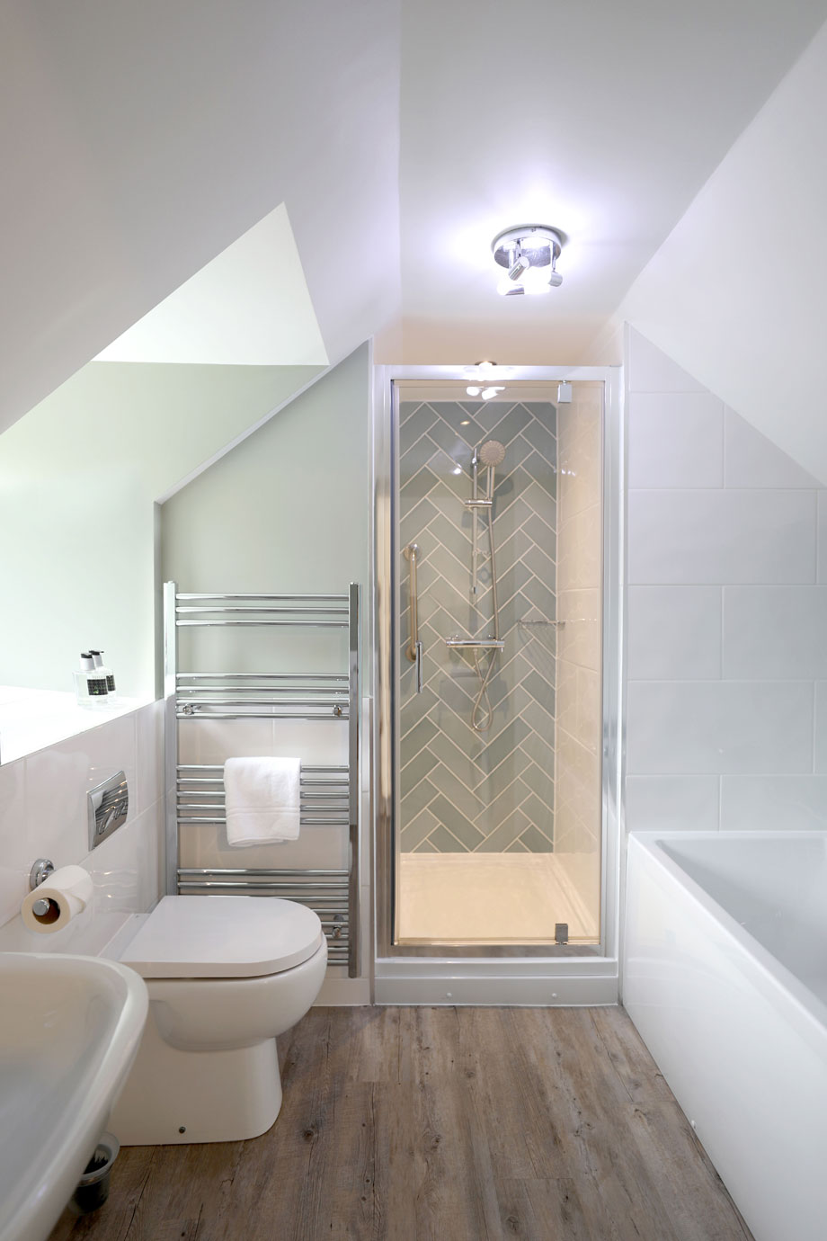
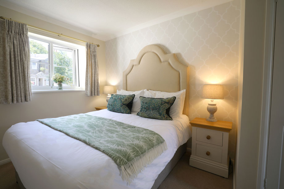
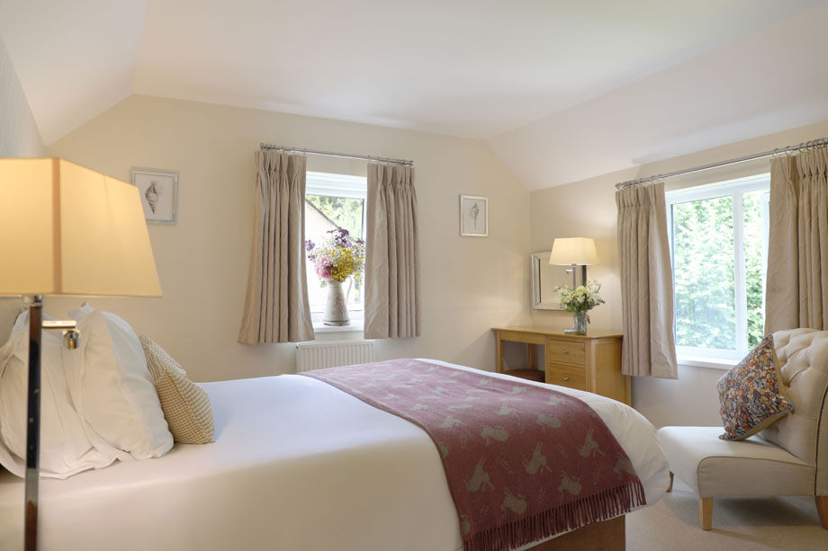
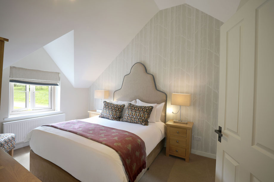
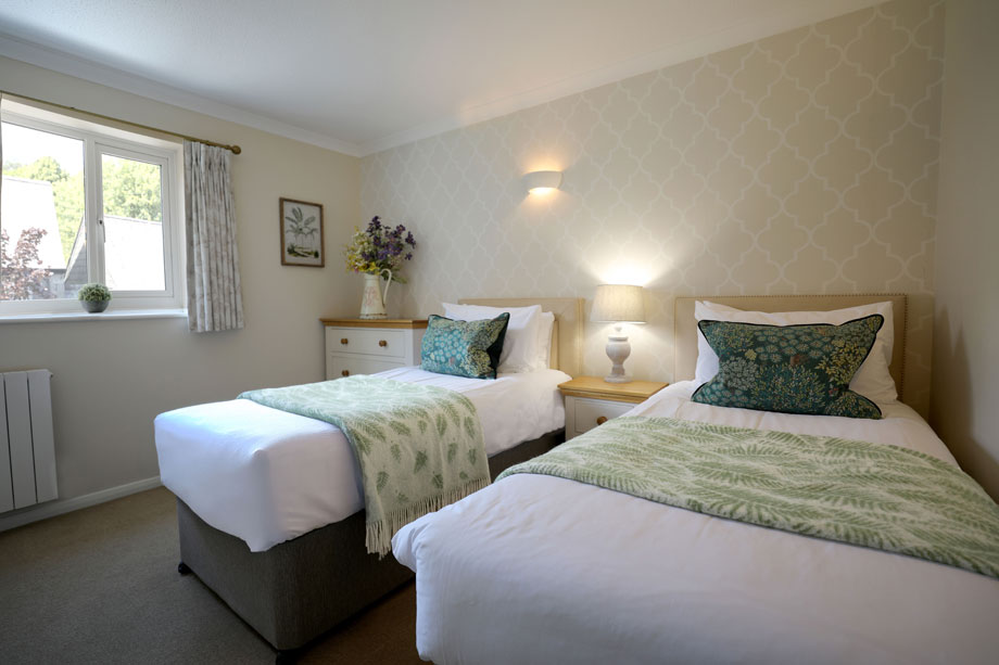
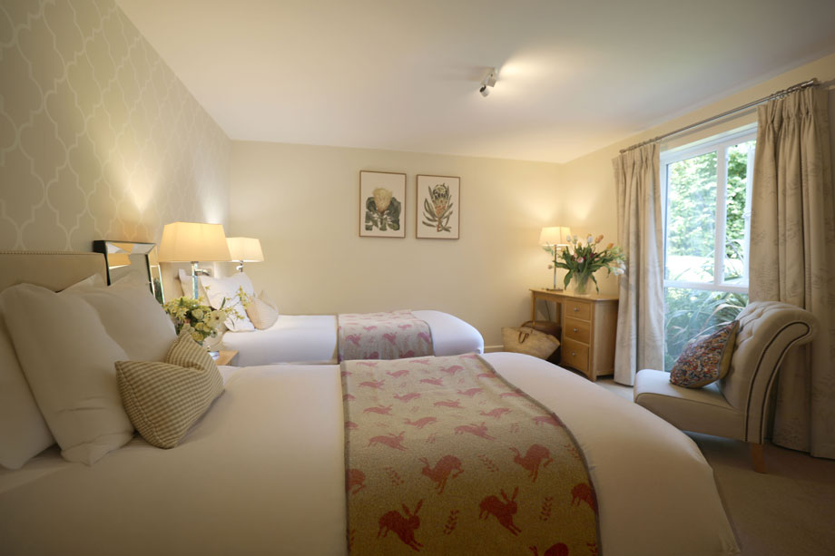
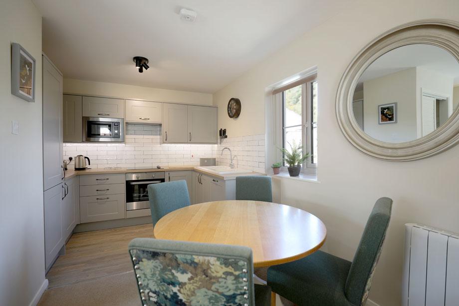
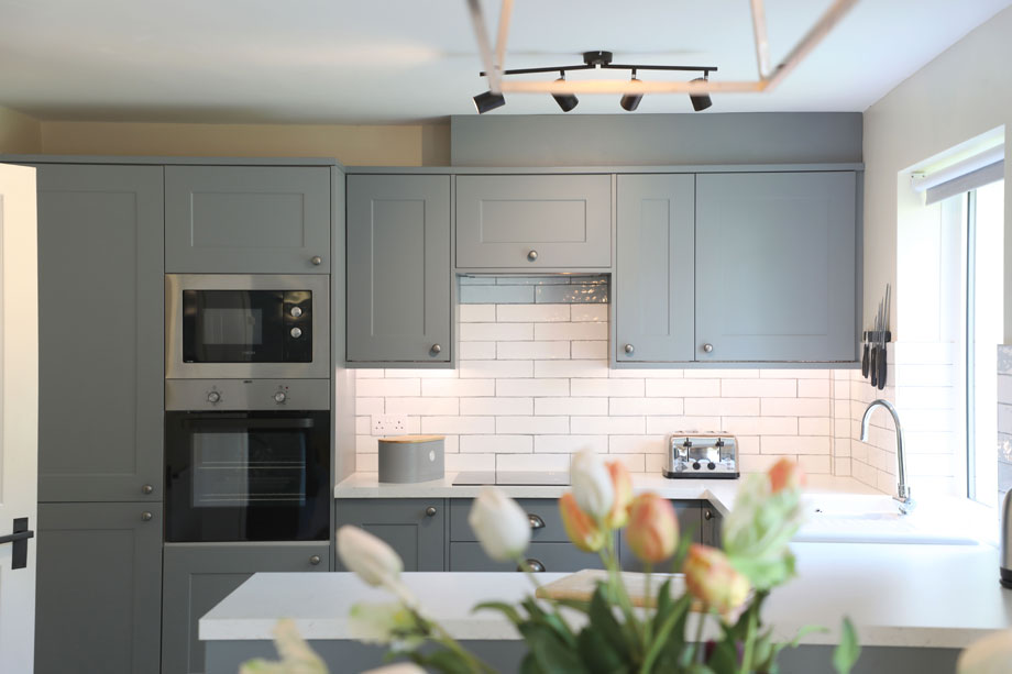
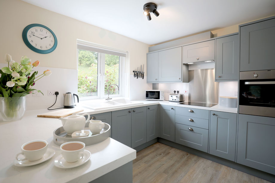
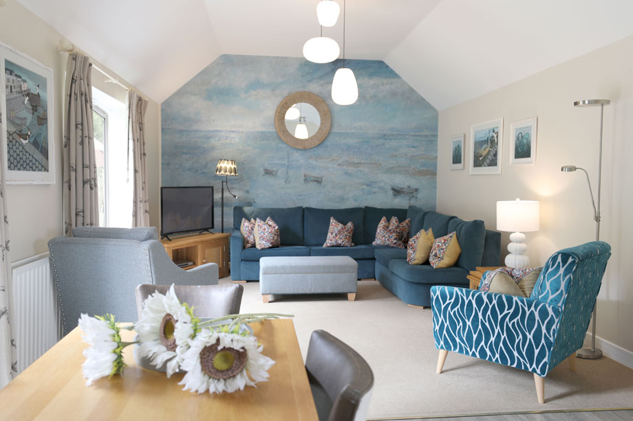
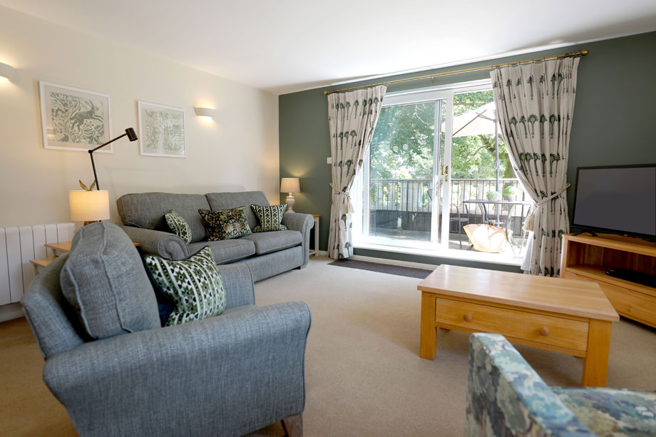
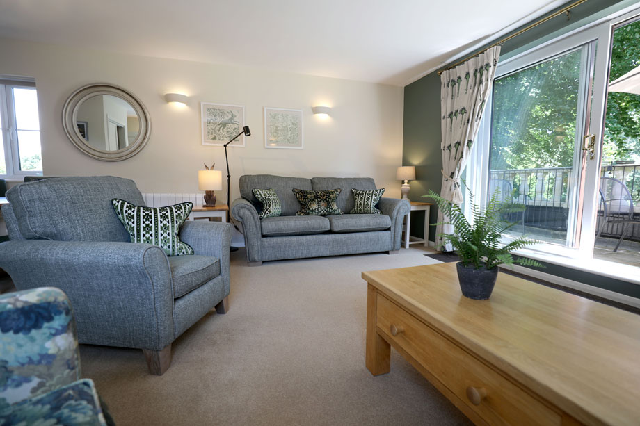
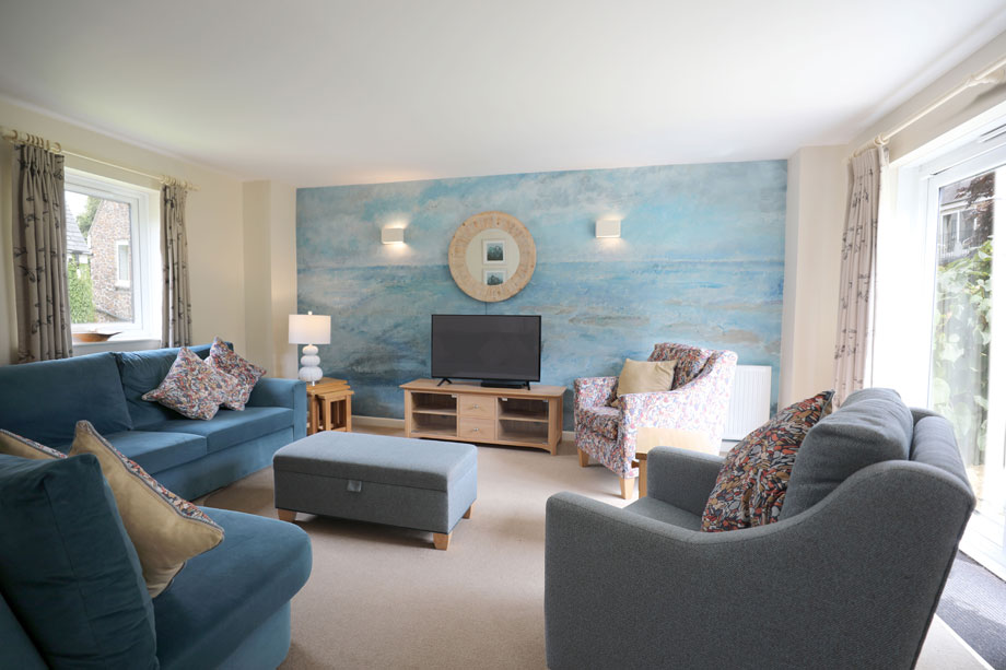
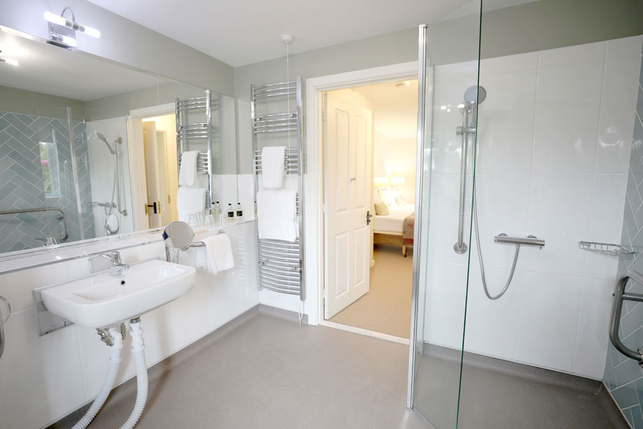
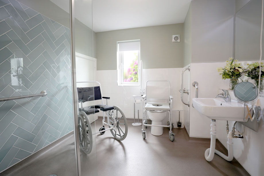
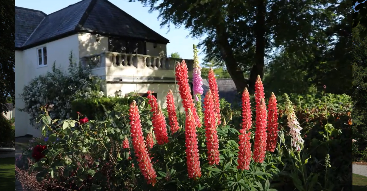
Duloe Manor, and its surrounding cottages, are beautiful inside and out. Don’t just take our word for it though, check out the images below. As you can see, all of the properties on-site have fresh and modern interiors, but they still feel like your home away from home.
The Manor isn’t short on amenities either; it offers an inviting heated outdoor swimming pool as well as an indoor pool in the on-site leisure complex. Not to mention the stunning grounds, where kids have plenty of space to safely play games and run around. Duloe Manor truly is a fantastic place to holiday – we’re sure you’ll agree!
Location
HPB Duloe Manor
Duloe
Liskeard
Cornwall
England
PL14 4PW
Tel: +44 800 230 0391
Email: details@hpb.co.uk
Cornwall has long been one of the most popular UK holiday locations. The beaches are unrivalled in Britain for their beauty and variety.
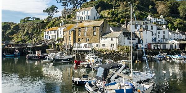
Along the coast are some of the Duchy’s most enchanting fishing villages and harbours. The towns and cities of Cornwall are rich in history with an array of attractions.
The National Trust is extremely active in Cornwall. With spectacular beaches, surfing, gardens, walks, boat trips and iconic attractions such as St Michael’s Mount, Land’s End and the Eden Project there is plenty to see and do.
Duloe Manor is ideally located for many of Cornwall’s best attractions.
The popular Monkey Sanctuary promotes the ‘welfare, conservation and survival of primates’. Meet a colony of Amazonian Woolly Monkeys and gain insight into their individual characters, before heading to the Bat Cave and the treetop café.
Other local attractions include the Land of Legend, Polperro’s model village, where you can get carried away by Cornish mysteries. Meanwhile, the Lower Lake Shooting Grounds near Liskeard offers expert shooting tuition from English Open Champion Bill Moussalli.
Things to do in Cornwall
Walks around Duloe Manor
The south-eastern part of Cornwall offers a rich variety of walking opportunity. On either side of the Manor, separated by the high ridge of farming land, are the wooded valleys of the East Looe and West Looe rivers, whilst the superb coast is only a few miles distant. Along that coast parts of the long distance South West Coast Path are included in several of the walks in this pack, involving attractive towns and villages such as Polperro, Looe, Fowey, Polruan, Cawsand and Pentewan. Inland, the fringe of Bodmin Moor provides a complete contrast in landscape, rich in ancient monuments and industrial remains.
With the exception of the suggestions for longer walks, these routes, whether direct from the Manor or located at a comparatively short driving distance, are generally intended to be half day excursions, allowing time for combination with other holiday activities.
Although the coast path can be quite demanding in its rise and fall, most of the walks are well within the ability of the average walker. No scrambling is included and the majority of the tracks and footpaths are, apart from some mud in wet weather, good underfoot. Road walking is, as always, kept to a minimum, using only quiet lanes. Along popular routes gates seem to be steadily replacing stiles; several of the walks have none and there are now only a few remaining on the others.
The coast path is well waymaked and most of the inland routes have at least some waymarking, most helpful in farming country.
Each walk is evaluated in terms of distance and ascent, with recommendations for car parking and refreshment where appropriate. An ordnance survey map is recommended in each case; although the route directions and sketch map should be adequate for route finding, the possession of the relevant map can undoubtedly add to the enjoyment of a walk.
Having a Private Tour at an HPB holiday location is an enjoyable way to see the high standards of furnishings and facilities you could enjoy with HPB.
A local HPB Representative will show you around the site and answer any questions you may have.
Alternatively, you are welcome to book a Personal Presentation at a hotel near you. You can chat to one of our local HPB Representatives, ask your questions and view the complete portfolio of HPB locations.