


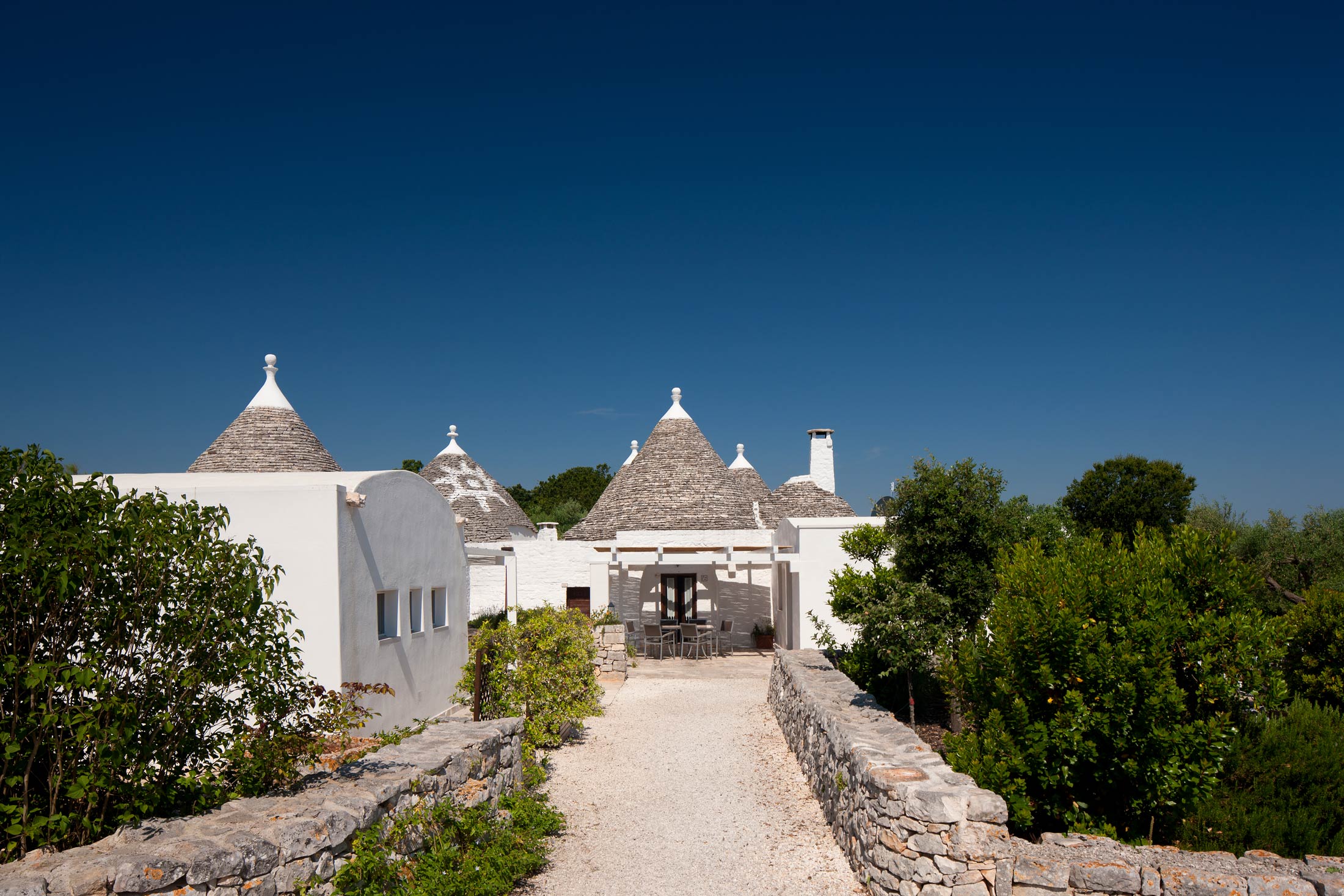
Coreggia, Puglia, Italy
Sandy beaches within easy reach and history on your doorstep
Open Gallery-
5 holiday properties in Puglia
-
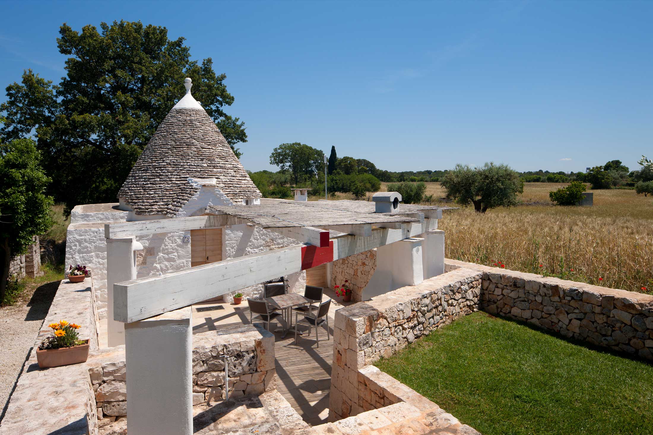
7 trulli, with more to come, plus a villa
-
Unique properties with modern amenities
-
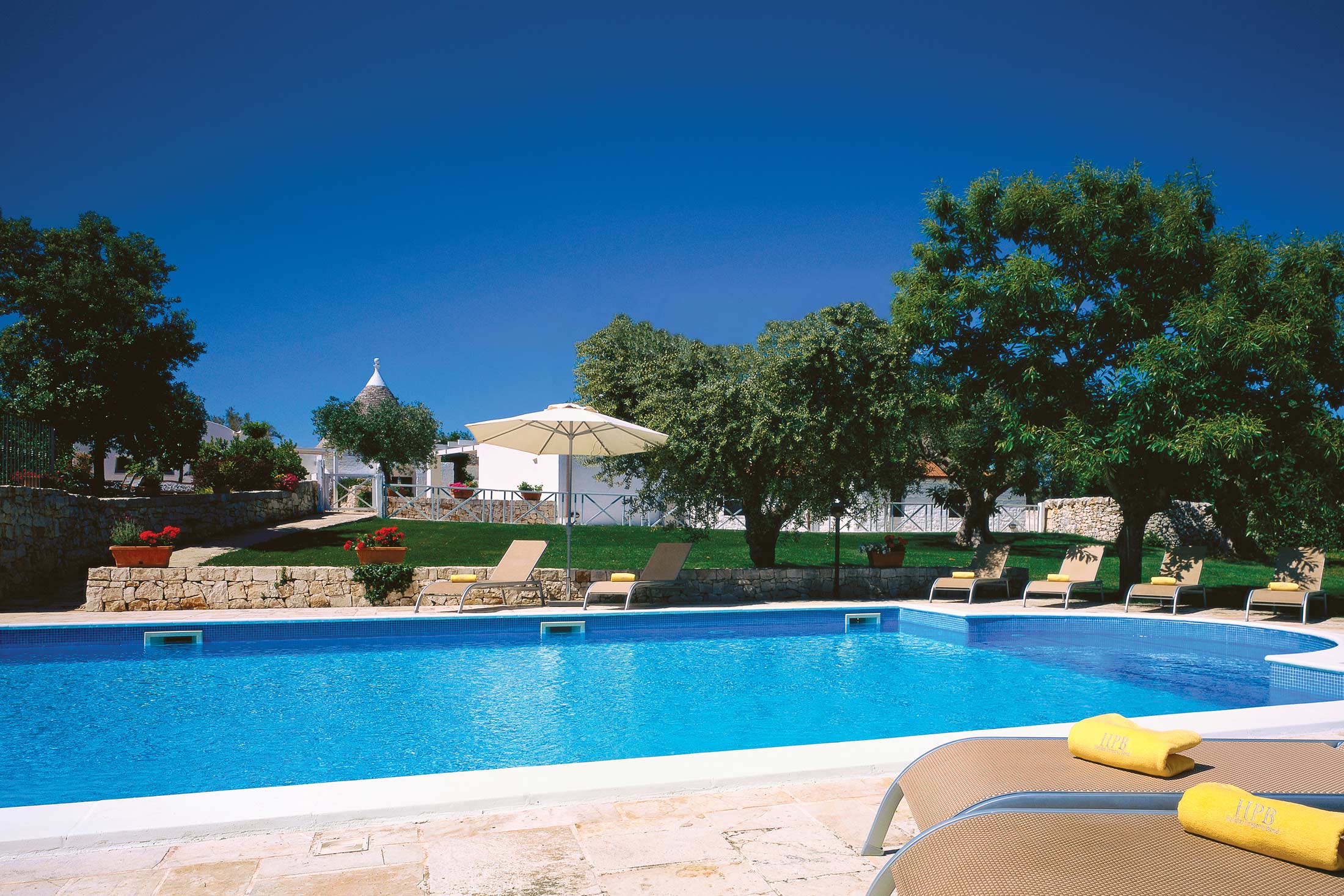
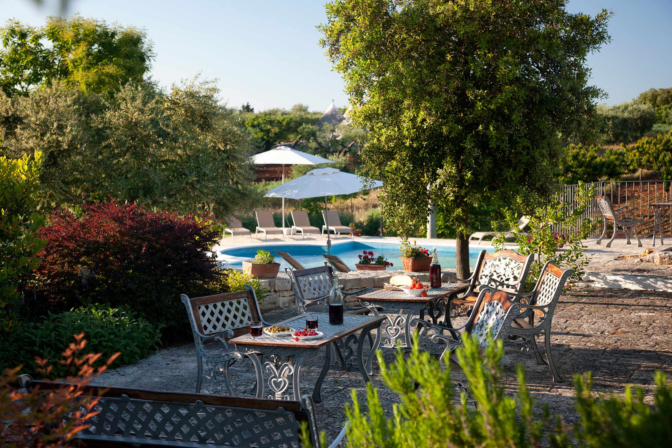
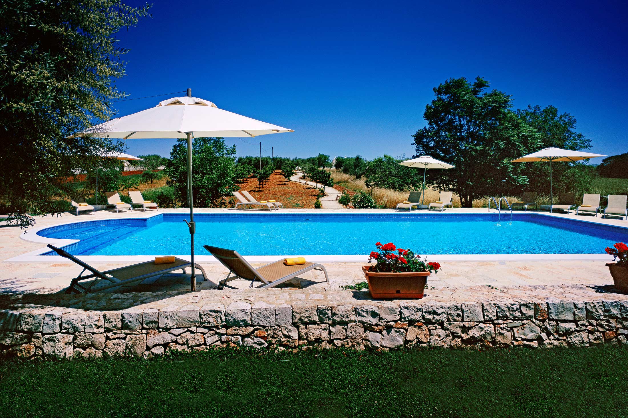
Communal outdoor pool
-
Olive groves, lemon trees, fine wine: the real soul of Italy
-
Close to the world heritage site of Alberobello
-
Sandy beaches within easy reach and history on your doorstep
-
A slower pace of life
Discover Puglia
The sun-drenched region of Puglia – in the far south east of Italy – is all but unknown to many holidaymakers. Consequently, it has maintained its authentic Italian feel. Here, medieval hilltop towns overlook gently rolling countryside, consisting for the most part of attractive olive groves, terraces and vineyards surrounded by dry stone walls.
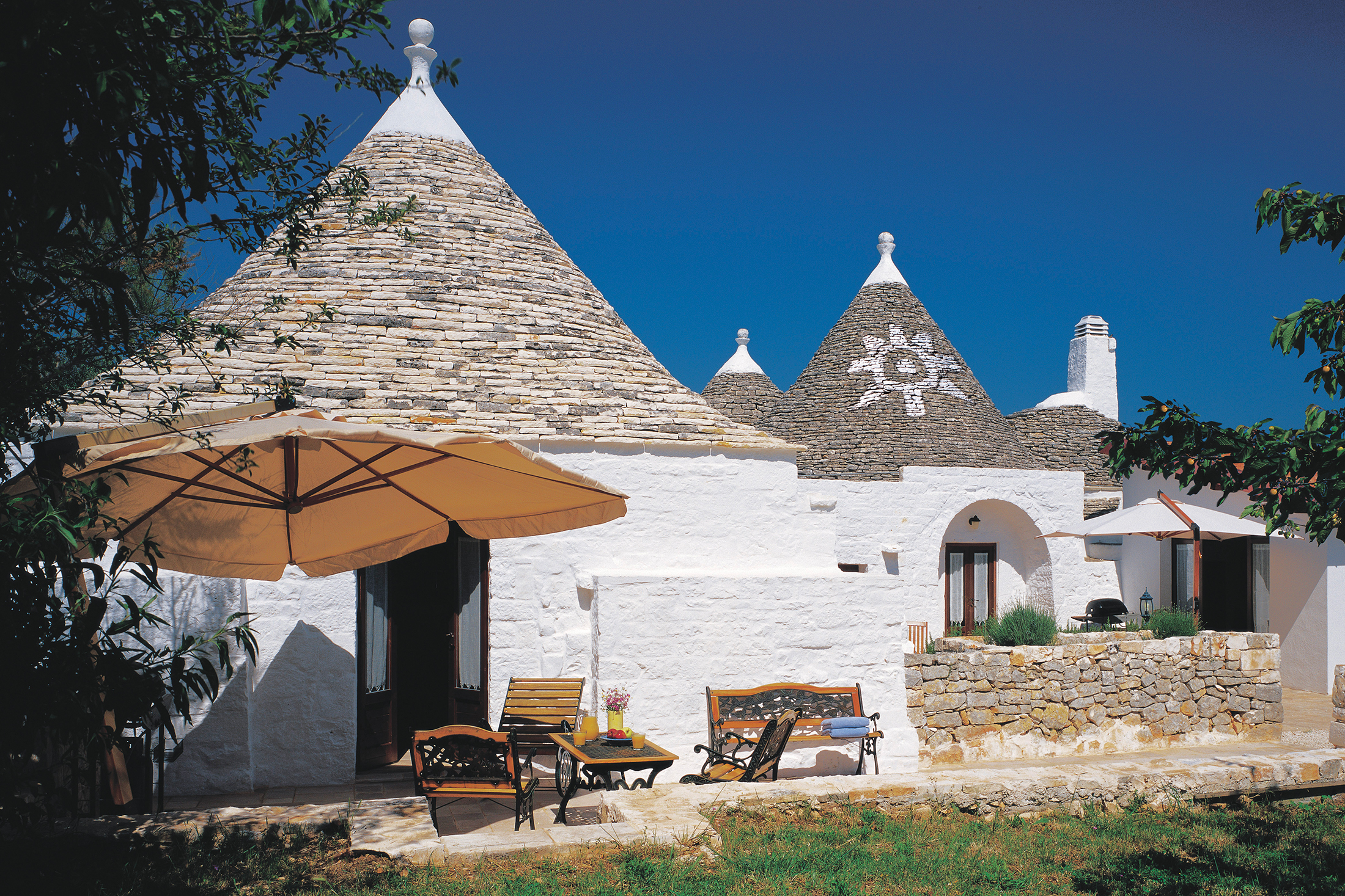
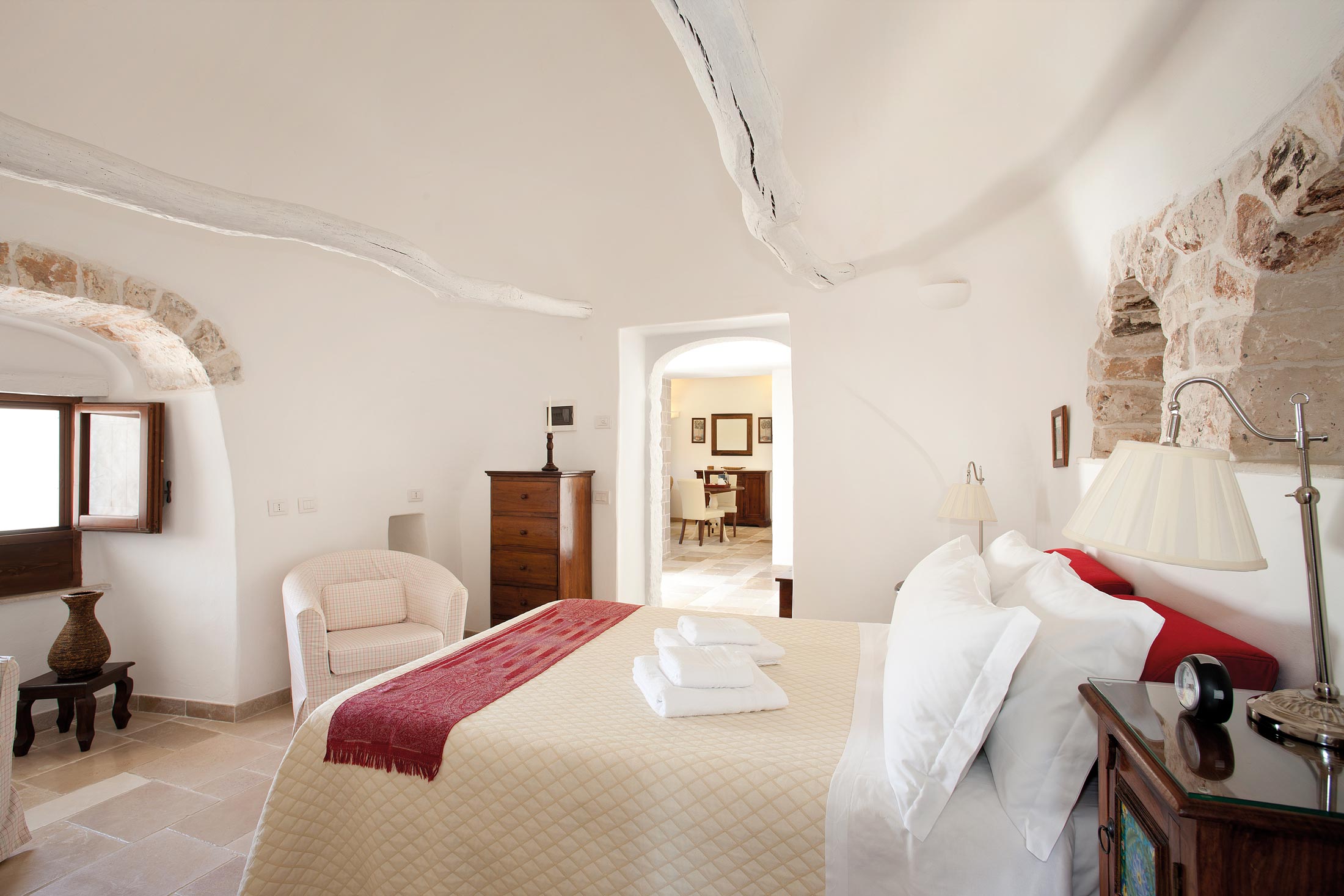
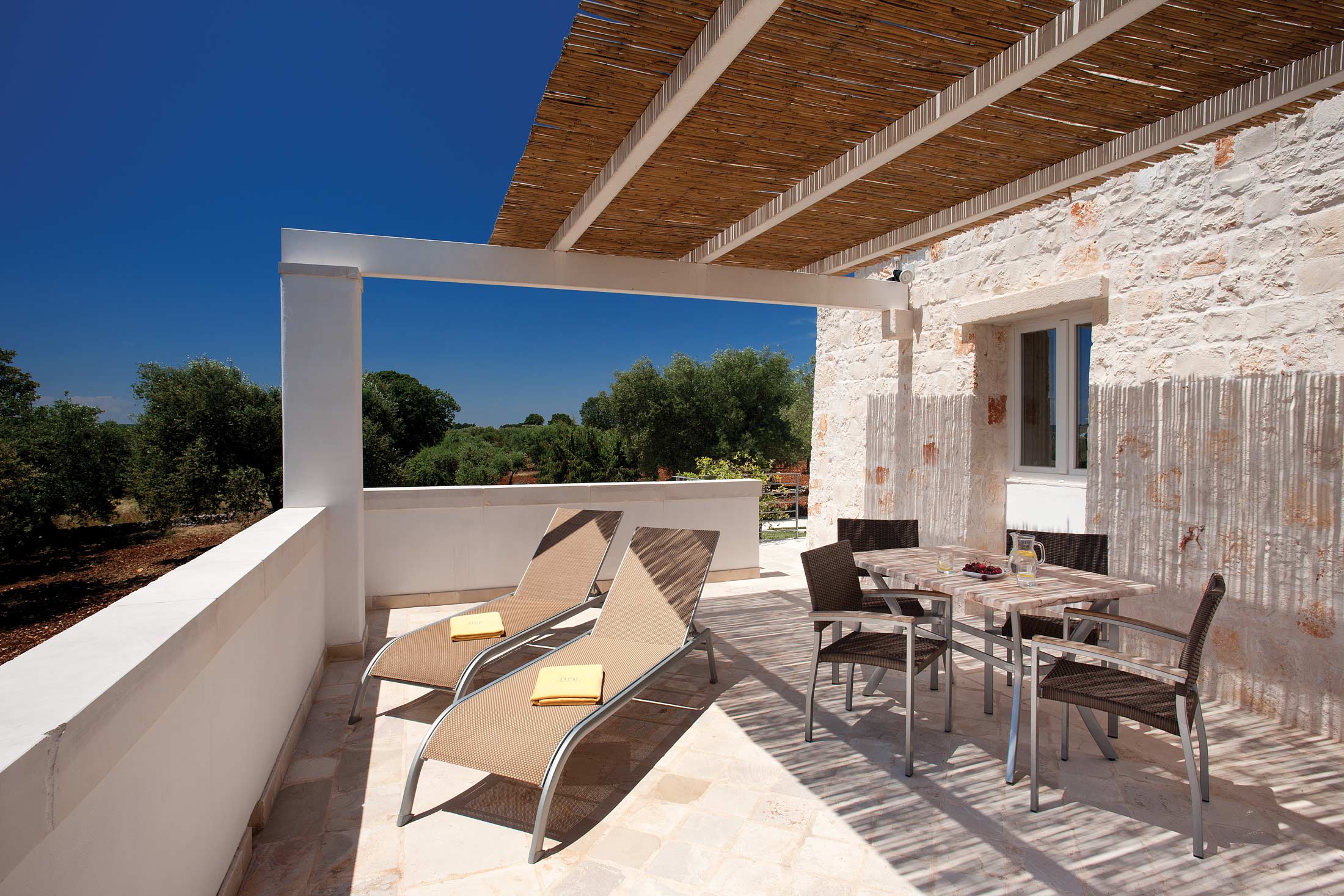
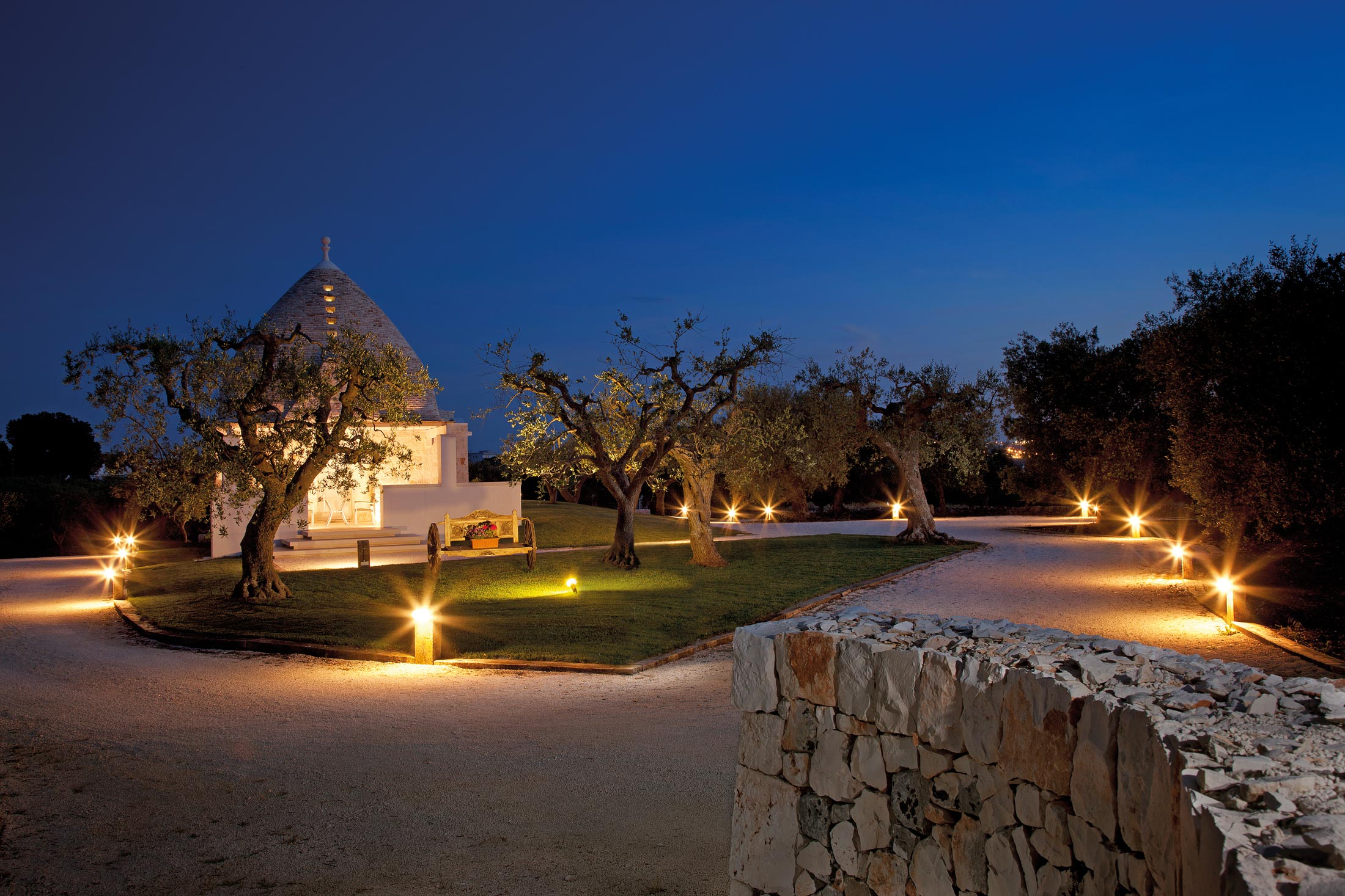
At Coreggia, just outside the World Heritage Site of Alberobello, you will find a slice of Italian heritage, in the shape of a group of small trulli – traditional conical cottages now available as holiday homes. These unusual and delightful properties are situated in a very peaceful rural setting, and they have been carefully restored, enlarged and adapted for modern living whilst retaining the character and charm of the original dwellings. There is a communal swimming pool close to the properties and each trullo has its own patio area.
Try a variety of Italian food and wine
Puglia is well-known for its amazing variety of food and wine, as each town has its own cuisine to reflect its history, traditions and nationalities. Eating is a social event here that brings everyone together, so don’t be afraid to get stuck in and try a bit of everything.
Food fairs are a regular event, with the majority taking place in July and August – be sure to check them out if your visit coincides.
Visit the famous trulli town, Alberobello
If you’ve fallen in love with the trulli at Coreggia, you’ll certainly want to visit Alberobello (meaning beautiful tree in Italian), as it’s also known as the Capitale dei Trulli. There are more than 1,000 white-washed trulli here, built across two hills. This World Heritage Site is unique and should not be missed.
See the incredible sassi cave dwellings at Matera
Just over the border in Basilicata is Matera, which is famed for its cave dwellings, known as ‘sassi’. As well as the homes, there are more than 120 cave churches, all of which were excavated from the rock. Even today, people still live in these caves, though they have been renovated to better accommodate modern life.
According to UNCESCO, Matera has the most “intact example of troglodyte settlements in the Mediterranean region”, so it really is worth stopping by. You can even visit the sassi themselves to see what it’s like to live in a cave. There are many wonderful frescoes to admire too.
Explore Castellana’s limestone caverns
If you haven’t had enough of caves yet, the limestone caverns at Castellana are beautiful and the best in all of Italy. First discovered in 1938, these interlinked caverns are full of stunning stalactite and stalagmite formations, but the real highlight is the Grotta Bianca. The stalactites in this white alabaster cavern are incredibly thin.
Admire the architecture in Lecce
Lecce’s nickname is the ‘Florence of the South’ thanks to its amazing architecture. The cathedral is the real stand-out attraction, with its Baroque art and twelve altars.
Shops and restaurants
Roughly a mile away, the village of Coreggia has a shop, bar and restaurant. And of course the properties are just ten minutes from the centre of ‘trulli town’ Alberobello which has over 40 cafes and restaurants.
On-site facilities
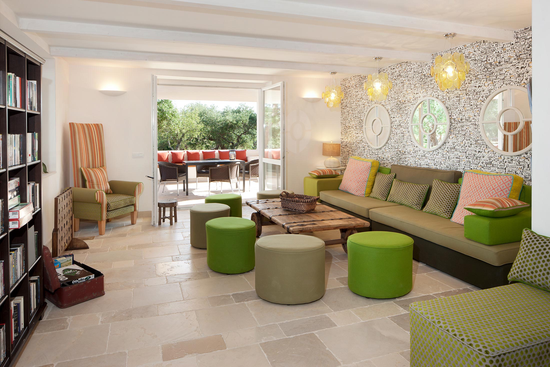
Although rustic in their charm, and relatively basic in their amenities, the properties are comfortable and have satellite television. (Be aware though that there are no landline telephones.)
The reception houses the office, tourist information, DVD library and free internet access.
The open air swimming pool is 15m x 7m and is 1.3m deep, and opens from April to the middle of October, weather permitting. The pool is not heated during July, August and September.
Cool in summer, warm in winter, and picturesque and charming all year round – the trulli of southern Italy offer an unforgettable holiday experience. A superb jumping-off point for taking in the sights of this glorious region, to be sure; but if all that seems too much of a fag why not simply find a shady spot under an olive tree? Take a good book, perhaps a bottle of chilled pinot grigio, and let the cares of the world pass you by.
Our Trulli complex at Coreggia provides a fantastic slice of Italian heritage and sits just outside the World Heritage Site of Alberobello.
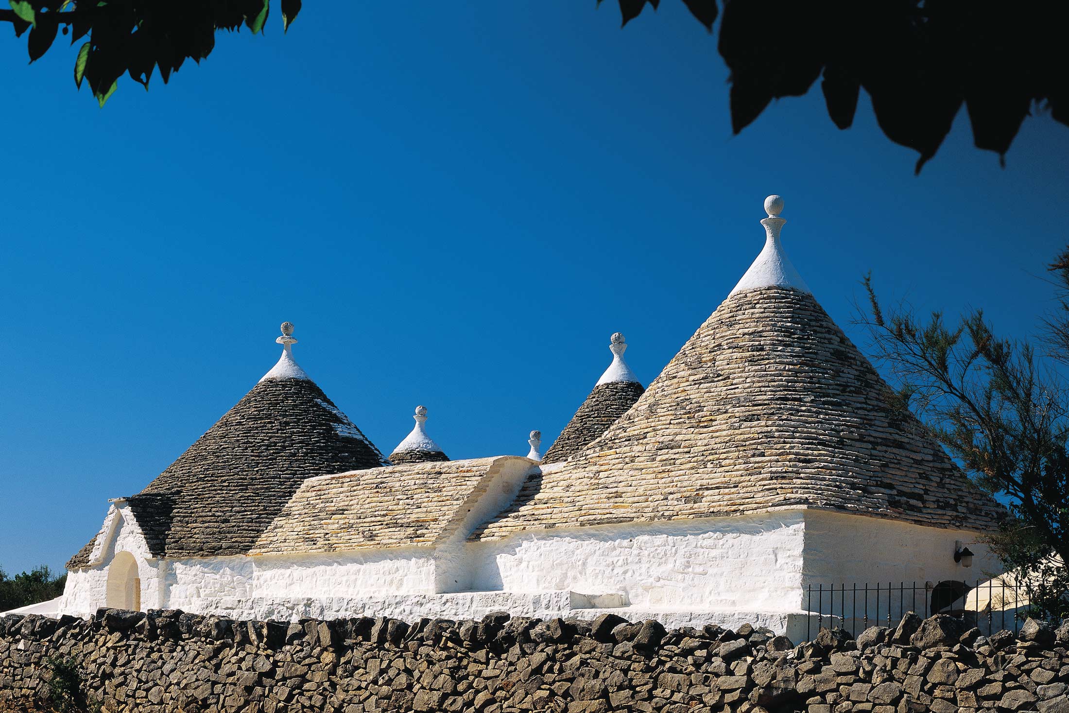
Unique to the region of Puglia, trulli are the traditional round Apulian dwellings that were built by local farmers using a unique drywall (mortar-less) technique, and feature pyramidal, domed or conical roofs constructed in two layers; an inner layer of limestone boulders capped by a keystone, and an outer layer of limestone slabs (to ensure that the building is watertight).
The five trulli properties comprise one 3 bedroom, one 2 bedroom & three 1 bedroom trulli. There is also a new clubhouse with two ‘trullo-style’ two-bed units, and a seperate three-bed, three-bath villa. All properties share a communal swimming pool on site.
Properties in Puglia
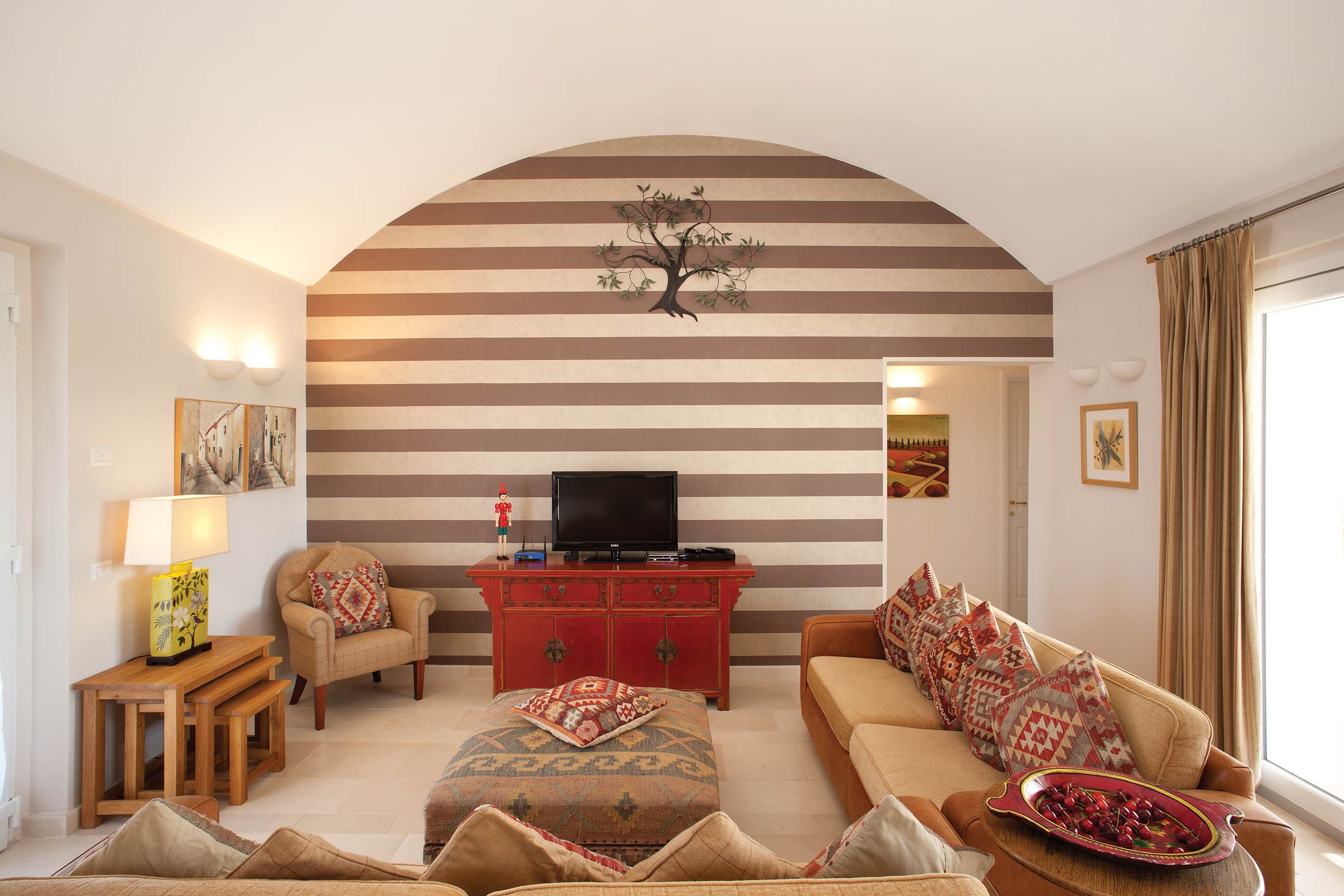
It’s hard not to fall in love with Coreggia’s holiday homes, as the traditional cottages are just so charming. The quirky conical roofs and white brick walls are a wonderful sight – there’s no mistaking that you’re in rural Italy.
Inside, the cottages have been modernised, yet still feel traditional. If you want to get away from it all to enjoy a more rustic and simple way of living for a week, Coreggia is the perfect place to do just that.
To top it all off, there’s a large open-air swimming pool, ideal for keeping cool on a hot summer’s day. Why would you want to be anywhere else?

Location
HPB Coreggia
Contrada Staffone
Coreggia
Metropolitan City of Bari
Italy
70011
Tel: +44 800 230 0391
Email: details@hpb.co.uk
Puglia is a jewel of Italy. The countryside stretches out with endless silver olive groves and orchards, dotted with white houses leading down to beautiful beaches and the Adriatic and Ionian seas. It is becoming increasingly popular as travellers discover the varied charms of the area.
The Pugliese community describe themselves as “nearly in Africa”, a reference to their Moorish past, strong traditions and of course the hot summers. Italian musicians can be found performing throughout the summer months, attracting tourists to dance to the ancient rhythms of the Tarantella music.
The wider region of Puglia is extremely rural and often known as the ‘Garden of Italy’. Most of the country’s wine and much of the world’s olive oil are produced here, as are oranges, lemons, cherries, nuts, vegetables and wheat.
As a result, there is plenty of mouth-watering Italian cuisine, which is also inexpensive (thanks to the absence of mass tourism). A rich variety of seafood is also available in the local markets and restaurants.
Things to do in Puglia
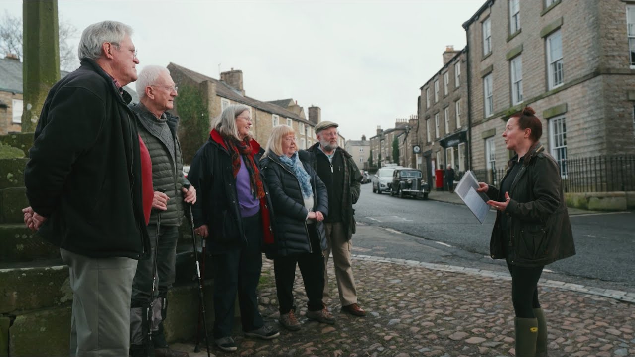
Walks around Coreggia
Explore the sun-drenched region of Puglia in the far south east of Italy.
Read our HPB Feefo Reviews
HPB’s holiday booking service has been rated 4.9 out of 5 based on 14,772 customer reviews on Feefo
![]()
“Headache-free holidays with HPB”
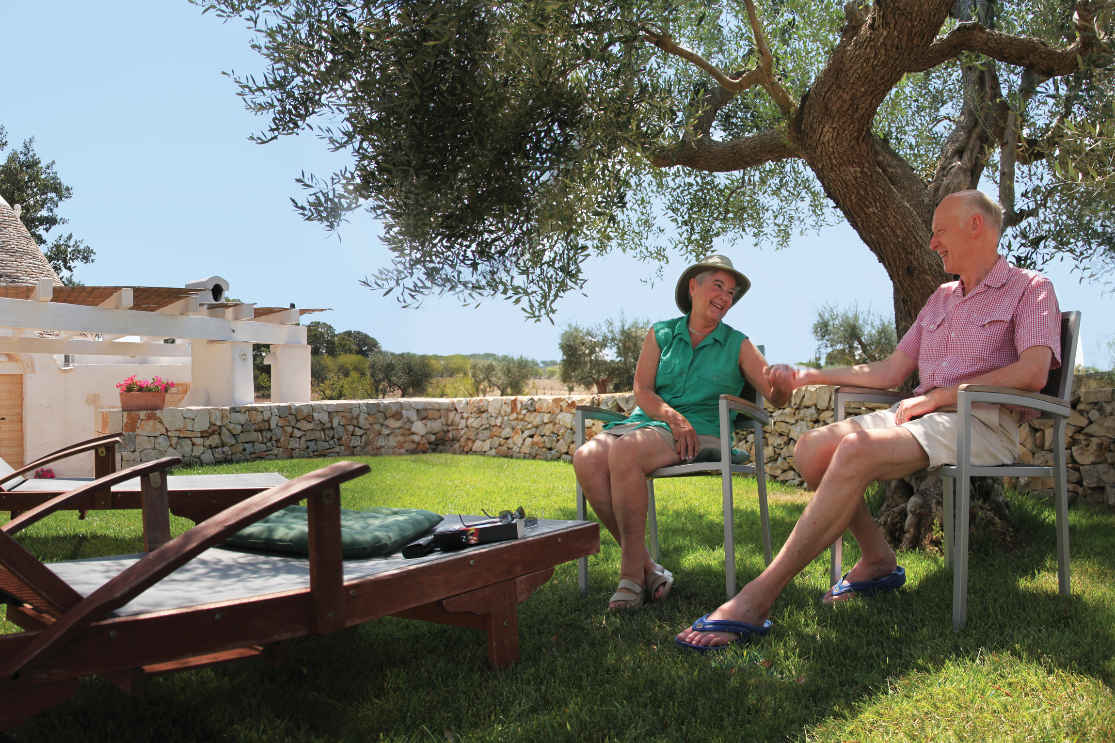
Stephanie and Nigel CollinsWe grabbed a few words with Nigel and Stephanie in Coreggia, where they were enjoying a summer break. Actually, “enjoying” doesn’t really do it justice: they loved the site and the area. The Coreggia surroundings are beautiful and fascinating; as well as the picturesque old town of Alberobello, there are the cave houses at Matera, Roman remains at Egnazia and the fantastic caves at Castellana Grotte. The trullo we’re staying in is just beautiful: the conversion from an old derelict trullo is simply amazing.