


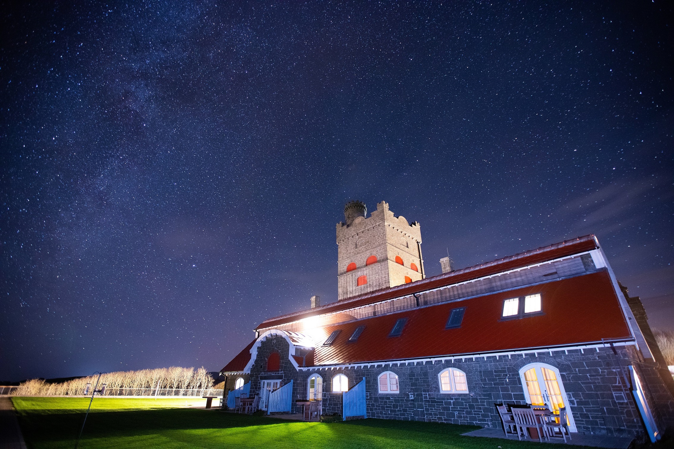
Bell End Farm – Rosedale, North York Moors, England
With stunning views across the North York Moors National Park and Howardian Hills AONB
Book a tour Open Gallery-
11 holiday units at a working moorland farm
-
With stunning views across the North York Moors National Park and Howardian Hills AONB
-
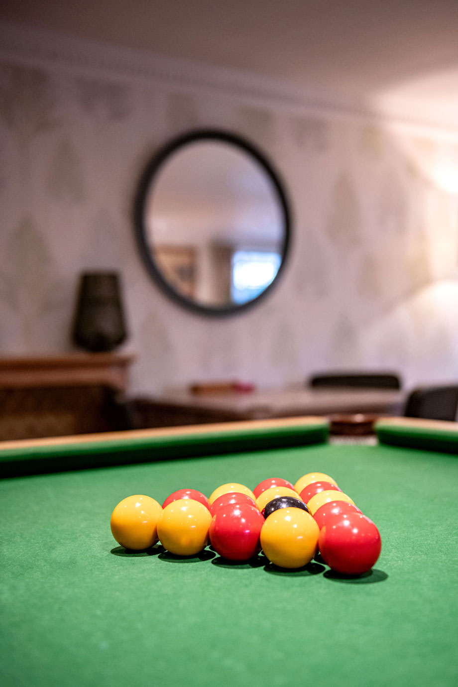
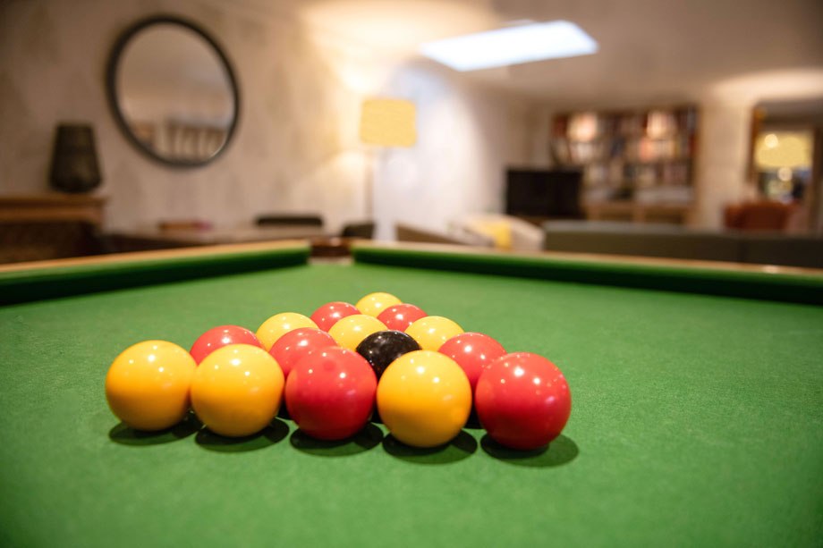
Facilities include: indoor heated plunge pool, snooker table, internet and WiFi
-
York and Ripon are both within easy reach
-
Great historic sites like Fountains Abbey and Richmond Castle
-
Over 1,400 miles of paths and tracks to choose from for great walks
-
Close to Pickering and the North Yorkshire Moors Steam Railway
Discover North York Moors
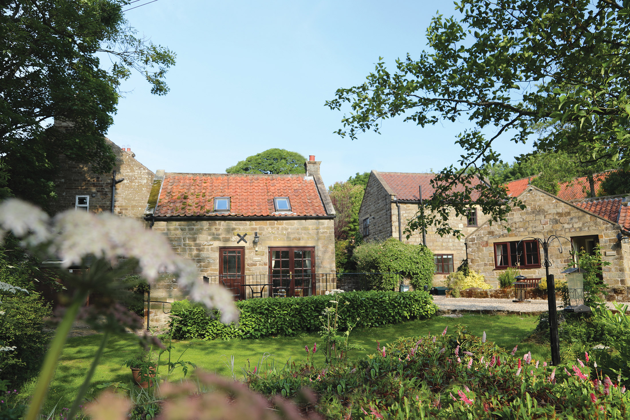
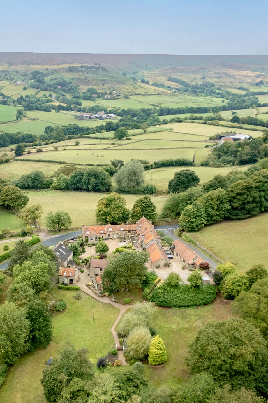
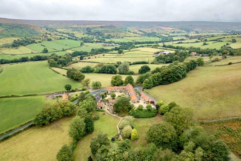
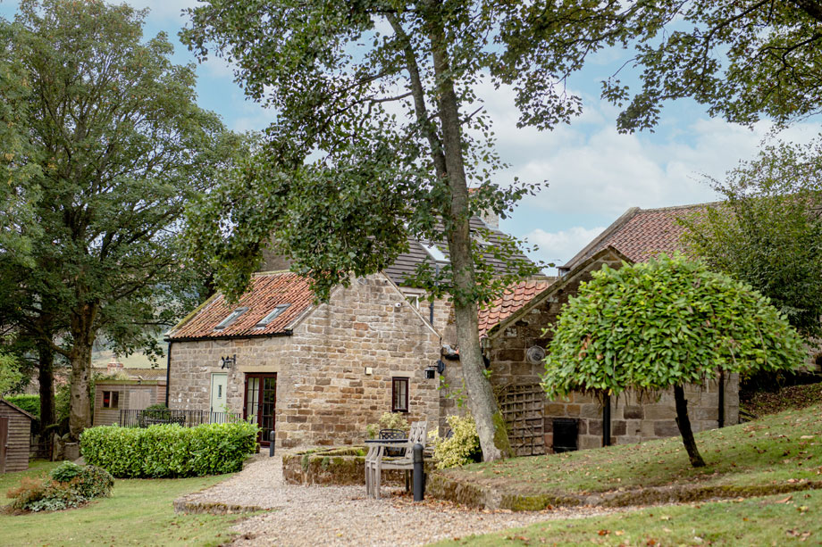
The village of Rosedale Abbey is located close to the centre of the North York Moors. The village is the site of a former Cistercian nunnery and has been inhabited since the mid-12th Century. It is also the location of Bell End Farm, a truly delightful holiday retreat.
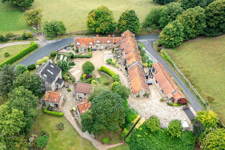
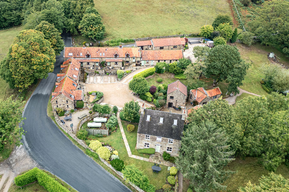
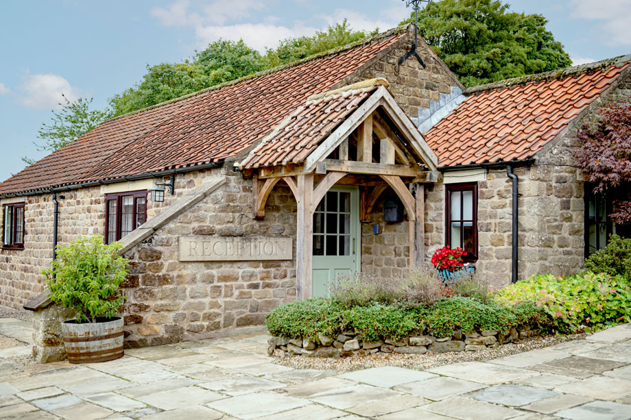
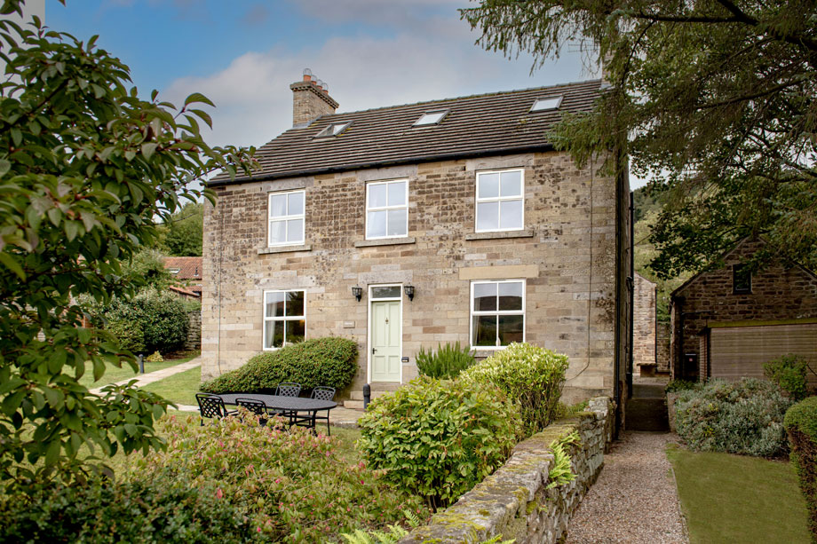
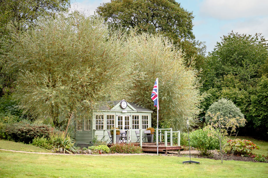
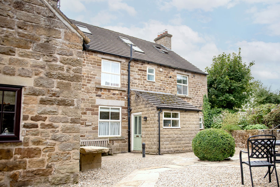
Bell End Farm was a typical working moorland farm until it fell into disuse in recent years. It was then developed into comfortable, award-winning holiday cottages with stunning views across the moors.
The North York Moors National Park, with its peaceful, rolling, heather-clad moorland and unspoilt valleys, is the perfect place for holidaymakers who want to get away from it all. It covers 553 square miles of the old North Riding, bounded to the west by the Hambleton and Cleveland hills, and to the east by the high cliffs of the rugged North Sea coast. The southern boundary follows the road eastwards from Thirsk, through historic Helmsley and the busy market town of Pickering (with its steam trains and castle ruins), all the way to Scarborough.
Discover incredible stately homes and historic sites
There are some breathtakingly-beautiful historic homes and sites in Yorkshire, England’s biggest county. Castle Howard is one of the finest – this 18th Century residence boasts 1,000 acres of land to explore. Kids will love the adventure playground, while the adults will no doubt spend hours admiring the lovely gardens.
Fountains Abbey and Studley Royal Water Garden is another historic attraction not to be missed. The abbey dates back to the 12th Century and is a stunning sight to behold, despite the fact it now lies in ruins, and the Georgian water garden is a relaxing place to spend a summer’s afternoon.
Walk to your heart’s content
With more than 1,400 miles of paths and tracks, you’ll find plenty of places to go walking in North Yorkshire. If you fancy a bit of a challenge, the 40-mile Lyke Wake Walk, which extends across the North York Moors National Park, might be ideal. If you want to walk every day, the Cleveland Way is a worthy test of your fitness – the 110-mile hike will take you from the edge of the National Park all the way to Filey on the coast.
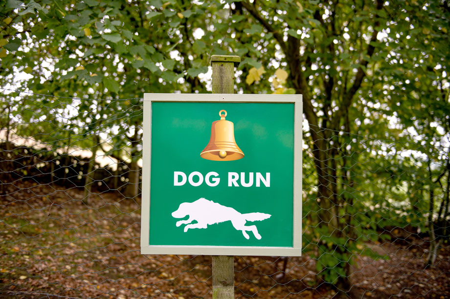
If you’d prefer a gentler, shorter walk, there are 20 routes along the coast you can take, collectively known as the North Sea Trails. Whichever route you take, remember that you must keep any dogs on a short lead between March and July, as this is when rare birds tend to nest on the ground and they must not be disturbed.
Go back in time
There are some great museums in Yorkshire, including Eden Camp Museum, which is situated in the ground of an original WWII prisoner of war camp. Take the little ones here to show them what Britain was like during the war, and why it transpired in the first place.
Travel back even further in time at the Jorvik Viking Centre in York, where you can explore the remains of Viking workshops, backyards and houses right under your feet!
Ride an authentic steam train
The North Yorkshire Moors Railway gives everyone a chance to fulfil their fantasy of riding a traditional steam train. Both the trains and the rural stations have been lovingly restored – it really does feel like you’re stepping into the past.
Shop until you drop
York has a huge selection of shops to browse, whether you’re after a treat for yourself or a souvenir for someone back home. The York Designer Outlet boasts more than 100 shops alone, all of which are selling designer items at low-cut prices. After an unusual gift? The Ampleforth Abbey Shop sells Benedictine monastic produce, including cider brandy, sloe gin and beer.
Of course, York isn’t the only location boasting a good selection of stores. Yorkshire’s villages and towns all have their own unique shops, which are well-worth checking out.
Shops and restaurants
The village of Rosedale, half a mile away, has a village shop and farm shop (both with cafés), a pub offering a bar and restaurant meals, a glass blowing studio, mountain bike hire and a meal delivery service.
On-site facilities
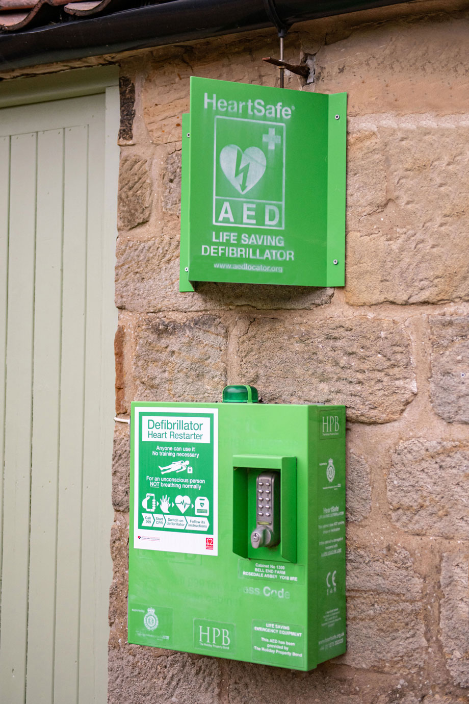
The nature of the area, and small size of the site, guarantee a relaxing and peaceful atmosphere. To maintain the ambience, facilities are necessarily limited.
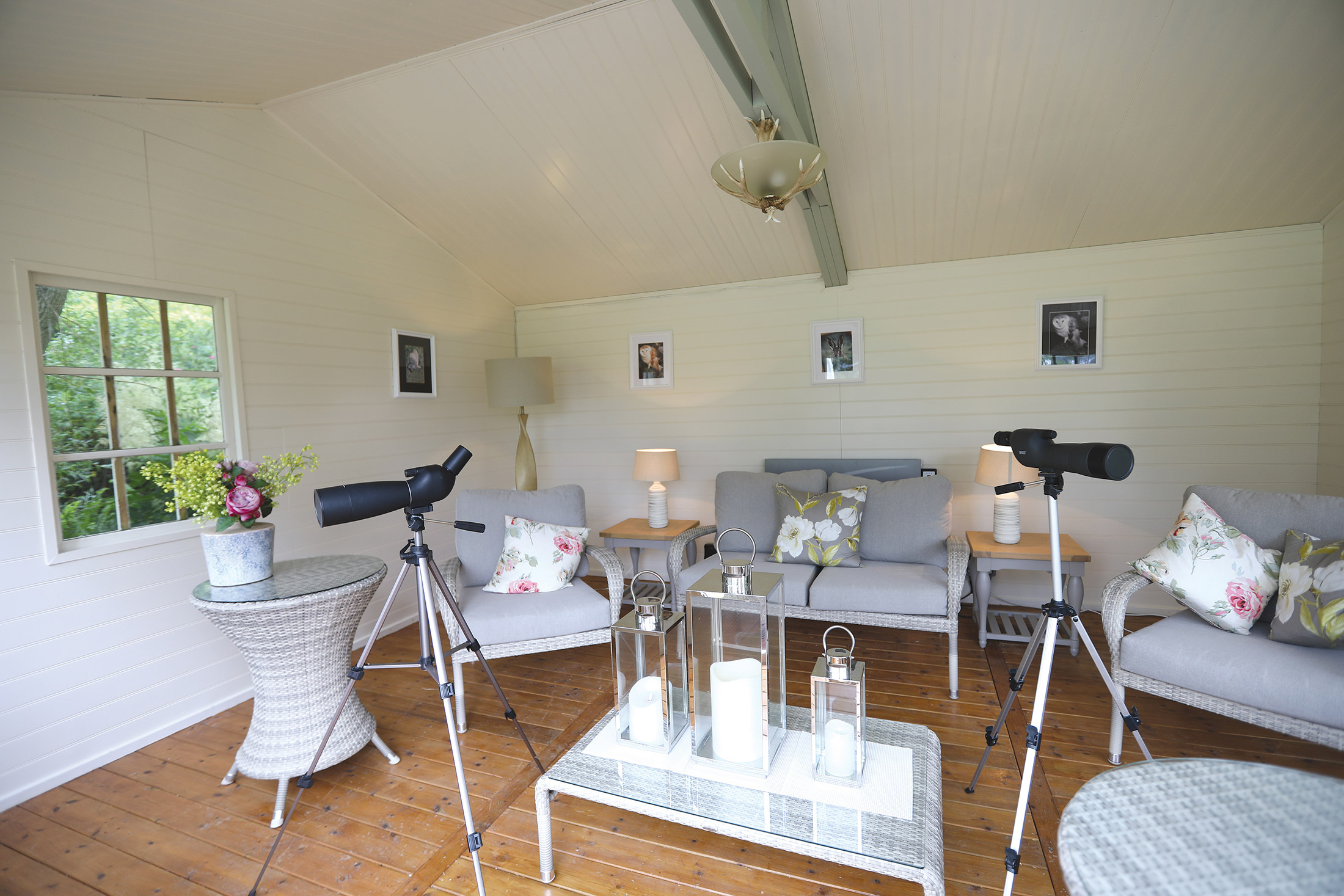
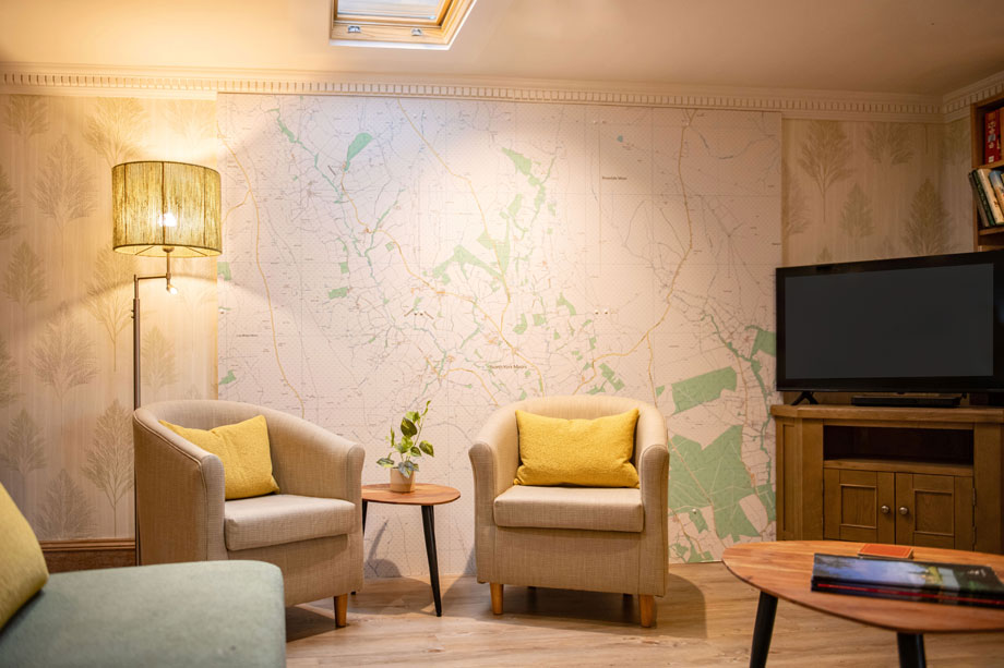
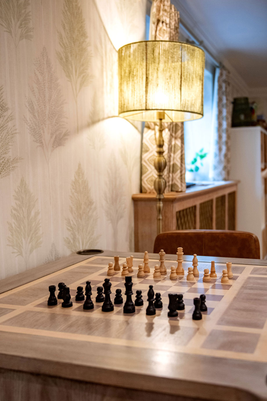
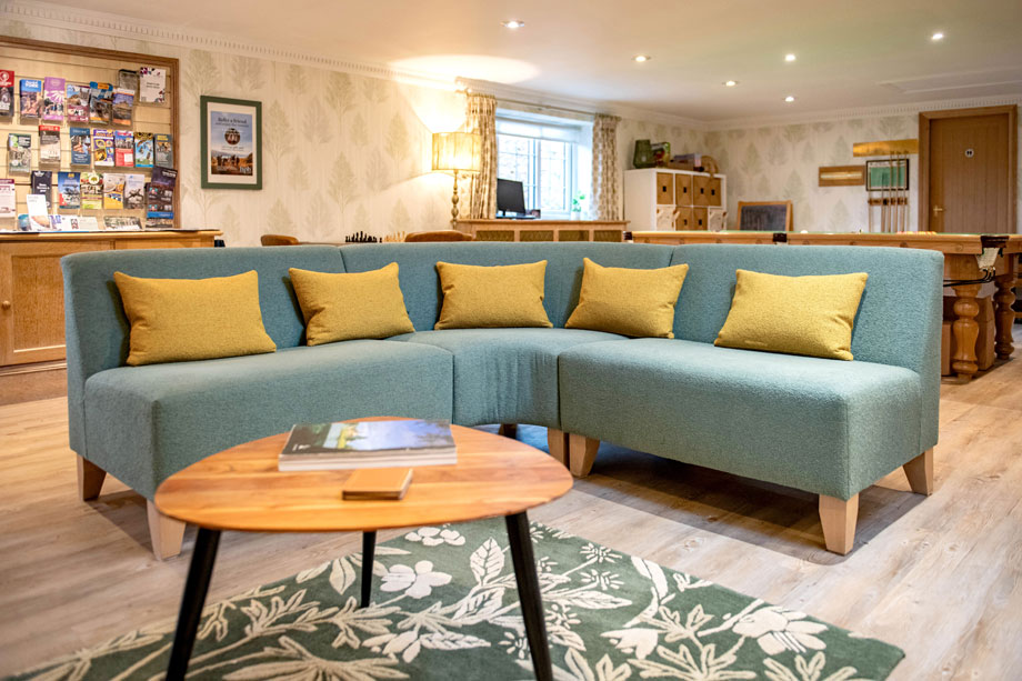
The clubhouse, which is available to residents and their guests, includes a snooker table, a free DVD and book library, puzzles and games, a children’s corner (with toys, books, DVDs etc.), and local information.
There is free Internet and Wi-Fi access.
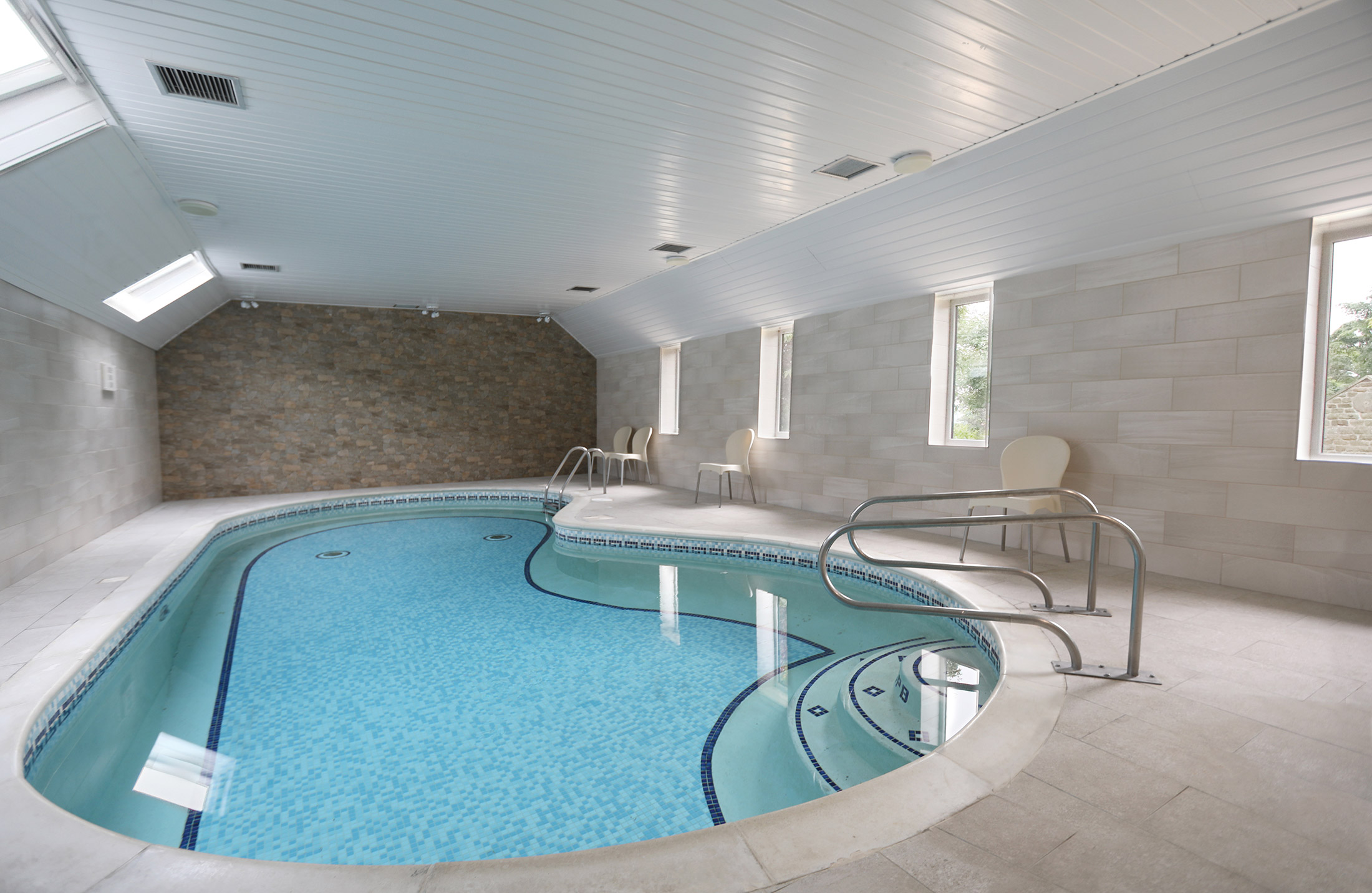
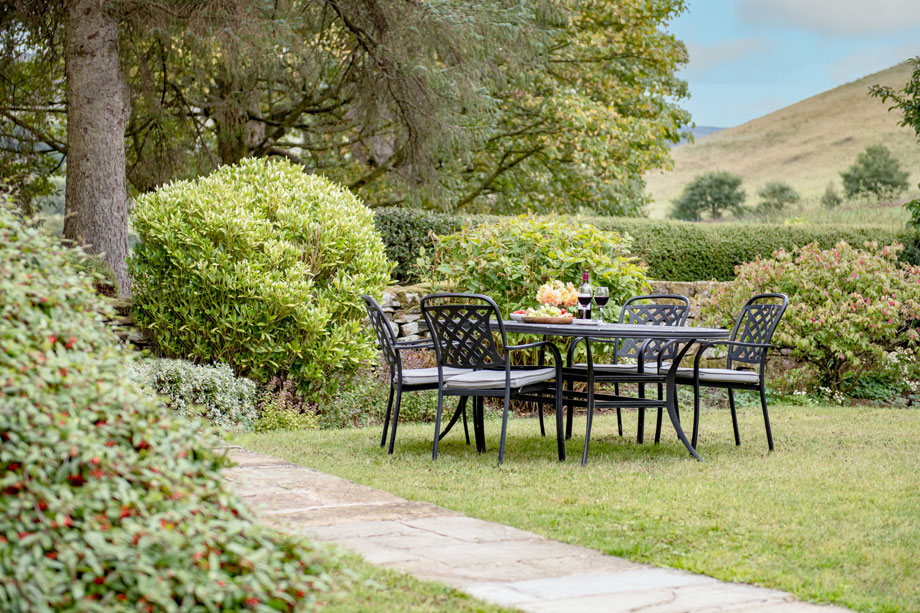
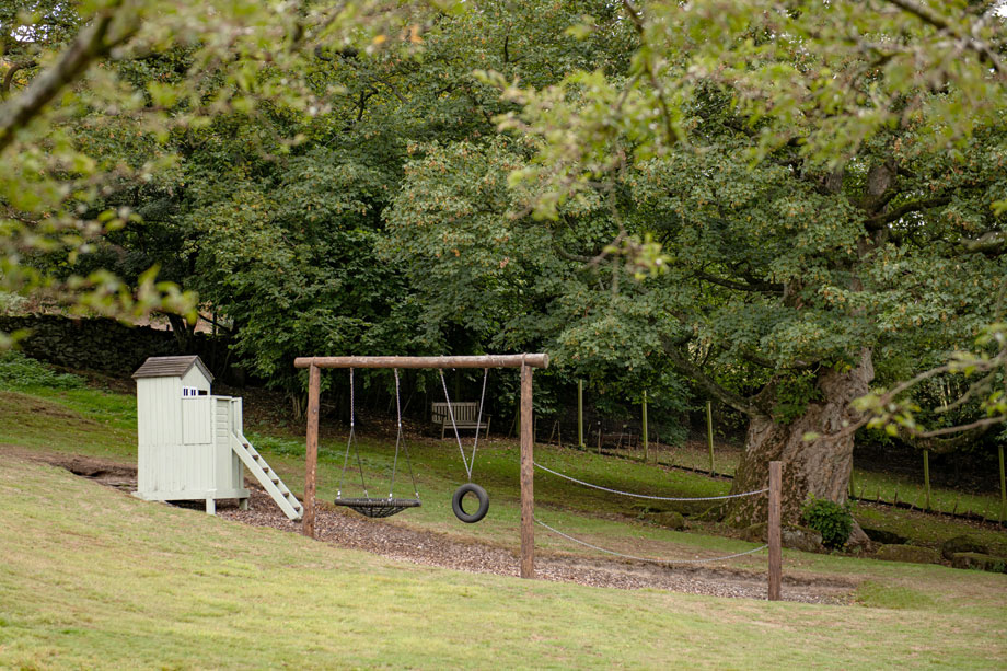
Other facilities include a compact indoor heated plunge pool (a little over eight metres long), a small outdoor child’s play area, and quiet garden with stunning views.
There is a communal laundry with washing machines and tumble driers.
The beach is just over 30 minutes away and nearby sports facilities include tennis, golf and, of course, rowing, windsurfing, stand-up paddleboarding and kayaking as well as boat trips out to sea.
Bell End Farm was, originally, a working moorland farm until it fell into disuse.
Later developed into holiday homes (which won several awards), it was acquired by its current owner in 1994.
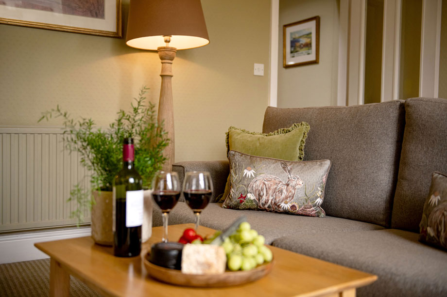
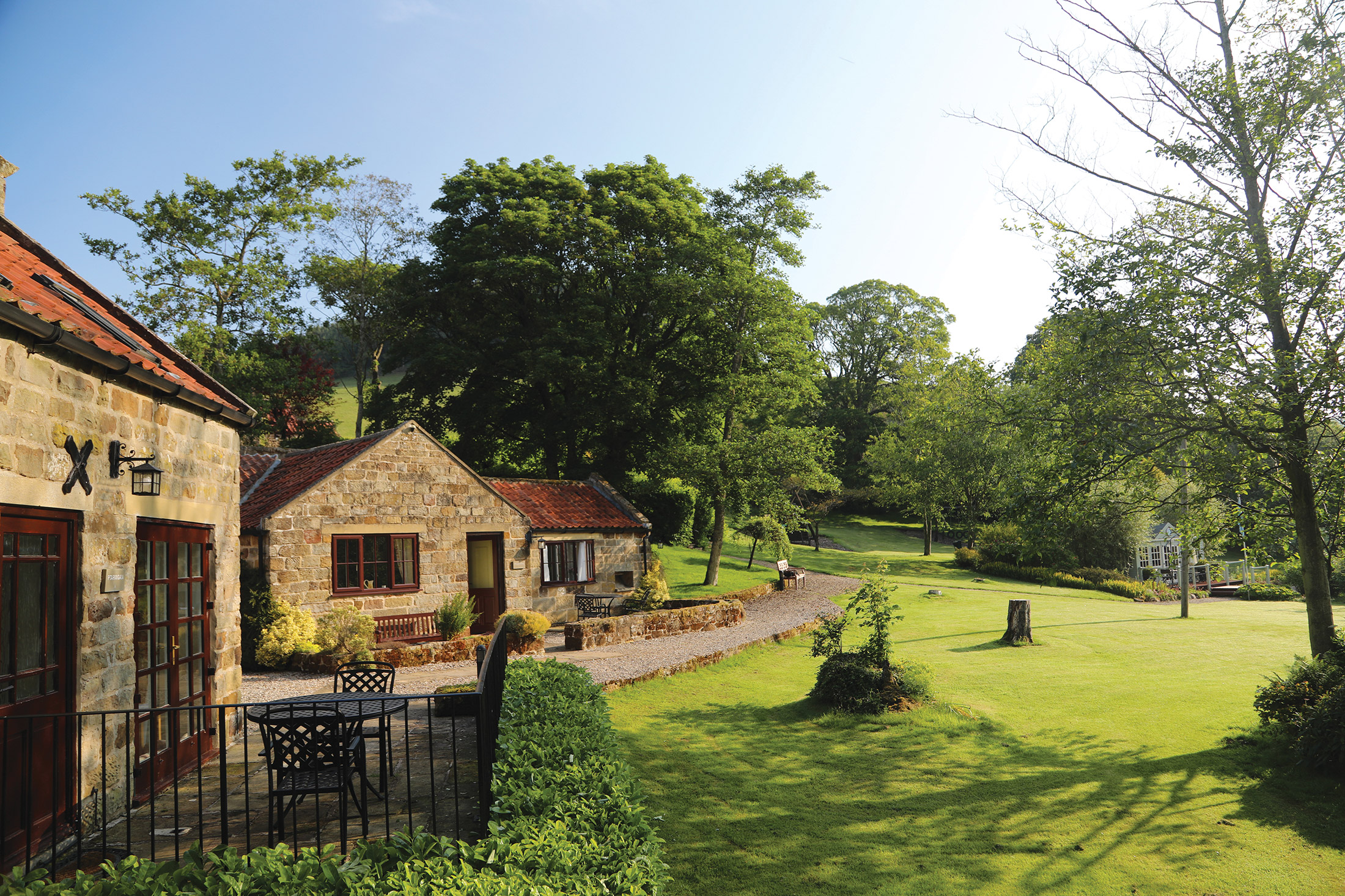
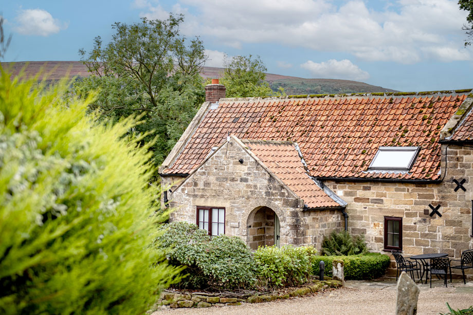
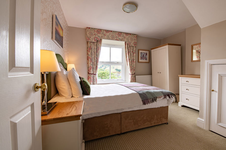
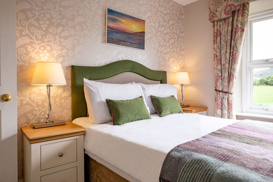
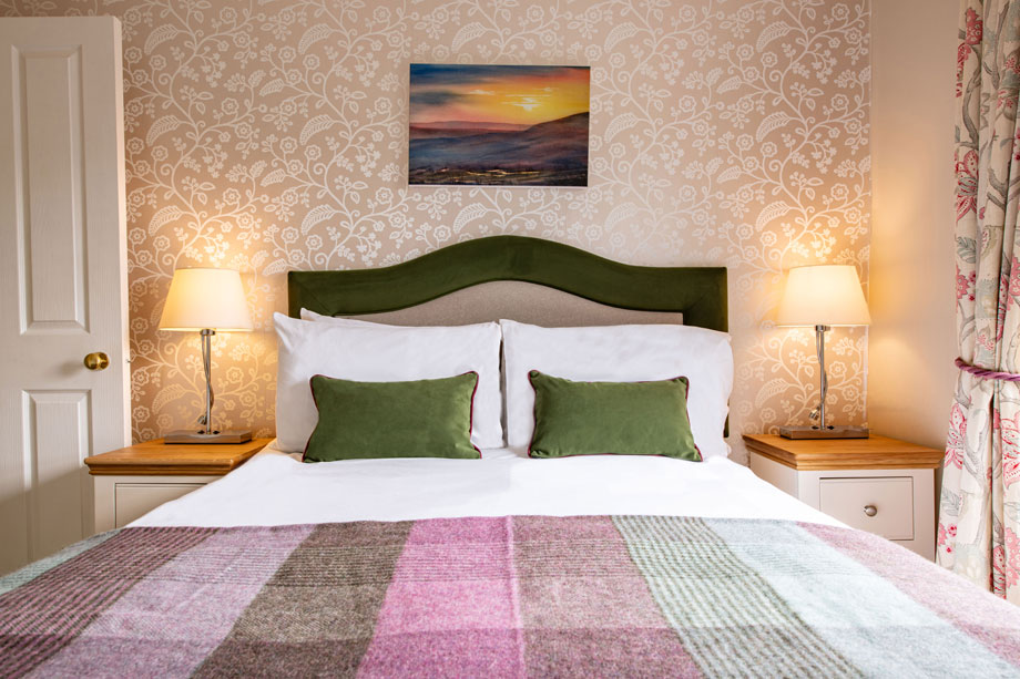
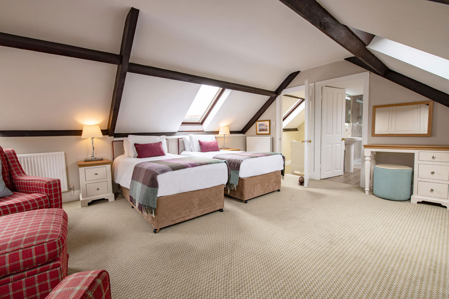
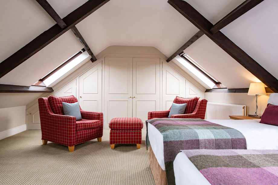
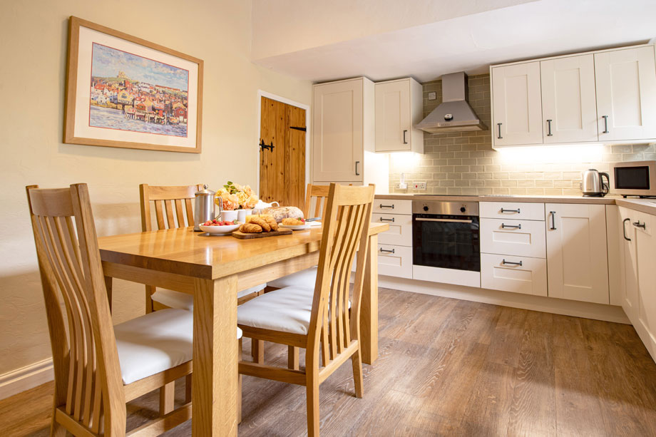
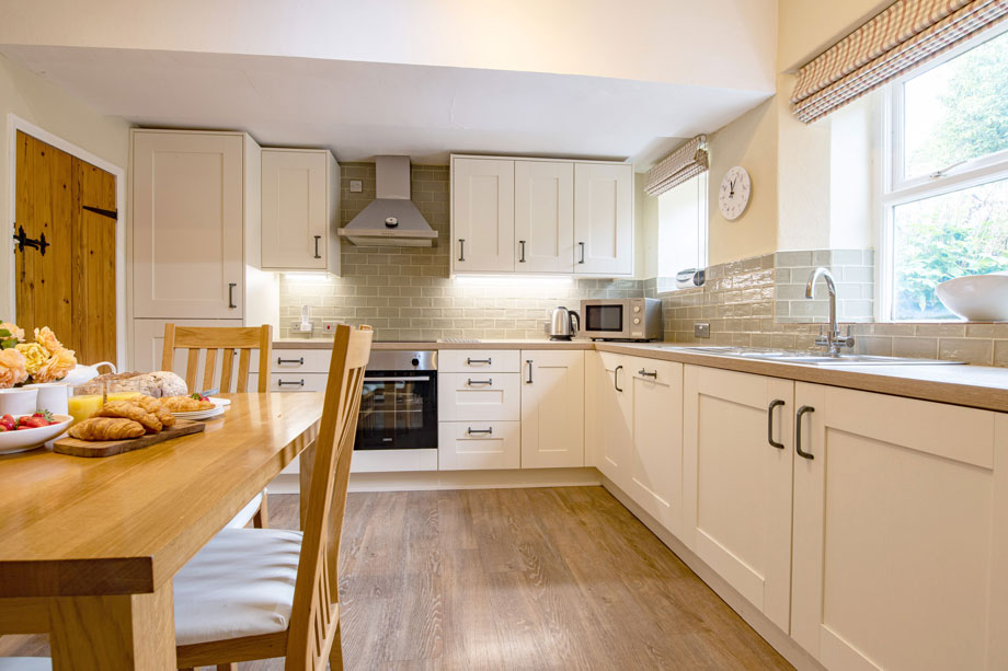
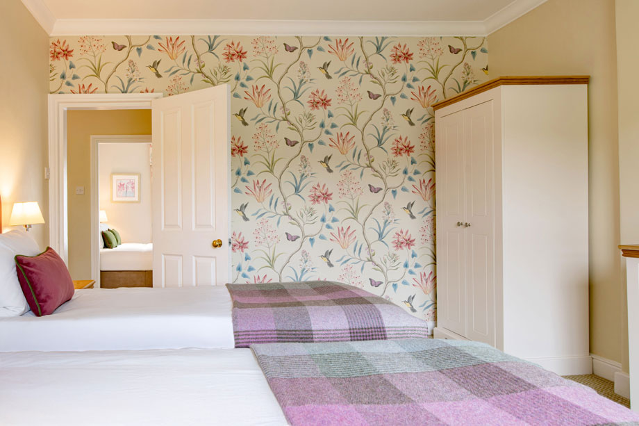
The accommodation comprises 11 cottages – 2 three-bedroom, 6 two-bedroom and 3 one-bedroom – all of which are named after birds, and all except one of which occupy two floors
Properties in Rosedale
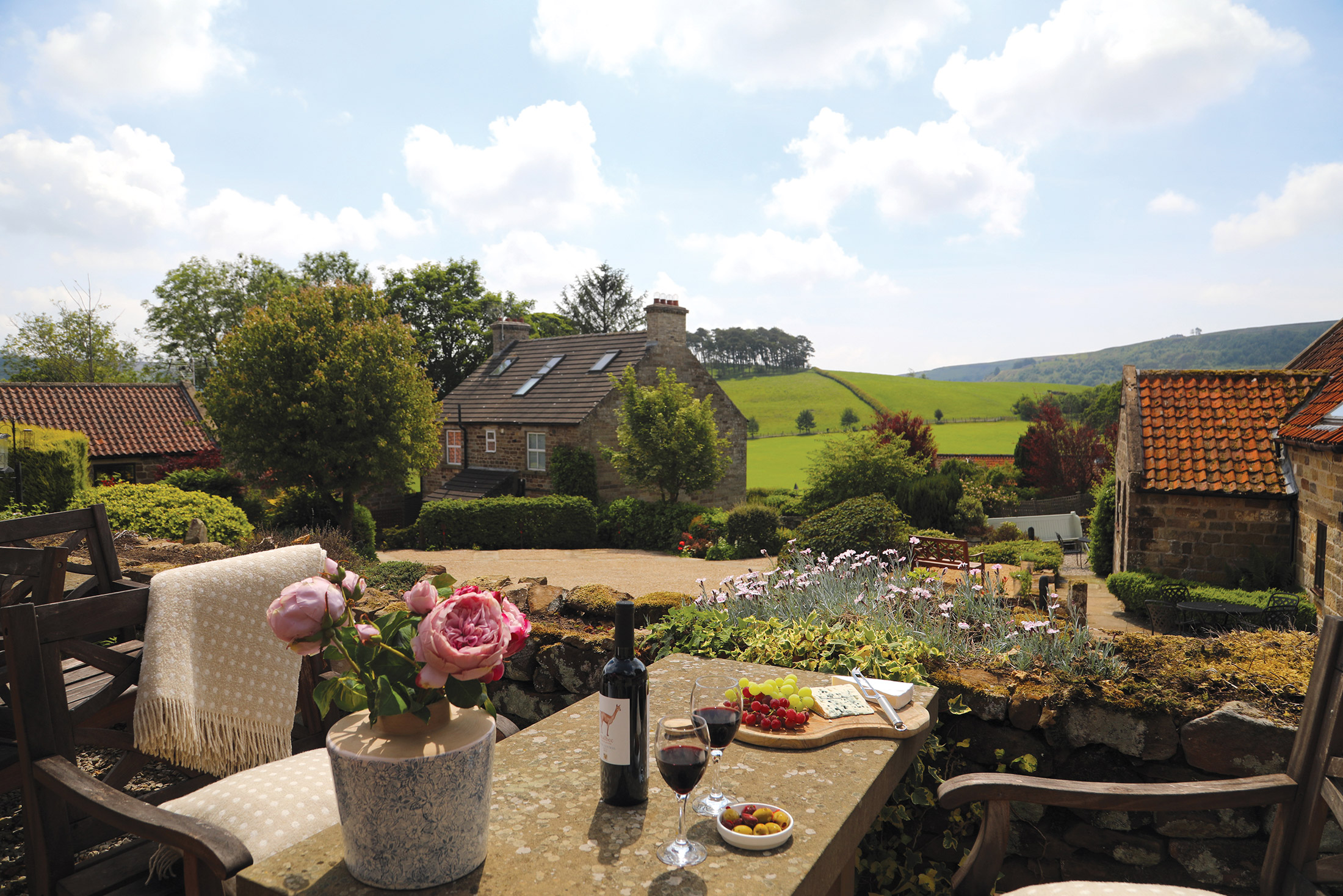
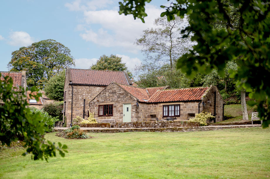
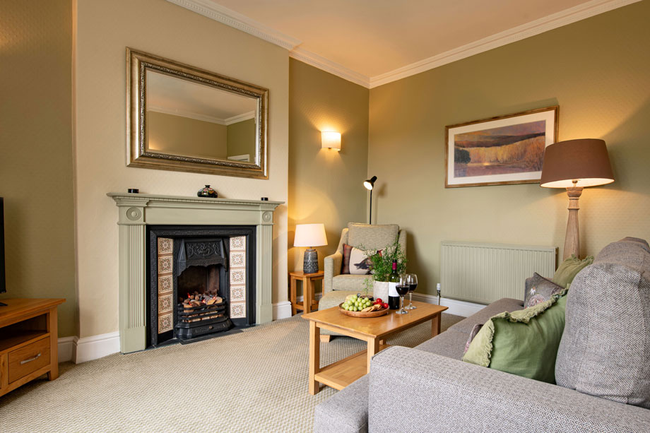
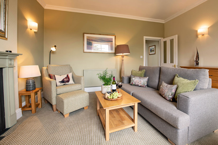
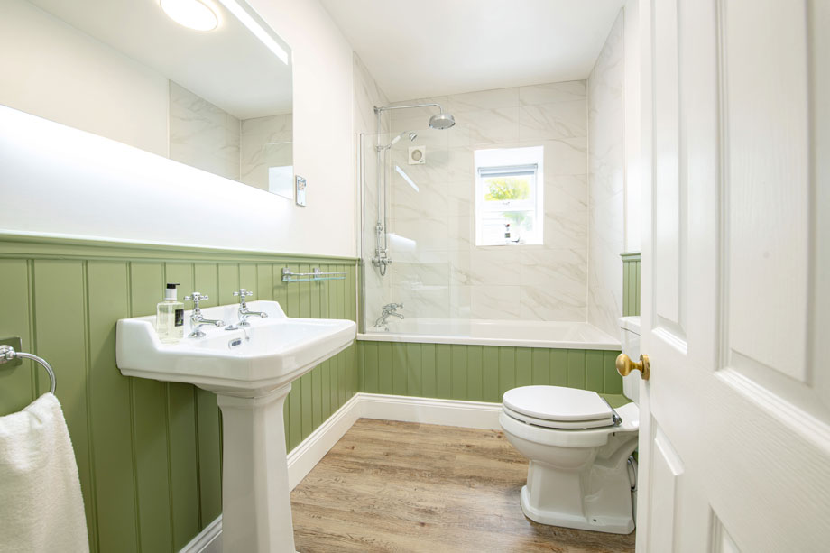
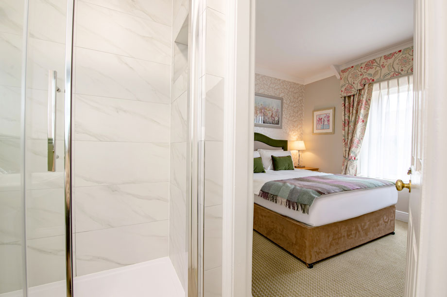
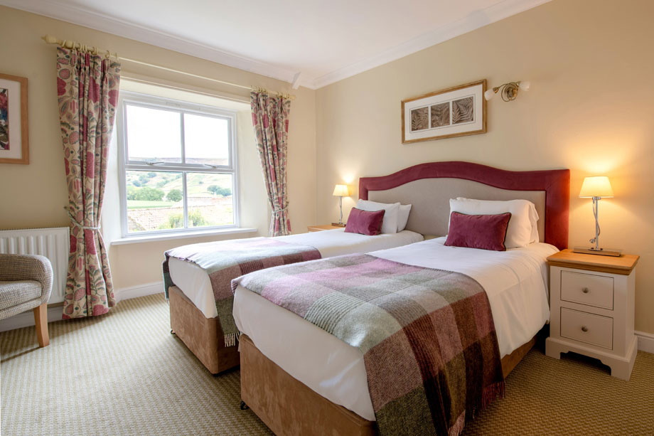
A quick look at our photos below reveals just how perfectly located Bell End Farm is – the rolling green hills, traditional stone walls and abundance of trees all make it clear you’re in beautiful Yorkshire. The properties make you feel right at home, with their traditional farmhouse styling – they even have wooden beams and brick fireplaces, so you’ll be cosy all year round.
There are plenty of facilities to keep you busy when you’re not out and about exploring the local area, including an indoor heated plunge pool and a club house, complete with snooker table.

Location
HPB Bell End Farm
Hanging Stone Lane
Rosedale Abbey
North Yorkshire
England
YO18 8RE
Tel: +44 800 230 0391
Email: details@hpb.co.uk
Yorkshire is England’s biggest county and its most rural.
The area encompasses the Yorkshire Dales, the Vale of York, the coastal region – and, of course, the North York Moors. Rosedale is a picturesque valley in the heart of the National Park.
The vast areas of heather combined with the tranquil dales and woodlands are an amazing sight, and the stunning landscapes will take your breath away.
Things to do in Rosedale
With over 1,400 miles of paths and tracks to choose from, this wonderful corner of North Yorkshire is overflowing with walking, cycling and horse riding opportunities.

Walks around Bell End Farm, Rosedale
Rosedale is a beautiful deep valley, extending nearly eight miles, and running north to south. The River Seven flows through the dale from its source at Rosedale Head, immediately south of the main east-west watershed on the North York Moors, to join the River Rye in the Vale of Pickering.
The main village is Rosedale Abbey, situated in the geographical centre of the National Park. It is the site of a former Cistercian Priory dating back to 1158, but visitors expecting to see majestic ruins, such as those at nearby Rievaulx or Whitby, are in for a disappointment, for all that remains is a ruined stone spiral staircase standing near the Church of St Mary and St Lawrence.
The village and dale rely these days on farming, forestry and tourism for income, but for a limited period during the mid/late 19th century, Rosedale was the scene of a flourishing ironstone industry. At first glance, looking at the peace and tranquility of the dale as it appears nowadays, one would find this difficult to believe. However, if you look around, there is still plenty of evidence to be found of Rosedale’s industrial past, much of which will be seen on the accompanying walks.
In 1871, at the height of the mining industry, the population of Rosedale was 2,839. These days it is probably nearer a tenth of that figure.
But the Dale lives on, amid the changing beauty of the seasons. Winters can be very harsh upon these moors and in the dales – drifting snow has been known to isolate the surrounding villages for several weeks in past years, although the milder climate we seem to be enjoying more recently has made this an ever rarer occurrence.
Spring brings forth a wonderful show of wild flowers, including bluebells and daffodils, the latter being a great attraction in nearby Farndale, the setting for one of our walks. In the summer, the fields are patchwork quilt of colours as the crops ripen. The various shades of green of the woodland and forest contrast with the bracken and heather covered slopes.
Then autumn follows, with the russet colours of dying leaves and bracken contrasting with the evergreen forests and darkening heather, bringing yet another season to a close.
Please remember that the weather can change rapidly in this area, especially on the moor tops. Wet and misty conditions can close in rapidly so make sure you either wear or carry suitable clothing, especially strong boots and waterproofs. Always carry such essentials as a good map, compass, whistle, first aid kit, plenty of food and drink, etc. Mobile phones are useful to carry with you these days, although most parts of Rosedale receive a weak signal, if any.
In fair weather, walking in Rosedale is a pleasure whatever the season. Not only is there the natural beauty of the area to enjoy, but also the fascinating relics of past industry, which seem to appear around every corner – try closing your eyes and imagine you were there over 100 years ago!
Having a Private Tour at an HPB holiday location is an enjoyable way to see the high standards of furnishings and facilities you could enjoy with HPB.
A local HPB Representative will show you around the site and answer any questions you may have.
Alternatively, you are welcome to book a Personal Presentation at a hotel near you. You can chat to one of our local HPB Representatives, ask your questions and view the complete portfolio of HPB locations.
Read our HPB Feefo Reviews
HPB’s holiday booking service has been rated 4.9 out of 5 based on 14,772 customer reviews on Feefo
![]()
“Buying into the future”
Mike DugdaleI got talking to our next-door neighbour at Barnham Broom, who’s been a Bondholder for a while; the family were full of enthusiasm and, while in no way pushy, was really keen to pass on advice and knowledge about any other sites we’re thinking of visiting. We swapped email addresses and will definitely be in touch – but it shows the strength of feeling about HPB, and the fact that there’s a real ‘family’ aspect to it.

